Regions
The Northern Hills
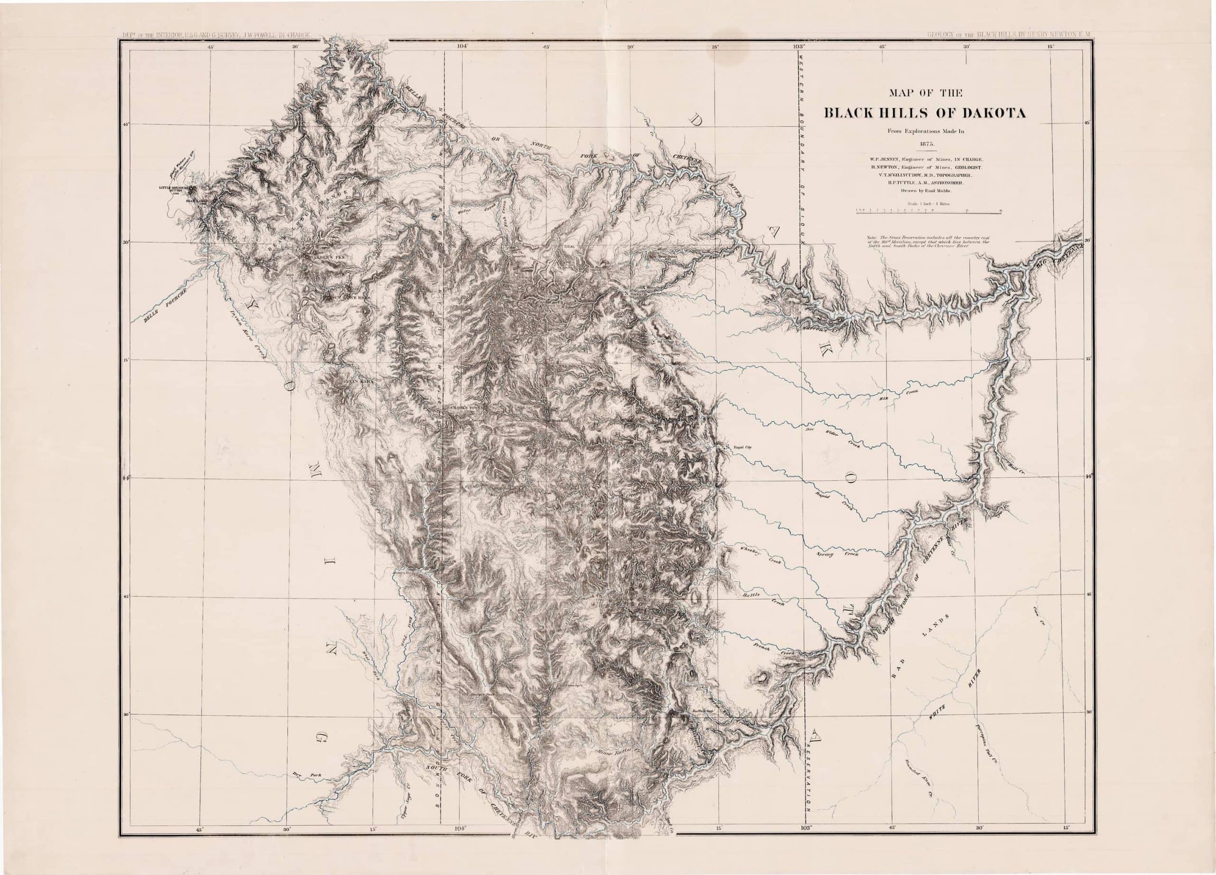
For three years after November 1887, the railroad into the northern Black Hills ended at Whitewood. When the Fremont, Elkhorn and Missouri Valley built beyond it, a state marker in town records, the track split two ways: a branch to Deadwood, a gold town in a gulch, and the main line to Belle Fourche, a cattle town on the plains. Those two destinations bracket the Northern Hills: the gold country around Lead and Deadwood, the limestone canyon of Spearfish Creek, the Red Valley towns along Interstate 90, and the plains around Belle Fourche and Newell.
Gold Country in the Gulches
At Lead, the ancient rock of the Hills' core reaches the surface, broken through by younger igneous rock that pushed into it and raised a dome geologists name for Lead and Deadwood. Most of the younger ore deposits of the northern Hills cluster around that dome or run east from it, a 1970 study for the U.S. Geological Survey found.
Deadwood fills a narrow gulch at 4,531 feet. Prospectors found gold there in the fall of 1875, and the townsite was laid out in 1876, during the Black Hills gold rush. Those miners worked land the 1868 Fort Laramie Treaty had set apart for the tribes, and the 1877 Act took the Hills without the consent the treaty required. Wild Bill Hickok was shot in Deadwood on August 2, 1876, and fire destroyed its downtown business district on September 26, 1879, as Deadwood's Wild Years tells. The town had 1,156 people in 2020.
Up Whitewood Creek, at 5,213 feet, Lead (pronounced "leed") is named for the gold-bearing "lead," or vein, that the Homestake Mine worked. Prospectors staked the Homestake claim there on April 9, 1876, and George Hearst's group bought it in 1877; when its last ore came out on December 14, 2001, the mine had produced nearly 40 million ounces of gold from an ancient iron-rich layer of the core. Its tunnels, where Raymond Davis Jr. began a neutrino experiment in 1965 that earned him a share of the 2002 Nobel Prize in Physics, now hold the Sanford Underground Research Facility (SURF). Lead had 2,982 residents in 2020.
East of the two towns, in the canyon of Bear Butte Creek, Galena mined silver and lead. Its mines peaked from 1881 to 1883, producing about $750,000 in those metals, before lawsuits over ownership all but shut the district down in 1883, the same study reported. SDPB noted in 2025 that the town, often called a ghost town, is not entirely deserted.
Down Spearfish Canyon to Spearfish
Southwest of Lead, U.S. Highway 85 runs through limestone country to Cheyenne Crossing, where U.S. 14A turns north into Spearfish Canyon. Spearfish Creek has cut through the gray Madison Limestone of the plateau and deep into older layers; near the old Elmore townsite the cliffs stand about 900 feet high. Oak, birch and aspen grow among the spruce and pine on the canyon's slopes, and Bridal Veil, Spearfish and Roughlock falls spill over rock ledges.
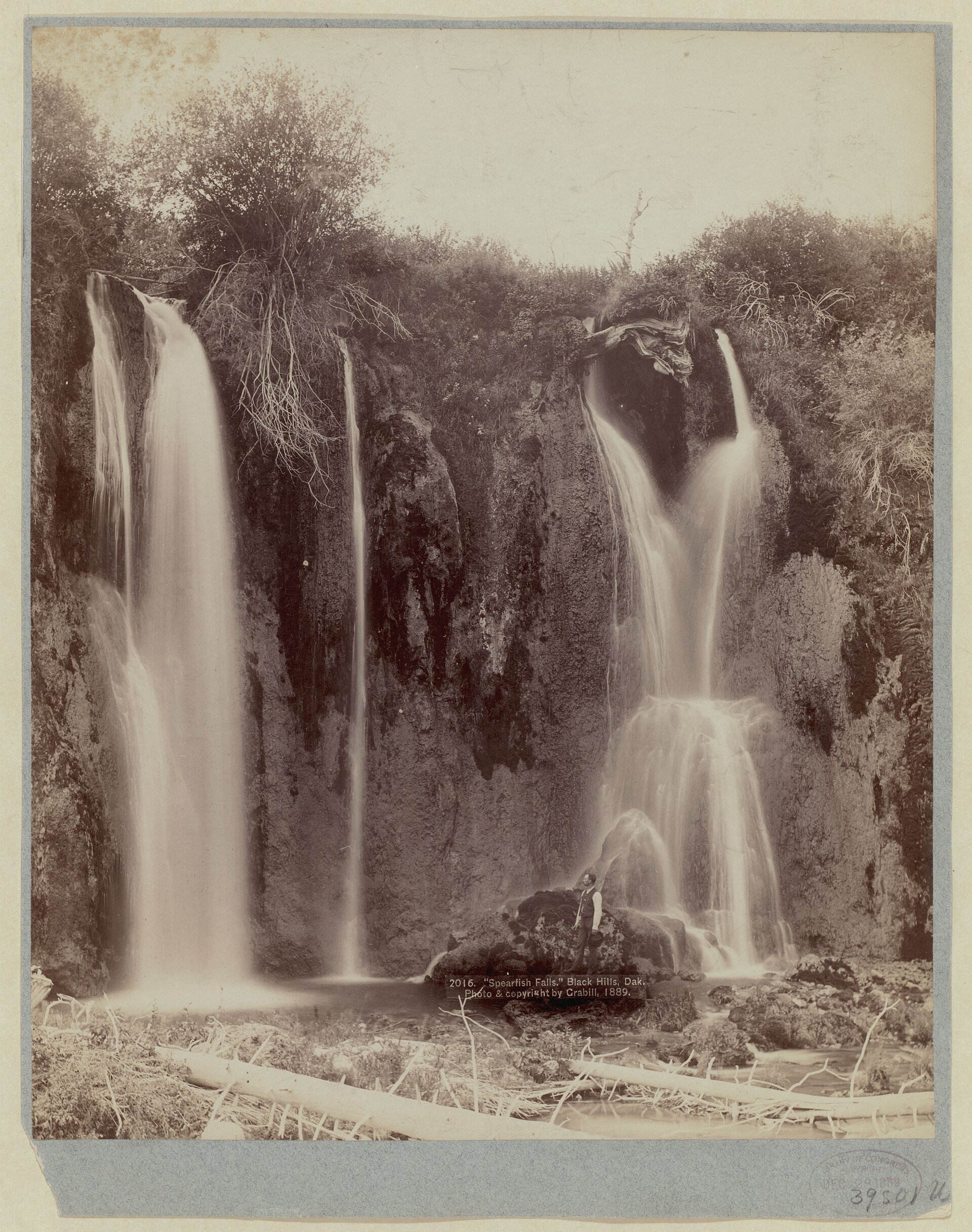
Trains ran up the canyon from 1893, by the dates on a Forest Service sign at Bridal Veil Falls and in a state geological survey road log, until the 1933 flood ended the line; the byway follows its old grade. At the canyon's mouth lies Spearfish, the region's largest town, with 12,193 people in 2020. The red Spearfish Formation, the rock of the Red Valley, is probably named for it, and the federal trout hatchery founded there in 1896 is now the D.C. Booth Historic National Fish Hatchery.
Farther west, within a mile of the Wyoming border, Tinton grew up on tin. Prospectors working gold placers there in 1876 soon found tin ore, and the district produced 105,039 pounds of tin from 1903 to 1927, the U.S. Geological Survey reported in 1941. Its last resident moved away in 1959, SDPB reported in 2018.
Red Valley Towns Along Interstate 90
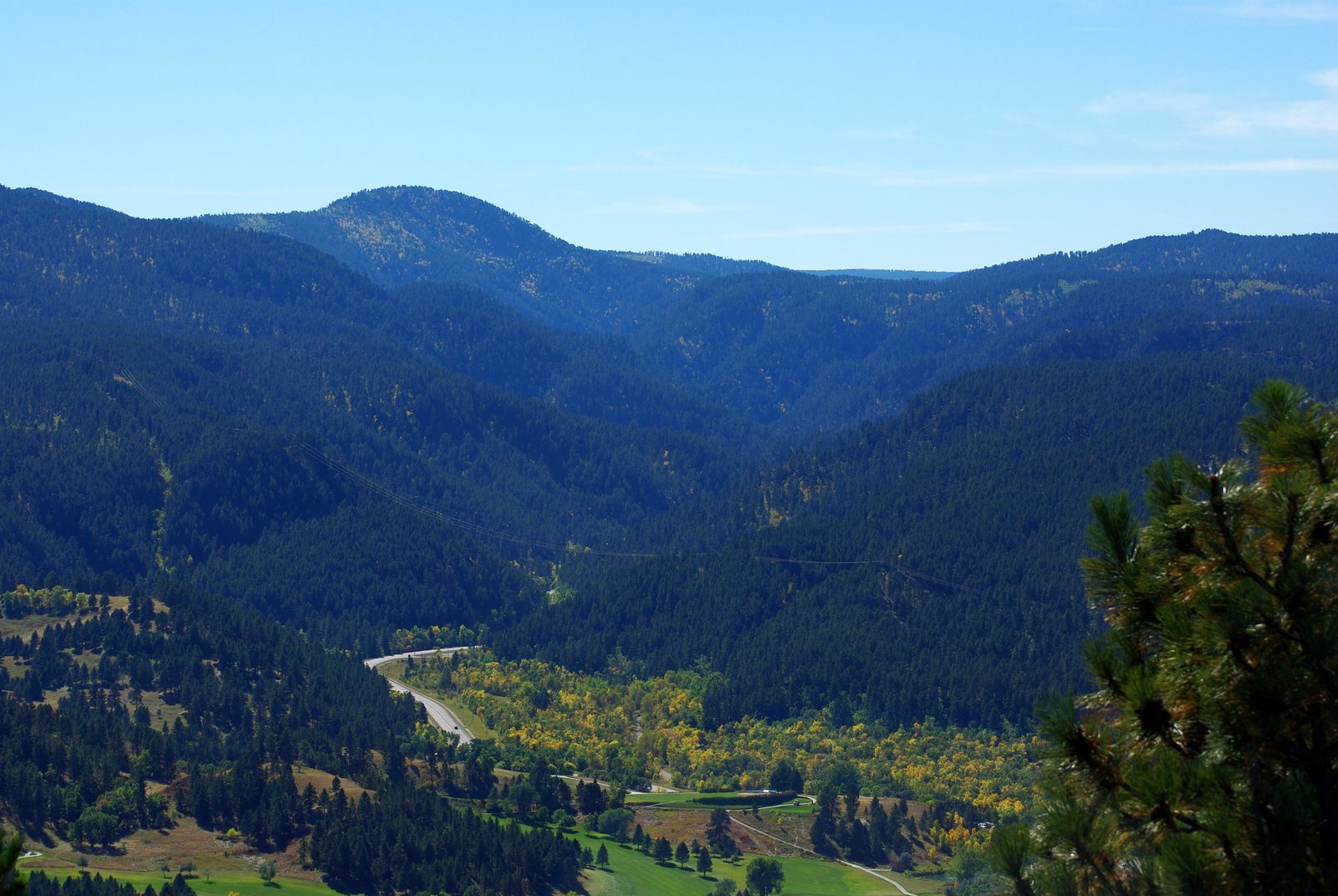
Below the limestone slopes the main forest ends, and the Red Valley opens out, a low, mostly treeless band of red shale and white gypsum just inside the Hogback, the sandstone ridge at the outer rim of the Hills. From Rapid City, Interstate 90 runs north along the valley to Sturgis, then swings west past Whitewood to Spearfish.
Whitewood, with 879 people in 2020, grew up as a railroad town that shipped out lumber, cattle and grain. Sturgis, home to 7,020, sits where the interstate meets the road up Boulder Canyon to Deadwood. Fort Meade, founded as a cavalry post just east of town in 1878, has been a veterans hospital since 1944.
The Sturgis Motorcycle Rally, held each August, began on August 14, 1938, as a race put on by J.C. "Pappy" Hoel and his club, the Jackpine Gypsies. State road counters, which count vehicles rather than people, logged 448,166 vehicles entering Sturgis during the 10 days of the 2026 rally, against 747,032 in 2015, the most of any year since 2011.
About 6 miles northeast of Sturgis, Bear Butte, an igneous mountain that many tribes hold sacred, rises alone beyond the Hogback. Bear Butte and the Plains Edge covers the butte, and Sacred Sites tells what it means to the tribes.
North to Belle Fourche and the Irrigated Plains
North of Spearfish and Whitewood, the Hogback is the last ridge before open grass. The Belle Fourche River, the northern of two rivers that nearly encircle the Hills, winds for several miles through that ridge, the USGS geologist N.H. Darton wrote in 1909. Past it the plains stretch away, flat or gently rolling.
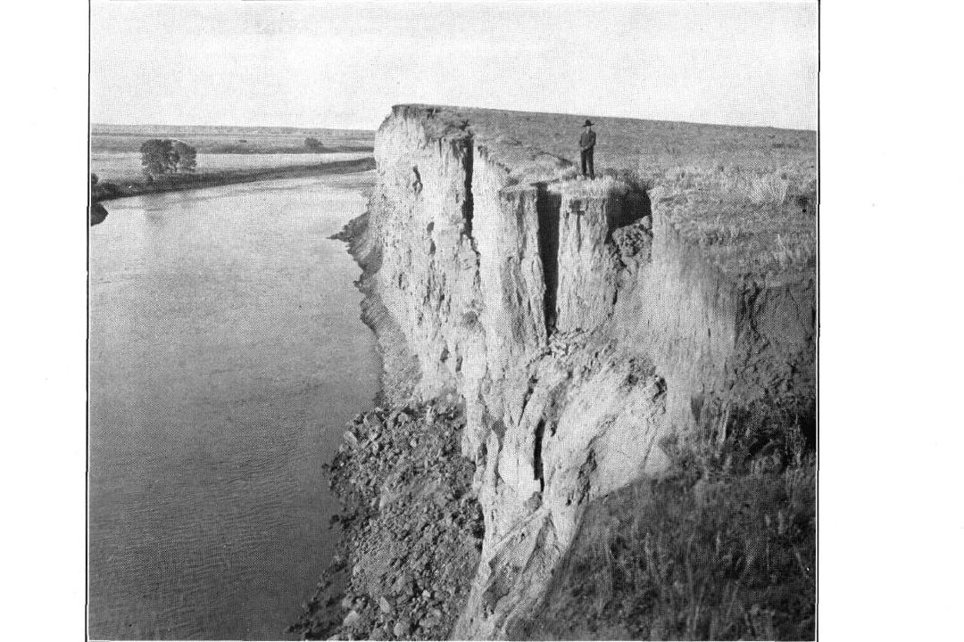
Belle Fourche, with 5,617 people in 2020, sits where the Redwater River meets the Belle Fourche. A 2016 SDPB history credits Deadwood's Seth Bullock and Sol Star with founding it, and the town grew up in the early 1890s around the railroad as a market and shipping point for cattle. Bentonite, a clay formed from altered volcanic ash, has been milled nearby since 1934 and shipped through Belle Fourche.
Downstream, irrigated alfalfa and corn replace the grass. The Belle Fourche Project, approved on May 10, 1904, as the new Reclamation Service's second project, stores water diverted from the river behind Belle Fourche Dam, also called Orman Dam; when the dam was finished on June 30, 1911, it was the largest rolled-earth dam in the world. The project waters about 57,000 acres, and the district that runs it is based in Newell, a town of 584.
Out on these plains, about 20 miles north of Belle Fourche, beside a gravel road that was once U.S. Highway 85, lies the calculated geographic center of the 50 states. A state marker written for a spot 0.3 mile west of the point says adding Alaska moved the center from Kansas into Butte County, and adding Hawaii shifted it a few miles farther southwest; state records disagree on whether it still stands there or at the museum in Belle Fourche.
Connected
- Spearfish, South DakotaThe region's largest town, at the mouth of Spearfish Canyon.
- Deadwood, South DakotaThe gold-rush town in Deadwood Gulch.
- Lead, South DakotaThe town built over the Homestake Mine.
- Sturgis, South DakotaThe Red Valley town on Interstate 90, near Fort Meade and Bear Butte.
- Whitewood, South DakotaThe railroad's end of the line from 1887 to 1890.
- Belle Fourche, South DakotaThe rail and cattle town where the Redwater meets the Belle Fourche.
- Newell, South DakotaThe irrigation project's town on the plains to the north.
- Spearfish CanyonThe limestone canyon from Cheyenne Crossing to Spearfish, and how to see it.
- Galena, South DakotaThe silver and lead camp in the canyon of Bear Butte Creek.
- Tinton, South DakotaThe tin camp less than a mile from the Wyoming line.
- The Sturgis Motorcycle RallyHow a 1938 race grew into the August crowds in Sturgis.
- How the Black Hills FormedThe rings of rock, from the core at Lead to the Hogback.
Sources
- South Dakota Historical Markers, numerical master list (markers 261 and 716). South Dakota State Historical Society, 2020.
- Geologic Road Log: Rapid City to Sturgis, Lead-Deadwood, Spearfish, to Rapid City, by Mark D. Fahrenbach (South Dakota Geological Survey), in Geologic Field Trips in the Black Hills Region, South Dakota (Bulletin 21). South Dakota School of Mines and Technology, 2010.
- Ore Deposits in Rocks of Paleozoic and Tertiary Age of the Northern Black Hills, South Dakota, by Lewis H. Shapiro and John Paul Gries (South Dakota School of Mines and Technology). U.S. Geological Survey Open-File Report, 1970.
- Timeline of Deadwood, South Dakota. City of Deadwood.
- Deadwood Historic District, National Historic Landmark nomination. National Park Service, 1976, amended 1989.
- Treaty of Fort Laramie (1868), transcript. National Archives.
- United States v. Sioux Nation of Indians, 448 U.S. 371. Supreme Court of the United States, 1980 (Legal Information Institute, Cornell Law School).
- Downhill view from Lead, a onetime gold-mining boomtown in the Black Hills of South Dakota (catalog record, with the photographer's notes on the town's name). Carol M. Highsmith, Library of Congress, Prints and Photographs Division, 2021.
- Mining a Rich Vein of Science, by Jordan Sorokin, a profile of Tom Nelson, then mayor of Lead. Symmetry magazine, 2009.
- Summary of the Mining Industry in South Dakota, 2001. South Dakota Department of Environment and Natural Resources, 2002.
- Davis Experiment. Sanford Underground Research Facility.
- Our Story. Sanford Underground Research Facility.
- Galena: The Ghost Town That Refuses to Die (program description). SDPB Documentaries, South Dakota Public Broadcasting, 2025.
- Spearfish Canyon. USDA Forest Service, Black Hills National Forest.
- Spearfish Canyon Scenic Byway. Recreation.gov.
- Spearfish Canyon Through Time (marker text). Black Hills National Forest, U.S. Forest Service; transcribed by the Historical Marker Database.
- D.C. Booth Historic National Fish Hatchery: About Us. U.S. Fish and Wildlife Service.
- Tin-Bearing Pegmatites of the Tinton District, Lawrence County, South Dakota (Bulletin 922-T), by Ward C. Smith and Lincoln R. Page. U.S. Geological Survey, 1941.
- Ghost Towns of South Dakota: Tinton, by Michael Zimny. South Dakota Public Broadcasting, 2018.
- Geology and Water Resources of the Northern Portion of the Black Hills and Adjoining Regions in South Dakota and Wyoming (Professional Paper 65), by N.H. Darton. U.S. Geological Survey, 1909 (online edition, NPS History).
- History. U.S. Department of Veterans Affairs, VA Black Hills Health Care.
- Fort Meade. SAH Archipedia, Society of Architectural Historians.
- History. City of Sturgis, Sturgis Motorcycle Rally.
- Black Hills Motor Classic Begins. South Dakota Public Broadcasting, 2023.
- Sturgis Rally Traffic Counts 2017–2026. South Dakota Department of Transportation, 2026.
- Statement of Llevando "Cowboy" Fisher, President, Northern Cheyenne Tribe, on H.R. 4350, the Northern Cheyenne Lands Act. Northern Cheyenne Tribe, before the House Committee on Natural Resources, 2014.
- Bear Butte State Park. South Dakota Game, Fish and Parks.
- Belle Fourche. Encyclopaedia Britannica.
- A Brief History of Belle Fourche, by Brian Gevik. South Dakota Public Broadcasting, 2016.
- Bentonite Deposits of the Northern Black Hills District, Wyoming, Montana, and South Dakota (Bulletin 1082-M), by Maxwell M. Knechtel and Sam H. Patterson. U.S. Geological Survey, 1962.
- South Dakota: Belle Fourche Dam. National Park Service.
- Belle Fourche Project. Bureau of Reclamation.
- TIGERweb, Census 2020: Incorporated Places (2020 populations of Spearfish, Deadwood, Lead, Sturgis, Belle Fourche, Whitewood and Newell). U.S. Census Bureau.
- Data sheet for survey station CENTER (PID PU2386), Butte County, South Dakota. National Geodetic Survey, retrieved 2015 (copy posted by RPLS.com).
Last reviewed: