Regions
The Central Hills
The 1880 census counted 321 people at Rockerville, a placer camp on the east flank of the Black Hills, and 292 in Rapid City, by the returns the historian Watson Parker compiled in 1965. In 2020 Rapid City had 74,703 people, and Rockerville, a ghost town, had no census count of its own. Both belong to the Central Hills: the granite around South Dakota's highest point, the mining camps of Hill City, Keystone and Rochford, three reservoirs, and Rapid City and Box Elder at the eastern foot.
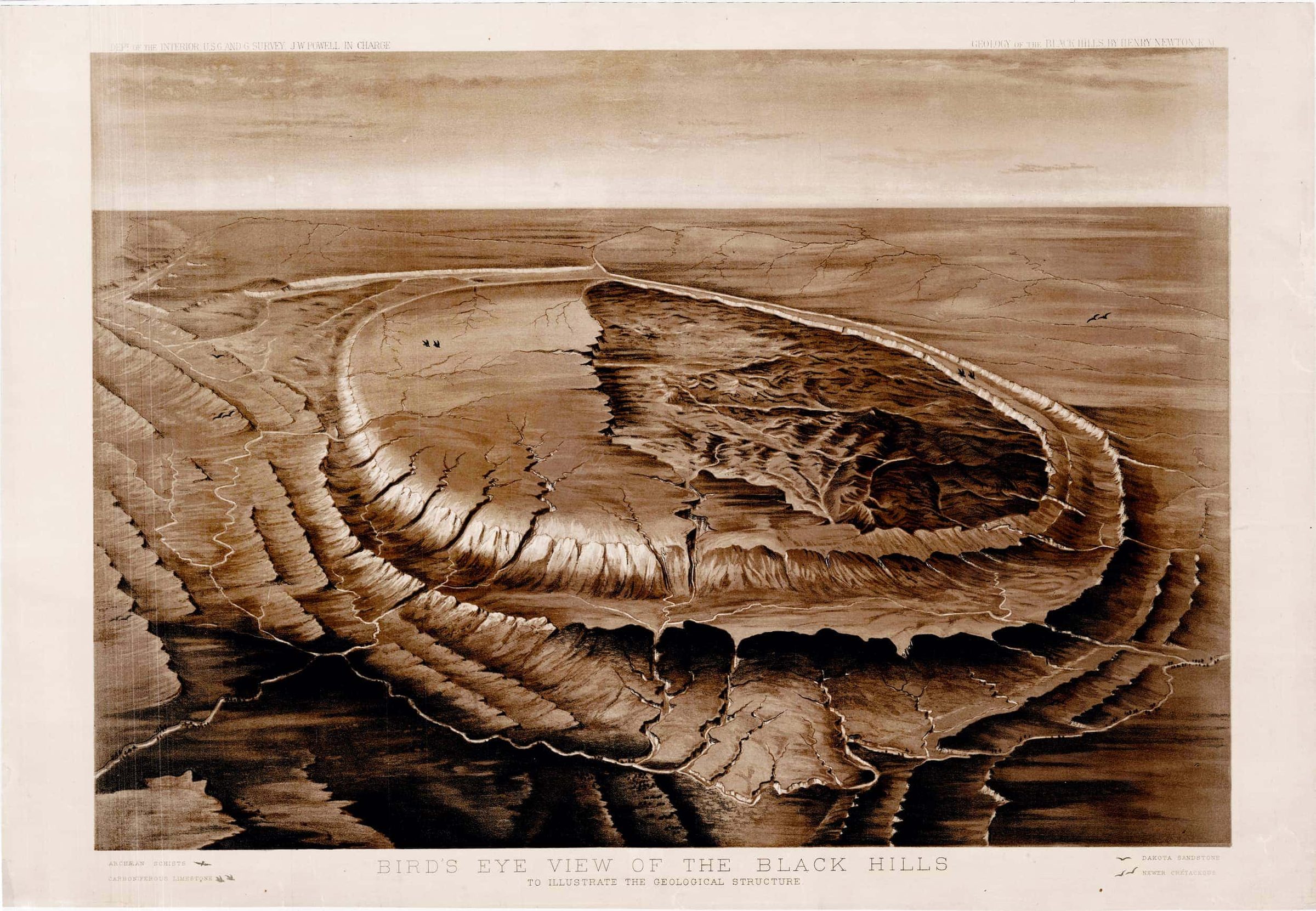
Granite Peaks and Schist Valleys
Black Elk Peak (called Harney Peak until 2016) rises to 7,242 feet, the highest point in South Dakota, in granite about 1.7 billion years old that geologists still call the Harney Peak Granite. Around it lies older schist, slate and quartzite, once mud and sand on a sea floor; together they form the crystalline core, the innermost ring on How the Black Hills Formed. The high ground is granite and the valleys follow the weaker mica schist, a 1973 U.S. Geological Survey study explains (more on The Granite Core).
The U.S. Board on Geographic Names renamed the peak on August 11, 2016, for Black Elk, the Oglala Lakota holy man. Basil Brave Heart, a Lakota elder, had sought the change. He objected to honoring Gen. William S. Harney, who led the troops that killed at least 86 Lakota people, among them women and children, at Blue Water Creek, Nebraska, in 1855. The peak rises in the Black Elk Wilderness, more than 13,534 acres by the Forest Service’s count, set aside by Congress in 1980 and enlarged in 2002, and its stone lookout, built by the Civilian Conservation Corps (CCC) from 1938 to 1940, is the goal of Hiking Black Elk Peak.
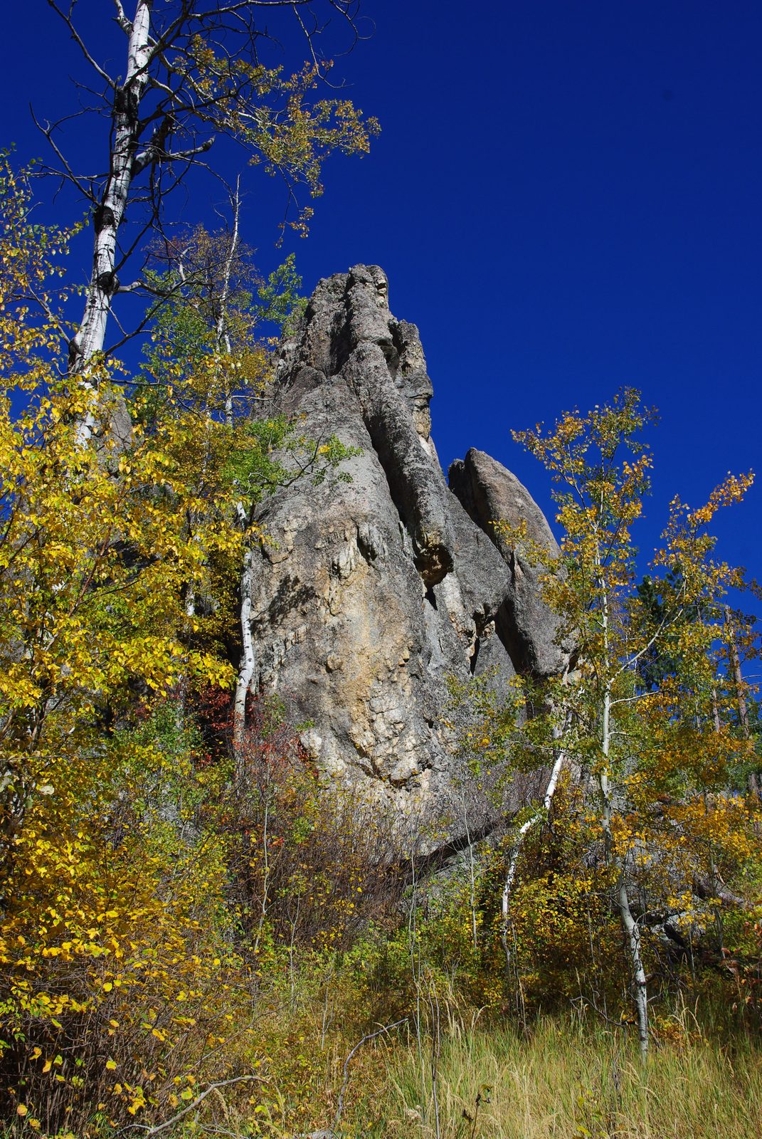
The state's welcome markers call Harney Peak the highest point in the country east of the Rockies, at 7,247 feet, 5 feet more than the USGS figure. An older line says nothing higher stands between the Rockies and the Alps; a 2026 South Dakota News Watch fact check found that false, since Greenland and the Canary Islands have taller peaks.
How Did Hill City and Keystone Begin?
Both grew out of mining. Hill City was laid out for gold in February 1876 and stood nearly empty by May, its miners gone to richer northern strikes, a state marker there says. Hardrock gold briefly revived it, Parker wrote; then came tin. In 1889 English investors listed the Harney Peak Consolidated Tin Company, capitalized at $15 million, and the tin venture kept its headquarters on the edge of Hill City. Its mine closed without warning on February 2, 1893, idling more than 400 men; the 1976 National Register nomination for its buildings calls its history fraudulent.
Hill City had 872 people in 2020. Neiman Enterprises closed its sawmill there in March 2021 after 53 years, cutting 120 jobs and blaming Forest Service logging limits (see Logging the Ponderosa). Since 1957 the Black Hills Central Railroad has run excursion trains, now to Keystone on an old Burlington branch; by its own account, its nickname, the 1880 Train, is "not quite accurate" (see Stagecoaches and Railroads).
Keystone, with 240 people in 2020, sits among pegmatites, granite with giant crystals. Tin was found at the Etta Mine, about 1 mile south of town, in 1883, and the mine was a mainstay of the Hills' tin venture, which failed.
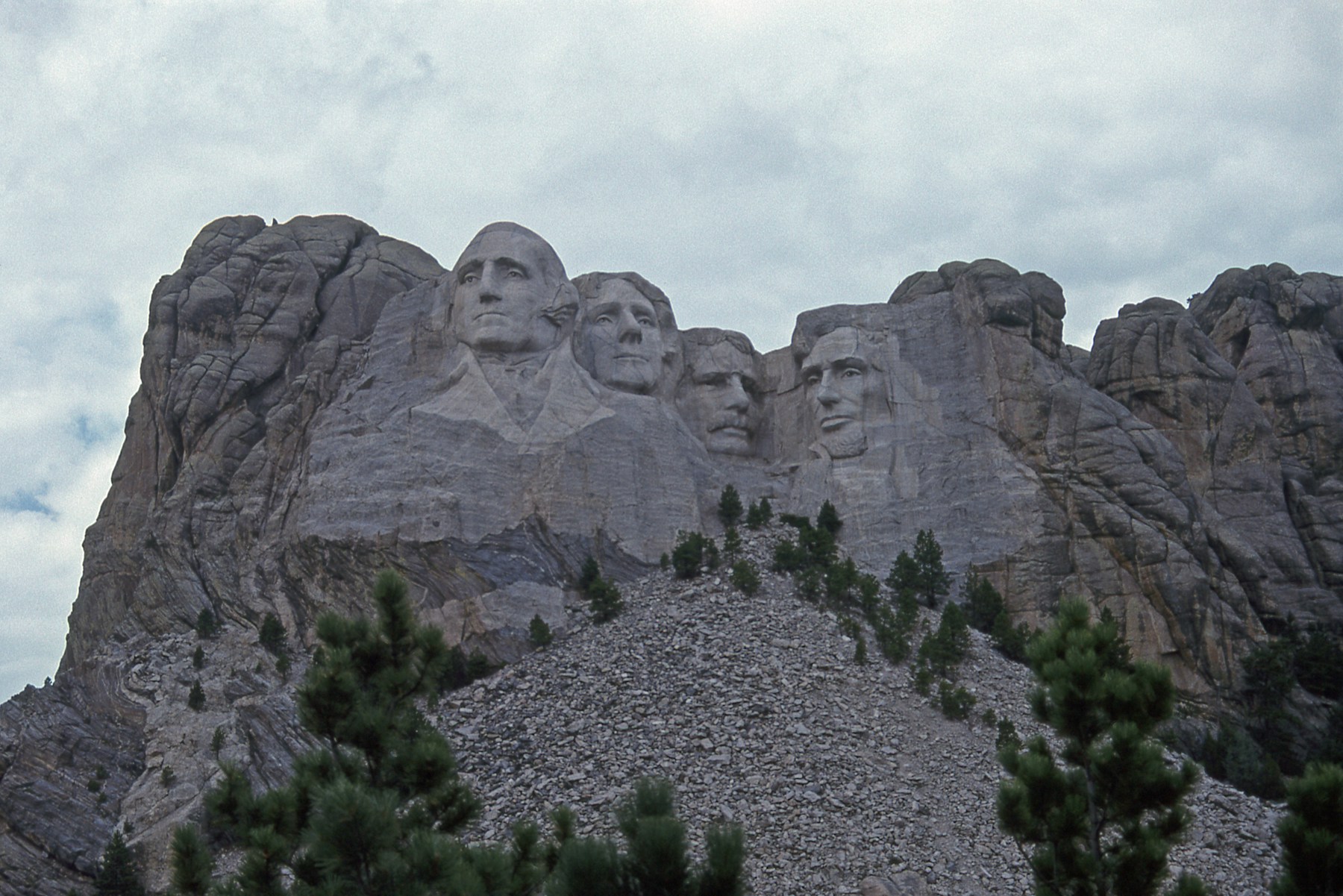
About 2 miles southwest of Keystone, Mount Rushmore was carved from 1927 to 1941 in the same granite, in Hé Sápa, on land the 1877 Act took from the tribes without the consent the 1868 treaty required (see The 1876 War and the Taking of the Hills). Its history, and how the tribes view it, are on Mount Rushmore and Crazy Horse Memorial.
Rochford and the Reservoirs of the High Country
Rochford lies about 15 miles south of Lead in steep, wooded hills 5,000 to 6,000 feet up, where the gold is found in iron-rich layers much like the Homestake Mine's ore-bearing rock, a 1972 USGS report found. The camp boomed on gold ledges in 1878, passing a thousand people by year's end, Parker wrote, though only the Standby mine did well. Its part in the rush is on The Black Hills Gold Rush.
Deerfield Reservoir, in high country west of Hill City, holds water for irrigators along Rapid Creek below Rapid City, a Bureau of Reclamation commissioner told Congress in 2005. Pactola Reservoir, on Rapid Creek about 15 miles west of Rapid City, ranks first in the Black Hills National Forest for both size and depth, the Forest Service says, at about 800 acres and up to 150 feet deep, behind a dam Reclamation built from 1952 to 1956.
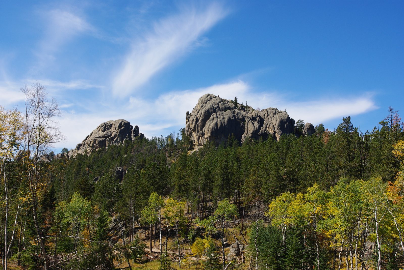
Sheridan Lake, on Spring Creek, is older. Work on its dam began in 1938, with CCC crews building the earth fill and the Works Progress Administration the concrete; the lake drowned Sheridan, an 1875 gold camp. The CCC's camps are on The National Forest and the CCC, and the lakes on Lakes of the Black Hills.
From Rockerville Down to the Plains
Rockerville had gold but no water. Its miners, there from December 1876, made do with rockers and barrels of water or carted the gravel to Spring Creek, until a ditch and flume 17 miles long brought the creek to them in 1880. The flume lost money. State markers credit Rockerville with half a million dollars or more in gold, but a 1974 USGS review found that what seemed the only published estimate, Parker's, cited no source and was probably too high.
Past Rockerville the old core gives way to younger layers along the highway to Rapid City. The city grew where Rapid Creek leaves the Hills through a water gap in the Hogback; the part of the city west of that ridge sits mostly on the red Spearfish Formation of the Red Valley, a 2010 geology field guide notes.
Rapid City is the region's gateway in a plain sense: it is South Dakota's second-largest city, after Sioux Falls, and the Encyclopedia of the Great Plains calls it the gateway to Mount Rushmore, Wind Cave, the Badlands and more. The capitalized slogan is marketing that more than one town claims: the Black Hills & Badlands Tourism Association bills Rapid City as the "Gateway to the Black Hills," while the Belle Fourche Chamber of Commerce calls its own town the "Northern Gateway."
East of the Hogback lies open prairie. Box Elder, with 11,746 people in 2020, sits beside Ellsworth Air Force Base, established by the War Department in January 1942 as Rapid City Army Air Base, where B-17 crews trained. Renamed in 1953 for Brig. Gen. Richard E. Ellsworth, it is covered on Ellsworth and the Minuteman Missiles. Rapid City and the base both draw municipal water from Pactola Reservoir, high in the Hills, the Interior Department said in 2024.
Connected
- Rapid City, South DakotaThe region's largest city, where Rapid Creek leaves the Hills.
- Hill City, South DakotaA gold camp of 1876 that tin, timber and tourist trains kept going.
- Keystone, South DakotaThe pegmatite mining town nearest Mount Rushmore.
- Rochford, South DakotaA hardrock gold camp of 1878 in the high country.
- Box Elder, South DakotaThe prairie town beside Ellsworth Air Force Base.
- Rockerville, South DakotaDry diggings on the east flank and a flume that lost money.
- Lakes of the Black HillsPactola, Sheridan, Deerfield and the other lakes behind dams.
- Hiking Black Elk PeakThe trail to the region's high point and its stone lookout.
- The Granite Core: Black Elk Peak and the NeedlesThe granite and schist under the whole region.
- How the Black Hills FormedWhy the oldest rock lies bare in the middle of the Hills.
- The Black Hills Gold RushThe rush that founded Hill City, Rochford and Rockerville.
- Mount Rushmore and Crazy Horse MemorialThe carving near Keystone, and how the tribes view it.
Sources
- The Black Hills Gold Rush, 1874–1879 (Watson Parker, doctoral dissertation). University of Oklahoma, 1965.
- TIGERweb, 2020 Census: incorporated places. U.S. Census Bureau, 2020 (queried October 2026).
- Hydrology of the Black Hills Area, South Dakota (Water-Resources Investigations Report 02-4094). U.S. Geological Survey, 2002.
- NPS Geodiversity Atlas: Mount Rushmore National Memorial, South Dakota. National Park Service.
- Water Resources and Geology of Mount Rushmore National Memorial, South Dakota (Water-Supply Paper 1865). U.S. Geological Survey, 1973.
- "In Sacred Motion": Five Years Ago, a Lakota Elder Beat the Establishment and Renamed Harney Peak (Seth Tupper). SDPB, 2021.
- Review of The First Sioux War: The Grattan Fight and Blue Water Creek, 1854–1856 (Mark R. Ellis). Great Plains Quarterly 26, no. 3, University of Nebraska–Lincoln, 2006.
- Wilderness. USDA Forest Service, Black Hills National Forest.
- South Dakota Historical Markers, numerical master list (markers 39, 67, 255, 392, 528, 649 and 651 to 653). South Dakota State Historical Society.
- Fact brief: Is Black Elk Peak the highest point between the Rocky Mountains and the Alps? (Michael Klinski, South Dakota News Watch). Dakota News Now, 2026.
- Harney Peak Tin Mining Company Buildings, National Register of Historic Places nomination (Scott Gerloff). National Park Service, 1976.
- Sawmill Closure Eliminates 120 Jobs in Hill City (Seth Tupper). SDPB, 2021.
- Learn Our History of Railroading in the Black Hills. Black Hills Central Railroad (the company's own account).
- Geology and Mineral Deposits of Some Pegmatites in the Southern Black Hills, South Dakota (Professional Paper 297-E). U.S. Geological Survey, 1964.
- The Workers. National Park Service, Mount Rushmore National Memorial.
- Treaty of Fort Laramie (1868), transcript. National Archives.
- A Preliminary Report on the Geology and Gold Deposits of the Rochford District, Black Hills, South Dakota (Bulletin 1332-A) (Richard W. Bayley). U.S. Geological Survey, 1972.
- Central Hills: Rapid City (recreation sites). USDA Forest Service, Black Hills National Forest.
- Pactola Reservoir Complex. USDA Forest Service, Black Hills National Forest.
- Statement on S. 819, the Pactola Reservoir Reallocation Authorization Act of 2005 (John W. Keys III, Commissioner, Bureau of Reclamation). U.S. Department of the Interior, 2005.
- Biden-Harris Administration Finalizes Protections for the Pactola Reservoir–Rapid Creek Watershed. U.S. Department of the Interior, 2024.
- Gold in the Black Hills, South Dakota, and How New Deposits Might Be Found (Circular 699) (James J. Norton). U.S. Geological Survey, 1974.
- Geologic Field Trips in the Black Hills Region, South Dakota (Bulletin No. 21) (M.P. Terry, E.F. Duke and J.A. Tielke, editors). South Dakota School of Mines and Technology, 2010.
- Rapid City, South Dakota (Edward Patrick Hogan). Encyclopedia of the Great Plains, University of Nebraska–Lincoln.
- Rapid City. Black Hills & Badlands Tourism Association (marketing page, cited for its slogan only).
- Nearby Communities. Belle Fourche Chamber of Commerce (marketing page, cited for its slogan only).
- Community Profile. City of Box Elder.
- The Missile Plains: Frontline of America's Cold War, Historic Resource Study, Minuteman Missile National Historic Site (Christina Slattery and others). National Park Service, 2003.
- Ellsworth Air Force Base 1942–1957 (Brian Gevik). SDPB, 2016.
Last reviewed: