The Outdoors
Lakes of the Black Hills
In the South Dakota Black Hills, nearly every lake was made by people, the state says, apart from ponds that beavers back up on some streams. “There are no natural ponded waters within the Black Hills,” the Wildlife Division of South Dakota Game, Fish and Parks wrote in a 2015 plan for the region’s reservoirs. Its 2020 fish plan for the Black Hills names four exceptions: Cox Lake, Mud Lake and the two Mirror lakes. The main lakes follow, with who made each one and what its managing agency allows on the water.
When Were the Lakes Built?
Most date from the 1930s, the state’s plan says, Stockade Lake among them. Deerfield and Pactola, two of the four the plan classes as large reservoirs, followed in the 1940s and 1950s. Public agencies built many of them for fishing and recreation, to store water or to hold back floods. Sylvan Lake is far older: Theodore Reder dammed Sunday Gulch Creek to make it in 1881, and the state bought the property in 1920, an architectural history of its lodge records.
Several were New Deal work. The Civilian Conservation Corps (CCC), the federal relief program that ran camps in the Hills from 1933 to 1942, put its crews on the dams that formed Horsethief, Center, Stockade and Bismarck lakes, the South Dakota Historical Society Foundation reported in 2019. Sheridan Lake, built from 1938 to 1940, was a joint job of the CCC and the Works Progress Administration, whose crews dammed Spring Creek with earth. The camps are on The National Forest and the CCC.
Three Reservoirs in the National Forest
Pactola Reservoir, on Rapid Creek about 15 miles west of Rapid City, is, in the words of the Forest Service’s Pactola page (2025), “the largest and deepest reservoir in the Black Hills National Forest”: about 800 acres, and up to 150 feet deep. The Bureau of Reclamation built its dam from 1952 to 1956 and still runs the dam and the water; the shore is national forest. Rapid City and Ellsworth Air Force Base draw municipal water from Pactola, the Interior Department said in 2024. A 1991 historical marker at the Pactola visitor center, on US 385, notes that the reservoir flooded the site of CCC Camp F-4.
Pactola is open to motorboats, waterskiing and paddling from two boat ramps, and swimmers use the sand at Pactola Point, on the south shore. Record lake trout come out of it every year, the Forest Service says. The state also lists rainbow and brown trout, bass and perch, along with northern pike that were put there without authorization and have made the fishery harder to manage. A seasonal Forest Service visitor center by the dam tells how it was built.
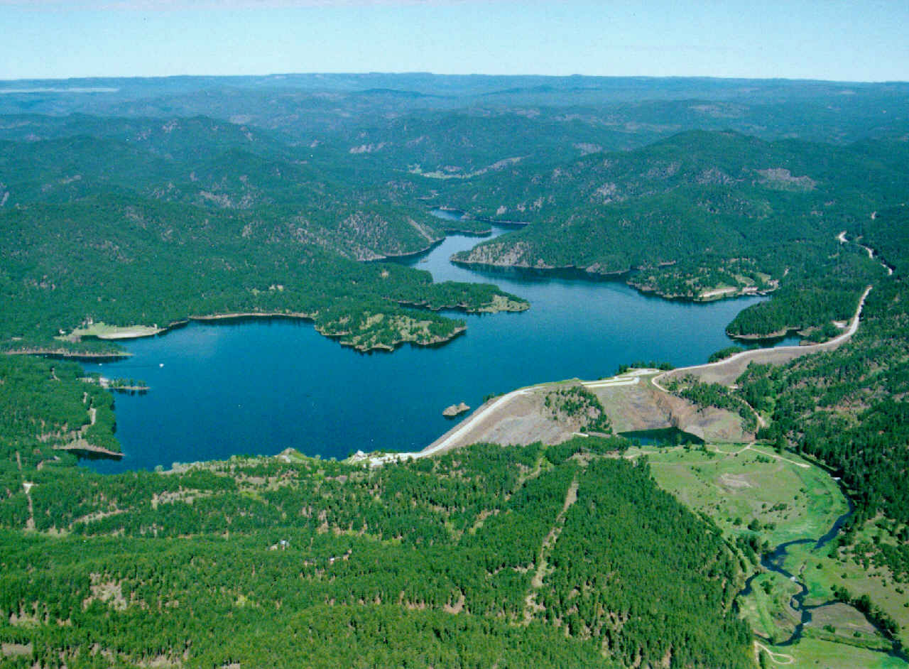
Sheridan Lake, on Spring Creek, covers about 385 acres by the state’s count. Its north launch takes motorized and non-motorized boats, the Forest Service lists waterskiing, and swim beaches lie on the north shore and on the south shore by the inlet. Northern pike, perch, and rainbow and brown trout live in the lake, says the federal booking site for its campground. The Centennial Trail passes both Sheridan and Pactola.
Deerfield Reservoir lies on Castle Creek about 20 miles west of Hill City. Its dam, owned by the Bureau of Reclamation, went up in the 1940s to store water for irrigation and for Rapid City. Deerfield is kept quiet. Boats are held to 5 mph with no wake, and the state credits those limits with keeping off the heavy non-fishing use of busier lakes. The state counts 414 acres and four kinds of trout, and a 10-mile trail, Trail 40L, circles the shore.
Four Lakes in Custer State Park
Game, Fish and Parks allows swimming in all four of Custer State Park’s lakes, with no lifeguards on duty and no jumping from rocks or cliffs. Each lake has its own boating rule. The park’s waters hold rainbow, brown and brook trout, and anglers need a South Dakota license.
Sylvan Lake, about 17 acres, lies in the granite of the Hills’ core, the rock of the Needles and Black Elk Peak (see The Granite Core: Black Elk Peak and the Needles). Boulders line the shore, and only electric motors are allowed. A 1-mile trail loops the lake, and Trail 9 to the summit of Black Elk Peak starts there (see Hiking Black Elk Peak).
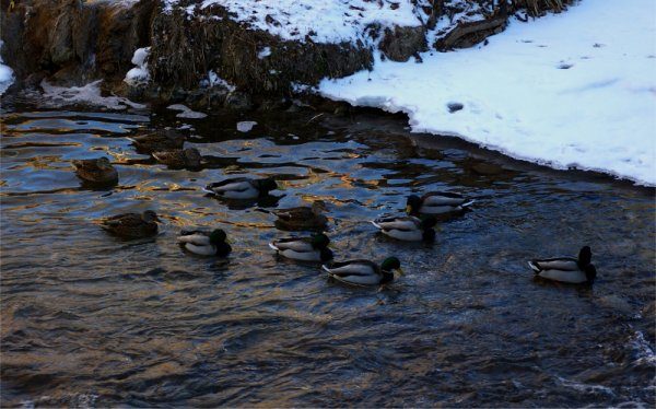
Stockade Lake, at about 120 acres the largest of the four, allows all boats and has a ramp. Men from Camp Doran, a CCC camp, built its dam in the 1930s; the camp’s first tents stood where the water is now. The lake was first called Doran. Its present name comes from the Gordon Stockade, the log fort of gold seekers who reached French Creek in December 1874, on land the 1868 treaty had reserved to the tribes; a replica stands by the west shore (see The Black Hills Gold Rush). Bass, northern pike, crappie, perch, bluegill and bullhead live there, and a 3.2-mile spur links the lake to the George S. Mickelson Trail.
Center Lake, about 26 acres, sits behind another CCC dam; boats must go slowly and leave no wake, and the state lists rainbow, brown and tiger trout. Legion Lake, about 9 acres, became park land in 1941. Before that, Custer’s American Legion Post 46, for which the lake is named, leased the ground in the 1930s and built a lodge there for a veterans’ summer camp. Legion allows electric motors only.
- Distance
- Lakeshore loops of less than 1 mile at Legion Lake and 1 mile at Sylvan Lake (Game, Fish and Parks); 10 miles around Deerfield Reservoir on Trail 40L (Forest Service)
- Elevation gain
- Not published by the managing agencies
- Difficulty
- Sylvan Lake’s loop is easy to moderate, by Game, Fish and Parks’ rating
- Trailhead
- Any point on the shore at Sylvan Lake, beside the Needles Highway (SD 87); the west end of the fishing dock parking lot at Legion Lake, off US 16A
- Season
- Ice fishing in winter at Pactola, Sheridan, Deerfield and Horsethief, by the Forest Service’s lists; it takes out its boat docks before the lakes freeze, and the Pactola visitor center is seasonal
Horsethief and Bismarck, Two Small Forest Lakes
Horsethief Lake lies on SD 244 west of Mount Rushmore National Memorial, about 2 miles away. It is a trout lake with an accessible fishing pier; anglers also fish from shore and from boats without motors, and ice fishing is popular, the Forest Service says. Dredging that ended in 2014 took out built-up sediment and restored the lake’s depth, by the Forest Service’s account; the state’s plan puts the lake at about 15 acres.
Bismarck Lake, spelled Bismark by the Forest Service, is national forest water, though the way in is through Custer State Park, by the park’s west entrance on US 16A. The state’s plan puts it at 25 to 27 acres; the Forest Service lists rainbow and brown trout, sunfish, smallmouth bass, northern pike and catfish.
The Forest Service’s own pages disagree about motors on these lakes. Its pages for Horsethief and Bismarck mention only non-motorized boats, but its overview of water activities says Horsethief, Bismarck and Deerfield allow small trolling motors. Ask the agency before bringing one.
Irrigation Reservoirs on the Edges of the Hills
Pactola’s ranking holds only inside the national forest. Beyond it lie three reservoirs built for irrigation, two of them many times Pactola’s size.
Angostura Reservoir, southeast of Hot Springs, holds back the Cheyenne River behind a 1949 Bureau of Reclamation dam, built to irrigate farmland. Game, Fish and Parks runs a recreation area on its 36 miles of shoreline, with boating, swimming beaches and fishing, and it says the lake is known for walleye, smallmouth bass and crappie. Its park page’s praise in 2026 for “some of the finest sandy beaches in the state” is the agency’s own billing, not a measurement.
Belle Fourche Reservoir, east of the town of Belle Fourche, fills behind Orman Dam (officially Belle Fourche Dam), finished in 1911 as the storage for the Belle Fourche Project’s irrigation water; full, it covers about 8,000 acres (see The Belle Fourche Irrigation Project). The state’s Rocky Point Recreation Area on its shore has boat ramps, a swim beach and shore fishing, and lists canoeing, kayaking and paddleboarding.
Keyhole Reservoir lies in Wyoming, northeast of Moorcroft by about 17 miles, on the Belle Fourche River. Reclamation began its dam on June 29, 1950, and finished it in October 1952. Full, it covers 13,700 acres, by Reclamation’s figure. Wyoming State Parks, which runs Keyhole State Park, lists northern pike, walleye, smallmouth bass and catfish. Some of Keyhole’s water also goes to the Belle Fourche Project, as a supplemental supply for farms about 146 miles downstream (more on The Wyoming Side of the Hills).
Connected
- The National Forest and the CCCThe New Deal camps whose crews built the dams at Horsethief, Center, Stockade, Bismarck and Sheridan.
- The Belle Fourche Irrigation ProjectOrman Dam, its canals and the farms Belle Fourche Reservoir waters.
- Hill City, South DakotaThe town about 20 miles east of Deerfield Reservoir.
- Custer State ParkThe park around Sylvan, Stockade, Center and Legion lakes.
- The Centennial TrailThe long trail that passes Pactola Reservoir and Sheridan Lake.
- The Central HillsThe region that holds Pactola, Sheridan and Deerfield.
- The Granite Core: Black Elk Peak and the NeedlesThe rock around Sylvan Lake.
- The Wyoming Side of the HillsThe Belle Fourche River country where Keyhole Reservoir lies.
- Where the Hills’ Water Comes FromWhich aquifers and reservoirs supply the towns, and how they hold up.
Sources
- Fisheries Management Plan for Black Hills Reservoirs, 2015–2019 (Greg Simpson and others). South Dakota Game, Fish and Parks, Wildlife Division, 2015.
- Fisheries and Aquatic Resources Adaptive Management System, 2020–2024: Black Hills Fish Management Area. South Dakota Game, Fish and Parks, 2020.
- Pactola Reservoir Complex. USDA Forest Service, Black Hills National Forest, 2025.
- Central Hills: Rapid City (recreation sites). USDA Forest Service, Black Hills National Forest, 2026.
- Water Activities. USDA Forest Service, Black Hills National Forest, 2026.
- Horsethief Lake. USDA Forest Service, Black Hills National Forest, 2026.
- Bismark Lake. USDA Forest Service, Black Hills National Forest, 2026.
- Sheridan Lake (campground page). Recreation.gov, for the Black Hills National Forest, viewed 2026.
- Biden-Harris Administration Finalizes Protections for the Pactola Reservoir–Rapid Creek Watershed. U.S. Department of the Interior, 2024.
- Civilian Conservation Corps Camp (South Dakota historical marker 529, erected 1991 by CCC alumni, the South Dakota State Historical Society, the state Department of Transportation and the Black Hills National Forest), transcription. Historical Marker Database, viewed 2026.
- The Work of the Civilian Conservation Corps in South Dakota. South Dakota Historical Society Foundation, 2019.
- Sheridan Lake – Black Hills National Forest SD. The Living New Deal, viewed 2026.
- Sylvan Lake Lodge (Michelle L. Dennis). SAH Archipedia, Society of Architectural Historians and University of Virginia Press.
- Tatanka: Custer State Park Visitor Guide (vol. 47). South Dakota Game, Fish and Parks, 2026.
- Trail Mix: A Hiker’s Guide to Custer State Park’s Trails. South Dakota Game, Fish and Parks, 2026.
- George S. Mickelson Trail (trail guide map). South Dakota Game, Fish and Parks, 2026.
- Angostura Recreation Area. South Dakota Game, Fish and Parks, viewed 2026.
- Rocky Point Recreation Area. South Dakota Game, Fish and Parks, viewed 2026.
- Keyhole Unit, Pick-Sloan Missouri Basin Program. U.S. Bureau of Reclamation, viewed 2026.
- About Keyhole State Park. Wyoming State Parks, Historic Sites and Trails, viewed 2026.
Last reviewed: