Section
Regions
- The Northern HillsHomestake gold at Lead, Deadwood's gulch, the limestone walls of Spearfish Canyon, Red Valley towns and irrigated plains around Belle Fourche.
- The Central HillsBlack Elk Peak's granite, the old mining towns of Rochford, Hill City and Keystone, the high reservoirs, and Rapid City below.
- The Southern HillsDrier and warmer than the north, with Wind Cave, Jewel Cave, Custer State Park, Hot Springs and Edgemont.
- The Wyoming Side of the HillsIgneous mountains, Devils Tower and its tribal names, the Belle Fourche valley, Newcastle and the old coal camp of Cambria.
- The Badlands and WallOutside every ring of rock: the Badlands Wall, Wall and Interior, the grassland, and who owns the park's South Unit.
- Bear Butte and the Plains EdgeThe Hogback where the Hills end, the shale prairie and cattle range beyond, and Bear Butte, a sacred mountain to many tribes.
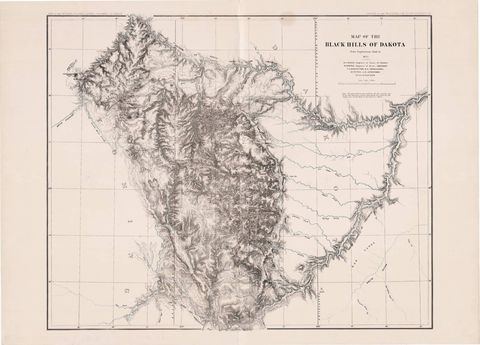
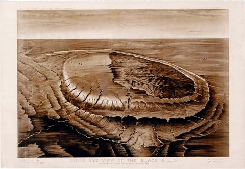
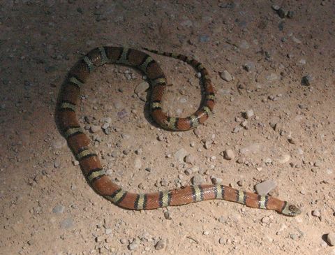
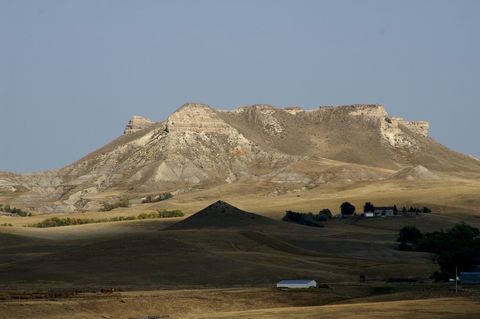
The Cheyenne River and its northern branch, the Belle Fourche, almost close a loop around the Black Hills, as the geologist N.H. Darton noted for the U.S. Geological Survey in 1909. Inside that loop the land rises in a long dome that runs along the line between South Dakota and Wyoming. This section divides the greater Black Hills into six regions: three named by direction, the Wyoming side, the Badlands to the east, and the plains edge where the Hills give out. Each region page covers its landscape, towns and landmarks, and links on to the town pages for the detail.
The rock under the Hills lies in rings. At the center is a core of ancient granite and schist. A high rim of limestone circles it, then the Red Valley, a trough eroded in soft red shale and siltstone that circles the whole range, and last the Hogback, a hard sandstone ridge along the outer edge. How the Black Hills Formed explains all four. The Central Hills hold Black Elk Peak (called Harney Peak until 2016) and its granite, along with towns that began as gold camps, Hill City among them. The Northern Hills run from the mining towns of Lead and Deadwood down Spearfish Canyon to the Red Valley and out to the plains at Belle Fourche.
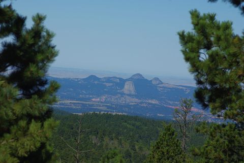
The Southern Hills take in Custer State Park, Hot Springs and its warm water, and two caves that rank among the world's longest: Jewel Cave, and Wind Cave, the cave of the Lakota emergence story. Across the state line, the Wyoming side holds the Bear Lodge Mountains, Inyan Kara Mountain and Devils Tower, all made of magma that cooled underground until erosion laid it bare. By the National Park Service's count, more than two dozen tribes have ties to Devils Tower, among them the Lakota, Cheyenne, Crow, Arapaho, Shoshone and Kiowa, and prayer offerings are still made there. In 1906 Devils Tower became the first national monument in the United States.
The last two regions sit at the Hogback and beyond it. Bear Butte and the Plains Edge follows that ridge and the grassland outside it to Bear Butte, about 6 miles northeast of Sturgis, which many tribes count as sacred and visit for prayer and ceremonies. The Lakota call it Mahto Paha (or Paha Mahto). The Northern Cheyenne hold that their prophet, Sweet Medicine, was given the Sacred Arrows there, and in 2014 the tribe's president told a House committee that Bear Butte is "our Mount Sinai."
Farther east, the Badlands and Wall lie beyond every ring, on soft rock deposited between about 75 million and 28 million years ago. The Cheyenne and White rivers carved that rock into buttes and gullies, and by the Park Service's estimate the Badlands still wear away at about an inch a year.
Sources
- Geology and Water Resources of the Northern Portion of the Black Hills and Adjoining Regions in South Dakota and Wyoming (Professional Paper 65), Topography. N.H. Darton, U.S. Geological Survey, 1909 (NPS History Electronic Library copy).
- NPS Geodiversity Atlas: Wind Cave National Park, South Dakota. National Park Service, 2024.
- Stop #7: Spearfish Formation / Inyan Kara Group. National Park Service, Wind Cave National Park, 2021.
- South Dakota State Historical Society Markers (marker 39, Hill City). South Dakota State Historical Society, 2020.
- A Place of Reverence for Native Americans. National Park Service, Devils Tower National Monument, 2025.
- Crook County, Wyoming. Nicole Lebsack, WyoHistory, Wyoming State Historical Society, 2014.
- Bear Butte State Park. South Dakota Game, Fish and Parks.
- Statement of Llevando "Cowboy" Fisher, President, Northern Cheyenne Tribe, on H.R. 4350, the Northern Cheyenne Lands Act. Northern Cheyenne Tribe, to the House Committee on Natural Resources, 2014.
- Geologic Formations: How Badlands Buttes Came to Be. National Park Service, Badlands National Park, 2020.
Last reviewed: