Regions
Bear Butte and the Plains Edge
From the top of Bear Butte the view divides. On one side rise the forested Black Hills, with Sturgis at their foot; to the east, open plains run out of sight. The butte stands alone on that grassland, about 6 miles northeast of Sturgis. The outer edge of the Black Hills runs from the Hogback, the sandstone ridge that forms the outermost ring of rock, across the prairie that circles the Hills beyond it, to Bear Butte, a mountain many tribes hold sacred.
Where Do the Black Hills End?
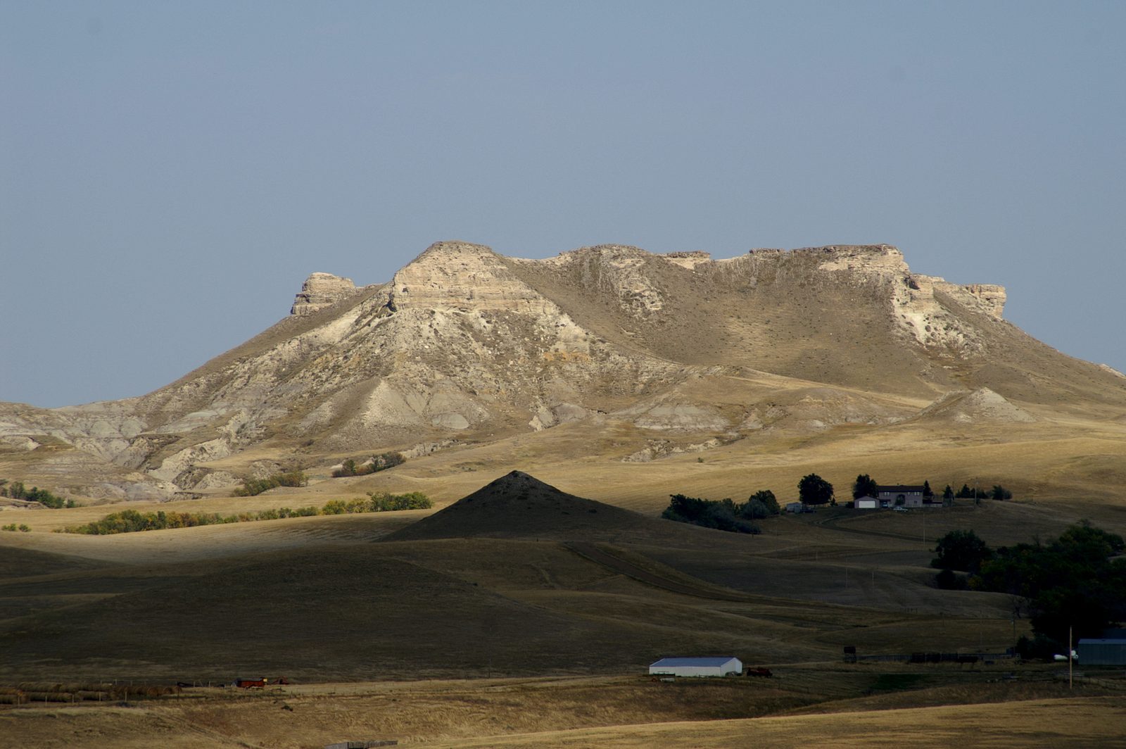
The Black Hills end at the Hogback. Made of Inyan Kara Group sandstone, this ridge is the outermost of the Hills' four rings of rock, counting out from the old core at the center. The U.S. Geological Survey uses the outer edge of that rock as the rough boundary of the Black Hills area. The ridge's inner face rises several hundred feet above the Red Valley, N.H. Darton of the USGS reported in 1909, and its outer side drops away to the plains.
Many creeks cut gaps through the ridge on their way out of the Hills. In Rapid City, concrete dinosaurs stand in Dinosaur Park on the ridge above Rapid Creek's gap. Driving north from there to Sturgis on Interstate 90, travelers follow the Red Valley with the ridge off to the right for most of the way. The two rivers that nearly surround the Hills cut long valleys through it: the Cheyenne loops across it for several miles at the southern tip, and the Belle Fourche crosses it at the north end.
Shale, Grass and Cattle Country
Outside the Hogback the ground drops to about 3,000 feet above sea level, more than 4,000 feet below the summit of Black Elk Peak, and opens into plains on every side. Darton's survey described them as largely level, rising here and there into low swells and cut by wide, shallow valleys. East and north of the Hills they rest on the Pierre Shale, a dark gray rock more than 1,000 feet thick.
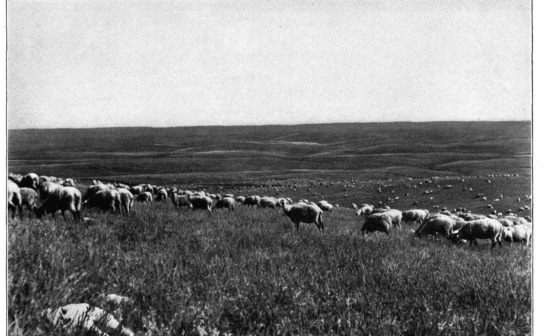
The pine forest mostly ends at the inner edge of the Red Valley. Out on the plains, cottonwood, ash and willow grow along the streams, and a 2002 USGS study describes unirrigated land there as used mainly for range, hay and winter wheat. North of Bear Butte, Highway 79 crosses the Belle Fourche River on its way to Newell, where the Pierre Shale lies under hay and cropland irrigated from the Belle Fourche Reservoir.
Bear Butte lay within the Great Sioux Reservation created by the 1868 treaty until the 1877 Act took it, with the Hills and the rest of the reservation west of the 103rd meridian, without the consent the treaty required. Cattle trailed up from Texas and Colorado were soon grazing the unfenced range around the Hills, and before long it was crowded. The historian John Burkholder dates the first signs of overstocking to 1883, when stockmen were readying a case for Congress to open what remained of the reservation to their herds. The big wave of homesteaders came after 1900. Claims in western South Dakota surged in 1907 and 1908, but 160 acres could not support a family in country this dry, and many gave up after the dry year of 1911.
Bear Butte in Tribal Accounts
Bear Butte is Nóávóse in Cheyenne and Mahto Paha (or Paha Mahto) in Lakota. In Northern Cheyenne tradition the Sacred Arrows came to the people on this mountain through the prophet Sweet Medicine, and the Arrows are still in the care of the tribe's traditional leaders. Llevando Fisher, then the Northern Cheyenne president, said so in May 2014, in testimony to a House subcommittee backing a bill to put 635 acres the tribe had bought beside the state park into federal trust. That land, he said, serves as "a base for tribal pilgrimages."
At a Senate hearing in June 2003, Steve Brady Sr., a headsman of the Northern Cheyenne Crazy Dogs Society, said his people had gone to the butte "for centuries upon centuries," to pray above all in hard times, when soldiers from the tribe are at war. He gave two examples from his own family. During the Vietnam War, in 1971, his grandfather spent several days on the butte fasting and praying with the keeper of the Sacred Arrows, and in 1975, when Brady entered the service himself, the older man brought him there to pray and make offerings.
At the same hearing, Charmaine White Face, who introduced herself as Oglala Lakota, said more than 30 nations count the butte among their most sacred places. Her own people go there too, she said, to seek guidance and to receive spiritual gifts. Sacred Sites: Bear Butte, Devils Tower and Wind Cave gives the fuller account of what the butte means.
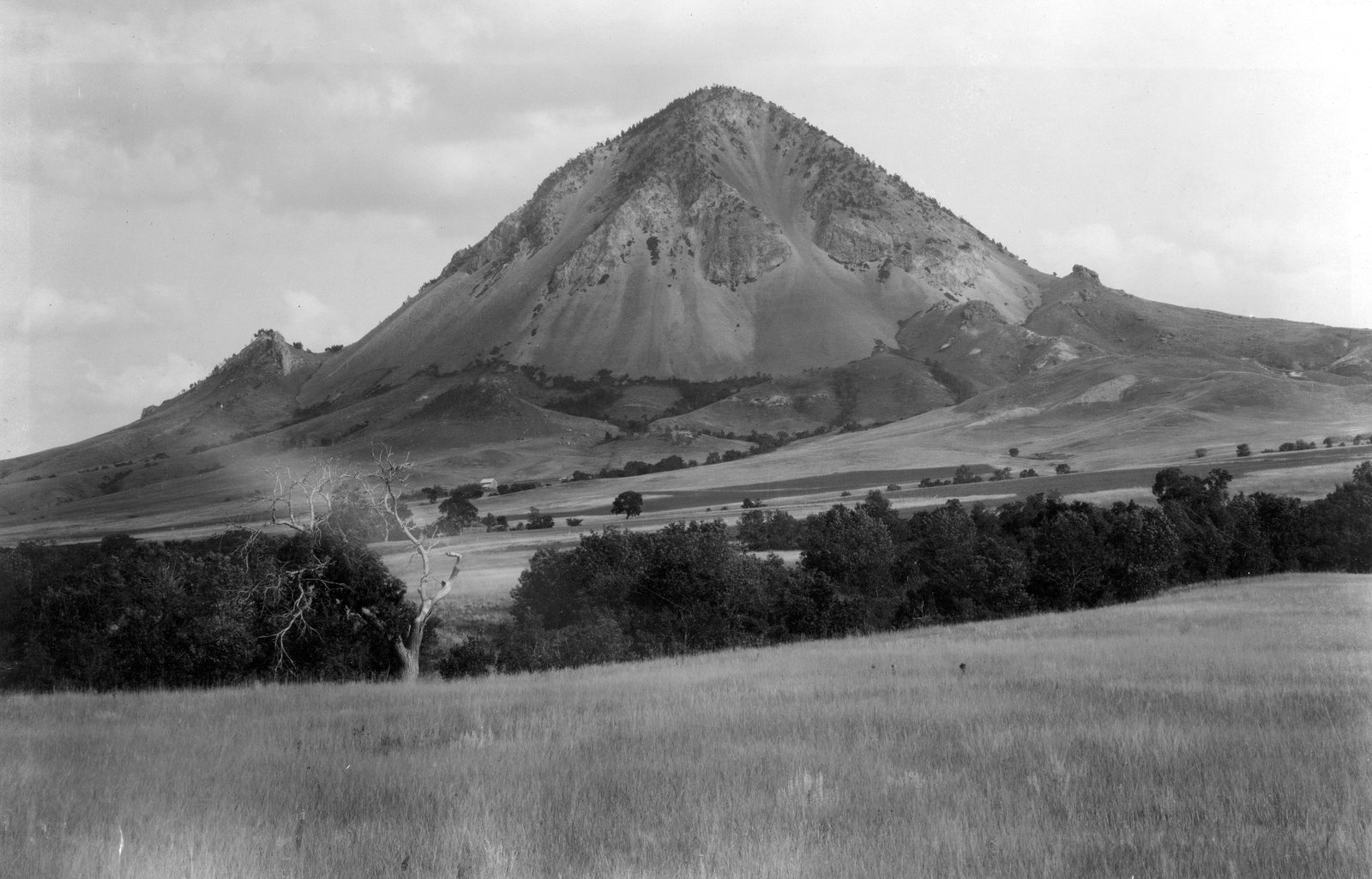
The butte itself is magma that pushed up into the layers beneath the plains and hardened without breaking through. Hikers on the Summit Trail pass rock layers tipped on end by its rise.
Visiting Bear Butte State Park
Bear Butte State Park lies off South Dakota Highway 79 and is open all year, and the butte is also a National Historic Landmark. In 1961 the state legislature set aside $50,000 to buy land at the butte for the park. An education center stands by the parking lot at the foot of the Summit Trail, and the park also holds Bear Butte Lake, campgrounds, and a horse camp across the highway.
The park's web page lists the Summit Trail at 1.85 miles; its current trail map gives 1.5 miles. From the parking lot it switchbacks up, past burned stumps from a 1996 fire, climbing more than 900 feet. Pets aren't allowed, since the trail is too narrow. The park asks hikers to keep to the path and show respect for anyone at prayer. Prayer cloths and tobacco ties hanging in the trees are to be left alone and not photographed. East of the highway, uncased guns and bows are banned year-round, a rule the park says cuts danger and disturbance for worshippers. A bison herd ranges around the base, and the park warns visitors not to approach.
From October 1 to April 30 the park may shut off its water, flush toilets included, but the vault toilets generally stay open. Summer lightning can close the trail: on the evening of August 28, 2026, a lightning-caused fire near the summit shut the Summit Trail for a time, and crews had it contained by the next morning.
Each August the Sturgis Motorcycle Rally brings crowds into the country around the butte. Since at least 2003, tribes and their members have objected to bars, campgrounds, a planned shooting range and other development near Bear Butte. The Rally and Bear Butte follows that dispute and the rally's place in it.
The Centennial Trail, built for South Dakota's statehood centennial in 1989, begins at the park and runs 111 miles through the Hills to its southern end in Wind Cave National Park.
Connected
- Sacred Sites: Bear Butte, Devils Tower and Wind CaveWhat the butte means to the tribes, and how visitors are asked to behave.
- Sturgis, South DakotaThe town in the Red Valley closest to Bear Butte.
- The Rally and Bear ButteDevelopment near the butte and the tribes' objections.
- Devils Tower, Bear Butte and the Igneous Rocks of the HillsThe magma that formed Bear Butte and its neighbors.
- The Open Range and the Cattle DrivesThe cattle outfits that took over the grass around the Hills.
- Homesteading the Edges of the HillsWho claimed the plains after 1900, and who stayed.
- How the Black Hills FormedThe four rings of rock, with the Hogback outermost.
- The Red ValleyThe red lowland just inside the Hogback.
- The Sturgis Motorcycle RallyHow a 1938 race grew into the August crowds near the butte.
- The Centennial TrailThe 111-mile trail that begins at Bear Butte State Park.
- The 1876 War and the Taking of the HillsHow the 1877 Act took the Hills from the tribes.
- The Northern HillsThe neighboring region of Spearfish, Deadwood, Lead and Sturgis.
Further reading
- Statement of Llevando "Cowboy" Fisher, President, Northern Cheyenne Tribe, on H.R. 4350, Northern Cheyenne Tribe (the tribe on Bear Butte and its land beside the park, 2014)
- Testimony of Charmaine White Face on the protection of Bear Butte, U.S. Senate Committee on Indian Affairs (her written statement, 2003)
- Native American Sacred Places, U.S. Senate Committee on Indian Affairs (the full 2003 hearing, with Lakota and Northern Cheyenne testimony on Bear Butte)
- Bear Butte State Park, South Dakota Game, Fish and Parks (current park rules and conditions)
Sources
- Statement of Llevando "Cowboy" Fisher, President, Northern Cheyenne Tribe, on H.R. 4350, the Northern Cheyenne Lands Act. Northern Cheyenne Tribe, before the House Committee on Natural Resources, 2014.
- Native American Sacred Places (S. Hrg. 108-197), hearing of June 18, 2003. U.S. Senate Committee on Indian Affairs, 2003.
- Bear Butte State Park. South Dakota Game, Fish and Parks.
- Bear Butte State Park: Summit Trail and Lake Trail, Trail Guide to South Dakota State Parks. South Dakota Game, Fish and Parks, 2015.
- Bear Butte Trail System (trail map). South Dakota Game, Fish and Parks.
- South Dakota State Park History (timeline poster). South Dakota Game, Fish and Parks.
- Geology and Water Resources of the Northern Portion of the Black Hills and Adjoining Regions in South Dakota and Wyoming (Professional Paper 65), by N.H. Darton. U.S. Geological Survey, 1909.
- Hydrology of the Black Hills Area, South Dakota (Water-Resources Investigations Report 02-4094), by Daniel G. Driscoll and others. U.S. Geological Survey, 2002.
- Geologic Field Trips in the Black Hills Region, South Dakota (Bulletin 21), edited by Michael P. Terry, Edward F. Duke and Jacob A. Tielke, including Mark D. Fahrenbach (South Dakota Geological Survey), "Geologic Road Log: Rapid City to Sturgis, Lead-Deadwood, Spearfish, to Rapid City," and Larry D. Stetler and James J. Stone, "Environmental Geology of Abandoned Uranium Mines, Harding County, South Dakota." South Dakota School of Mines and Technology, 2010.
- South Dakota State Historical Society Markers (marker 436, Thomas E. Odell). South Dakota State Historical Society, 2020.
- Fort Laramie Treaty (1868), transcript, Article II. National Archives.
- Agreement with the Sioux, Arapaho and Northern Cheyenne, 1876, Article 1. Oklahoma State University Libraries, Tribal Treaties Database.
- Poised to Profit: Fort Pierre and the Development of the Open Range in South Dakota, by John H. Burkholder. South Dakota History 41:3, South Dakota State Historical Society, 2011.
- Fifty Years of South Dakota Agriculture, by Ray F. Pengra and Gabriel Lundy. South Dakota State College, Agricultural Experiment Station, 1954.
- Chokecherry fire near Bear Butte summit fully contained. KOTA, 2026.
- Hiking. National Park Service, Wind Cave National Park.
- Big Pine Trailhead (Centennial #89). USDA Forest Service, Black Hills National Forest.
Last reviewed: