Landscape and Geology
Devils Tower, Bear Butte and the Igneous Rocks of the Hills
Devils Tower spent most of its existence underground. By the National Park Service's account, its rock hardened about 50 million years ago, one to two miles below the surface, and erosion began uncovering it only 5 to 10 million years ago. The Tower belongs to a family of igneous rocks (rocks that were once molten) in the northern Black Hills, along with Bear Butte, Inyan Kara Mountain, the Bear Lodge Mountains and Sundance Mountain. All but perhaps Sundance Mountain came from magma that rose into the region's rock layers about 58 to 46 million years ago. How some of them formed is still argued.
Most of these rocks, as far as the evidence shows, never erupted. They cooled out of sight and were laid bare much later, as water carried off the softer rock above them. Sundance Mountain may be an exception, and for Devils Tower the question isn't settled.
What Is an Igneous Intrusion?
An igneous intrusion is magma that forced its way into older rock and hardened there instead of pouring out as lava. In the northern Hills the magma pushed into thick layers of sandstone, siltstone, shale and limestone, the layers that ring the old core of the Hills. Some spread between layers and bowed up the rock above like a blister, a shape geologists call a laccolith. Some rose as narrow plugs or as small masses called stocks.
The igneous rock wears down more slowly than the poorly cemented sandstones and siltstones around it, so erosion left it standing as lone peaks and buttes, often with tilted or broken layers at their feet. The signature in the landscape is an isolated peak of gray rock, skirted with fallen blocks, rising out of red hills or open plains.
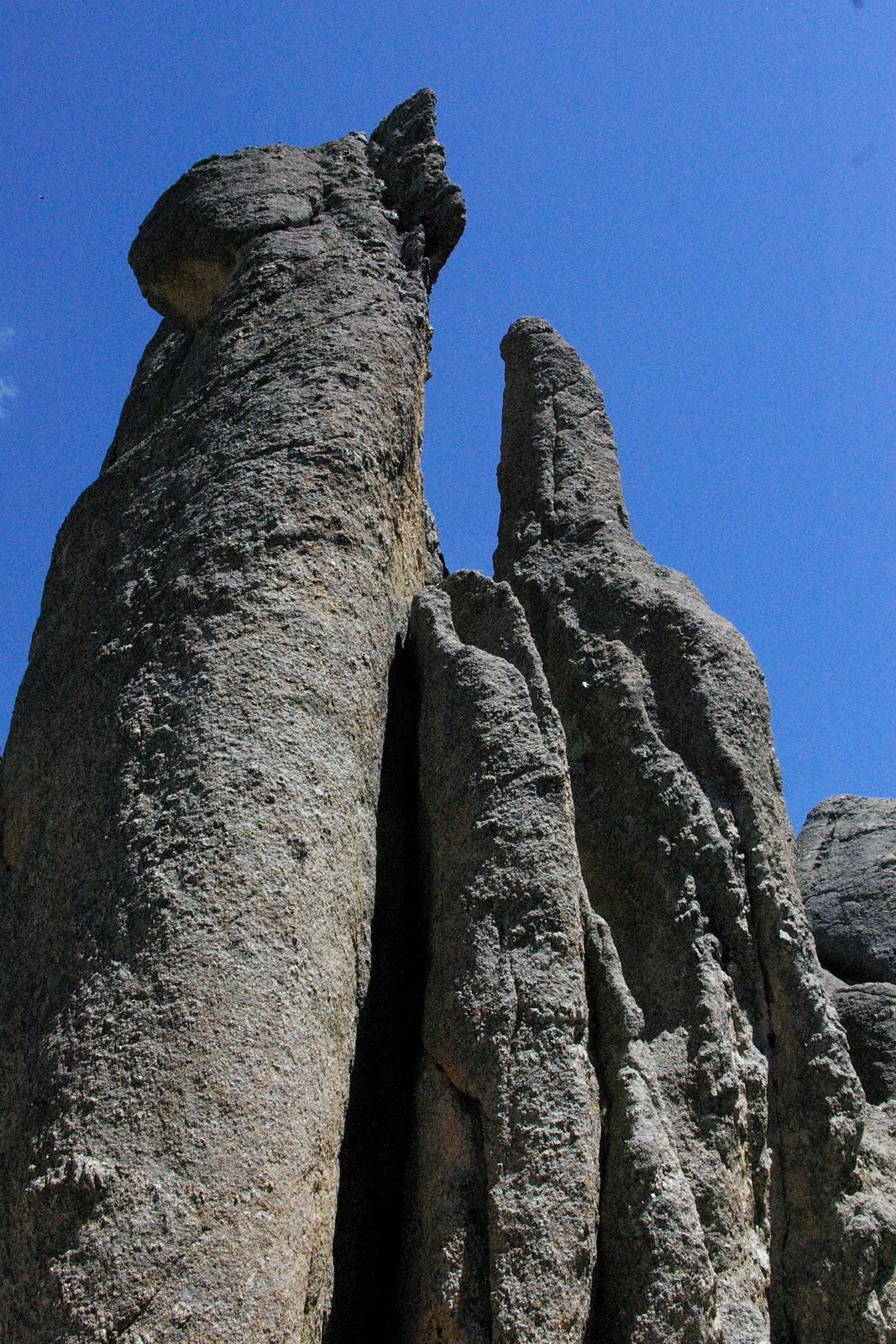
In 2002, geologists from the South Dakota School of Mines and Technology, the University of Wisconsin and the U.S. Geological Survey published argon dates for 12 intrusions in the northern Hills. The dates fell in three bursts: about 58, 55 to 54, and 49.6 to 46 million years ago. The dated South Dakota intrusions were the older ones. The Wyoming group, Devils Tower among them, came about 4 million years later.
How Tall Is Devils Tower?
Devils Tower rises 867 feet from its base to its summit and 1,267 feet above the Belle Fourche River, according to the National Park Service. The summit stands 5,112 feet above sea level. The base measures about a mile around, and the top covers about 1.5 acres, roughly 180 by 300 feet. The Tower sits 9 miles south of Hulett, Wyoming; its trails and climbing are covered on Devils Tower National Monument.
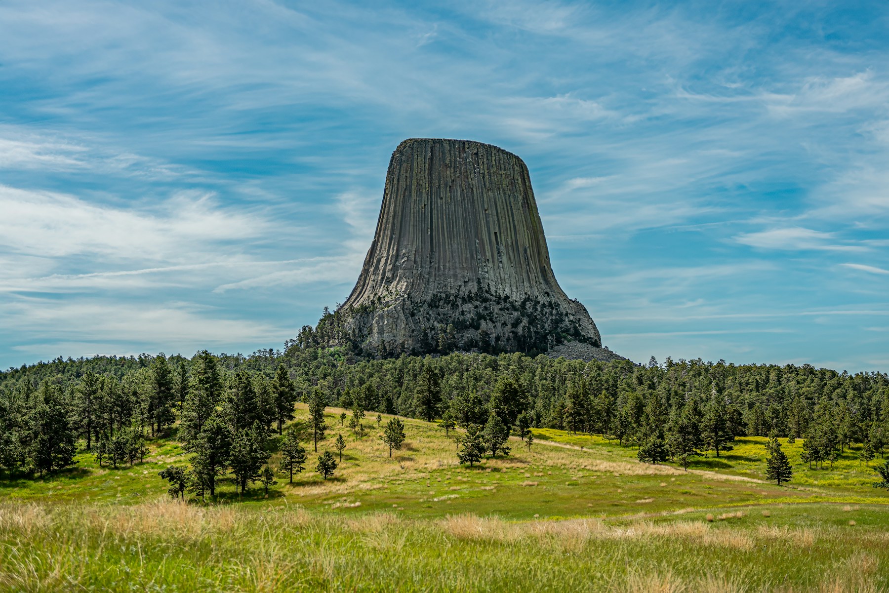
The rock is phonolite porphyry. Phonolite, named for the ring it gives off when struck, is a fine-grained igneous rock, mostly feldspar. Porphyry means it holds large crystals in a finer mass, here white feldspar about a quarter to a half inch across. Unlike granite, it has no quartz.
As the magma cooled it shrank, and the shrinking cracked it into long columns, a pattern called columnar jointing. The Park Service calls the Tower "the largest example of columnar jointing in the world." Cooling cracks usually make six-sided columns, but the Tower's have four to six sides, and many are five-sided, for reasons scientists haven't pinned down. The bigger columns are 6 to 8 feet across near the bottom and narrow to about 4 feet near the top.
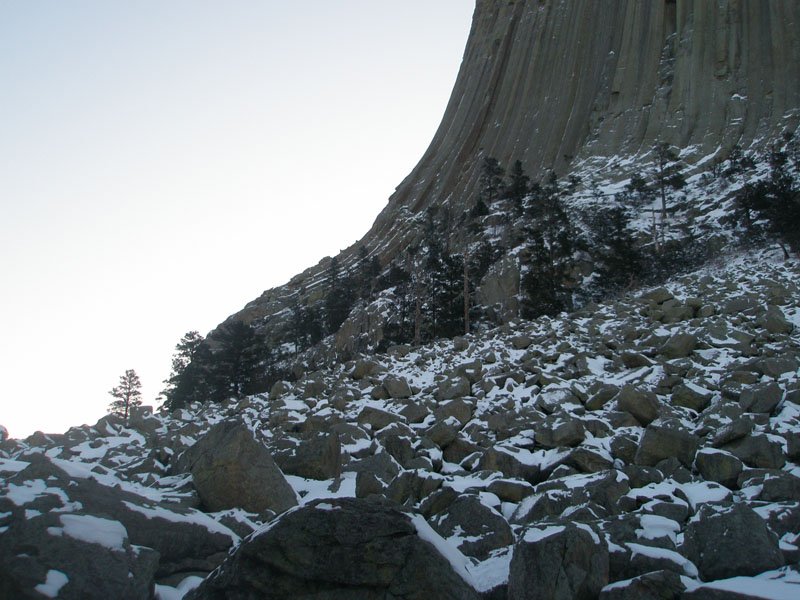
Broken columns lie heaped around the base in a talus apron (a slope of fallen rock) that reaches about 1,100 feet out, with blocks as long as 25 feet. Small pieces break loose often, but the Park Service knows of no major column fall in about 200 years.
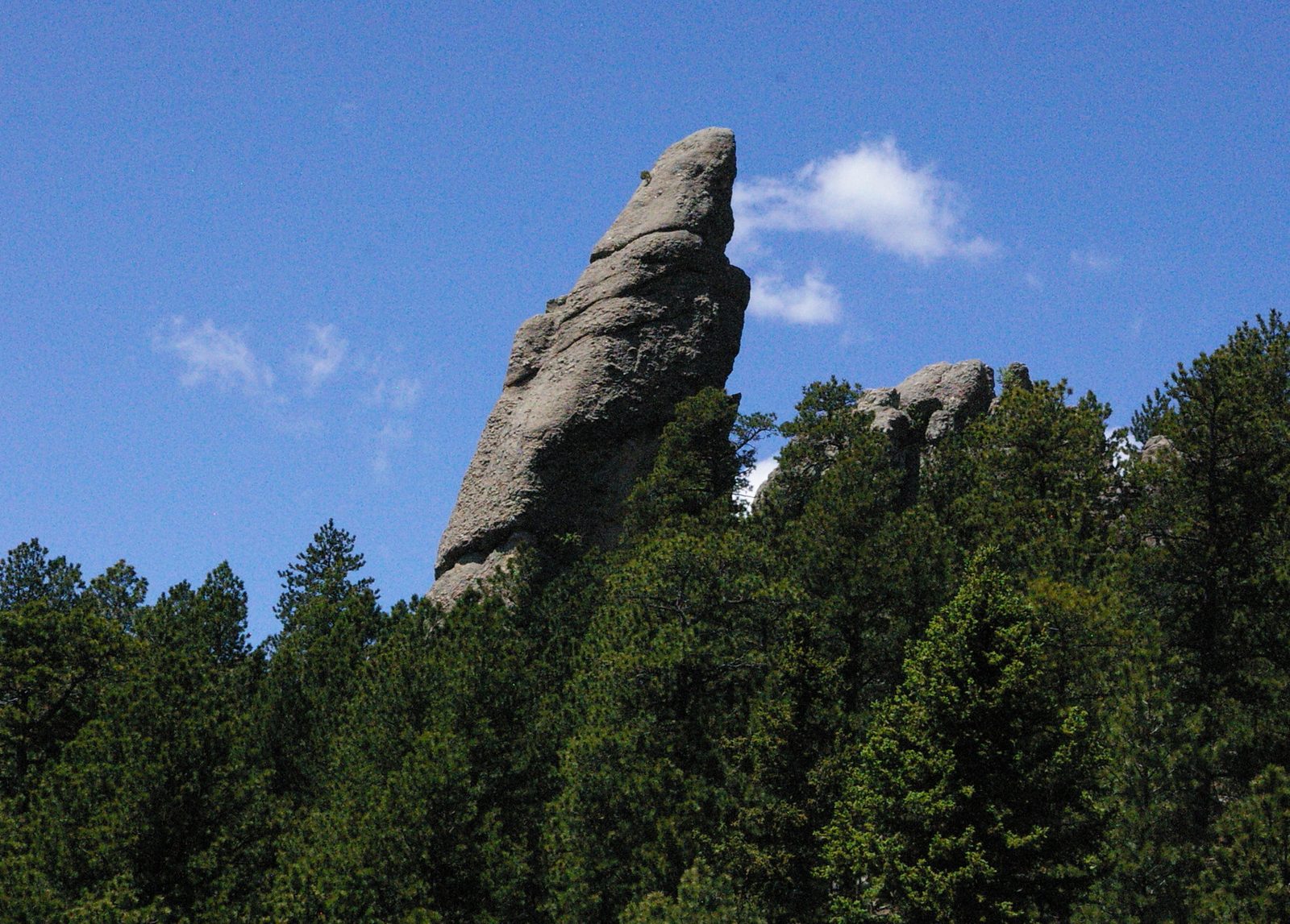
About 3.5 miles to the northwest, the four Little Missouri Buttes are made of the same phonolite porphyry. The 2002 argon study gave the buttes and the Tower ages that can't be told apart, about 49 million years, which suggests one burst of magma fed both.
How Did Devils Tower Form?
No one knows for certain, and the National Park Service says so. Geologists agree the Tower began as magma forced up into sedimentary rock. What shape the magma took, and how near the surface it came, is still argued, and the Park Service lists several explanations without choosing one.
The simplest makes it a stock, a small underground mass of magma that erosion later laid bare. In 1907 the geologists Darton and O'Hara concluded it was a laccolith, since stripped of its roof. Another idea makes the Tower the plug of an old volcano, the magma that froze in its throat, though little sign of volcanic activity survives nearby. A fourth, argued most recently in 2015 by Prokop Závada and colleagues, starts with rising magma meeting groundwater: steam blasts opened a crater, lava filled it, and erosion later carved the Tower from that fill.
If either of the last two ideas is right, the Tower's magma reached the surface, though the Park Service still tells visitors it is not an old volcano. The same erosion that uncovered the Tower, the Park Service notes, wiped away the clues that would settle it. Below the Tower, the Belle Fourche River has cut into deep red sandstone and siltstone, the same red beds that ring the Hills in the Red Valley.
Bear Butte: Magma That Stopped Short
Bear Butte is an igneous intrusion standing alone on the plains about 6 miles northeast of Sturgis, South Dakota, some 1,200 feet above the surrounding country. South Dakota Game, Fish and Parks describes it as the remains of "a volcano that did not erupt," which geologists call a laccolith. On its flanks, layers the magma pushed up now stand on end. Bear Butte's rock has no published date, so it is counted with the same belt as Devils Tower. Its setting is covered on Bear Butte and the Plains Edge.
Bear Butte and Devils Tower are sacred places. In 2014 Llevando Fisher, president of the Northern Cheyenne Tribe, told a House committee that Bear Butte is his tribe's "most precious sacred site," a place many other tribes hold sacred too, and the National Park Service says more than 20 tribes hold Devils Tower sacred. What the two places mean, in the tribes' own accounts, is told on Sacred Sites, and Rock, Bear and Rope: Devils Tower follows the thread from the Tower's rock to the bear story tribes tell about it.
The Bear Lodge Mountains and a Disputed Butte
In N.H. Darton's 1905 USGS survey of the country around Sundance, Wyoming, the largest igneous mass is the Bear Lodge Mountains, a range of steep, canyon-cut slopes that begins just north of town and runs northwest. The magma came more than once. A 2019 study found igneous rock there both older and younger than the carbonatite veins at its center. Carbonatite is an unusual igneous rock rich in carbonate minerals, and here it carries rare earth elements. Dates from the range run from about 52 to 46 million years ago.
Just south of town, Sundance Mountain climbs past 5,800 feet, its rocky sides rising more than 1,000 feet from the valleys below. Whether it belongs with the others is an open question. Darton mapped it as an intrusion, the worn-down base of a laccolith, which would put it in the same belt. A 1979 master's thesis at the University of North Dakota by Earl Fashbaugh found that two-fifths to three-quarters of its rock is breccia (broken, angular fragments) and tuff (hardened volcanic ash), and read the mountain as a volcanic cone instead, which would make it much younger, less than about 28 million years old.
Inyan Kara Mountain and a Dome Still Waiting
Inyan Kara Mountain, between Sundance and Newcastle on the Wyoming side of the Hills, stands by itself, its 6,368-foot summit more than 1,000 feet higher than the land around it. Its core is syenite porphyry, a light to medium gray rock dotted with pale feldspar crystals. At the surface the core makes a rough circle about a mile wide, broken into sheer cliffs and sharp crags.
The magma shoved the surrounding rock into a sharp dome about 1.5 miles across. Rock layers elsewhere in the area tilt only 1 to 3 degrees, but on the mountain's southwest side a limestone layer stands vertical, in places tipped past it, and a horseshoe-shaped fault nearly circles the peak. Early geologists called Inyan Kara a laccolith. W.J. Mapel and C.L. Pillmore, mapping it for the USGS in 1963, judged the exposed part to be more of a small plug. It, too, has no published age.
About 4 miles to the southeast, a rounded, wooded hill called Strawberry Mountain sits on a dome of the same size. No igneous rock shows at its surface. The 1963 mappers concluded that an intrusion probably lies underneath anyway, one that erosion has not yet uncovered.
Connected
- Devils Tower National MonumentVisiting the Tower: the trails around its base and climbing.
- Rock, Bear and Rope: Devils TowerHow the Tower's rock, the tribes' bear story and the climbing closure connect.
- Sacred Sites: Bear Butte, Devils Tower and Wind CaveWhat Bear Butte and Devils Tower mean to the tribes who hold them sacred.
- Bear Butte and the Plains EdgeBear Butte's place on the prairie rim of the Hills.
- The Wyoming Side of the HillsThe region that holds Devils Tower, Inyan Kara and the Bear Lodge Mountains.
- Sundance, WyomingThe town between Sundance Mountain and the Bear Lodge Mountains.
- Hulett, WyomingThe town 9 miles north of Devils Tower.
- From the Sun Dance to the Sundance KidHow a ceremony's name passed to the mountain, the town and an outlaw.
Sources
- How the Tower Formed. National Park Service, Devils Tower National Monument.
- Frequently Asked Questions. National Park Service, Devils Tower National Monument.
- NPS Geodiversity Atlas: Devils Tower National Monument, Wyoming. National Park Service.
- Little Missouri Buttes. National Park Service, Devils Tower National Monument.
- Devils Tower: Proposals to Change the Name. National Park Service, Devils Tower National Monument.
- Directions and Transportation. National Park Service, Devils Tower National Monument.
- 40Ar/39Ar Laser Incremental-Heating Ages of Devil's Tower and Paleocene-Eocene Intrusions of the Northern Black Hills, South Dakota and Wyoming, by Genet I. Duke, Brad S. Singer and Ed DeWitt. Geological Society of America Abstracts with Programs, vol. 34, no. 6, 2002.
- C–O Stable Isotope Geochemistry and 40Ar/39Ar Geochronology of the Bear Lodge Carbonatite Stockwork, Wyoming, USA, by Allen K. Andersen, Peter B. Larson and Michael A. Cosca. Lithos (U.S. Geological Survey publication record), 2019.
- Geology of the Inyan Kara Mountain Quadrangle, Crook and Weston Counties, Wyoming, by W.J. Mapel and C.L. Pillmore. U.S. Geological Survey Bulletin 1121-M, 1963.
- Sundance Folio, Wyoming-South Dakota, by N.H. Darton. U.S. Geological Survey, Geologic Atlas of the United States, Folio 127, 1905.
- Geology of Igneous Extrusive and Intrusive Rocks in the Sundance Area, Crook County, Wyoming, by Earl F. Fashbaugh. M.S. thesis, University of North Dakota, 1979.
- Bear Butte State Park. South Dakota Game, Fish and Parks.
- Bear Butte State Park trails. South Dakota Game, Fish and Parks.
- National Register of Historic Places Inventory-Nomination Form: Bear Butte. National Park Service, 1970s.
- Statement of Llevando "Cowboy" Fisher, President, Northern Cheyenne Tribe, on H.R. 4350, the Northern Cheyenne Lands Act. Northern Cheyenne Tribe, before the House Committee on Natural Resources, 2014.
- International Chronostratigraphic Chart. International Commission on Stratigraphy, 2024.
Last reviewed: