Landscape and Geology
The Granite Core: Black Elk Peak and the Needles
The granite that crowns Black Elk Peak (called Harney Peak until 2016) is a pale rock, flecked with shiny mica and, in places, black needles of tourmaline. It is about 1.7 billion years old, and it builds the highest ground in South Dakota, more than 7,200 feet above sea level. This granite and the still older rocks around it make up the crystalline core of the Black Hills, the innermost of the four rings of rock. Three things set this part of the Hills apart, and the granite explains all of them: crystals several feet long in the walls of old mines, a skyline of rock spires called the Needles, and the choice of this stone for carving.
How Old Is the Granite Core?
The rocks of the core range from about 1.7 billion to about 2.5 billion years old, the U.S. Geological Survey reports, and the Harney Peak Granite sits at the young end of that span. A 1973 USGS study and a Park Service web page give the granite about 1.6 billion years; more recent dates in the USGS geologic names database put it near 1.7 billion. Most of the core began as layers of sand and mud on the floor of an ancient sea. Buried, heated and squeezed, the mud turned into mica schist, a glittery rock that comes apart in thin flakes, and the sand turned into quartzite, a glassy stone that resists breaking. Geologists call such rocks metamorphic: rocks changed by heat and pressure without melting.
Some of the oldest rocks dated in the core are granite rather than schist. Small bodies of granite near Bear Mountain and near Nemo are about 2.5 billion years old. A 1982 USGS study describes the Harney Peak Granite and its pegmatites as the youngest of the Black Hills' Precambrian rocks, the ancient rocks of the core.
About 1.7 billion years ago, a large body of magma, or molten rock, rose into the schist. A National Park Service geology report says the magma likely formed when still older crust melted, and that it forced its way into the schist, partly by melting it. It did not arrive in one piece. On USGS maps the main body breaks into a handful of big sills, which are sheets of granite slipped in between rock layers, and swarms of smaller sills and of dikes, sheets that cut across the layers. The Forest Service describes these outcrops as built from hundreds of separate intrusions. As the magma pushed in, it bowed the schist upward, so the layers of schist now tilt down and away from Black Elk Peak on every side, the way a dome's sides fall from its top.
The main body of the granite covers about 40 square miles between Custer and Keystone. When the peak was renamed in 2016 for Black Elk, the Oglala Lakota holy man, the rock kept its old name. Geologists still call it the Harney Peak Granite, a name first published in 1898.
Pegmatite: Granite With Giant Crystals
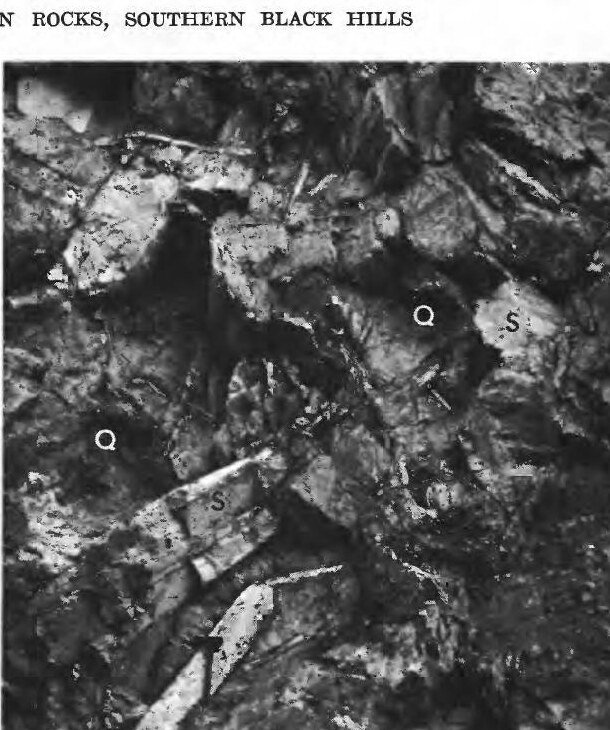
Much of the Harney Peak Granite is far coarser than ordinary granite. USGS geologists describe it as alternating layers of two kinds: coarse rock with feldspar crystals that can run inches or even feet long, and finer rock that is granite in the usual sense. Geologists call the coarse rock pegmatite: igneous rock whose crystals grew far bigger than usual and lock tightly into one another. Newcomers tend to notice the pegmatite first, a 1982 USGS report observes.
Pegmatite also fills thousands of separate bodies in the schist around the main granite. A USGS estimate, drawn from geologic maps, came to about 22,000 pegmatites in the southern Hills. Only about 1 percent of them are zoned: sorted into shells of different minerals around a core that is often a mass of quartz. Those few have been the main source of the mica, feldspar, beryl and lithium minerals mined in the Hills.
USGS geologists trace the giant crystals to the melt they grew from. The granite and the pegmatites belong to one magma system, the 1982 report concludes. Earlier USGS studies favored a melt made of granite's ordinary ingredients, such as silica, sodium and potassium, along with unusually large amounts of water, boron, lithium and beryllium. As magma crystallizes, water collects in the liquid that is left, the National Park Service explains, making it thinner and easier to force into the surrounding rock. The pegmatites cooled slowly, far underground, and crystallized from their walls inward. Some of their feldspar crystals grew several feet long, and a few reached several tens of feet.
The best-known pegmatite in the Hills is the one worked at the Etta Mine, about 1 mile south of Keystone, where a USGS report records a crystal of spodumene, a lithium mineral, with an exposed length of 47 feet; the mine's story is told on Giant Crystals, Wartime Minerals and Keystone.
Why Do the Needles Stand Up as Spires?
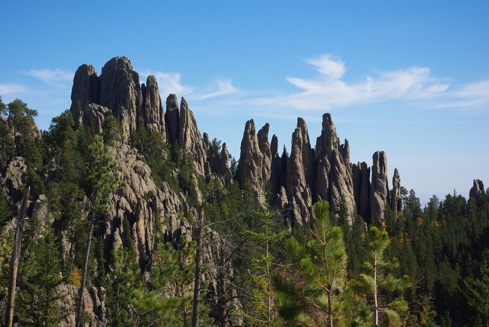
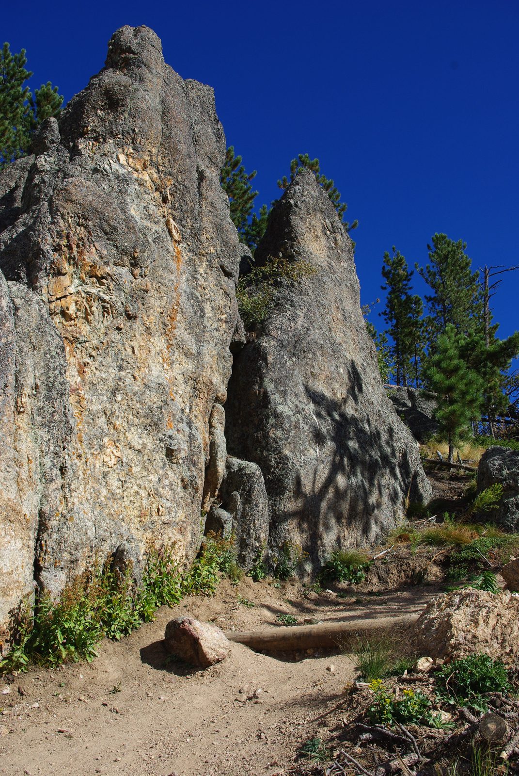
The Needles stand where the granite is broken by steep cracks, and weathering has worked along those cracks, leaving columns and slabs of sounder rock standing between them. Geologists call such cracks joints. The cracking happened as the Black Hills rose, according to a National Park Service geology report, which traces the Needles' spires and standing slabs to weathering of that broken rock once it reached the surface. Joints are common across the granite country. In a 1973 USGS study of a small area southwest of Keystone, they turned up in schist, quartzite, granite and pegmatite alike, far too many to study one at a time.
Water does much of the prying. It seeps into a joint, freezes and expands, forcing the crack wider. The Park Service counts this frost wedging as a bigger force in the Black Hills than wind or rain. Rain and wind still do their share. Weather has even worn a hole through one granite formation beside the Needles Highway. The formation, the Needle's Eye, is named for that gap, which South Dakota Game, Fish and Parks credits to wind and rain and the cycle of freezing and thawing.
Granite also outlasts the rock around it. The same 1973 study describes the pattern: streams cut their valleys in the schist, which wears down much faster, and left the tougher granite standing as hills and peaks. That is why the high country of the core, from the Needles to Black Elk Peak, is granite. The granite was once buried under younger layers of rock. As the Black Hills rose, erosion stripped those layers from the center of the dome and laid the granite bare, a story told on How the Black Hills Formed.
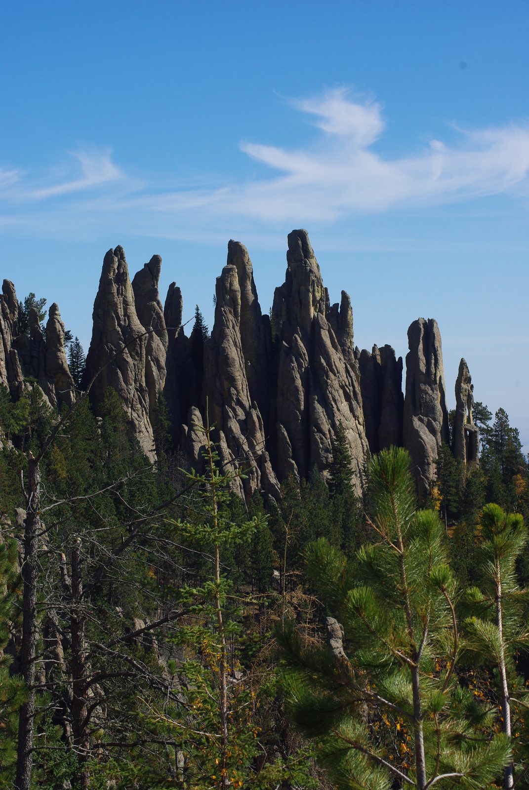
Black Elk Peak is the top of this granite country. A fire lookout tower built by the Civilian Conservation Corps between 1938 and 1940 still stands on the summit, and the route up is described on Hiking Black Elk Peak. In Custer State Park, a cluster of granite towers called the Cathedral Spires was named a National Natural Landmark in 1976, together with the rare limber pines that grow among them. The Needles Highway, South Dakota Highway 87, runs 14 miles through this country and was completed in 1922; the drive is covered on Scenic Drives.
Carving Granite on Treaty Land
Mount Rushmore, about 2 miles southwest of Keystone, is carved into this granite in Hé Sápa, on land the 1868 treaty set aside for the tribes; the 1877 Act took the Hills without the consent the treaty required. The Park Service says the site was chosen because its granite is one large, uniform, fine-grained mass with few cracks and a southeast face in good light, and estimates that it wears away only about 1 inch every 10,000 years; how the tribes view the carving is told on Mount Rushmore and Crazy Horse Memorial.
Reading the Core on the Ground
The rocks of the core are easy to tell apart once the pattern is clear. Pale high ground and spires are granite or pegmatite, the rocks that resist weathering. Valleys tend to follow the mica schist, which wears away faster. Pegmatite gives itself away by the size of its grains: blocky feldspar, glassy quartz and mica that peels apart in stacked sheets, often several inches across in the old mica mines. Nowhere in the Hills are pegmatites packed more thickly than in the country south of Custer, off the southwest side of the main granite.
Connected
- Hiking Black Elk PeakThe trail to the granite summit, the highest point in South Dakota.
- Scenic Drives: Needles Highway, Iron Mountain Road and MoreThe Needles Highway winds among the jointed granite spires.
- Mount Rushmore and Crazy Horse MemorialWhy the carving was made, and how the tribes view it.
- Custer, South DakotaA town at the south end of the granite, near the thickest cluster of pegmatites.
- Keystone, South DakotaPegmatite mines and the carved granite lie within a few miles south of town.
- Giant Crystals, Wartime Minerals and KeystoneThe Etta Mine's spodumene and the minerals mined from the pegmatites.
- How the Black Hills FormedHow the uplift raised the core, and the other rings of rock around it.
- Granite, Rushmore and Crazy HorseWhy this granite drew sculptors, and what carving it meant.
Sources
- Hydrology of the Black Hills Area, South Dakota (Water-Resources Investigations Report 02-4094). U.S. Geological Survey, 2002.
- Geology of the Harney Peak Granite, Black Hills, South Dakota (Open-File Report 82-481). U.S. Geological Survey, 1982.
- Geology and Mineral Deposits of Some Pegmatites in the Southern Black Hills, South Dakota (Professional Paper 297-E). U.S. Geological Survey, 1964.
- Geolex: Harney Peak Granite, significant publications. U.S. Geological Survey, National Geologic Map Database.
- Water Resources and Geology of Mount Rushmore National Memorial, South Dakota (Water-Supply Paper 1865). U.S. Geological Survey, 1973.
- Mount Rushmore National Memorial Geologic Resource Evaluation Report. National Park Service, 2008.
- Geologic Activity. National Park Service, Mount Rushmore National Memorial.
- NPS Geodiversity Atlas: Mount Rushmore National Memorial. National Park Service.
- Pegmatite. National Park Service, Black Canyon of the Gunnison National Park, 2025.
- Geology. USDA Forest Service, Black Hills National Forest, 2025.
- Harney Fire Lookout. USDA Forest Service, Black Hills National Forest.
- Scenic Drives. South Dakota Game, Fish and Parks, Custer State Park.
- Limber Pines of the Cathedral Spires: A Unique Tree. South Dakota State University Extension, 2025.
- Highest Peak in South Dakota Renamed for Oglala Lakota Medicine Man. Smithsonian Magazine, 2016.
- Fort Laramie Treaty (1868). National Archives, Milestone Documents.
- United States v. Sioux Nation of Indians, 448 U.S. 371. Supreme Court of the United States, 1980 (Legal Information Institute, Cornell Law School).
Last reviewed: