The Outdoors
Scenic Drives: Needles Highway, Iron Mountain Road and More
The Needles Eye Tunnel on South Dakota Highway 87 is 8 feet wide and 9 feet 9 inches high, by Custer State Park’s measurements, numbers that matter to anyone in a wide vehicle. It is one of six rock tunnels on the Peter Norbeck Scenic Byway, a National Scenic Byway through Custer State Park and the granite country near Black Elk Peak (called Harney Peak until 2016) and Mount Rushmore. This page covers two of the byway’s roads, the Needles Highway and Iron Mountain Road, with their tunnels, the rock they cross and the men who built them, then the Wildlife Loop Road, the Spearfish Canyon Scenic Byway and the Badlands Loop Road.
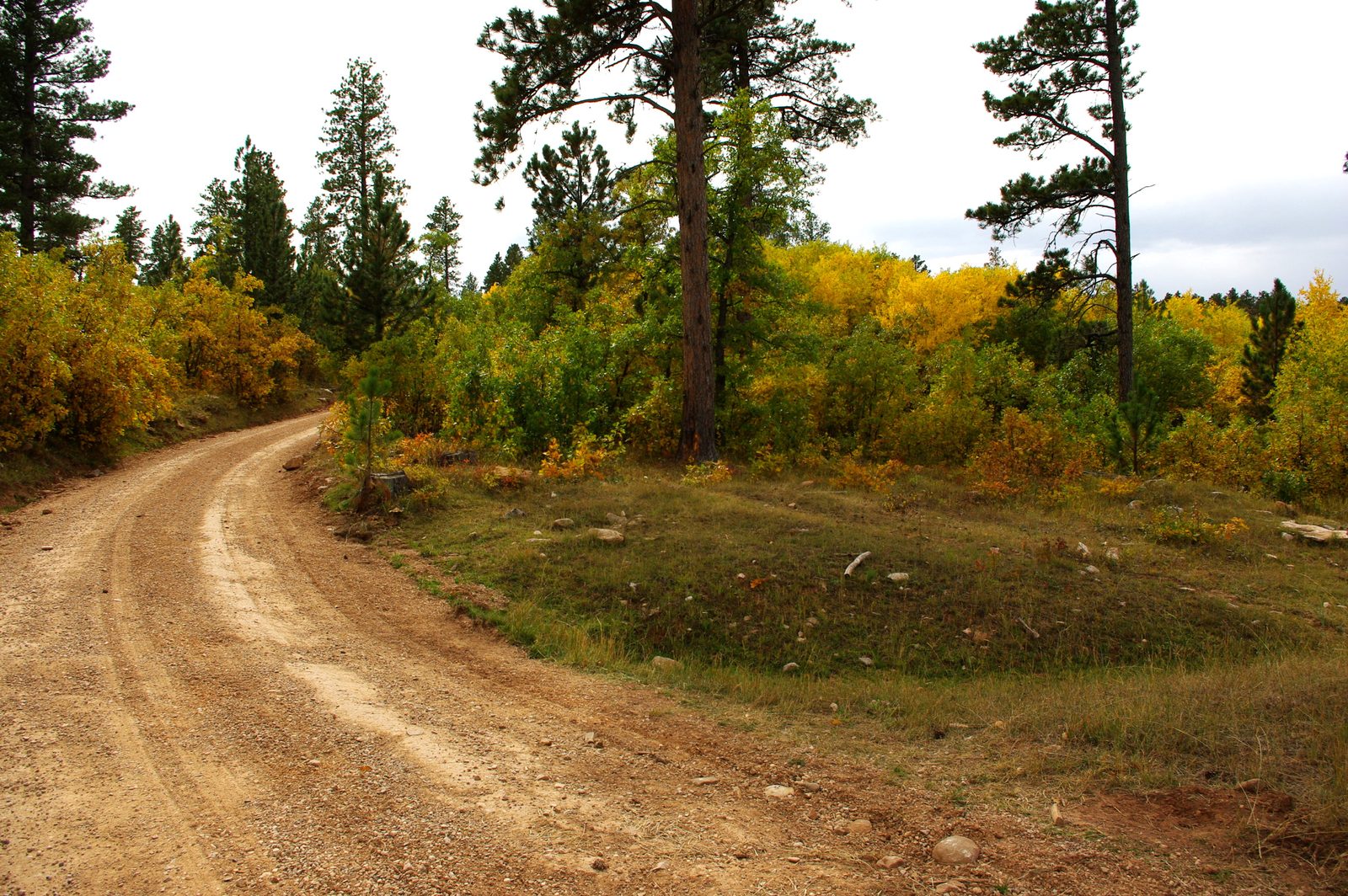
The Needles Highway: 14 Miles and Three Tunnels
The Needles Highway is the 14-mile stretch of South Dakota Highway 87 that crosses the granite country of Custer State Park, past Sylvan Lake and the needle-shaped spires it is named for. Game, Fish and Parks, which runs the park, says to allow an hour or more. The highway is seasonal.
The South Dakota Department of Transportation names three tunnels on the road: Hood, Iron Creek and Needles Eye. The park gives sizes for two, not for Hood. The Needles Eye Tunnel, beside the Needle’s Eye, a spire with a gap worn through it, is the tight one; the Iron Creek Tunnel is 8 feet 9 inches wide and 10 feet 10 inches high. The Forest Service’s byway map prints other clearances, not tied to tunnel names. Its brochure cautions that the byway’s hairpins and tunnels may stop a bus, an RV or a trailer, and it sends questions to the park.
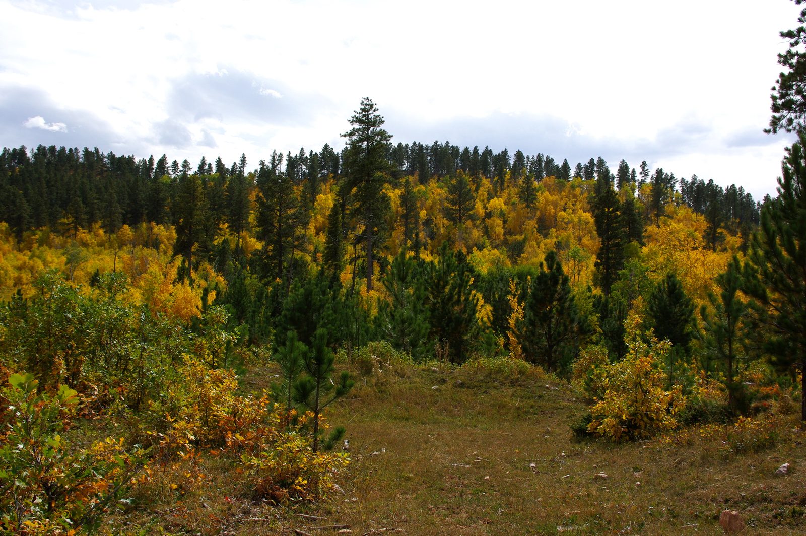
The Needles are granite, part of the crystalline core of the Black Hills. At about 1.7 billion years old, this granite is young for the core, whose oldest rocks the U.S. Geological Survey puts at about 2.5 billion years. The spires stand where steep cracks cut the granite. Water freezing in the cracks pries them wider, which the National Park Service calls frost wedging and singles out as a major force of erosion in the Hills. How the granite formed is told on The Granite Core: Black Elk Peak and the Needles.
Iron Mountain Road: Pigtail Bridges and Framed Faces
Iron Mountain Road is the 17-mile part of U.S. Highway 16A between Custer State Park and Mount Rushmore National Memorial, by the park’s count. Its north end lies inside the memorial’s boundaries, but the state transportation department manages the road, the National Park Service notes. Three pigtail bridges, wooden spirals built for sharp changes in elevation, let it climb and drop quickly.
Its three tunnels are 10 feet 9 inches to 12 feet wide by the park’s figures, but each takes one lane at a time, and the Park Service asks drivers to take turns and honk on the way through. Heading north, you see Mount Rushmore framed in the tunnel openings; heading south, the Park Service notes, the sculpture is behind you. Game, Fish and Parks says the road closes now and then in winter, depending on conditions and how soon it can be cleared safely.
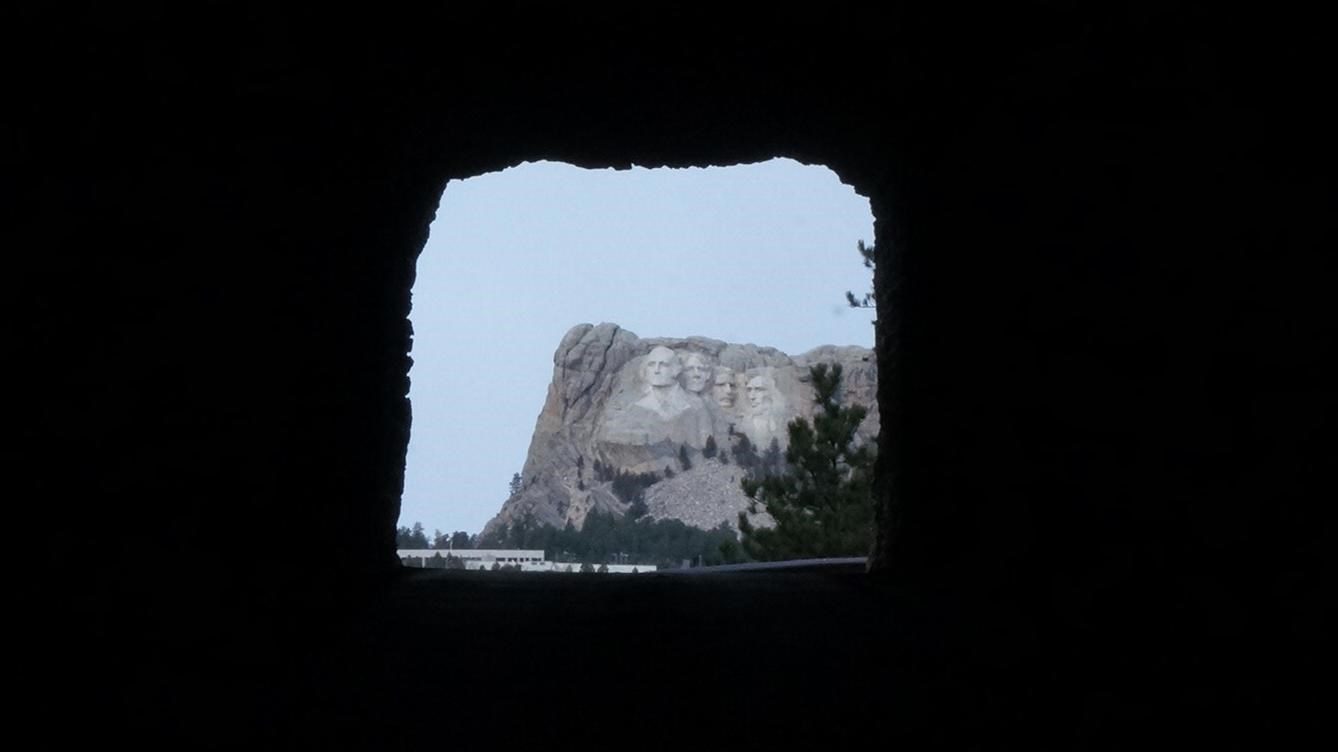
The faces in those frames are carved in the Black Hills, Hé Sápa, on land the 1868 Fort Laramie Treaty set apart for the tribes, and the Hills were later taken without the consent that treaty required (see The 1876 War and the Taking of the Hills). Tribes and tribal members see the carving in different ways, and their views are on Mount Rushmore and Crazy Horse Memorial.
Three More Drives: Wildlife Loop, Spearfish Canyon and the Badlands
The Wildlife Loop Road makes an 18-mile circuit of prairie and pine-covered hills in Custer State Park and is open all year. Game, Fish and Parks suggests about an hour and a half, longer when bison stop traffic, and early morning or the hours near sunset for seeing animals. The park’s bison are covered on Custer State Park.
The Spearfish Canyon Scenic Byway follows U.S. Highway 14A from exit 10 of Interstate 90, at Spearfish, to Cheyenne Crossing on U.S. Highway 85, by a federal recreation listing. Between limestone walls, the pavement lies on the grade of the canyon’s old railroad, which never ran again after flooding in 1933, by the Forest Service’s account. No agency gives the byway a length. Fall color comes in September, when the aspens turn, the Forest Service says; the falls and trails are on Spearfish Canyon.
The Badlands Loop Road, South Dakota Highway 240, crosses the North Unit of Badlands National Park and is reached from Interstate 90 at exit 110, at Wall, or exit 131. The Park Service lists it as open year round and fit for any motor vehicle, steep passes and all, and allows one to two hours for its more than a dozen overlooks and trailheads. It gives no length. Its stops are on Badlands National Park.
- Distance
- Needles Highway 14 miles, Iron Mountain Road 17, Wildlife Loop Road 18 (Game, Fish and Parks); Peter Norbeck Scenic Byway 68 (Federal Highway Administration; 66 in a Forest Service brochure); no agency length for Spearfish Canyon or the Badlands Loop
- Elevation gain
- Not given on the agencies’ drive pages
- Difficulty
- Needles Highway and Iron Mountain Road: winding, with hairpins and tunnels that may stop a bus, RV or trailer (Forest Service); one lane at a time through the Iron Mountain Road tunnels (Park Service). Badlands Loop Road: any vehicle, steep passes (Park Service)
- Tunnels
- Needles Highway: Needles Eye 8 ft 0 in wide by 9 ft 9 in high; Iron Creek 8 ft 9 in by 10 ft 10 in; Hood not given. Iron Mountain Road: Doane Robinson 12 ft 0 in by 11 ft 4 in; C.C. Gideon 11 ft 6 in by 10 ft 9 in; Scovel Johnson 10 ft 9 in by 11 ft 0 in (Game, Fish and Parks). The Forest Service map’s figures, not tied to named tunnels, differ and go as low as 9 ft 7 in high
- Where they start
- Custer State Park (Needles Highway, Wildlife Loop); the park or Mount Rushmore (Iron Mountain Road); I-90 exit 10 or Cheyenne Crossing (Spearfish Canyon); I-90 exits 110 and 131 (Badlands Loop)
- Season
- Needles Highway seasonal; Iron Mountain Road closes at times in winter, depending on conditions; Wildlife Loop all year (Game, Fish and Parks); Badlands Loop year round (Park Service); Spearfish Canyon aspens turn in September (Forest Service)
Did Peter Norbeck Lay Out the Needles Highway on Foot?
Peter Norbeck did walk the route, though not alone. Game, Fish and Parks says Norbeck, governor in 1919, marked the road’s whole course on foot and on horseback. His biographer, the historian Gilbert Fite, in an account South Dakota Magazine quoted in 2025, has him on foot because much of the ground was too rough for horses, with C.C. Gideon and Scovel Johnson, the state engineer, along. The Forest Service’s undated brochure says the route he mapped that year broke the engineering rules of the day, and it casts the doubters as “diploma boys.” The brochure and Fite both tell of Norbeck asking Johnson if the road could be done, and of Johnson saying yes, given enough dynamite.
Two other accounts give Johnson a bigger share. A state-run history site for students says the two men planned the road together and that Johnson built it. The Black Hills State University library’s record of a 2015 history-conference paper describes Johnson as a state highway superintendent of the 1920s who engineered both the Needles Highway and Iron Mountain Road. By the brochure’s count the work took two years and used 150,000 pounds of dynamite, and the highway was finished in 1922.
Iron Mountain Road came in the early 1930s, when Norbeck was a United States senator, elected in 1920; the Game, Fish and Parks page still calls him governor. The Forest Service credits him with a route through three tunnels, set to frame the carving on Mount Rushmore. Both agencies also quote Norbeck, in different words, urging drivers to keep to 20 miles an hour or less; neither says when or where he said it. C.C. Gideon, who managed the State Game Lodge and worked with Norbeck on both roads, designed the pigtail bridges in 1932, the State Historical Society’s journal, South Dakota History, records. The Forest Service names the builder as Owen Mann, the park superintendent, whose crew of 16 men had the road done in 1933 after roughly 18 months of work. That was eight years before the last drilling on the mountain, on October 31, 1941.
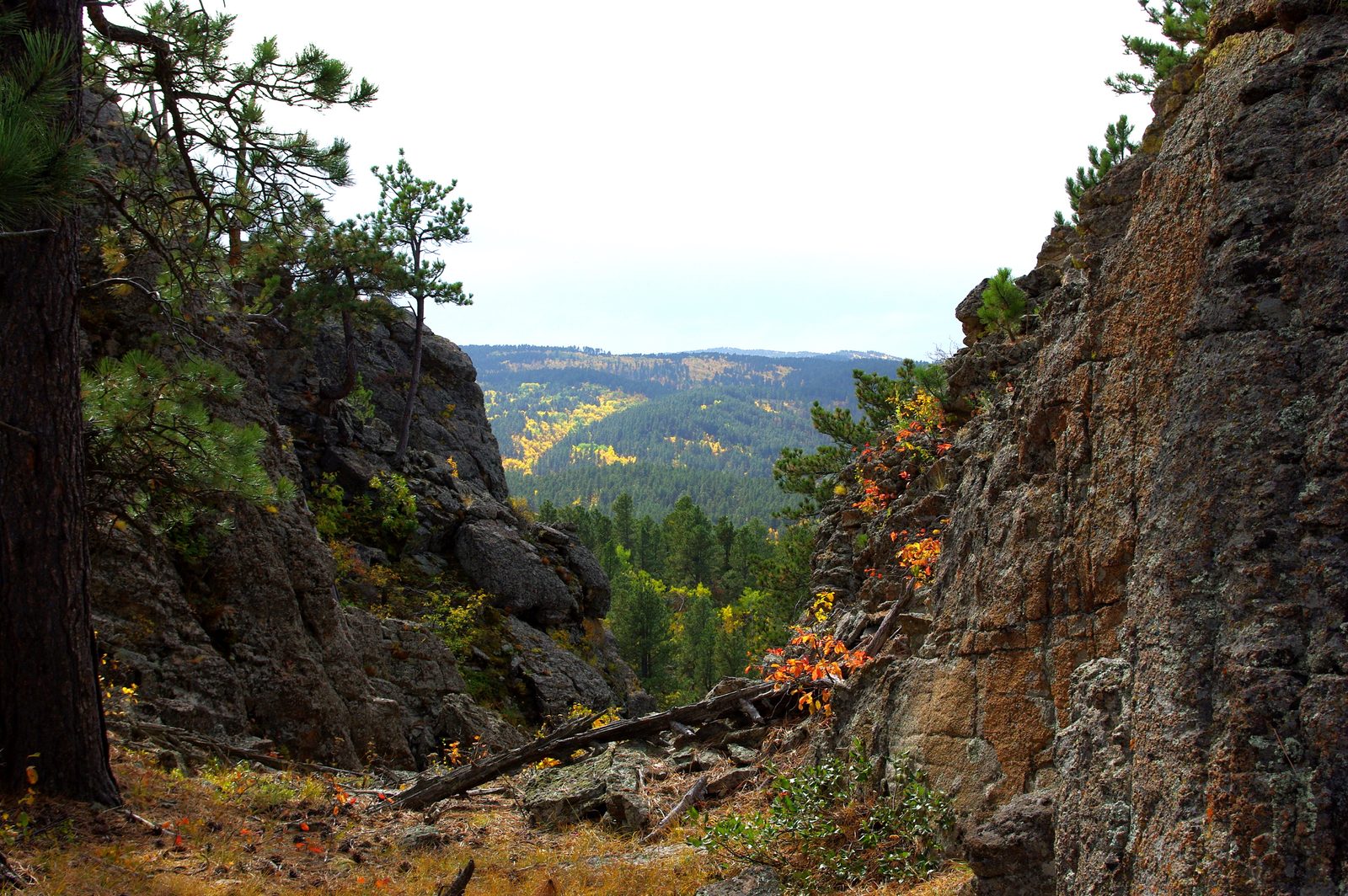
Iron Mountain Road’s tunnels carry the names of Gideon, of Johnson and of Doane Robinson, the state historian whose first idea for giant carvings in the Hills put them in the Needles. Civilian Conservation Corps crews built bridges on both roads as well, a story told on The National Forest and the CCC.
Connected
- The Granite Core: Black Elk Peak and the NeedlesThe 1.7-billion-year-old granite the Needles Highway winds through, and why its spires stand.
- Custer State ParkThe park that holds the Needles Highway and the Wildlife Loop, with its bison, lakes and trails.
- Mount Rushmore and Crazy Horse MemorialThe carving the Iron Mountain Road tunnels frame, and how tribes view it.
- The National Forest and the CCCThe CCC crews who built bridges on both roads in the 1930s.
- Spearfish CanyonThe limestone canyon on U.S. 14A, with its falls and trails.
- Badlands National ParkThe park the Badlands Loop Road crosses, from Wall to the Northeast Entrance.
- The 1876 War and the Taking of the HillsHow the land under these roads was taken from the tribes.
Sources
- Scenic Drives (Custer State Park). South Dakota Game, Fish and Parks, 2026.
- Tunnel Inspections Scheduled in the Black Hills Area (news release, September 27, 2022). South Dakota Department of Transportation, 2022.
- Welcome to the Peter Norbeck Scenic Byway (visitor brochure and map). USDA Forest Service, Black Hills National Forest, undated.
- Peter Norbeck Scenic Byway. America’s Byways, Federal Highway Administration.
- Peter Norbeck Scenic Byway. Recreation.gov.
- Iron Mountain Road North Entrance. National Park Service, Mount Rushmore National Memorial, 2022.
- Dakota Images: Cecil C. (“C. C.”) Gideon, by Stephen S. Witte. South Dakota History 44, no. 4, South Dakota State Historical Society, 2014.
- Iron Mountain Road (Unit 7 lesson page, with Needles Highway). SD4History, State of South Dakota history site for students, undated.
- Scovel Johnson, 2015 (record of a paper by Dillon Haug, 23rd Annual West River History Conference). Leland D. Case Library, Black Hills State University.
- Needles Highway in Winter, by Bernie Hunhoff (revised from the November/December 2023 issue). South Dakota Magazine, 2025.
- Peter Norbeck: Prairie Statesman, by Gilbert C. Fite (publisher’s page for the biography). South Dakota Historical Society Press.
- Hydrology of the Black Hills Area, South Dakota (Water-Resources Investigations Report 02-4094, section 2), by Daniel G. Driscoll, Janet M. Carter, Joyce E. Williamson and Larry D. Putnam. U.S. Geological Survey, 2002.
- Geologic Activity. National Park Service, Mount Rushmore National Memorial, 2024.
- Spearfish Canyon Scenic Byway. Recreation.gov.
- Spearfish Canyon. USDA Forest Service, Black Hills National Forest, 2026.
- Drive Badlands Loop Road (Highway 240). National Park Service, Badlands National Park, 2020.
Last reviewed: