The Outdoors
Spearfish Canyon
A plant collected in Spearfish Canyon in 1929 is the basis of the first Black Hills record of the large round-leaved orchid (Platanthera orbiculata), a flower of the cool northern forests whose Black Hills plants grow far from the species' main range. Spearfish Canyon is the gorge of Spearfish Creek, which runs north through the limestone of the northern Black Hills to the town of Spearfish, and most people know it from the road. The canyon holds gray cliffs that run for miles, Bridal Veil, Spearfish and Roughlock falls, and trails kept by the Forest Service and South Dakota Game, Fish and Parks. U.S. Highway 14A runs through it on the grade of a railroad that a 1933 flood ended.
Where Does the Spearfish Canyon Byway Run?
The Spearfish Canyon Scenic Byway follows U.S. 14A between exit 10 of Interstate 90, at Spearfish, and Cheyenne Crossing, where it meets U.S. Highway 85 southwest of Lead. Neither the federal government’s recreation booking site, which lists the route, nor the Forest Service gives a length for the drive.
From the Spearfish end, the road climbs with the creek between steep walls, and most of the view is upward. Bridal Veil Falls, about 60 feet tall, comes down the canyon side within sight of the highway. The Forest Service keeps a viewing platform there, usable all year, and asks visitors to keep to it and the parking lot to protect the site. For fall color the Forest Service points drivers to September, when the quaking aspens (Populus tremuloides) change.
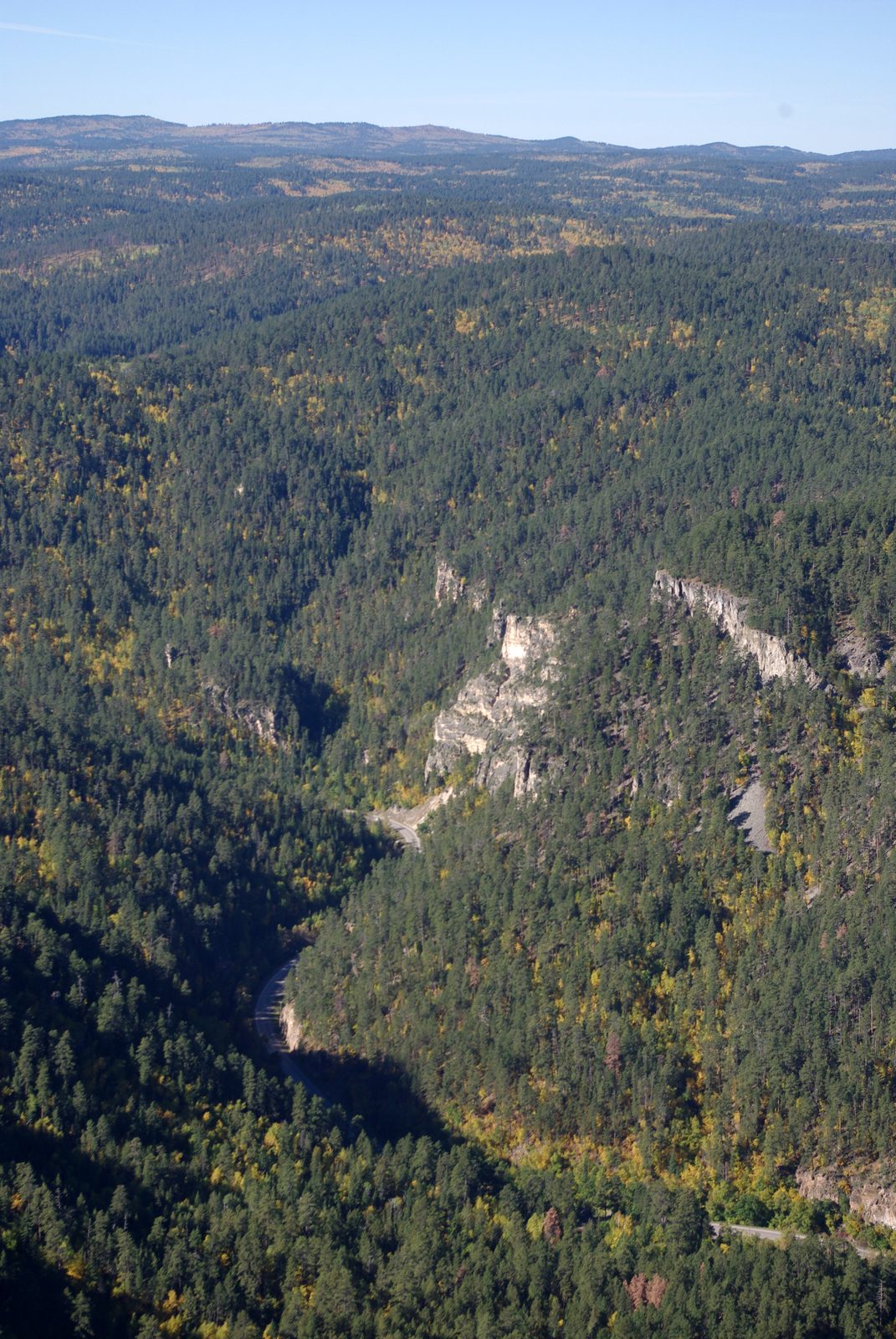
The Forest Service calls the byway "the best place in the Black Hills to see waterfalls," and Game, Fish and Parks says the canyon "is considered one of the most beautiful locations" in the Hills. Travel writing often calls Spearfish Canyon the longest and deepest canyon in the Black Hills, and a 2010 state geological survey road log does too, without a measurement for either. Excerpts from a letter by the architect Frank Lloyd Wright, dated September 28, 1935, appear on a Forest Service sign at Bridal Veil Falls. In them Wright adds "a third type of earthly marvel," which the sign names in brackets as Spearfish Canyon, to the Badlands and the Black Hills. Another line rates the place he was describing above the Grand Canyon, but the excerpts don't make clear which place that was.
Roughlock Falls, Spearfish Falls and the Trails at Savoy
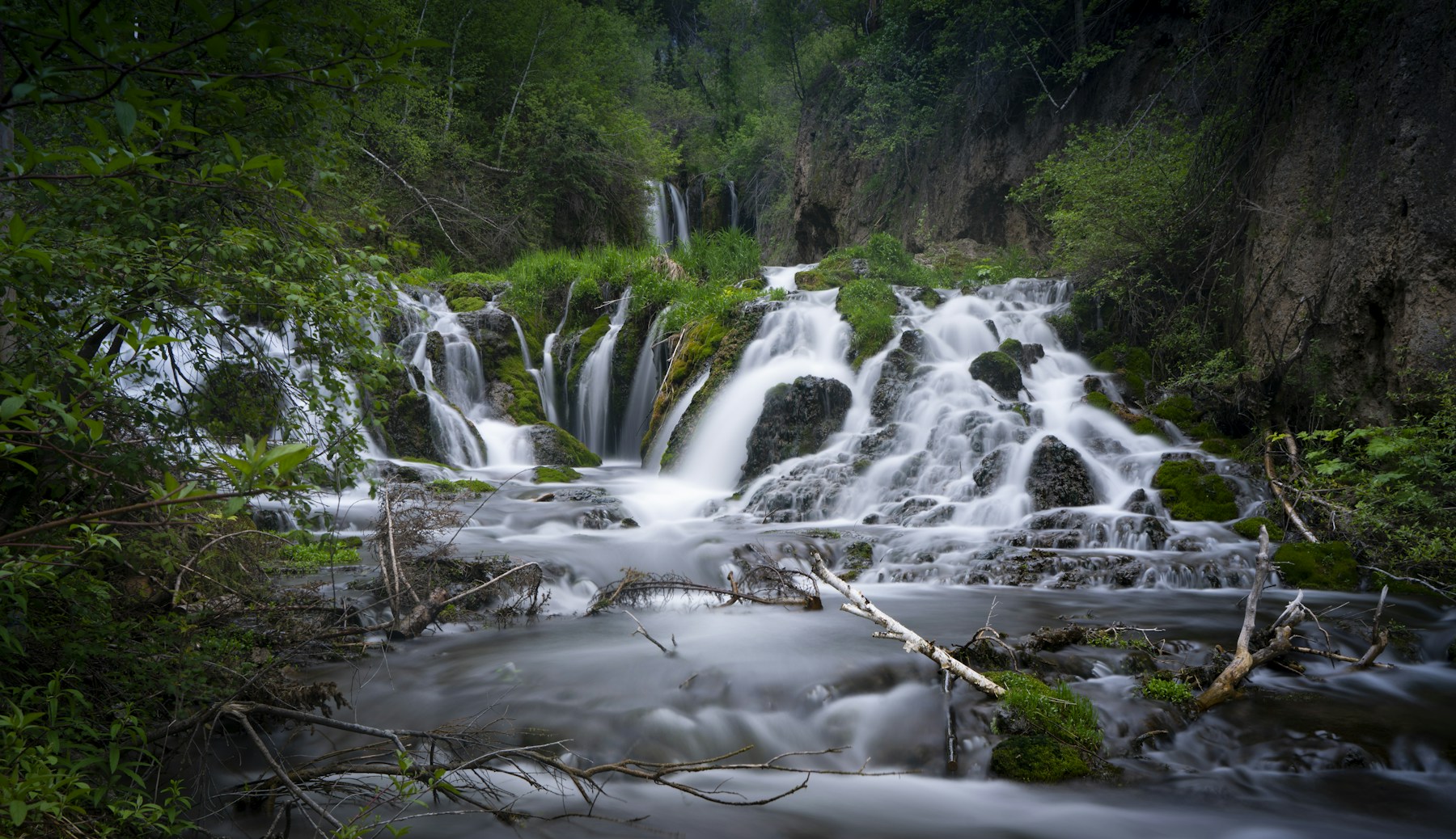
Several of the canyon's trails start at Savoy. Game, Fish and Parks runs the Spearfish Canyon Nature Area there, a day-use park whose linked trails reach Savoy Pond and two waterfalls, Spearfish and Roughlock. Little Spearfish Creek comes down to Savoy from the west, out of Little Spearfish Canyon, the side canyon that holds Roughlock Falls.
The Roughlock Falls Trail is the easy one: 1 mile each way along Little Spearfish Creek to the falls, open all year, by the department's account. You can also drive to the falls, about a mile west of Savoy on Forest Road 222, but that road is seasonal. The Spearfish Falls Trail, rated moderate, runs 0.75 mile each way, dropping from Savoy into the main canyon and along the creek to the falls. The Savoy Trail, also moderate, runs 1 mile from Savoy Pond.
For a real climb, the Forest Service's '76 Trail starts just off U.S. 14A near Savoy, on Roughlock Falls Road, and gains more than 1,000 feet in 3/4 mile. It is steep and strenuous, and it ends in views over the canyon. It's for foot traffic only. Parking at its trailhead is scarce, so the agency points hikers to the nature area's lot a little farther along the road.
Longer loops start at the Little Spearfish Trailhead, near Timon Campground on Little Spearfish Creek. The Little Spearfish Trail (Trail 80) is a 6-mile loop open to hikers, riders and mountain bikers, for day use only. The Rimrock Trail (Trail 79) adds 7.2 miles in two loops and a spur to the Old Baldy Trail, winding through paper birch (Betula papyrifera), quaking aspen and ponderosa pine (Pinus ponderosa). In winter it is also open to cross-country skiing and snowshoeing.
- Distance
- Roughlock Falls Trail, 1 mile one way; Spearfish Falls Trail, 0.75 mile one way; Savoy Trail, 1 mile one way (Game, Fish and Parks). '76 Trail, 3/4 mile; Little Spearfish Trail, 6-mile loop; Rimrock Trail, 7.2 miles in two loops and a spur (Forest Service)
- Elevation gain
- '76 Trail, more than 1,000 feet (Forest Service); no figure published for the other trails
- Difficulty
- Roughlock Falls Trail easy; Spearfish Falls and Savoy trails moderate (Game, Fish and Parks); '76 Trail steep and strenuous (Forest Service); no rating published for the Little Spearfish and Rimrock trails
- Trailhead
- Savoy, on U.S. 14A, for the nature area's trails; Roughlock Falls Road, west of the highway near Savoy, for the '76 Trail; the Little Spearfish Trailhead near Timon Campground for the Little Spearfish and Rimrock trails
- Season
- The Roughlock Falls Trail and the Bridal Veil platform are open all year; the road from Savoy to Roughlock Falls is seasonal; the aspens turn in September
What Are the Canyon Walls Made Of?
The gray cliffs are Madison Limestone, the rock of the Limestone Plateau that rings the core of the Hills, and the same layer that holds Wind Cave and Jewel Cave in the south. The U.S. Geological Survey describes it as massive and gray to buff, with dolomite mixed in. The rock dates from the Mississippian period, roughly 345 to 360 million years ago, when sediment and shells collected on the bed of a warm, shallow sea. N.H. Darton, the USGS geologist who mapped the northern Hills, put the limestone at about 700 feet thick in Spearfish Canyon in 1909 and described its cliffs lining the creek for many miles. How water later opened caves in the same rock is told on The Limestone Plateau and the Caves.
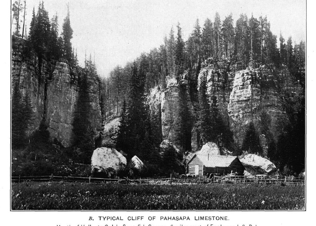
Below the limestone, the creek has cut into older rock, and near the old Elmore townsite the 2010 road log puts the cliffs at about 900 feet high. Darton found the Whitewood Limestone, yellow and 70 feet thick at the mouth of Iron Creek, and noted the hard ledge it makes at the foot of the gray cliffs along long stretches of the canyon. Lower still lie the sandstones of the Deadwood Formation, with quartzite at the base, 450 feet thick here. Out at the canyon's mouth, the town of Spearfish probably gave its name to the red Spearfish Formation, the rock of the Red Valley.
Rails, Power and the 1933 Flood
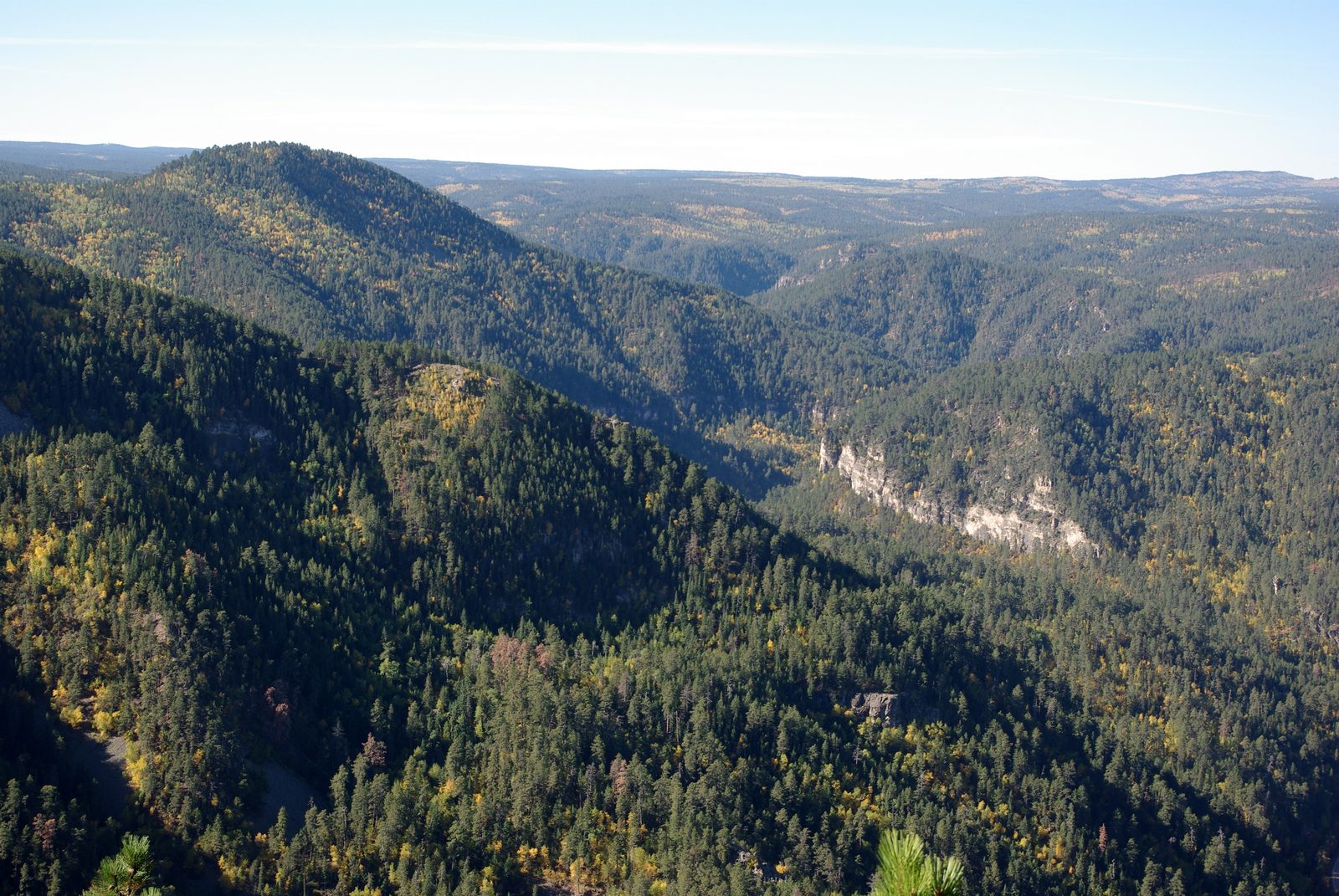
Trains first ran up the canyon in 1893, according to a Forest Service sign at Bridal Veil Falls and a state geological survey road log. Savoy and Elmore were among the stops, the Forest Service says. The 1933 flood ended the line, and the byway now follows its old grade. Its place among the Hills' railroads is on Stagecoaches and Railroads.
The creek made electricity, too. Savoy Pond, where the Savoy Trail starts, was built to send creek water into a 5-mile aqueduct that served the Maurice Hydro Plant downstream, Game, Fish and Parks says. How Spearfish Creek's water was harnessed, and what the flood did, is followed on Spearfish Creek: Power, Rails and the 1933 Flood.
Dippers on Spearfish Creek
The bird to watch for is the American dipper (Cinclus mexicanus), a gray songbird that feeds in the water of fast, clear streams. The Forest Service notes that dippers live on Spearfish Creek all year. South Dakota lists the dipper as a threatened species, and the Black Hills birds live more than 120 miles from any others.
Nest boxes put up along Spearfish Creek in the late 1990s brought a sharp rise in nesting there, the Bird Conservancy of the Rockies reported to Game, Fish and Parks in 2019. In its surveys of 2017 and 2018, most of the active nest sites in the Hills were on Spearfish Creek or elsewhere in its drainage. It estimated the breeding population at no fewer than 70 adults and said the number appeared stable next to the 57 to 66 counted from 2004 to 2009. More on the dippers and the orchid is on Birds and Wildflowers.
Connected
- The Limestone Plateau and the CavesThe Madison Limestone of the canyon walls, and the caves in the same rock.
- Spearfish, South DakotaThe town at the canyon's mouth, which probably gave its name to the red Spearfish Formation.
- Spearfish Creek: Power, Rails and the 1933 FloodHow the creek's water was put to work, and the flood that ended the canyon railroad.
- The Northern HillsThe gold towns, Red Valley and plains around the canyon.
- Birds and WildflowersThe dippers of Spearfish Creek and the orchid first recorded in the canyon.
- Stagecoaches and RailroadsThe canyon line among the railroads of the 1880s and 1890s.
- Scenic Drives: Needles Highway, Iron Mountain Road and MoreThe canyon byway beside the other drives of the Hills.
Sources
- Spearfish Canyon. USDA Forest Service, Black Hills National Forest, 2026.
- Bridal Veil Falls. USDA Forest Service, Black Hills National Forest, 2025.
- '76 Trailhead. USDA Forest Service, Black Hills National Forest, 2026.
- Little Spearfish Trailhead (Trail #80). USDA Forest Service, Black Hills National Forest, 2026.
- Rimrock Trailhead (Trail #79). USDA Forest Service, Black Hills National Forest, 2025.
- Northern Hills: Spearfish (recreation sites). USDA Forest Service, Black Hills National Forest.
- Scenic Drives. USDA Forest Service, Black Hills National Forest, 2025.
- Spearfish Canyon Nature Area. South Dakota Game, Fish and Parks.
- Spearfish Canyon Trails (trail list and map). South Dakota Game, Fish and Parks.
- Spearfish Canyon Scenic Byway. Recreation.gov.
- Spearfish Canyon Through Time (marker text). Black Hills National Forest, U.S. Forest Service; transcribed by the Historical Marker Database.
- Geologic Road Log: Rapid City to Sturgis, Lead-Deadwood, Spearfish, to Rapid City, by Mark D. Fahrenbach (South Dakota Geological Survey), in Geologic Field Trips in the Black Hills Region, South Dakota (Bulletin 21). South Dakota School of Mines and Technology, 2010.
- Geology and Water Resources of the Northern Portion of the Black Hills and Adjoining Regions in South Dakota and Wyoming (Professional Paper 65), by N.H. Darton, stratigraphy section. U.S. Geological Survey, 1909 (online edition, NPS History).
- Madison Limestone in Spearfish Canyon, SD (photograph and description). U.S. Geological Survey, Dakota Water Science Center, 2001.
- Geology of Jewel Cave. National Park Service, Jewel Cave National Monument.
- Cave Geology. National Park Service, Wind Cave National Park, 2024.
- Conservation Assessment for the Large Roundleaved Orchid in the Black Hills National Forest, South Dakota and Wyoming, by J. Hope Hornbeck, Carolyn Hull Sieg, Deanna J. Reyher and Darcie J. Bacon. USDA Forest Service, Black Hills National Forest, 2003.
- Identification and Monitoring of American Dipper Populations and Inhabited Areas in South Dakota: Final Report, by Nancy E. Drilling. Bird Conservancy of the Rockies, for South Dakota Game, Fish and Parks, 2019.
Last reviewed: