The Outdoors
Badlands National Park
For a place named for bare, crumbling rock, Badlands National Park holds a great deal of grass. No other park in the national park system encloses as much mixed-grass prairie, the National Park Service says, and bison, bighorn sheep and prairie dogs live on it, among eroded buttes. Badlands National Park lies about 75 miles east of Rapid City, South Dakota, in two parts: the North Unit, crossed by a paved scenic road, and the South Unit, within the Pine Ridge Reservation. Below are the drive, the trails, the wildlife, the rock and the park’s history.
Highway 240 Through the North Unit
The Badlands Loop Road, South Dakota Highway 240, is the park’s main road, two paved lanes through the North Unit with several steep passes. It is reached from Interstate 90 at either end: from Exit 110 at Wall it is about 7 miles south to the Pinnacles Entrance, and from Exit 131 about 3 miles to the Northeast Entrance. Overlooks and the Ben Reifel Visitor Center lie between.
Wall is named for the Badlands Wall, the line of eroded cliffs that separates an upper prairie from a lower one. Interior sits in the White River valley, 2 miles south of the park’s Interior Entrance on Highway 377. Both towns and the country around them are covered on The Badlands and Wall.
Short Trails, a Ladder and an Open Hike Policy
The Park Service lists eight official trails and rates them from easy to strenuous. Four of them start at the Door and Window parking area. The Door and Window Trails are easy and begin on accessible boardwalk. The Window Trail is about a quarter mile round trip; NPS pages give 0.26 or 0.75 mile for the Door Trail, and past its maintained end, you go at your own risk.
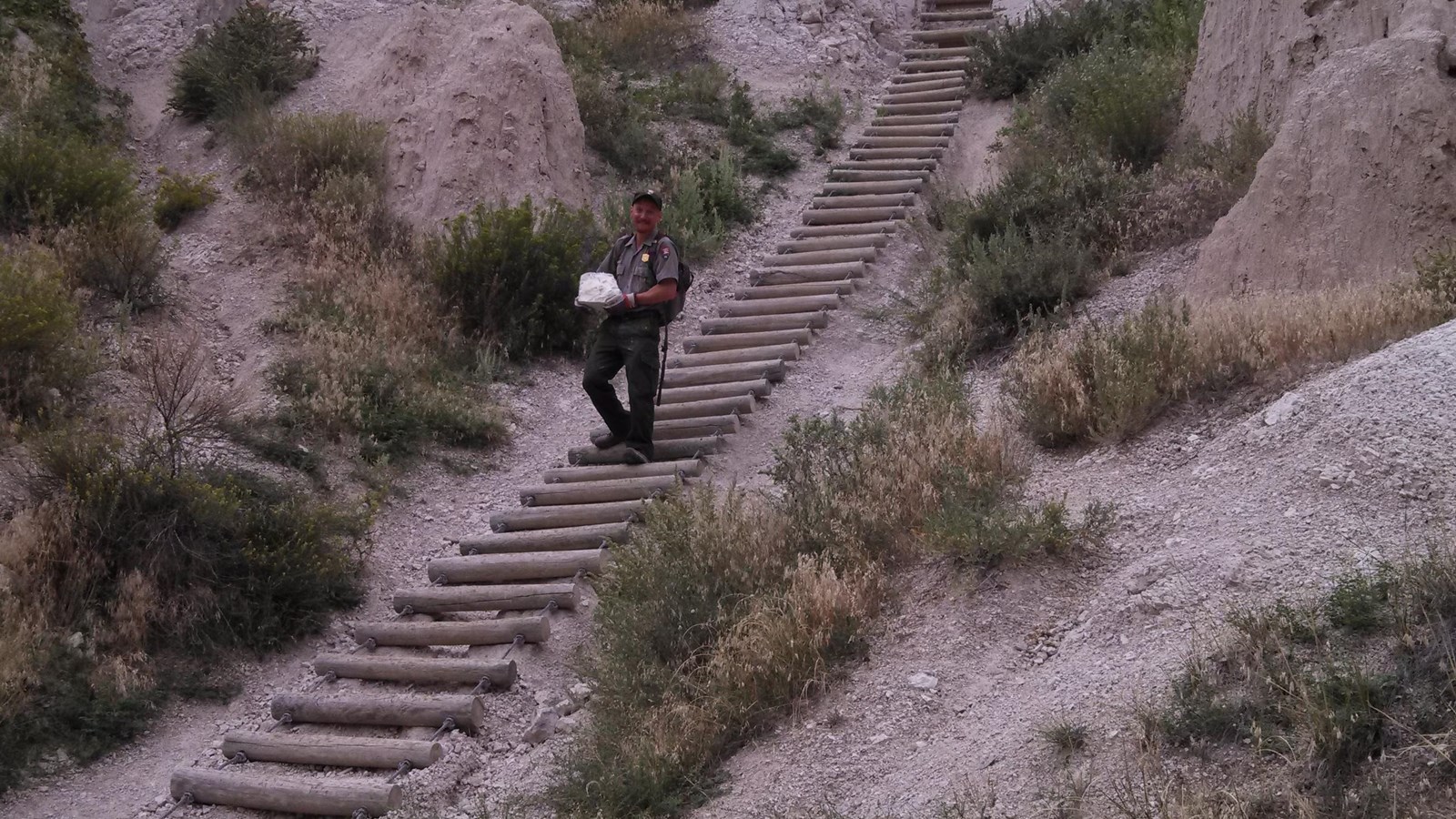
The Notch Trail leaves from the south end of the same lot. The Park Service rates it moderate to strenuous and ranks it among the park’s busiest trails, with more injuries than any other. Its round trip is 1.25 or 1.5 miles, depending on the NPS page. Hikers thread a canyon, climb a ladder of logs and steel cable, then edge along a shelf above drop-offs to the notch, which looks out over the White River valley. The route turns dangerous in and after rain, and the park warns anyone uneasy with heights to skip it.
The Castle Trail, which also starts there, is the park’s longest established trail: about 10 miles round trip, moderate and fairly level. Saddle Pass, short but strenuous, climbs steeply up the Wall. Replicas of fossils line the Fossil Exhibit Trail, a boardwalk loop that wheelchairs can use from end to end.
- Distance
- About a quarter mile (Window) to about 10 miles (Castle), round trip, per NPS, whose pages differ on several trails
- Elevation gain
- About 200 feet on the Cliff Shelf loop; NPS gives no figure for the others
- Difficulty
- Easy (Door, Window, Fossil Exhibit) to strenuous (Saddle Pass); Notch is moderate to strenuous
- Trailhead
- Door and Window parking area for Door, Window, Notch and Castle; NPS places all eight a few miles or less from the Ben Reifel Visitor Center
- Season
- Year-round; summer heat often passes 100°F, and the clay turns slick when wet
Away from the marked trails, an open hike policy lets you walk off-trail, though climbing down a formation is often harder than climbing up, the park warns. Don’t count on a phone signal over most of the park. Carry about two quarts of water per person for every two hours on foot. Summer brings dry heat and now and then a violent thunderstorm, and lightning may come well ahead of the storm itself.
Bison, Bighorns and Prairie Dogs Along Sage Creek
Bison, bighorns and prairie dogs often turn up along the Sage Creek Rim Road, the Park Service says. The gravel road, Highway 590, branches off the Loop Road by Pinnacles Overlook and runs west along the north side of the Badlands Wilderness, past Roberts Prairie Dog Town to the primitive Sage Creek Campground, which has no water. Congress designated the wilderness, 64,250 acres, on October 20, 1976. No trails cross it, so hikers find their way by map and compass and bring all the water they will need; what flows there is too laden with silt and minerals to drink.
Plains bison (Bison bison bison) were reintroduced in 1963 (see Bison). Bighorn sheep (Ovis canadensis) followed in 1964, when 22 were brought from Pikes Peak, Colorado, to what was then Badlands National Monument (see Elk, Bighorn Sheep and Mountain Goats). In March 2026, South Dakota Game, Fish and Parks gave its commission a minimum count of 65 Badlands bighorns for 2025, and biologist Chad Lehman said a pneumonia outbreak had cut the herd, once as large as 300, to 28, the Black Hills Pioneer reported.
Black-footed ferrets (Mustela nigripes) depend on black-tailed prairie dogs (Cynomys ludovicianus), which make up about 90 percent of their diet, the Park Service says. In the fall of 1994, 36 ferrets went free in the park, in the Conata Basin–Badlands prairie dog complex, which spans the park and the Conata Basin, part of the Forest Service’s Buffalo Gap National Grassland. After plague returned in 2024 and drought hit in 2025, fewer than 100 were left there as of July 2026, biologist Travis Livieri of Prairie Wildlife Research told South Dakota Public Broadcasting. Prairie Dogs and Black-Footed Ferrets follows both animals.
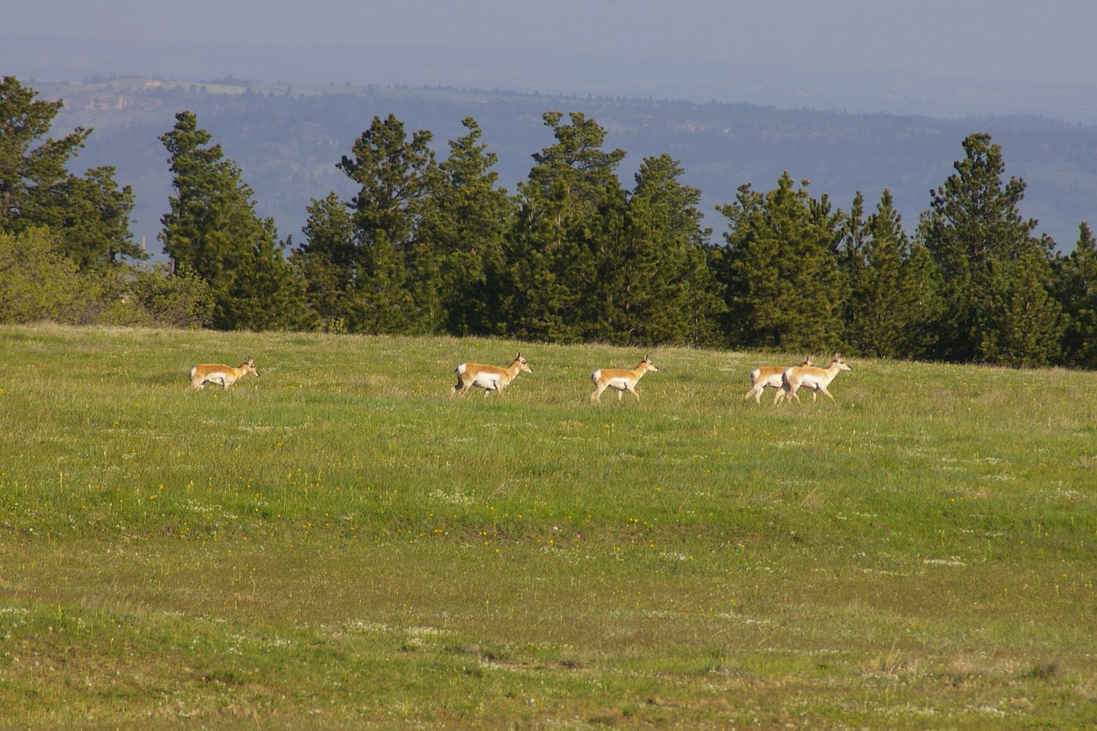
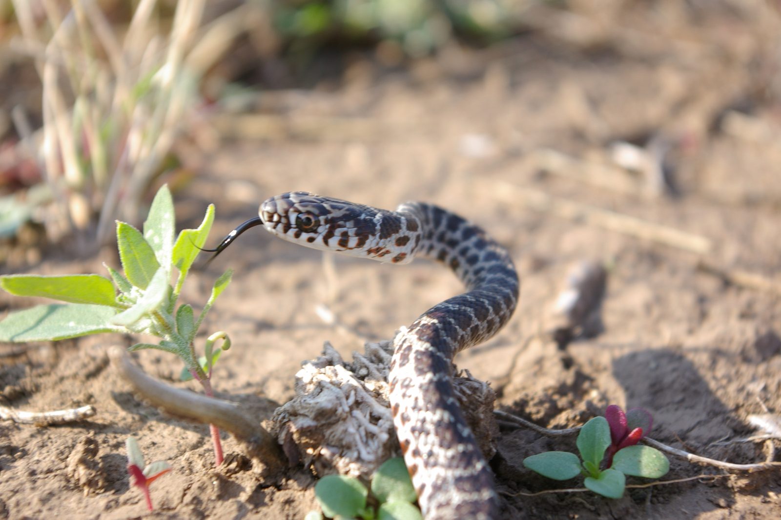
Bison can top 30 miles per hour, and park regulations keep visitors at least 100 feet from them and from all other wildlife. Tall grass and the shade under stairs and boardwalks are where rattlesnakes wait out the day, the park warns, so keep your hands and feet where you can see them.
Clay and Ash That Wear Away an Inch a Year
The buttes are soft, loosely bound beds of clay, sand and volcanic ash, and by the Park Service’s figure they wear back about an inch a year on average, fast for rock. They piled up between about 75 million and 28 million years ago, from the Pierre Shale at the base, once mud on the floor of an inland sea, to the Sharps Formation on top. The White and Cheyenne Rivers carved them, and the Park Service expects the Badlands to be gone in about 500,000 more years. How the Badlands Erode explains why, and why rates measured on real slopes have mostly come in lower.
The same erosion keeps uncovering bones. In 2024 the Park Service credited the park with “the world’s richest collection of Oligocene-age vertebrate fossils,” the bones of backboned animals from an epoch that opened about 34 million years ago. Many come from the Brule Formation, about 34 to 30 million years old. Collecting fossils in the park is illegal, so leave any you find in place. Fossils and the Mammoth Site describes the animals, from oreodonts to brontotheres.
A Monument in 1939, and the South Unit on Pine Ridge
Congress authorized Badlands National Monument on March 4, 1929, on conditions: enough private land had to pass to the United States at no cost to the federal Treasury, and South Dakota first had to build the highways the act described. President Franklin D. Roosevelt’s proclamation, which declared those conditions met, established the monument on January 25, 1939. Congress renamed it Badlands National Park on November 10, 1978.
Some people still see the South Unit as “land lost,” Christian Knutson, an Oglala Lakota ranger at the park’s White River Visitor Center, said in a 2023 article in the Smithsonian’s American Indian magazine. The War Department took 341,726 acres of the Pine Ridge Reservation in 1942 for an Army Air Forces aerial gunnery range used in World War II training, and 125 families had to leave. Unexploded ordnance from the range still turns up, and in 1993 the Oglala Sioux Tribe founded its Badlands Bombing Range Project to find and map it.
Most of the range was declared excess in 1968 and went back to the tribe. The South Unit, about 133,000 acres, lies entirely within the Pine Ridge Reservation, most of it on the old range. It is held in trust for the Oglala Sioux Tribe and run by the National Park Service under a 1976 agreement with the tribe. As of October 2026, the Park Service describes the unit as managed with the tribe.
With no road across the South Unit, the Park Service names two ways in: on foot, or up Sheep Mountain Table Road, a dirt track that leaves Highway 27 south of Scenic. Bring four-wheel drive even when it’s dry, the park says, and stay off the road in or after a storm. Leave any ordnance you come across untouched, get well away from it, and report where it lies to the White River Visitor Center, which opens seasonally. How the range was taken and returned, and the debate since over who should run the unit, are told on The Badlands and Wall.
Connected
- How the Badlands ErodeThe soft layers and the rivers that cut them.
- Fossils and the Mammoth SiteThe ancient mammals and sea reptiles the park’s erosion lays bare.
- Wall, South DakotaThe town at Exit 110, named for the Badlands Wall.
- Interior, South DakotaThe White River valley town 2 miles south of the Interior Entrance.
- Prairie Dogs and Black-Footed FerretsThe ferrets first released in the park in 1994, and the prairie dogs they live on.
- The Badlands and WallThe country around the park, and the longer story of the South Unit.
- BisonThe animal the park brought back in 1963.
- Fossil Hunters and Tribal StoriesWho found the park's fossils first, and what scientists made of them.
Sources
- On Dangerous Ground: Oglala Lakota Land Used as a Bombing Range in World War II Is Still Perilous, by William C. Meadows. American Indian magazine, Smithsonian National Museum of the American Indian, 2023.
- Memorandum of Agreement Between the Oglala Sioux Tribe of South Dakota and the National Park Service of the Department of the Interior. Oglala Sioux Tribe and National Park Service, 1976; copy posted by Badlands National Park.
- South Unit. National Park Service, Badlands National Park, 2020.
- Aerial Gunnery Range. National Park Service, Badlands National Park, 2020.
- Foundation Document Overview: Badlands National Park. National Park Service, undated; copy held by the NPS History Collection.
- Directions. National Park Service, Badlands National Park, 2020.
- Scenic Driving. National Park Service, Badlands National Park, 2025.
- Badlands National Park map, text description. National Park Service, Harpers Ferry Center, NPGallery, undated.
- Hiking in Badlands. National Park Service, Badlands National Park, 2026.
- Hiking the Badlands. National Park Service, 2026.
- Notch Trail. National Park Service, Badlands National Park, 2020.
- Notch Ladder. National Park Service, Badlands National Park, 2020.
- Safety. National Park Service, Badlands National Park, 2020.
- Weather. National Park Service, Badlands National Park, 2020.
- Badlands Wilderness (park handout). National Park Service, Badlands National Park, undated; copy held by the NPS History Collection.
- Badlands Wilderness. Wilderness Connect, University of Montana, viewed 2026.
- History of Badlands National Monument and the White River (Big) Badlands of South Dakota: Chronology, by Ray H. Mattison and Robert A. Grom. Badlands Natural History Association, 1968; copy held by the NPS History Collection.
- Bighorn Sheep in the Badlands. National Park Service, Badlands National Park, 2020.
- Commission Book, March 5–6, 2026 (bighorn sheep proposal, Table 1, minimum counts for 2024 and 2025). South Dakota Game, Fish and Parks Commission, 2026.
- BH Bighorn Sheep Herds Healthy, Badlands Herd at Historic Lows, by Wendy Pitlick. Black Hills Pioneer, 2026.
- Black-footed Ferret: Rebounding in the Badlands. National Park Service, Badlands National Park, 2020.
- Badlands (South Dakota): Black-Footed Ferret Reintroduction. National Park Service Morning Report, December 16, 1994; copy held by the NPS History Collection.
- Scientists celebrate a milestone for the critically endangered black-footed ferret, by Lori Walsh. South Dakota Public Broadcasting, 2026.
- Geologic Formations: How Badlands Buttes Came to Be. National Park Service, Badlands National Park, 2020.
- NPS Geodiversity Atlas: Badlands National Park, South Dakota. National Park Service, 2024.
- 16 U.S. Code § 441, with notes. Legal Information Institute, Cornell Law School.
- Proclamation 2320: Badlands National Monument, South Dakota, by Franklin D. Roosevelt, 1939. The American Presidency Project, University of California, Santa Barbara.
Last reviewed: