Towns
Wall, South Dakota
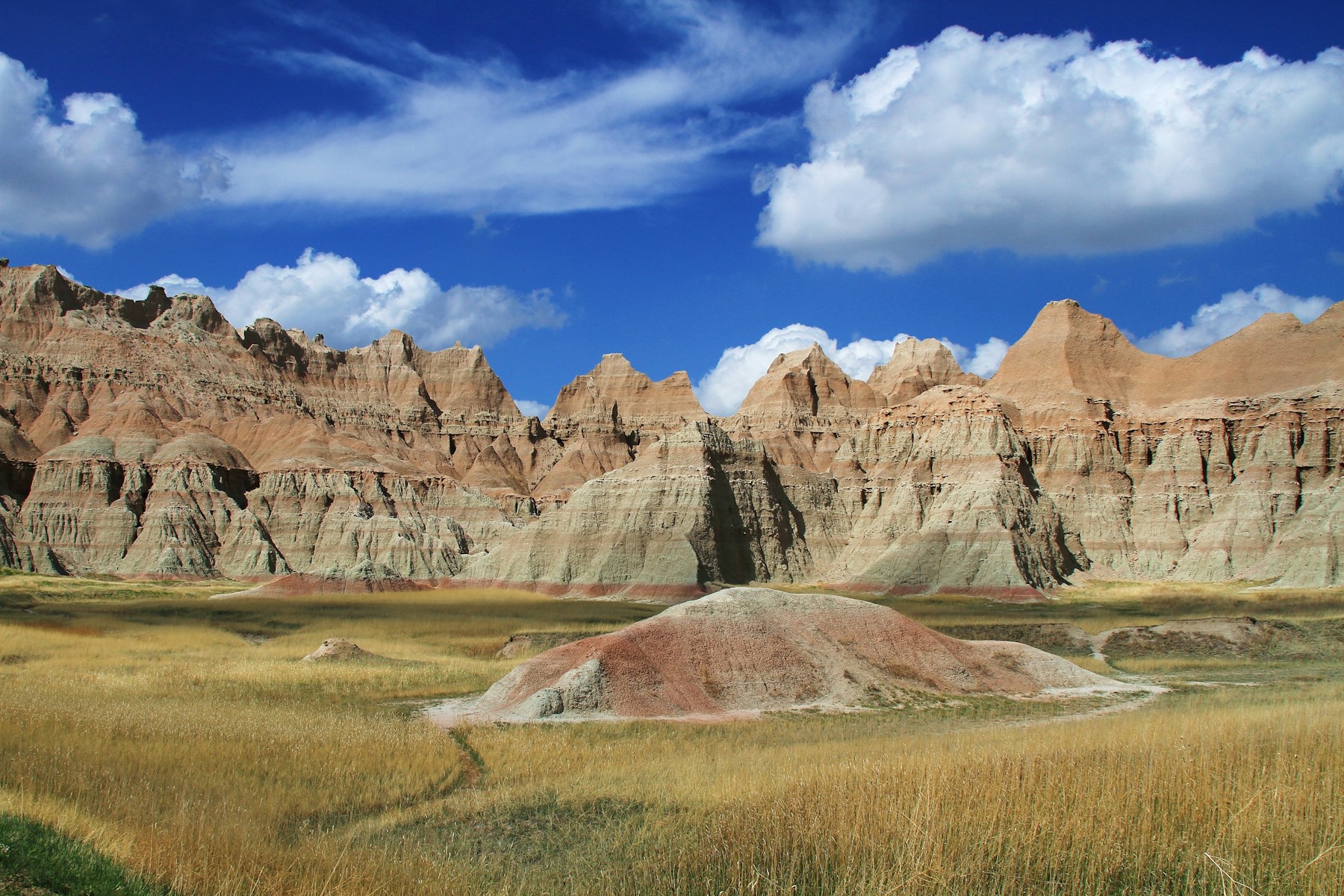
The Badlands Wall runs out at the edge of town. From near Kadoka it follows the north side of the White River valley west for miles, a broken line of cliffs with one prairie on top and a lower one at its foot, and the town at its western end is named for it. Wall had 699 people in the 2020 census. It was established in 1907, the year a railroad was built through it, grew as homesteaders took up the country around it, drew highway travelers to a drugstore that gave away ice water, and now has three federal neighbors: Badlands National Park, the Buffalo Gap National Grassland and a Cold War missile site.
A Town at the End of the Wall
The City of Wall traces the town's name to its place on the Badlands Wall. That wall is what the White River left as it cut its valley: the valley's north side, worn back into cliffs and gullies. Its rock is the soft Badlands sequence of clay, sand and volcanic ash, roughly 75 to 28 million years old, with the Pierre Shale at the bottom and the Sharps Formation on top. All of it is younger than the rings of rock around the Black Hills, and Wall lies well out on the plains beyond the Hogback, the outermost ring described on How the Black Hills Formed.
The cliffs wear back quickly. The Park Service puts the rate at close to an inch a year, and the sediment that runoff carries down the slopes makes the creeks below unfit to drink. Why these layers come apart so easily is the subject of How the Badlands Erode.
The badlands begin a short drive from town. The city puts Badlands National Park 8 miles south, and the road south from Wall enters the park at its Pinnacles Entrance. Close to that entrance is Pinnacles Overlook, which the Park Service names as the highest spot in the North Unit; it looks south across the Sage Creek Wilderness area. Bison may be in sight in the valley below, and in clear weather the Black Hills can be made out in the distance.
Homestead Claims and the 1907 Railroad
Homesteaders and the railroad arrived close together. The Fort Laramie Treaty of 1868 had set the country around Wall inside the Great Sioux Reservation, and only in 1890, a Park Service history of the Badlands records, did much of the Badlands country become public land, open to later settlement. Western South Dakota's population rose from 57,575 in 1905 to 137,687 in 1910, according to the same history. The Chicago and North Western Railway laid track west from Pierre to Rapid City in 1907, passing through Philip and Wall, and the City of Wall dates the town's founding to 1907. The same year the Milwaukee Road built through Interior, so the country that later became Badlands National Monument had a railroad near each edge.
Building lumber came the same way. A 1908 photograph in the Park Service history shows the Louis J. Jensen house, a homestead-era home west of the Badlands built of Black Hills lumber that reached Wall by rail.
The standard 160-acre claim was too small for this dry grass country, the Park Service history notes. Congress extended the 320-acre Enlarged Homestead Act to South Dakota in 1915, and the Stock-Raising Homestead Act of 1916 allowed claims of up to 640 acres on land the government rated as grazing range beyond the reach of irrigation. By the early years of the Depression, the Encyclopedia of the Great Plains says, drought had left the farm and ranch families who shopped in Wall short of cash, and few of the cars on the highway through town stopped. Homesteading the Edges of the Hills follows the claims through the dry years to the federal land buying that later produced the Buffalo Gap grassland.
How Did Wall Drug Start?
Wall Drug started as a small-town pharmacy. Ted Hustead, newly out of pharmacy school, and his wife, Dorothy, bought the drugstore in Wall on December 31, 1931, using a $3,000 inheritance from Ted's father, and ran it under their name, as Hustead's Drugstore. The first years were lean.
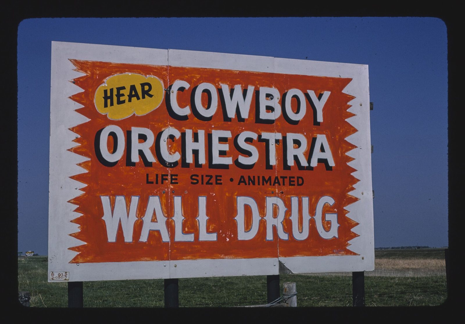
The idea that turned the business around was Dorothy's. During a heat wave in the summer of 1936, she suggested that the store give away ice water to anyone driving by, and Ted made roadside signs to say so, on the Burma-Shave pattern of a few words to a board, read one after another from a passing car. The rest of that story, from the signs to the traffic they brought to town, is on The Dust Bowl, Free Ice Water and the Highway.
Ted's son Bill Hustead, also a pharmacist, began enlarging the business in the 1950s, and Ted's grandson Rick Hustead was its chairman when KFF Health News reported on it in 2024. The store's pharmacy was then the only one in Wall, open year-round to people in town and to customers on ranches up to 60 miles out; the next nearest lay half an hour's drive northeast. The City of Wall notes that people often mix up the town's name with the store's.
Grassland, Ferrets and a Missile Silo
Wall is also a Forest Service town. The Wall Ranger District's office on Main Street runs the east side of the Buffalo Gap National Grassland, almost 600,000 acres of public prairie reaching southwest from Kadoka to the three-state corner of South Dakota, Nebraska and Wyoming. A second district, based in Hot Springs, manages the rest. Next door, the National Grasslands Visitor Center has exhibits on grassland plants and animals, on grazing, and on the story of the 20 national grasslands.
Some of that prairie holds black-footed ferrets. A Park Service decision signed on June 14, 1994, chose the Conata Basin and Badlands area near Wall, on both park and grassland, for bringing the ferrets back, and gave the park the first releases. In July 2026 the visitor center and the town planned two days of events to mark 30 years, by the organizers' count, of returning ferrets to western South Dakota, with a ferret float in a Main Street parade among them. The ferrets' history here, and their counts over the years, are on Prairie Dogs and Black-Footed Ferrets.
The Wall is the main feature of the park's North Unit, the Park Service says. The South Unit lies farther south, within the Pine Ridge Reservation. The park is covered on Badlands National Park, and the country around Wall on The Badlands and Wall.
The missile silo Delta-09 sits 6 miles east of town, on the south side of Interstate 90 at Exit 116. The Strategic Air Command took charge of it on November 1, 1963, and it came off alert with every other Minuteman II in September 1991. Congress made it and the launch control facility Delta-01, at Exit 127, into Minuteman Missile National Historic Site on November 29, 1999; the history of the whole missile field is on Ellsworth and the Minuteman Missiles. The silo's launcher door is now fixed partly open, and through a glass and aluminum enclosure built over it in 2001, visitors look down at a deactivated training missile.
Connected
- The Badlands and WallThe region Wall belongs to, from the Wall to the South Unit.
- How the Badlands ErodeThe soft layers of the escarpment the town is named for.
- Badlands National ParkThe park whose Pinnacles Entrance lies south of town.
- The Dust Bowl, Free Ice Water and the HighwayHow Dorothy Hustead's 1936 idea drew drivers into Wall.
- Ellsworth and the Minuteman MissilesThe missile field around Wall and the Delta-09 silo east of town.
- Homesteading the Edges of the HillsThe claims taken up around Wall and the grassland that came after.
- Prairie Dogs and Black-Footed FerretsThe ferrets returned to the Conata Basin and the park near Wall.
- Uranium, the Cold War and the MissilesEdgemont's uranium, the missile field and the silo east of town.
Sources
- Visitors. City of Wall, South Dakota.
- History of Wall. City of Wall, South Dakota.
- Badlands Wall. National Park Service, Badlands National Park, 2020.
- Pinnacles Overlook. National Park Service, Badlands National Park.
- History of Badlands National Monument and the White River (Big) Badlands of South Dakota: The Settlers Come, by Ray H. Mattison and Robert A. Grom. Badlands Natural History Association, 1968; copy held by the NPS History Collection.
- History of Badlands National Monument and the White River (Big) Badlands of South Dakota: Chronology, by Ray H. Mattison and Robert A. Grom. Badlands Natural History Association, 1968; copy held by the NPS History Collection.
- Great Sioux Reservation (guide to the 1892 census rolls). South Dakota State Historical Society, State Archives.
- Wall Drug, by Sheila R. Aaker. Encyclopedia of the Great Plains, University of Nebraska–Lincoln.
- The early days of Wall Drug, by Brian Gevik. South Dakota Public Broadcasting, 2015.
- Wall Drug: Overview (guide to the Wall Drug collection). Archives and Special Collections, University Libraries, University of South Dakota, 2023.
- You can pan for gold at Wall Drug in South Dakota. Locals need it as a pharmacy, too. KFF Health News, as carried by KERA, 2024.
- Wall Ranger District. USDA Forest Service, Nebraska National Forests and Grasslands.
- Buffalo Gap National Grassland. USDA Forest Service, Nebraska National Forests and Grasslands.
- National Grasslands Visitor Center. USDA Forest Service, Nebraska National Forests and Grasslands.
- Record of Decision, Final Environmental Impact Statement, Black-Footed Ferret Reintroduction, Conata Basin/Badlands, South Dakota. National Park Service, Federal Register 59, no. 118, 1994.
- Forest Service, community of Wall celebrating black-footed ferret reintroduction. South Dakota Public Broadcasting, 2026.
- Delta-09. National Park Service, Minuteman Missile National Historic Site.
- Directions. National Park Service, Minuteman Missile National Historic Site.
- Public Law 106-115, Minuteman Missile National Historic Site Establishment Act of 1999 (approved November 29, 1999). Copy posted by the Office of the Law Revision Counsel, U.S. House of Representatives.
- Pinnacles Overlook (image). U.S. Geological Survey, Geology and Ecology of National Parks, 2009.
Last reviewed: