Towns
Lead, South Dakota
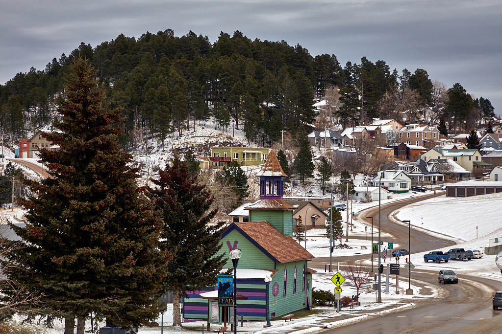
Some of Lead's sidewalks are staircases. The ground is so steep that the town's walks take flights of wooden and metal steps, the city's 2004 comprehensive plan observes, and many of its streets give up on a straight grid and double back in switchbacks. The Open Cut, the pit where the Homestake Mine began, can be seen from Main Street. Lead, South Dakota, a town of 2,982 people in the 2020 census, sits high in the northern Black Hills and grew up as the Homestake's company town. Lead's story runs from the rock beneath the town to the years after the mine closed.
Gold in the Oldest Rock of the Hills
Lead sits on the innermost ring of the Black Hills, the Precambrian crystalline core described on How the Black Hills Formed. The core's rocks are about 1.7 to 2.5 billion years old. At Lead they reach the surface, with younger igneous rock forced up through them. Among them lies the Homestake Formation, an Early Proterozoic iron-formation, meaning layered rock rich in iron minerals, and the Homestake Mine took almost all its ore from that one unit.
That layer made the town. In a 1974 report for the U.S. Geological Survey, the geologist James J. Norton found that about 90 percent of the gold South Dakota had produced through 1971 came from the Homestake Mine, and that about 99 percent of the recorded total was mined within 5 miles of Lead. Why so much gold gathered in one formation is explained on Gold and the Other Minerals.
The mine's mark on the town is easy to see. The Open Cut opened on the spot of the 1876 Homestake strike, and the city's plan counts 40 million tons of rock hauled out of it between 1876 and 1945; as the pit spread, nearby homes and businesses had to move again and again. SDPB's Brian Gevik, writing in 2016, described a town whose homes and most of its downtown crowded up to the mine and in places sat on top of it. The ground was already unsettling foundations in the mid-1890s, and in the 1920s and 1930s parts of Lead sank.
A Town Named for a Vein of Ore
The town's name, said "leed," is a miners' word: a lead is a ledge or vein of ore. The city's 2004 plan says the name came from the many leads of ore around the town.
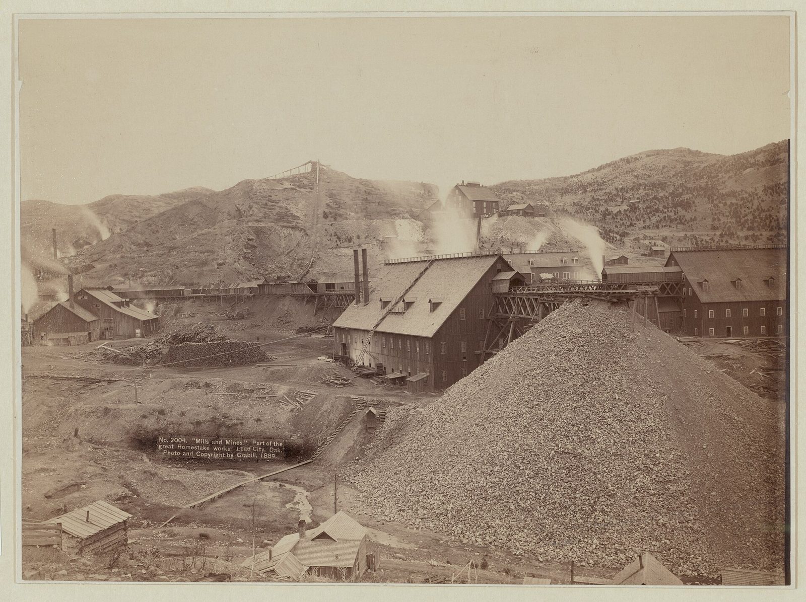
Prospectors came with the gold rush. On April 9, 1876, Moses and Fred Manuel, Hank Harney and Alex Engh staked the Homestake claim near present-day Lead. The city's website dates Lead's first settlement to 1876, as Encyclopaedia Britannica does, while the city's 2004 plan says the town was founded in 1878. The plan and Britannica both give 1890 for its incorporation, under the name Lead City in the plan's telling, but the website gives 1877. Lead grew on land the 1868 Fort Laramie Treaty had set apart for the tribes, and the 1877 Act took the Hills without the consent the treaty required.
A group led by George Hearst, with J.B. Haggin and Lloyd Tevis, bought the claim in 1877, and that November the Homestake Mining Company was incorporated. The mine eventually reached more than 8,000 feet down and yielded nearly 40 million ounces of gold. Its last ore came out on December 14, 2001, and the mill shut down on February 13, 2002. The full story, from the claim to the laboratory in its tunnels, is on The Homestake Mine and Sanford Lab.
Life in the Company Town
By the mid-1880s Lead lived on one mine. The ground beneath Lead's first neighborhoods belonged to the company, which also helped its miners find housing, according to the city's plan. Under a later lot sale program, homeowners could buy the surface rights from Homestake and gain full title to their lots. A company hospital opened in 1889, and Phoebe Apperson Hearst, George Hearst's widow, gave the town a free library in 1894 and, from 1900, paid for a free kindergarten that Lead's Woman's Club had started; it was dedicated in the spring of 1901.
Superintendent Thomas J. Grier and Phoebe Hearst together planned the largest gift of all: the Homestake Opera House and Recreation Building, opened on August 31, 1914. Under one roof it held a theater, a library, a swimming pool and a bowling alley. The Advisory Council on Historic Preservation calls it "the center of community life" from 1914 until a fire in 1984 burned out the theater. The Homestake Opera House Society has been renovating the building since 2018, KOTA reported in May 2025, starting with a fire-protection system.
The census shows how fast the town filled. Lead counted 2,581 people in 1890, 6,210 in 1900 and 8,392 in 1910. In 1900, among the South Dakota cities the Census Bureau listed, only Sioux Falls was larger. The city's plan ties the swings in Lead's population since 1880 mainly to the fortunes of mining, and it puts the 1990 count at 3,632.
What Changed When the Homestake Closed?
The closing took away Lead's main employer. Homestake announced on September 11, 2000, that it would close the mine, citing low gold prices, high costs and ore poorer than expected. Writing for the Federal Reserve Bank of Minneapolis in January 2001, Douglas Clement counted more than 330 jobs to be lost, after 400 layoffs in 1998, along with sizable mine-related taxes that the city, the county and the state would no longer collect. Local officials hoped to grow tourism, with skiing and snowmobiling leading the way, and to bring in light industry that could hire the mine's electricians and carpenters.
Part of the loss had come before the end. Talk that the mine would close was already driving people away in the 1990s, the city's 2004 plan says. Its tables show school enrollment dropping from 892 in 1990 to 795 in 2000, and vacant housing units climbing from 177 to 338. Deadwood is another tie. Limited-stakes gaming began there on November 1, 1989, and the plan counts a short commute and cheaper housing among the reasons many people who work in Deadwood live in Lead.
The mine itself found a second use. Barrick Gold, the property's owner, gave it to the state in 2006, and the South Dakota Science and Technology Authority now runs the Sanford Underground Research Facility (SURF) there, named for the donor T. Denny Sanford. How the gold mine became a laboratory is told on The Homestake Mine and Sanford Lab.
Science, Snow and the Towns Nearby
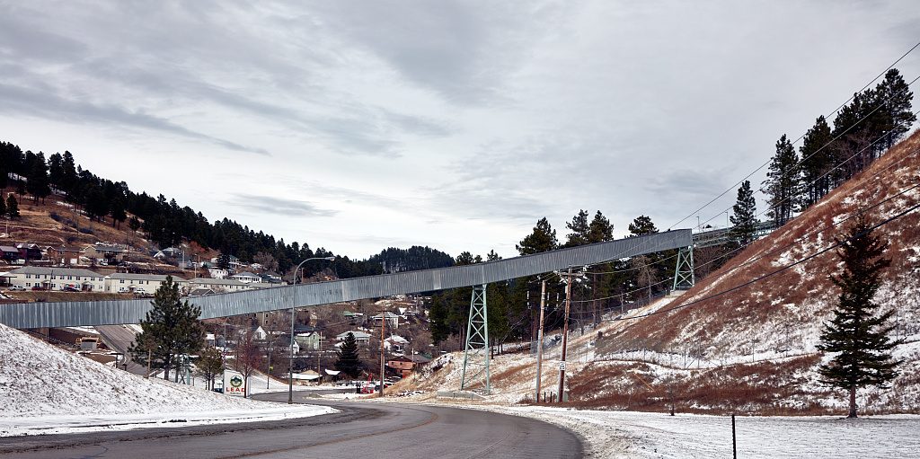
Science moved into the mine's tunnels long before the gold ran out. In 1965 Raymond Davis Jr. set up a neutrino detector on the 4,850-foot level, work that earned him a share of the 2002 Nobel Prize in Physics, as From a Gold Mine to a Nobel Prize tells. Digging the caverns for the Deep Underground Neutrino Experiment, from 2019 to 2024, sent about 800,000 tons of rock into the Open Cut, and SURF runs a visitor center in Lead.
Lead is snow country. The National Weather Service station at Lead, at 5,350 feet, averages 183.9 inches of snow a year in its 1991 to 2020 normals, and April is its snowiest month, with 29.0 inches. Winter in the Hills covers the snowmobile trails, the ski loops and the downhill ski area on Terry Peak near town. Most of that ski area is private land; Congress found in 1999 that the Black Hills National Forest made up only 10 percent of it.
One road from Lead down to Deadwood, the gold-rush town of 1876, passes through Central City. U.S. Highway 85 leaves Lead to the southwest for Cheyenne Crossing, where the road down Spearfish Canyon begins. The George S. Mickelson Trail, on a former rail line, ends at Deadwood, and the city's 2017 plan addendum lists, as a long-term goal, a trailhead plan with routes linking the trail to the downtowns of Lead, Deadwood and Central City. In March 2026 Mayor Dustin Heupel proclaimed April 9, 2026, as Homestake Day, 150 years after the claim the town grew around.
Connected
- The Northern HillsLead's region, from the gold gulches to the plains around Belle Fourche.
- Gold and the Other MineralsWhy the Homestake Formation under Lead held so much gold.
- The Homestake Mine and Sanford LabThe mine from the 1876 claim to its closing, and the lab in its tunnels.
- From a Gold Mine to a Nobel PrizeHow a tank on the 4,850-foot level led to a Nobel Prize.
- Winter in the HillsLead's snowfall, the snowmobile trails and Terry Peak.
- Deadwood, South DakotaThe gold-rush town down the road, past Central City.
- The 1876 War and the Taking of the HillsHow the treaty land under Lead was taken from the tribes.
- Spearfish Creek: Power, Rails and the 1933 FloodThe creek water that powered the Homestake, and the flood of 1933.
- Gold, Lithium and the New Mining RushWho is mining and drilling in the Hills now, and under which law.
Sources
- Lead Comprehensive Plan, 2004–2014 (draft of June 23, 2004). City of Lead, 2004.
- 2017 Lead Comprehensive Plan Addendum. City of Lead, 2017.
- City of Lead, South Dakota (home page). City of Lead, undated.
- Lead (South Dakota, United States). Encyclopaedia Britannica, 2015.
- Homestake Day Proclamation. City of Lead, 2026.
- Lead, South Dakota (Preserve America Community). Advisory Council on Historic Preservation, undated.
- Mining a Rich Vein of Science, by Jordan Sorokin, a profile of Tom Nelson, then mayor of Lead. Symmetry magazine, 2009.
- Thirteenth Census of the United States, 1910: Abstract of the Census, with Supplement for South Dakota. U.S. Census Bureau, 1913.
- South Dakota Historical Markers, numerical master list (marker 444, The Hearst Highway). South Dakota State Historical Society, 2020.
- Philanthropy as Cultural Outreach: Phoebe Hearst and Music in Lead, South Dakota, by Leta E. Miller. South Dakota History 47, no. 3, South Dakota State Historical Society, 2017.
- Gold in the Black Hills, South Dakota, and How New Deposits Might Be Found (Circular 699), by James J. Norton. U.S. Geological Survey, 1974.
- Homestake Closes; High Stakes Open, by Douglas Clement. Fedgazette, Federal Reserve Bank of Minneapolis, 2001.
- The Sinking Town of Lead, South Dakota, by Brian Gevik. South Dakota Public Broadcasting, 2016.
- The Latest on the Homestake Opera House Restoration Efforts, by Adrian Carbajal. KOTA Territory News, 2025.
- Our Story. Sanford Underground Research Facility, undated.
- Lead, SD: 30-Year Normals (1991–2020) and Climate Records. National Weather Service, Rapid City, SD, 2026.
- Terry Peak Land Transfer Act of 1999 (Public Law 106-138, 113 Stat. 1693). U.S. Congress, 1999.
- Geologic Field Trips in the Black Hills Region, South Dakota (Bulletin 21), Field Trip 1 road log, by Michael P. Terry and others. South Dakota School of Mines and Technology, 2010.
Last reviewed: