Towns
Hill City, South Dakota
The tin company that English investors listed in 1889, with its headquarters at Hill City, carried $15 million in capital stock. The ground gave up far less: about 120 tons of metallic tin, worth $70,000 to $80,000, most of it mined between 1884 and 1912, by the estimate in a 1969 U.S. Geological Survey report on the Hill City area. Hill City, South Dakota, had 872 people in the 2020 census. It sits in the old metamorphic rock of the Central Hills, began as a gold camp in 1876, and lived on tin, rails and timber before tourism became its main trade.
What Rock Lies Under Hill City?
Schist and phyllite underlie the Hill City area, the 1969 USGS report says. Both are metamorphic rocks of the crystalline core, the innermost of the four rings of rock on How the Black Hills Formed; phyllite is the finer-grained of the two, with a silky sheen. Metamorphic rock has been changed by heat and pressure without melting. These rocks began as layers of mud and muddy sand. They are older than the Harney Peak Granite, which is about 1.7 billion years old, and the rocks of the core as a whole run from about 1.7 to 2.5 billion years.
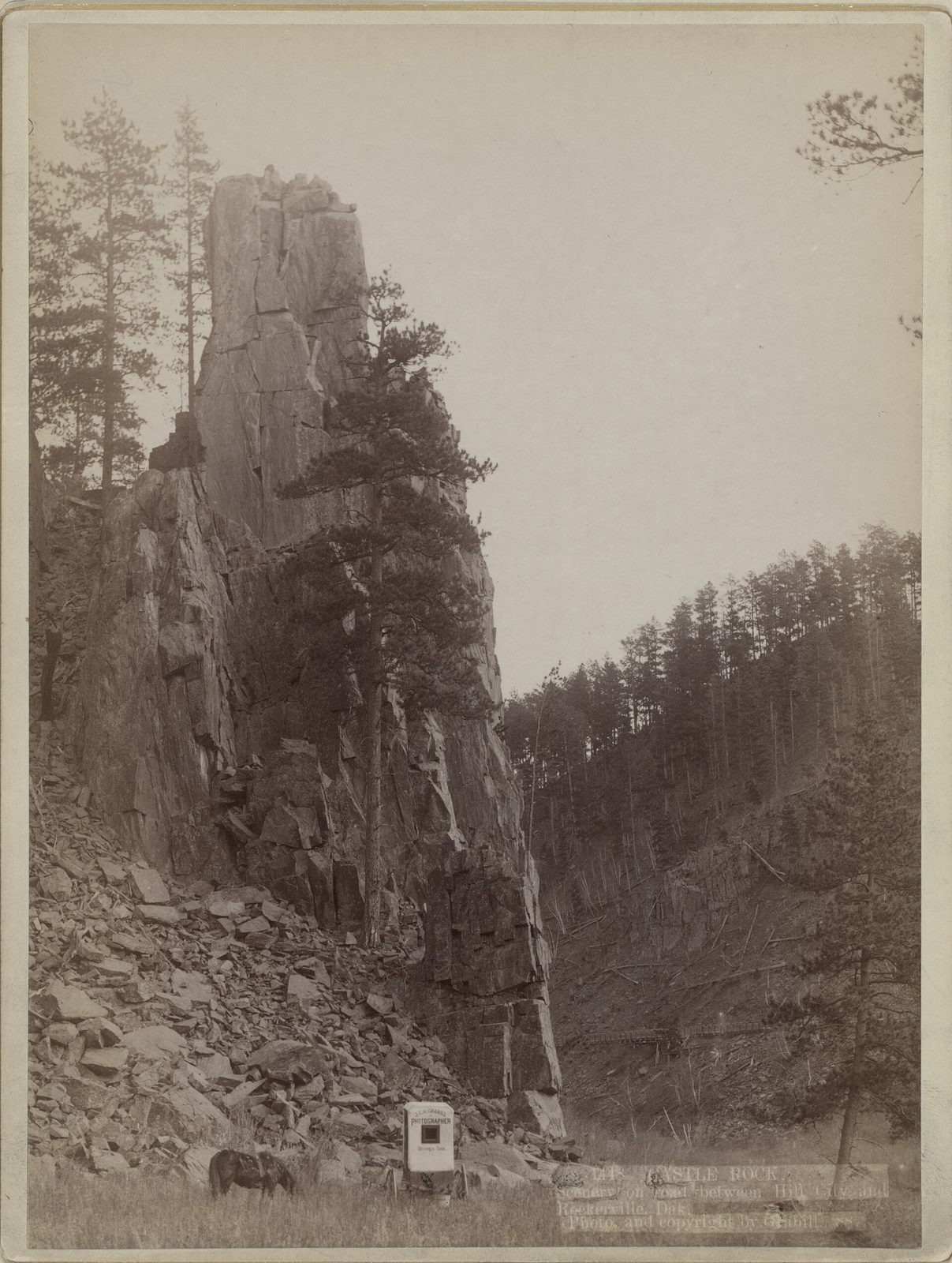
The town lies on the northwest side of the Harney Peak dome, the swell of granite and schist around Black Elk Peak, and the rock near town was squeezed into tight folds, so many of its layers dip steeply. Ridges around town are often held up by metagraywacke, a hard metamorphosed muddy sandstone that crops out in big masses, the 1969 USGS report says. Softer mica schist, a glittery rock that splits into thin flakes, wears down faster and tends to floor the low ground between them (more on The Granite Core). Spring Creek crosses town at about 4,990 feet, by the USGS's figure. The ground also held what Hill City first lived on: gold, and tin in small pegmatite dikes and quartz veins, mostly no more than a mile from town on its west and south sides.
A Gold Camp Emptied by Deadwood
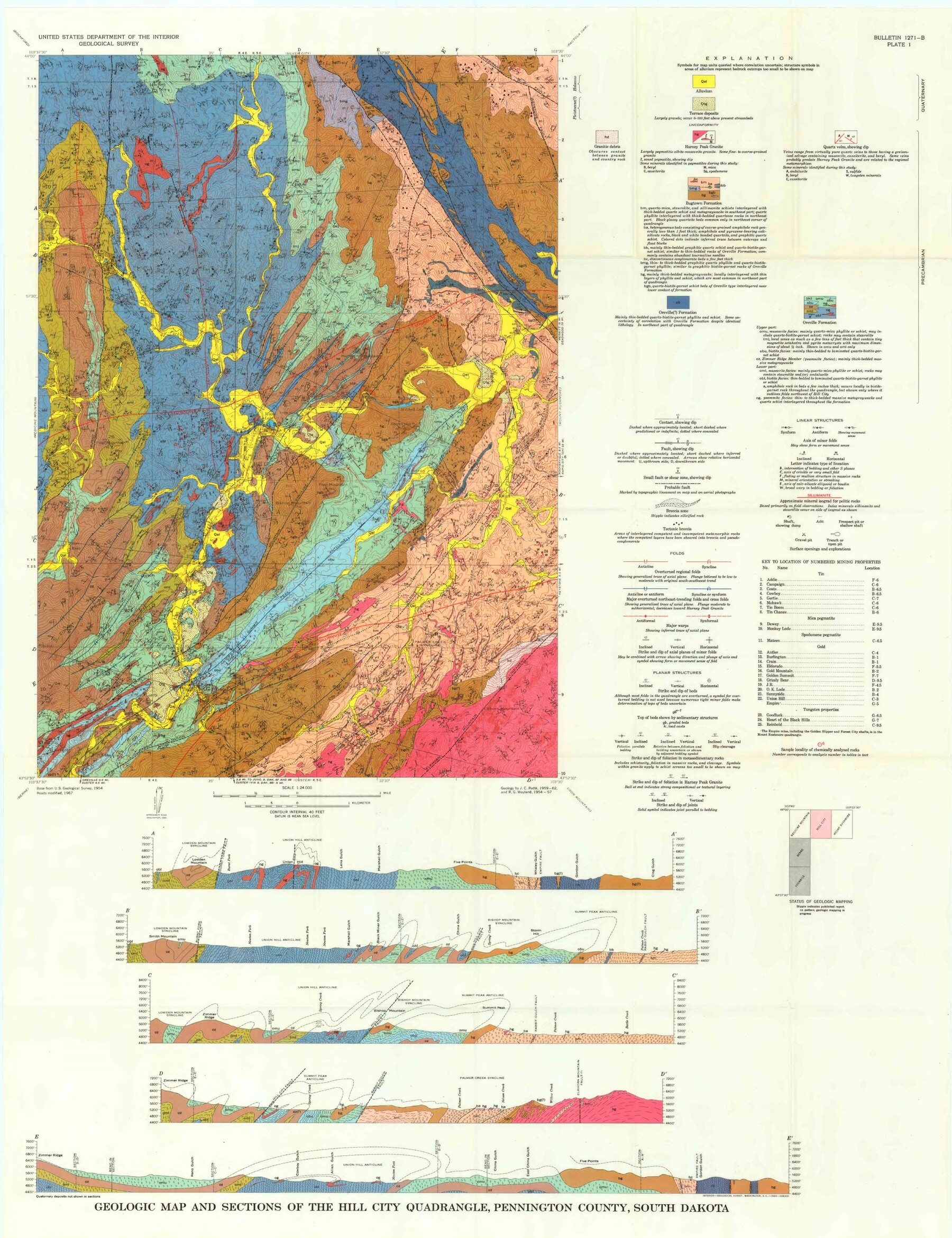
Hill City's town plan dates from February 1876, when Thomas Harvey, John Miller and Hugh McCullough marked it out for gold miners, says a 1955 state historical marker that the State Historical Society lists on Highway 16, across from the school. The camp stood in Hé Sápa, on land the 1877 Act took from the tribes without the consent the 1868 treaty required (see The 1876 War and the Taking of the Hills). By May the camp was all but empty, its miners gone after the richer gold up north, the marker says; the rush itself is told on The Black Hills Gold Rush. Gold mining near town went on, mostly from 1890 to 1910, the USGS found, and the J.R. mine led with about 12,000 ounces.
By 1883, the same marker says, the town's teacher was Annie D. Tallent, whom it calls “the first woman to enter the Hills and its historian.” She came in with the Gordon Party in 1874, but Lakota women, and women of other tribes, had lived in the Hills long before she arrived.
A sign at the trailhead in Tracy Park claims “Oldest Community in Pennington County,” and a 2023 SDPB program preview called Hill City the second-oldest town in the Black Hills, naming no source. The record doesn't settle the county claim. Rapid City's founders made camp on February 24, 1876, and laid out a mile-square townsite the next day, by the state's 1955 marker in Rapid City, while Hill City's marker gives only the month.
The Tin Venture That Failed in 1893
The tin venture headquartered at Hill City ran from 1884 until February 2, 1893, when its mine shut without warning and more than 400 men lost their work. The USGS ties those years to the Harney Peak Tin Mining, Milling and Manufacturing Company. The 1976 National Register nomination for the company's buildings tells how the money came and went.
The nomination dates a find of cassiterite, tin's main ore, near Hill City to 1877, when miners had eyes only for gold. The find that mattered came in 1883, when A.J. Simmons turned up tin again. His sample, and others, went to Professor William P. Blake, who visited the Hills and came away expecting a large supply. Yet Blake warned investors that ore as rich as the reports claimed came only from the Etta mine, near Keystone, and a second expert judged that the district held no tin worth working.
Money came anyway. A London group circulated a prospectus in 1887 that included buying the Dakota tin mines; British financial and mining papers attacked it, and the proposed company fell apart. In 1889 English investors listed the Harney Peak Consolidated Tin Company, Ltd., with $15 million in capital stock. About 1890 the venture put up headquarters buildings at the edge of town, bought more claims and launched a big publicity drive, the nomination says, and it calls the company's history fraudulent.
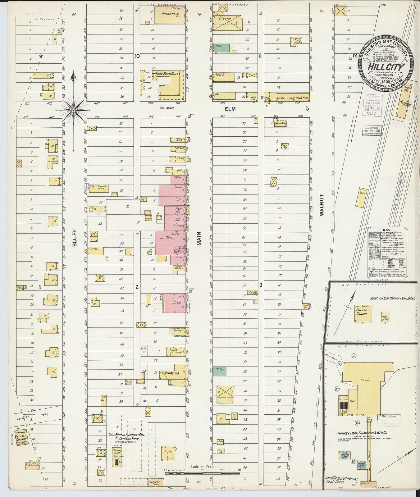
Five stockholders sued in 1894, and the case ended in a receivership. The superintendent's house and the barn, on either side of US 385, were nominated to the National Register in 1976 as the Harney Peak Tin Mining Company Buildings.
Rails, Timber and a Trail Through Town
The Burlington's line from Edgemont to Deadwood, built in 1890 and 1891 by the account of a trail sign once posted at Deadwood, ran through Hill City, and the Burlington added a branch from Hill City to Keystone. The Black Hills Central Railroad, by its own account, has run excursion trains since August 18, 1957, and now runs them on that branch, a 10-mile spur (see Stagecoaches and Railroads).
Trains on the main line north of Custer stopped on November 8, 1983, by the Deadwood sign, and the right of way from Custer to Deadwood passed to the state in 1988 and 1989, a sign at the Hill City trailhead says. It is now part of the George S. Mickelson Trail, which runs 109 miles from Edgemont to Deadwood on a former rail line and was completed in September 1998.
Timber outlasted tin. In March 2021 the owner of the sawmill just outside town said it was closing after 53 years, putting 120 people out of work, and blamed Forest Service logging restrictions, SDPB reported. In 2023 Mayor Mike Verchio told SDPB the loss hit the community hard, though many of the workers lived elsewhere, and the chamber of commerce's director, Janet Wetovick-Bily, said, “We run on tourism.” The timber dispute behind the closing is on Logging the Ponderosa.
Lakes, a Wilderness and the Neighbors
Below town, Spring Creek flows on into Sheridan Lake, a 2008 state water-quality study of the creek shows, and a state marker places the old settlement of Sheridan at the bottom of the lake. Deerfield Reservoir lies about 20 miles west of town, circled by a 10-mile trail, the Forest Service says. Both are on Lakes of the Black Hills.
Southeast of town the granite rises to Black Elk Peak (called Harney Peak until 2016), 7,242 feet, the highest point in South Dakota. It stands in the Black Elk Wilderness, which Congress set aside in 1980 and enlarged in 2002, and which covers more than 13,534 acres, the Forest Service says (see Hiking Black Elk Peak).
To the south lies Custer, on French Creek, near where Tallent and the rest of the Gordon Party spent the winter of 1874 and 1875. At the far end of the excursion line is Keystone, and about 1 mile south of it the Etta mine, the only place where Blake said the rich ore held.
Connected
- The Central HillsThe region of granite, schist and mining camps that Hill City sits in.
- How the Black Hills FormedThe crystalline core, the innermost ring, where the town stands.
- The Black Hills Gold RushThe 1876 rush that founded Hill City and then drew its miners north.
- Stagecoaches and RailroadsThe Burlington line through town and the excursion trains to Keystone.
- The George S. Mickelson TrailThe 109-mile trail on the old rail line, with a trailhead in town.
- Logging the PonderosaThe sawmill that closed outside town in 2021, and the timber dispute behind it.
- Lakes of the Black HillsSheridan Lake down Spring Creek, and Deerfield Reservoir to the west.
- Hiking Black Elk PeakThe granite summit and wilderness southeast of Hill City.
Sources
- Geology of the Hill City Quadrangle, Pennington County, South Dakota: A Preliminary Report (Bulletin 1271-B) (James C. Ratté and Russell G. Wayland). U.S. Geological Survey, 1969.
- TIGERweb, 2020 Census: incorporated places. U.S. Census Bureau, 2020.
- South Dakota Historical Markers, numerical master list (markers 39, 67 and 118). South Dakota State Historical Society, revised 2020.
- Dakota Images: Annie D. Tallent. South Dakota History 3, no. 2, South Dakota State Historical Society, 1973.
- Gordon Stockade (The Wi-Iyohi 15, no. 11). South Dakota State Historical Society, 1962.
- Treaty of Fort Laramie (1868), transcript. National Archives.
- Harney Peak Tin Mining Company Buildings, National Register of Historic Places nomination (Scott Gerloff, Historical Preservation Center). National Park Service, 1976.
- Welcome to Hill City (sign text). Sign in Tracy Park at the Hill City trailhead of the George S. Mickelson Trail; transcribed by the Historical Marker Database, 2026.
- Dakota Life Preview: Greetings From Hill City. SDPB, 2023.
- Track or Trail: Sweat Equity Played a Role (sign text). Sign erected by the George S. Mickelson Trail at the Deadwood trailhead; transcribed by the Historical Marker Database.
- Learn Our History of Railroading in the Black Hills. Black Hills Central Railroad (the company's own account).
- Dreams Can Come True (sign text). Sign at the Hill City trailhead of the George S. Mickelson Trail; transcribed by the Historical Marker Database.
- George S. Mickelson Trail. South Dakota Game, Fish and Parks.
- Sawmill Closure Eliminates 120 Jobs in Hill City (Seth Tupper). SDPB, 2021.
- Two Years On, Tourism Helps Hill City Move Past Closure of Sawmill (C.J. Keene). SDPB, 2023.
- Spring Creek at South Rail Crossing at Hill City (monitoring location 435532103343600). U.S. Geological Survey, Water Data for the Nation.
- Spring Creek Fecal Coliform Bacteria Total Maximum Daily Load (TMDL) (Scott Kenner and Aaron M. Larson). South Dakota Department of Environment and Natural Resources, 2008.
- Central Hills: Rapid City (recreation sites). USDA Forest Service, Black Hills National Forest.
- Wilderness (Black Elk Wilderness). USDA Forest Service, Black Hills National Forest.
Last reviewed: