Towns
Interior, South Dakota
The badlands west of Interior are brightly colored, and for more than a century geologists have used the town's name for them. Freeman Ward called them the "Interior phase of the Pierre" in 1922, the U.S. Geological Survey reports, and later workers narrowed the name to one red fossil soil, the Interior paleosol. Interior, South Dakota, had 65 people in the 2020 census. It sits in the White River valley just south of the North Unit of Badlands National Park, began as a settlement called Black, moved in 1907 to meet a railroad, and has lived on cattle, the railroad and now the park next door.
A Valley Town on Soft Ground
Interior lies far outside the rings of rock described on How the Black Hills Formed. The ground around it belongs to the Badlands stack: beds of mud, sand and volcanic ash roughly 75 to 28 million years old, so loosely bound that rain and frost strip them fast. How the Badlands Erode covers the Interior paleosol and the layers around it.
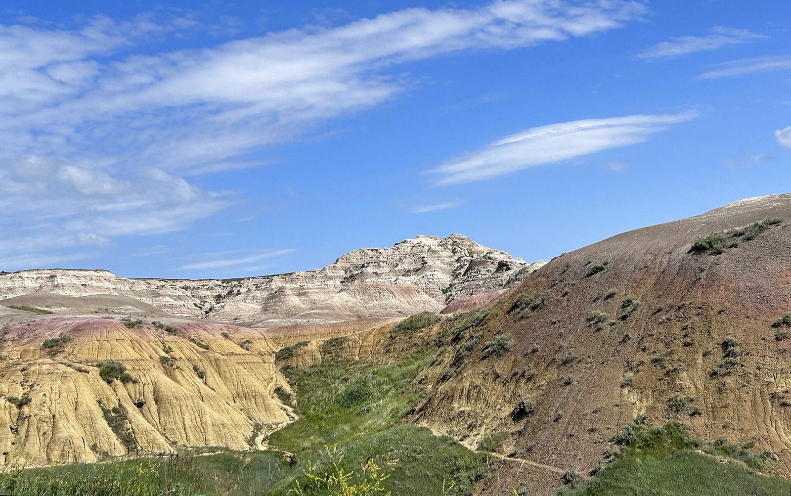
In the National Park Service's description, the Badlands Wall, a line of eroded cliffs from near Kadoka to Wall, divides an upper prairie from a lower one to its south and forms the north side of the valley the White River cut into those beds. Interior lies in that valley, and the park's Interior Entrance is 2 miles north of town on Highway 377. From town, the Wall and the park lie to the north, and Ward's colored beds to the west.
Why Did Interior Move?
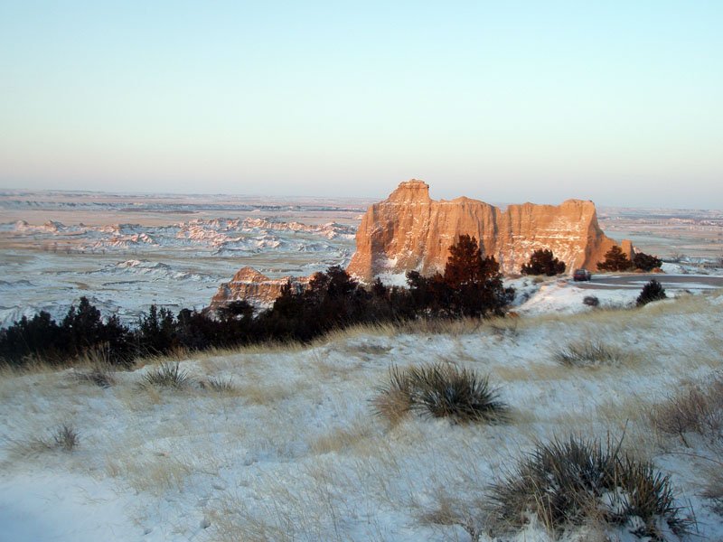
Interior moved to be on the railroad. The first settlement went up around 1881, about 2 miles southeast of where the town stands now, under the name Black, according to a 1968 history of the national monument by Ray H. Mattison and Robert A. Grom. South Dakota Magazine, in a 2022 profile of the town, puts Black on the White River, names it for a pioneer family, and says floods and a fire struck it before the move.
Sources disagree on when Black became Interior, and only one says why. Mattison and Grom put the change around 1895. A list of towns kept by the South Dakota State Archives dates Interior's post office to June 27, 1894, and gives Black as another name for the place. South Dakota Magazine links the name to the 1907 move: the postmasters, Louis and George Johnson, had a letter from the federal Department of the Interior, and it suited a new site in the "interior" of the Badlands. The older records give no reason.
The Milwaukee Road, formally the Chicago, Milwaukee and St. Paul, laid track up the White River valley between Chamberlain and Rapid City in 1907, and the settlement left its old site for a new townsite on the line. A marker the town put up at A Street and 4th Avenue calls Interior "the oldest town in the badlands." That claim rests on Black. The townsite itself dates from 1907.
Cattle, Rails and Visitors
Livestock came before the railroad. In the 1890s, Mattison and Grom write, the Badlands country was mainly range for cattle and sheep outfits. Homesteaders followed; the same history prints a 1911 photograph of sod just plowed for a farm northwest of town, close to the Wall. Ranching goes on: South Dakota Magazine's portrait of the town included a third-generation rancher a few miles west.
Tourists came by train and by road. Travelers from the east in the late 1920s most likely took the road over Cedar Pass, by Mattison and Grom's reckoning, and went on to Interior, a railroad town by then. Businessmen and residents of the Badlands towns, as the Wonderland Hiway Association, resolved to petition the state for a highway west from Kadoka, through Cedar Pass and Interior, and on through Scenic to Hermosa. In South Dakota Magazine's profile, Jerry Johnston ranks the town's 1920s rodeo as the world's third biggest; the article gives no figures to back the ranking.
The state finished a 30-mile road in 1935, running from Interior over Big Foot Pass to Sage Creek, for about $320,000. Governor Tom Berry cited it that year in asking for the monument Congress had authorized, on conditions, in 1929, and the proclamation came in 1939. By South Dakota Magazine's account, the town now lives on the visitor trade, with Badlands National Park in view.
Cedar Pass to the North, Pine Ridge to the South
Highway 377 runs north from town through the Interior Entrance to meet the Badlands Loop Road near the Ben Reifel Visitor Center, the park's headquarters, which stands beside Cedar Pass Lodge, below Cedar Pass. Highway 44 crosses Interior on its way northwest to Scenic, now a ghost town, and Rapid City. Wall lies at the far western end of the Wall.
The lodge went up on land that Ben Millard, a longtime banker, took as a homestead in 1927, and he built and ran it. Its dance hall drew bandleaders who included Lawrence Welk, a Park Service marker at Cliff Shelf says, and the town's own marker claims Welk's early music for Interior too. In 1957, the year after his death, a six-tenths-mile piece of the Wall just east of the pass was dedicated to him as Millard Ridge.
South of the White River lies the Pine Ridge Reservation, which holds the park's South Unit. In 1942 the War Department took 341,726 acres of the reservation for a World War II aerial gunnery range used by the Army Air Forces, and 125 families were relocated. Pilots found the range's edges hard to judge, the Park Service says, and some of their fire reached Interior, where six-inch shells broke through the roof of a church and of the building where the post office is today. The Park Service reports no civilian casualties. How part of the range became the South Unit is told on The Badlands and Wall.
Connected
- The Badlands and WallThe country around Interior, and the story of the gunnery range and the South Unit.
- How the Badlands ErodeThe soft layers, the Interior paleosol among them, and the river that cuts them.
- Badlands National ParkThe park whose Interior Entrance lies 2 miles north of town.
- Wall, South DakotaThe other Badlands town, at the west end of the Wall.
- Scenic, South DakotaThe ghost town to the west, once tied to Interior by the Washington Highway.
- How the Black Hills FormedThe rings of rock that end long before the White River valley.
- Prairie Dogs and Black-Footed FerretsRanchers, prairie dogs and ferrets on the grasslands around the park.
Sources
- Geology of Badlands National Park: A Preliminary Report, by Philip W. Stoffer (Open-File Report 03-35). U.S. Geological Survey, 2003.
- Badlands Wall. National Park Service, Badlands National Park, 2020.
- Directions. National Park Service, Badlands National Park, 2020.
- Badlands National Park map, text description. National Park Service, Harpers Ferry Center, NPGallery, undated.
- History of Badlands National Monument and the White River (Big) Badlands of South Dakota: The Settlers Come, by Ray H. Mattison and Robert A. Grom. Badlands Natural History Association, 1968; copy held by the NPS History Collection.
- History of Badlands National Monument: Legislation for Park Establishment, by Ray H. Mattison and Robert A. Grom. Badlands Natural History Association, 1968; copy held by the NPS History Collection.
- History of Badlands National Monument: The Depression Years, by Ray H. Mattison and Robert A. Grom. Badlands Natural History Association, 1968; copy held by the NPS History Collection.
- SD Towns. South Dakota State Historical Society, State Archives, 2010.
- Nestled in the Badlands, by Chad Coppess. South Dakota Magazine, May/June 2022; revised online 2025.
- Town of Interior Historical Marker (marker erected by the Town of Interior). Historical Marker Database, 2026.
- Badlands Oasis (marker erected by the National Park Service). Historical Marker Database, 2019.
- Aerial Gunnery Range. National Park Service, Badlands National Park, 2020.
- South Unit. National Park Service, Badlands National Park, 2020.
- On Dangerous Ground: Oglala Lakota Land Used as a Bombing Range in World War II Is Still Perilous, by William C. Meadows. American Indian magazine, Smithsonian National Museum of the American Indian, 2023.
- White River. Encyclopaedia Britannica, undated.
Last reviewed: