Ghost Towns
Scenic, South Dakota
For $799,000, in the summer of 2011, a buyer could have had most of Scenic, South Dakota: about 46 acres on Highway 44, along the western edge of the Badlands, roughly 12 of them taken up by the empty town. By October a church founded in the Philippines owned it. Scenic had been a railroad town in ranch country, and its population peaked at 155 in 1915, according to State Historical Society records cited by the Associated Press. Its story runs from the Badlands rock under its streets to the foundation that holds its lots today.
Badlands Rock Past the Hogback
Scenic sits on the plains well outside the Black Hills, beyond the sandstone ridge of the Hogback, last of the rings of rock that How the Black Hills Formed lays out. The Pine Ridge Reservation lies to the south. In the late 1920s Rapid City, to the northwest, was 45 miles away by dirt road, according to a 1968 history of the Badlands by Ray H. Mattison and Robert A. Grom.
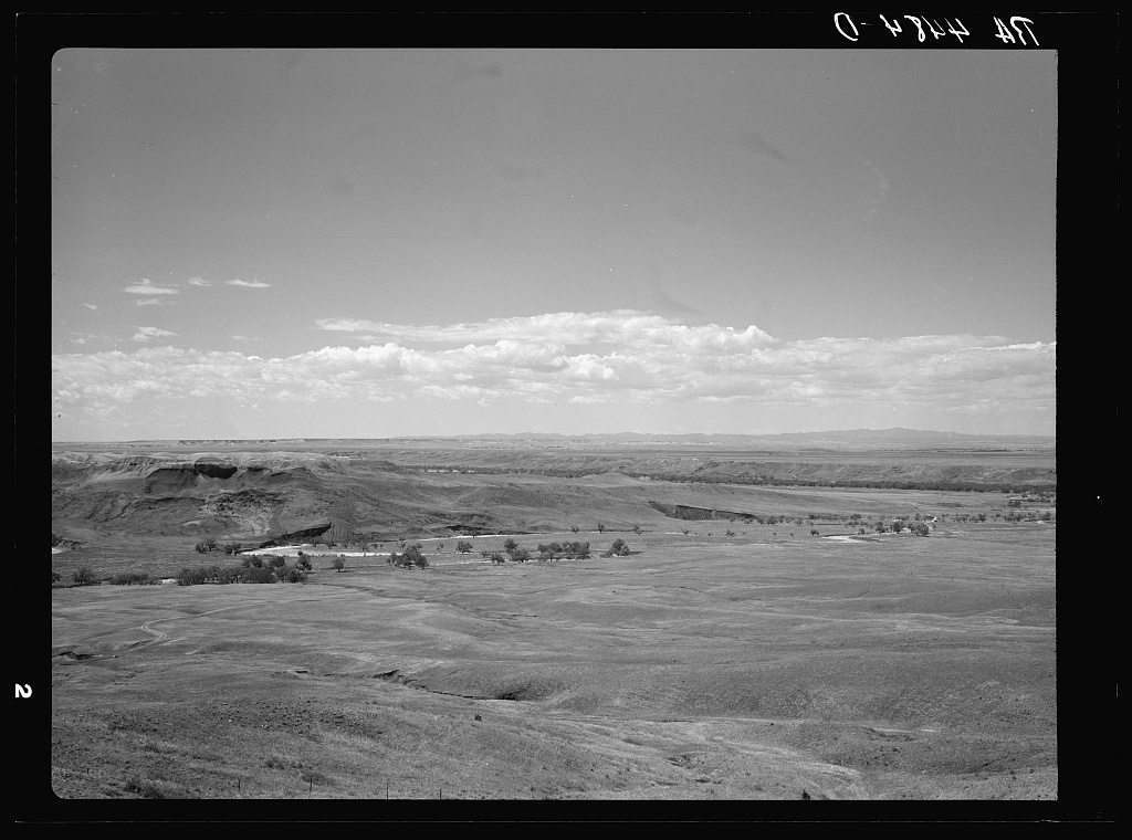
The ground here is Badlands rock, soft layers that wear away fast, as How the Badlands Erode explains. Among them is the Brule Formation. The Park Service dates it to 34 million to 30 million years ago, a stretch when this country dried and cooled into open savanna, with a river cutting across it now and then. One part of the Brule carries the town's name. Geologists call it the Scenic Member, and U.S. Geological Survey records place its standard section, designated in 1956, 2.2 miles south of town.
Rails, a State Road and Ranch Country
Few settlers came into this country until the railroads were on their way, Mattison and Grom write, and in 1907 two lines arrived. The Chicago and North Western built from Pierre to Rapid City by way of Philip and Wall. The Chicago, Milwaukee and St. Paul, later called the Milwaukee Road, came up the White River valley from Chamberlain through Kadoka and Interior. The 1968 history calls Scenic a railroad town. State route 40, the Washington Highway, tied it to Interior and Rapid City; crews were at work on the road in 1919, and its course kept roughly to the Milwaukee's tracks. County land records at Scenic still note that today's Highway 44 was formerly Highway 40. Earlier lines into the Hills are traced on Stagecoaches and Railroads.
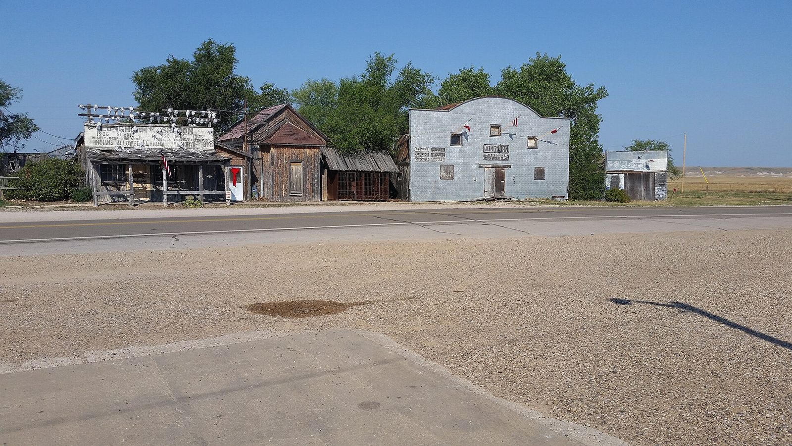
The Longhorn Saloon's building dates from 1906, going by the year shown on its sign, which the Associated Press found trimmed with cattle skulls in 2011. At its height, the AP reported, the town had a hotel, a bank, a school, a post office, two restaurants and three gas stations.
Travelers came through too. Anyone who wanted to see Badlands formations away from the road could find a guide at Scenic's Museum Filling Station, which by the late 1920s had a wide reputation for its Badlands fossils. The town also served ranch country. After World War II, ranchers and the custodian of Badlands National Monument joined forces to clear several hundred unclaimed horses out of the Sage Creek basin. The drives ended at the loading chutes in Scenic, and on at least one of them airplanes kept the bands from doubling back.
Boarded Up and Sold in 2011
By 2011 the post office was the only business still open in Scenic, with a single employee, the AP found. The saloon had stood empty for years, and the remaining buildings were locked up, their doors and windows boarded with plywood. Just when and why the town's people left is not well recorded.
Most of the town by then belonged to Twila Merrill, a onetime rodeo bronc rider who had been acquiring property in Scenic since 1963. A South Dakota Magazine story by its publisher, Bernie Hunhoff, written several years before the magazine reposted it online in July 2011, said her family's corporation held nearly every home in town. It found the Catholic church, built in 1913, abandoned. It also reported that the Longhorn's sign had once read "No Indians Allowed," and that Merrill had painted over its first word. The story gave no date for the change. Tim Giago, an Oglala journalist, remembered the words carved into a large wooden sign; he wrote in 2019 that the saloon removed the "No" once federal law ended the ban on alcohol sales to tribal members, which he dated to 1953.
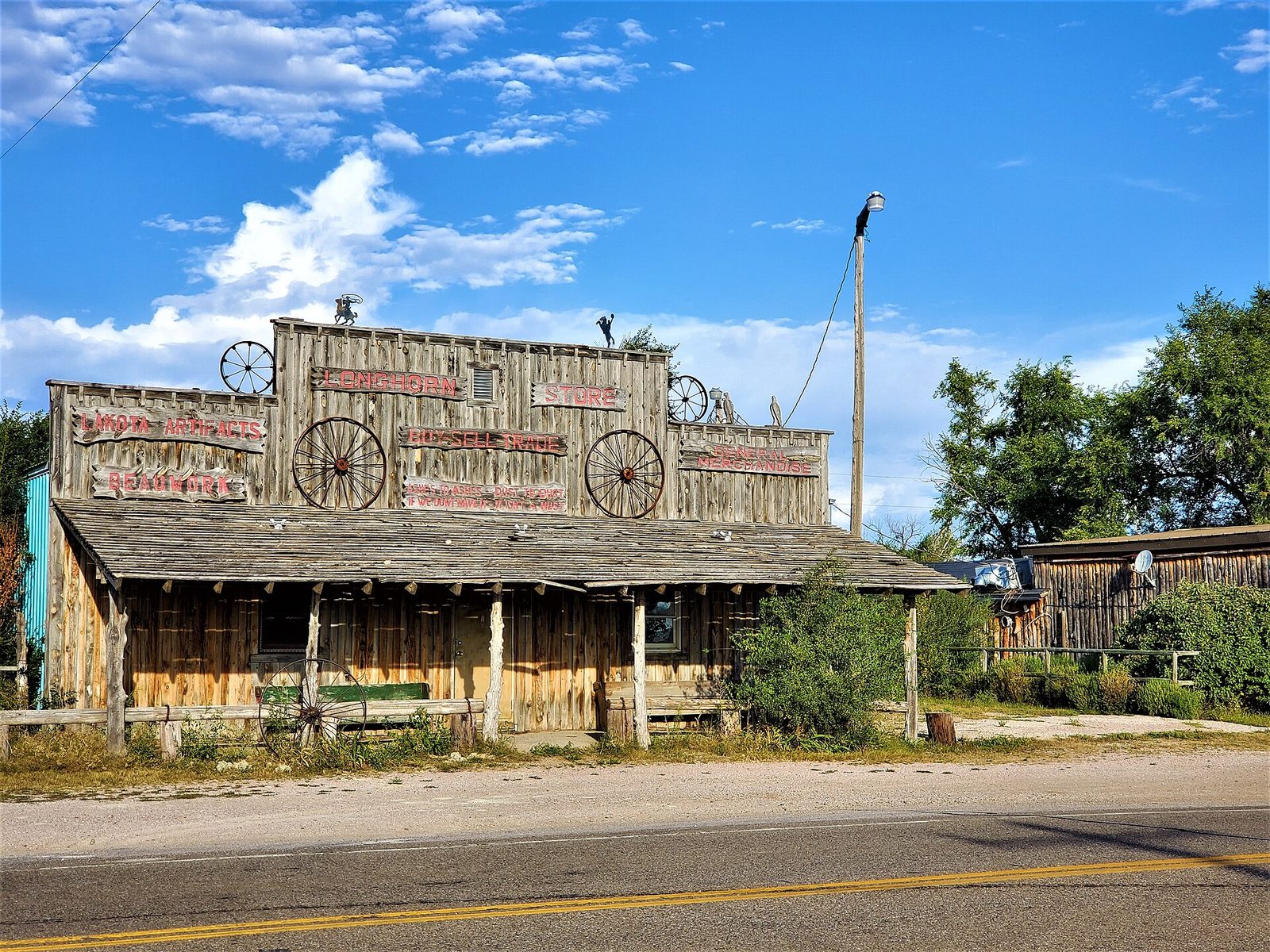
After the asking price dropped to $799,000 in July 2011, Merrill's holdings, the town and the land around it, were sold to the Iglesia ni Cristo, a church that began in the Philippines in 1914. By early October, the AP reported, the county had received neither a permit application nor a development plan from the church.
Fifty-Eight Parcels and a Foundation
Most of Scenic's townsite is private land. Pennington County's tax-parcel records, last updated in July 2026, list 58 parcels in the town, about 47 acres, under the Felix Y. Manalo Foundation, Inc., which acquired them in 2013 and 2014. Felix Manalo founded the Iglesia ni Cristo, and a 2014 Manila city council resolution describes the church launching an outreach program with a foundation of the same name. The county assesses buildings on 16 of the foundation's Scenic parcels, eight on Main Street. The census doesn't count Scenic separately: it is neither an incorporated town nor a census-designated place.
Public land begins within a mile of town: the Forest Service's ownership maps show agency land that close. It belongs to the Buffalo Gap National Grassland, run from the agency's Wall Ranger District, whose share of the grassland reaches from the Cheyenne River past Badlands National Park to near Kadoka. How worn-out homestead claims in this country became public grassland is told on Homesteading the Edges of the Hills.
Connected
- The Badlands and WallThe Badlands country Scenic belongs to, from the Wall to the South Unit.
- Wall, South DakotaOn the Chicago and North Western line, the other railroad built across this country in 1907.
- Stagecoaches and RailroadsThe stage roads and early rail lines that came before the Badlands country's 1907 railroads.
- Interior, South DakotaA Milwaukee Road town east of Scenic on the old Washington Highway.
- How the Badlands ErodeThe soft layers, the Brule Formation among them, that make the ground here.
- How the Black Hills FormedThe rings of rock that end at the Hogback, well short of Scenic.
- Homesteading the Edges of the HillsThe claims, the 1930s buyouts and the Buffalo Gap National Grassland.
Sources
- History of Badlands National Monument and the White River (Big) Badlands of South Dakota, by Ray H. Mattison and Robert A. Grom. Badlands Natural History Association, 1968; online edition, NPS History Collection.
- Church won't say boo on plans for ghost town, by Amber Hunt (Associated Press). Honolulu Star-Advertiser, 2011.
- Scenic: Where Characters Have a Town, by Bernie Hunhoff. South Dakota Magazine; written several years earlier, posted online July 28, 2011.
- Geologic Formations: How Badlands Buttes Came to Be. National Park Service, Badlands National Park, 2020.
- Geolex: Scenic. U.S. Geological Survey, National Geologic Map Database.
- Tax Parcels (Pennington County tax parcel ownership information). Rapid City and Pennington County GIS open data, 2026.
- Chapter 2: Geographic Area Direction, land management plan for the Nebraska National Forests and Grasslands. USDA Forest Service, 2026.
- U.S. Forest Service Surface Ownership Parcels (Basic Ownership). USDA Forest Service, map service consulted October 2026.
- National Grassland boundaries and Ranger District boundaries. USDA Forest Service, map services consulted October 2026.
- Proposed Senate Resolution No. 471, remembering the 125th birth anniversary of Felix Manalo. Senate of the Philippines, 2011.
- Manila City Council resolution congratulating the Iglesia ni Cristo on its centennial. City Council of Manila, 2014; Supreme Court of the Philippines E-Library.
- Type of land purchased by Resettlement Administration for grazing project. Pennington County, South Dakota. Arthur Rothstein, photograph; Library of Congress, Prints and Photographs Division, 1936.
- Scenic and the Main Street Bars of Rapid City, by Tim Giago. Indianz, 2019.
Last reviewed: