Landscape and Geology
How the Black Hills Formed
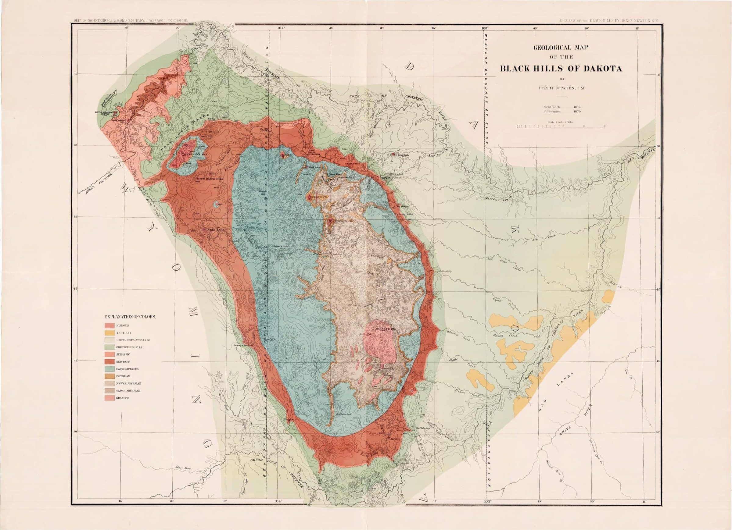
Under the plains of western South Dakota, the oldest rock lies far underground, buried beneath younger layers. In the Black Hills the same ancient rock lies open to the sky in the middle of the range, with the younger layers circling it in bands. A push from below raised the land into a dome, and a far longer wearing-down from above did the rest. Together they left the Black Hills in four rings of rock, each with its own color, landform and age: the crystalline core, the Limestone Plateau, the Red Valley and the Hogback.
When Did the Black Hills Rise?
The Black Hills began to rise about 60 to 65 million years ago, during a long mountain-building episode that geologists call the Laramide orogeny. The uplift probably continued into the Eocene epoch and ended roughly 40 to 50 million years ago. Over that time, forces deep in the earth bowed the land upward into an elongated dome, known to geologists as the Black Hills uplift.
Before the push, the ancient core rock had been worn down to a gently rolling plain, and over hundreds of millions of years, seas and rivers spread sand, mud and lime across it in nearly flat layers. The uplift raised and bent that whole stack. The layers now tilt away from the center on every side, at angles that can reach 15 to 20 degrees or more close to the Hills and flatten to less than 1 degree out on the plains.
The dome is about 120 miles long and 60 miles wide, according to the U.S. Geological Survey, with its long axis running north-northwest. It lies mostly in South Dakota and reaches across the state line into northeastern Wyoming.
Why the Rock Lies in Rings
Erosion made the rings. Since the dome began to rise, weather and running water have worn at its high middle, stripping the younger layers off the top until the oldest rock lay bare at the center. Around that core, the worn-off edges of the younger layers show at the surface as bands, each younger than the one inside it.
Picture a layer cake that bulged up in the middle and then had its top sliced off level. The bottom layer shows in the center, and the cut edge of every layer above it shows as a ring around it.
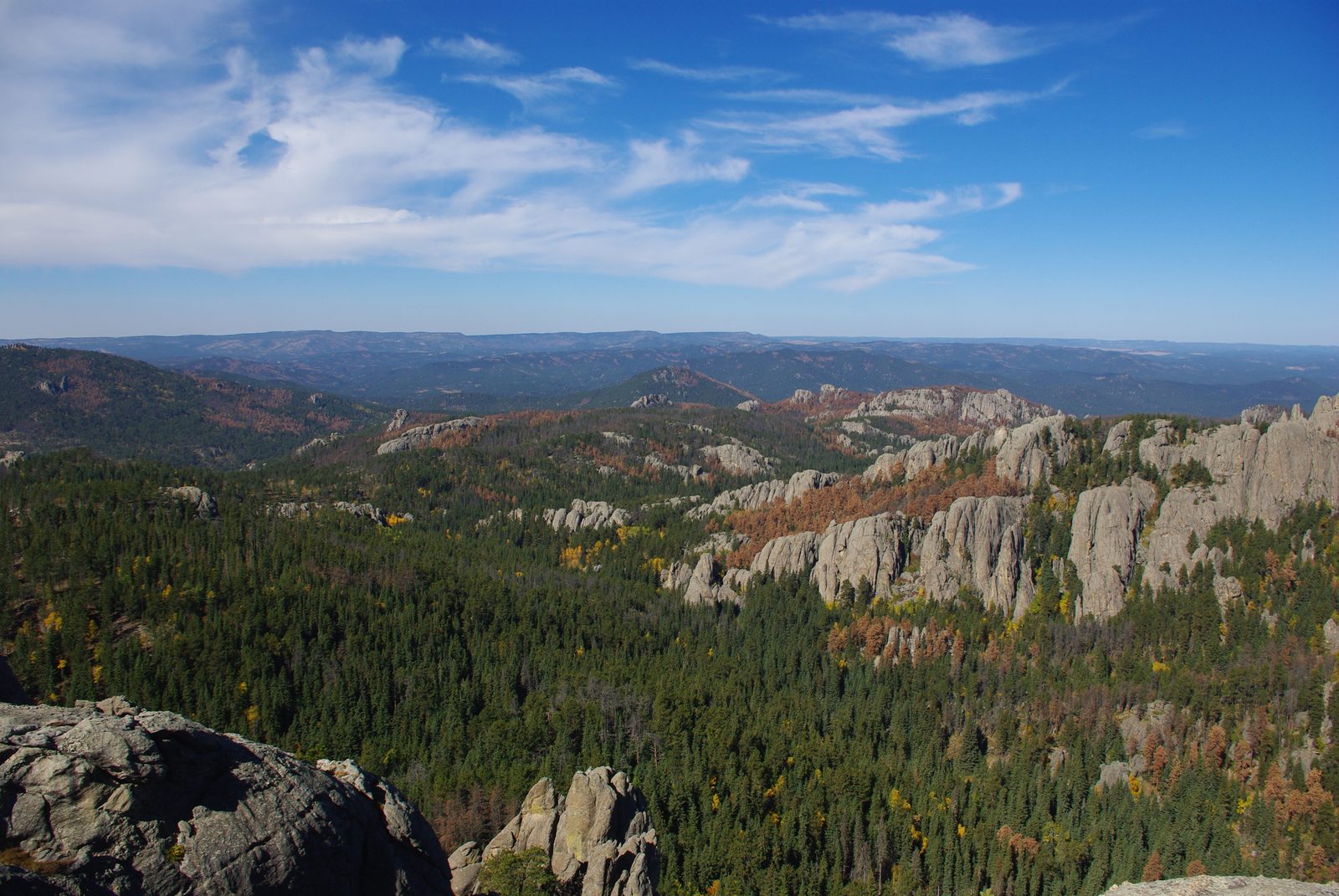
Each ring also has its own shape, because rocks wear away at different speeds. Hard limestone and sandstone hold up as plateaus and ridges; soft shale wears down into valleys. From the center out, that gives a rugged core, a higher limestone rim, a low red valley and a sandstone ridge at the edge.
The Four Rings, From the Center Out
From the center out, the rings are the crystalline core, the Limestone Plateau, the Red Valley and the Hogback, with the plains beyond.
The crystalline core
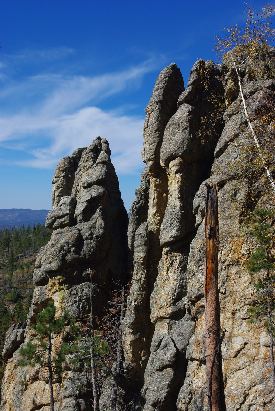
The center of the Hills is the crystalline core: granite, and metamorphic rock (rock changed by heat and pressure). Most of it is schist and similar rock that began as layers of sediment; most of the granite came later. The core’s rocks range from about 1.7 to 2.5 billion years old. The granite of Black Elk Peak (called Harney Peak until 2016), which geologists still call the Harney Peak Granite, is about 1.7 billion years old.
On the ground the core is high, broken country. Granite and schist break the surface in ridges and peaks, open grassy valleys lie between them, and ponderosa pine covers much of the rest. Black Elk Peak, the highest point in the Hills, rises from its granite. The Granite Core has more on these rocks, and The Central Hills covers the country around Black Elk Peak.
The Limestone Plateau
Around the core rises the Limestone Plateau, a high rim of gray to buff limestone. Its highest ground comes close to the height of Black Elk Peak, and on the side facing the core it breaks off in cliffs, hundreds of feet high in places. The main rock is the Madison Limestone, about 350 million years old, made of the shells of animals that lived in a warm, shallow sea.
The plateau is lopsided: broad, high and fairly flat on the west, along the South Dakota–Wyoming line, but narrowed to a ridge on the east, where the layers tilt more steeply. Pine forest covers much of it. Its streams drop into steep-walled limestone canyons, Spearfish Canyon the best known, and many lose part or all of their flow into cracks and caves. Wind Cave formed in this rock, and The Limestone Plateau and the Caves follows the water underground.
The Red Valley
Outside the limestone lies the Red Valley, a low band of bright red ground that circles the Hills just inside the Hogback. Its other name, the Racetrack, and the story behind it are told in The Red Valley. Its rock is the Spearfish Formation: red shale, siltstone and sandstone, colored by iron oxides, with beds of white gypsum. The formation is probably named for the town of Spearfish, the USGS says, and is roughly 250 to 200 million years old.
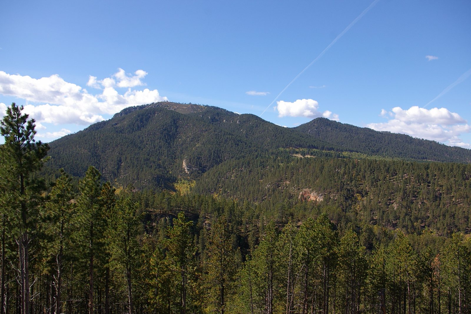
The red beds are soft and wear down faster than the rock on either side. From Whitewood to south of Rapid City the valley is mostly 1 to 2 miles wide; near Sundance, Wyoming, it widens to about 6 miles. Where the pines give out at the base of the limestone, the valley begins: open, nearly treeless ground, red soil, and bare hillsides banded white with gypsum. Few features in the region are easier to spot.
The Hogback
The outermost ring is the Hogback, a long ridge of hard sandstone that forms the rim of the Black Hills. Its rock belongs to the Inyan Kara Group: mostly sandstone, yellow to reddish brown, with layers of claystone, siltstone and pebbly conglomerate. Rivers laid down most of it in the Early Cretaceous, which ran from about 145 to 100 million years ago.
Streams leaving the Hills must cross this rim. Creeks have notched it in many places, and two rivers have cut clean through it: the Belle Fourche at the north end of the Hills, and the Cheyenne at the south end, where it winds through the ridge for several miles. Seen from the Red Valley, the Hogback climbs steeply, in most places several hundred feet; on its far side the ground falls away to the plains, the country of Bear Butte and the Plains Edge.
The four rings in brief, from the center out:
- Crystalline core: granite and schist, about 1.7 to 2.5 billion years old; rocky peaks and grassy valleys. See it at Black Elk Peak.
- Limestone Plateau: gray Madison Limestone, about 350 million years old; a high, forested rim with cliffs facing inward. See it in Spearfish Canyon.
- Red Valley: red beds of the Spearfish Formation, roughly 250 to 200 million years old; a low, open valley. See it near Whitewood.
- Hogback: sandstone of the Inyan Kara Group, Early Cretaceous, more than 100 million years old; a ridge with a steep face toward the Hills. See it where the Belle Fourche and Cheyenne rivers cut through.
What Do the Black Hills Look Like From the Air?
From orbit, the Black Hills, Hé Sápa in Lakota, show as a dark oval of pine forest in the paler grassland of the Great Plains, longer north to south than east to west. A geologic map shows what the trees hide: the four rings, one inside the next, but not evenly spaced. The limestone band is wide on the west and thin on the east, and the Red Valley is several times wider in some places than in others.
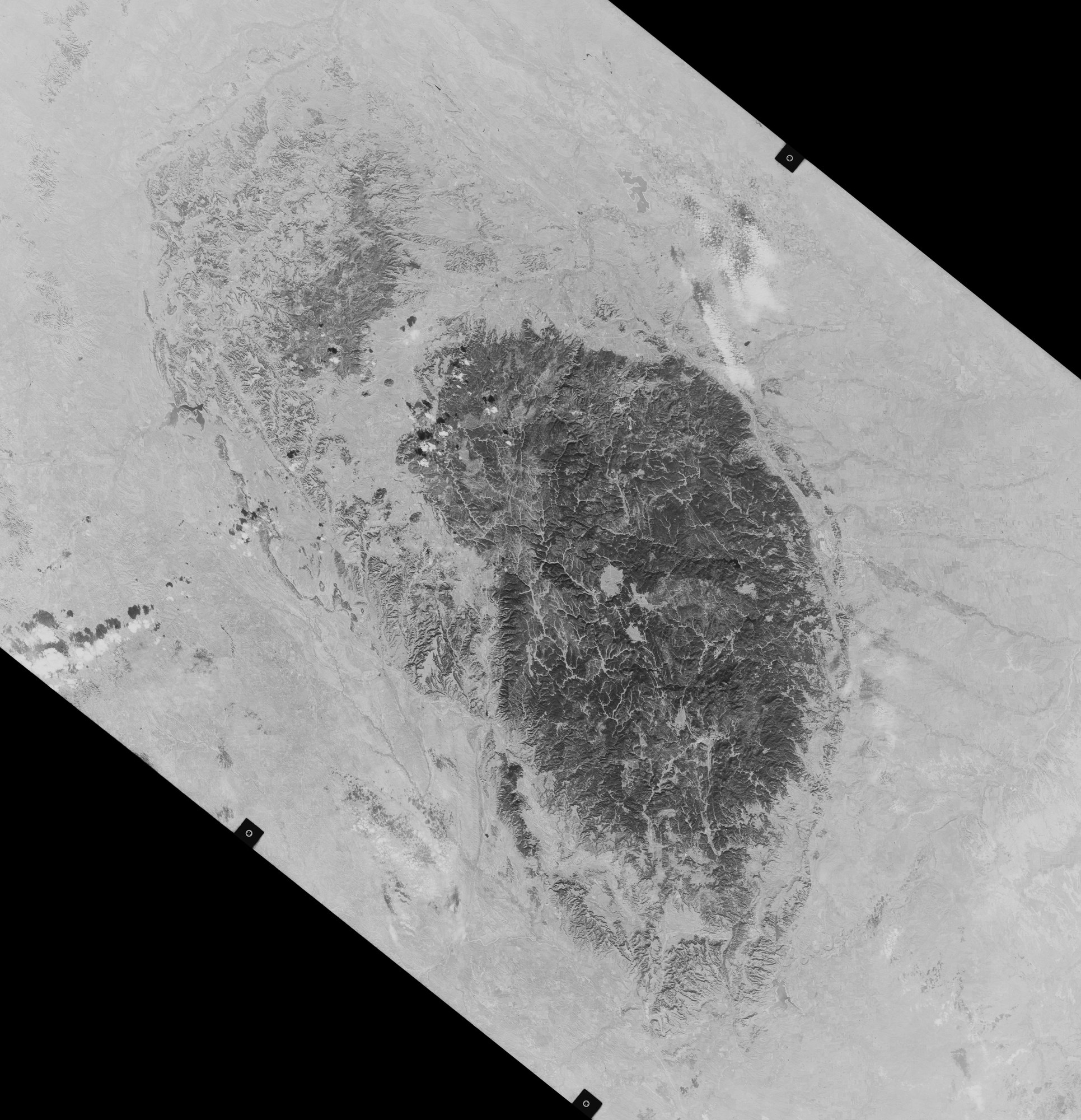
In the northern Hills and just beyond them, the pattern breaks. Magma pushed into the layers about 58 to 46 million years ago and cooled underground, and erosion has since uncovered it as Devils Tower, Bear Butte, Inyan Kara Mountain and the Bear Lodge Mountains (more in Devils Tower, Bear Butte and the Igneous Rocks of the Hills). Bear Butte is also sacred to many tribes (see Sacred Sites).
Every Ring in One Park
Wind Cave National Park holds a piece of every ring. In the park’s northwest corner, South Dakota Highway 87 passes granite and schist of the crystalline core. Beneath the park’s grassy hills, Wind Cave winds for about 170 miles through the Madison Limestone. The cave holds a central place in the Lakota emergence story, in the account of Wilmer Mesteth, an Oglala Lakota historian and spiritual leader, which the National Park Service shares on its site (see Sacred Sites).
Near the park’s northern edge, a gravel road, NPS 5, leaves Highway 87 just before the Custer State Park boundary and runs 4 miles to a lone pine and a small gravel lot. Below lies the Red Valley, and the park’s geology tour points out the Inyan Kara sandstone of the Hogback at the same stop: the last ring before the plains.
Connected
- The Granite Core: Black Elk Peak and the NeedlesThe innermost ring: the oldest rock and the granite peaks.
- The Limestone Plateau and the CavesThe second ring, and the caves and springs that formed in it.
- The Red ValleyThe third ring: the red beds of the Spearfish Formation and the towns along them.
- Bear Butte and the Plains EdgeThe Hogback, the outermost ring, and the prairie beyond it.
- Devils Tower, Bear Butte and the Igneous Rocks of the HillsThe younger igneous rock that breaks the ring pattern in the north.
- The Central HillsThe region around Black Elk Peak, the high point of the crystalline core.
- Wind Cave National ParkA park where all four rings can be seen.
- Sacred Sites: Bear Butte, Devils Tower and Wind CaveWhat Bear Butte and Wind Cave mean to the tribes.
Sources
- Geology and Water Resources of the Northern Portion of the Black Hills and Adjoining Regions in South Dakota and Wyoming (Professional Paper 65), by N.H. Darton. U.S. Geological Survey, 1909.
- Hydrology of the Black Hills Area, South Dakota (Water-Resources Investigations Report 02-4094). U.S. Geological Survey, 2002.
- NPS Geodiversity Atlas: Devils Tower National Monument, Wyoming. National Park Service, 2024.
- NPS Geodiversity Atlas: Mount Rushmore National Memorial, South Dakota. National Park Service, 2024.
- Park Geology. National Park Service, Wind Cave National Park.
- Cave Geology. National Park Service, Wind Cave National Park, 2024.
- Black Hills, by Richard G. Reider, in the Encyclopedia of the Great Plains. University of Nebraska–Lincoln, 2011.
- Geolex: Spearfish. U.S. Geological Survey, National Geologic Map Database.
- Geologic Formations. National Park Service, Devils Tower National Monument.
- Stop #7: Spearfish Formation / Inyan Kara Group. National Park Service, Wind Cave National Park, 2021.
- Geolex: Inyan Kara. U.S. Geological Survey, National Geologic Map Database.
- Divisions of Geologic Time: Major Chronostratigraphic and Geochronologic Units (Fact Sheet 2018-3054). U.S. Geological Survey, 2018.
- The Black Hills. NASA Earth Observatory, 2016.
- How the Tower Formed. National Park Service, Devils Tower National Monument.
- Bear Butte State Park. South Dakota Game, Fish and Parks.
- The Lakota Emergence Story. National Park Service, Wind Cave National Park.
- NPS Geodiversity Atlas: Wind Cave National Park, South Dakota. National Park Service, 2024.
- Ancient Granite Gneiss in the Black Hills, South Dakota, by R.E. Zartman, J.J. Norton and T.W. Stern. Science, 1964 (U.S. Geological Survey record).
Last reviewed: