Landscape and Geology
The Limestone Plateau and the Caves
Hydrologists testing Boxelder Creek near Rapid City in 1993 poured dye into a swallow hole, an opening in the creek bed that drains water into the rock. Some of the dye reached wells in the Rapid City area in less than 50 days. Most streams that cross this rock lose all of their water into it, up to a certain flow. The rock is the Madison Limestone, the same layer that holds Wind Cave and Jewel Cave. The Madison also forms the Limestone Plateau, the high ring around the core of the Hills, where water has dissolved caves, filled an aquifer that feeds springs, and cut deep canyons.
The Second Ring of the Hills
The Limestone Plateau is the second of the four rings of rock around the Black Hills, counting from the center. It lies between the granite and schist of the crystalline core and the Red Valley. On the west side the plateau is broad and nearly flat, a little more than 7,000 feet high in places, and it forms the main divide of the Hills. Its inner edge breaks off in cliffs, in places 800 feet above the valleys of the core.
The plateau is built of the Madison Limestone and, on top of it, the sandstone and other layers of the Minnelusa Formation. The Madison is a massive gray to buff limestone, dolomite in places. It formed roughly 345 to 360 million years ago, in the Mississippian period, from shells and sediment on the floor of a warm, shallow sea. It thins to almost nothing in the southeastern corner of the Hills and thickens to about 1,000 feet east of Belle Fourche.
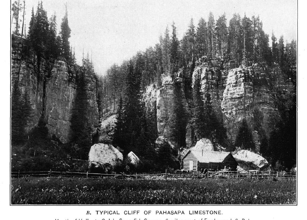
On the ground, the plateau shows as gray cliffs and ledges, with level, forested uplands on top where running water is rare. After the sea drained away, the Madison sat at the land surface for about 50 million years, and rain turned it into karst: rock full of sinkholes, caves and cracks widened by dissolving water. Younger layers buried that surface, but the openings in the upper limestone survived.
How Did Wind Cave and Jewel Cave Form?
Wind Cave and Jewel Cave were not cut by underground rivers, as many limestone caves are. Both were dissolved slowly by acidic water, in stages over more than 300 million years.
Both caves began with gypsum, a soft mineral left in the limestone where seawater evaporated. At Wind Cave, fresh water reacting with the gypsum made acids that dissolved the first passages about 320 million years ago. At Jewel Cave, gypsum beds dissolved and the limestone above them collapsed into the gaps. When the seas returned, sand and red mud of the Minnelusa Formation filled some of the early openings, and that reddish fill still shows in the upper passages of both caves.
The next big stage came with the uplift of the Black Hills, which began about 60 to 65 million years ago and cracked the limestone as it bent. Wind Cave's maze, the Park Service says, probably formed as water sat in those cracks for long periods and slowly widened them; that water began draining about 40 to 50 million years ago. Most of Jewel Cave came later, by the Park Service's account, in a wetter climate that began nearly 40 million years ago. Rainwater took up carbon dioxide from the soil, turned mildly acidic, and filled cracks below the water table, where it dissolved rock until erosion opened springs lower down and the cave drained.
At a place in Wind Cave called the Lakes, water still sits about 500 feet below the surface. A 2019 study of mineral crusts in the lower passages found that within the past 300,000 years the water has stood as much as about 150 feet higher than today, and that at those high stands it resembled the warm Madison aquifer water that rises at springs around the southern Hills. The Park Service still calls the origin of Wind Cave, and of its boxwork in particular, a mystery.
Boxwork, Spar and a Cave That Breathes
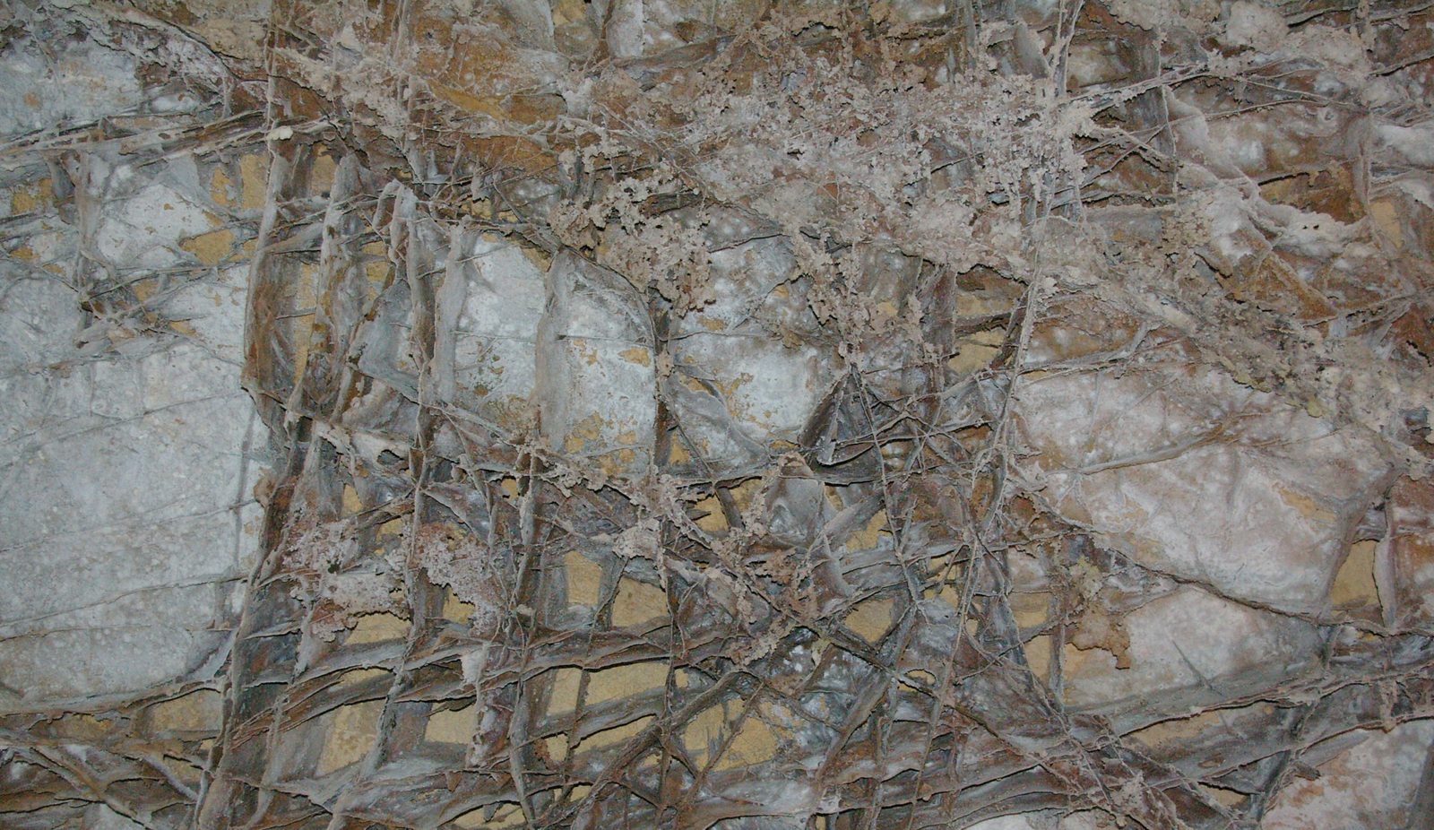
Boxwork is the formation Wind Cave is known for. It looks like a honeycomb or a wall of post office boxes: thin calcite blades jutting from the rock and crossing at odd angles. Geologists broadly agree that the blades are calcite fillings of old cracks, left standing when the weaker rock between them wore away. In the Park Service's account, the cracks opened when gypsum in the rock dried out and took on water again. Most of Wind Cave's boxwork sits in dolomite layers in its middle and lower levels. Other caves have a little, but the Park Service writes that "perhaps in no other cave in the world is boxwork so well-formed and abundant" as in Wind Cave.
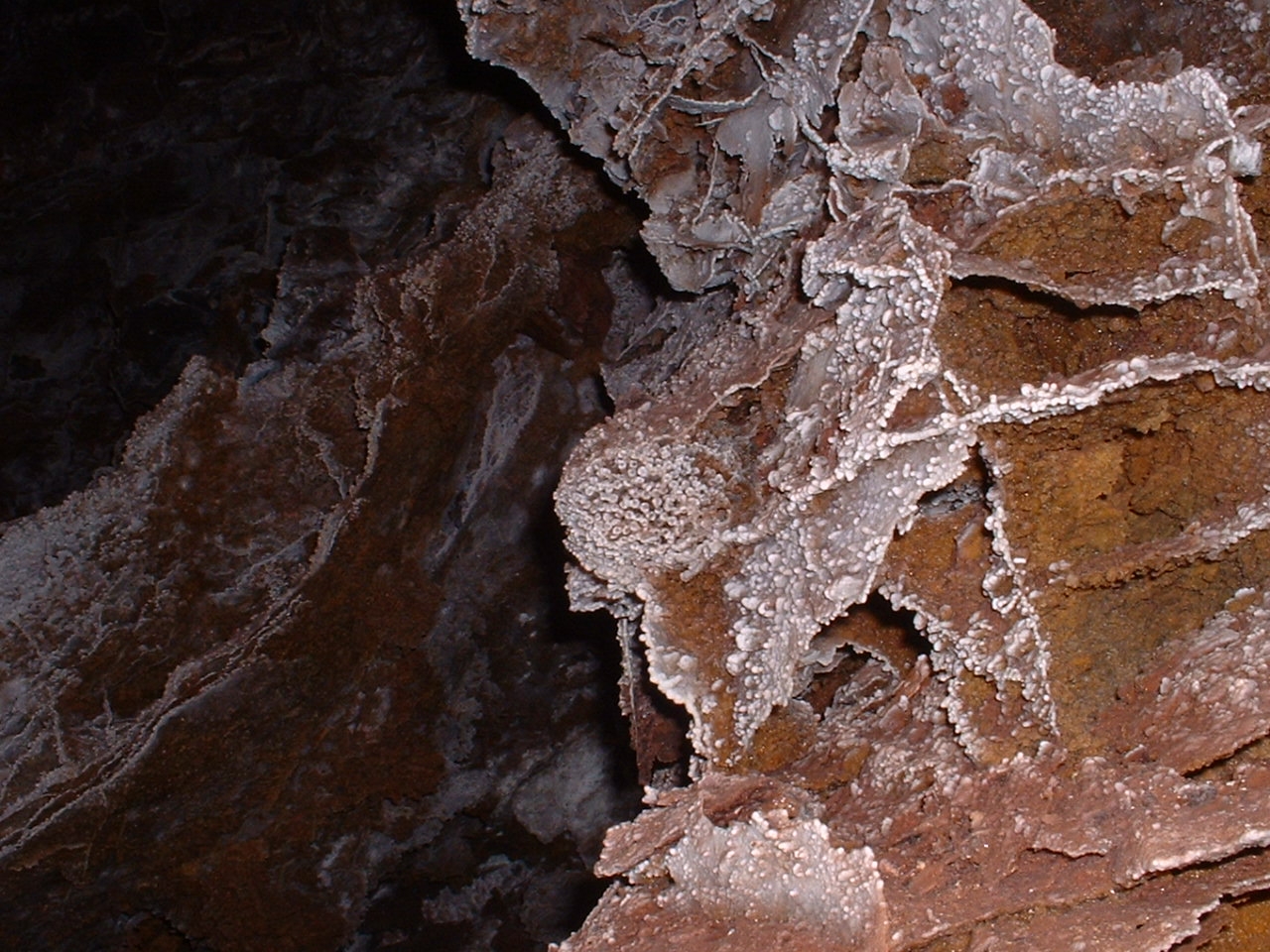
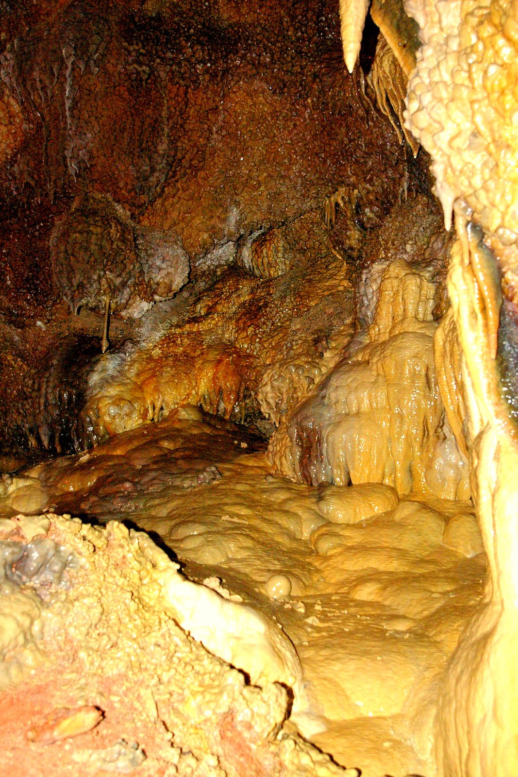
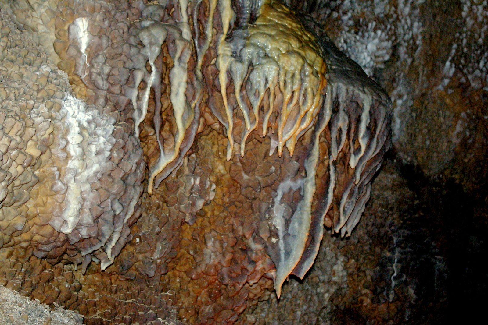
Jewel Cave takes its name from calcite crystals that at one time coated its walls and ceilings completely. Blunt nailhead spar grew while the cave was filled, or partly filled, with water and is not forming today; pointed dogtooth spar lined early openings while the limestone was still buried deep. Jewel Cave also holds rare hydromagnesite balloons, only a thousandth of an inch thick. Wind Cave has frostwork and cave popcorn, made by slowly seeping water.
Wind Cave is also tied to the Lakota emergence story, as told by Wilmer Mesteth, an Oglala Lakota tribal historian and spiritual leader, and retold by Sina Bear Eagle on the National Park Service's site. How the rock and the story meet is the subject of Limestone, Caves and the Emergence Story; the story's full telling belongs to Sacred Sites: Bear Butte, Devils Tower and Wind Cave.
At Wind Cave, rising air pressure outside pushes air into the cave and falling pressure draws it out. In 1881 the sound of that rushing air led Tom and Jesse Bingham to the natural entrance, a 10-by-16-inch hole in the limestone. Jewel Cave had 220.33 miles of surveyed passage as of September 2024, making it the fifth-longest cave in the world. Wind Cave, at about 170 miles, is the sixth-longest.
What Is the Madison Aquifer, and Why Does It Matter?
The Madison aquifer is the groundwater held in the cracked, cave-filled upper part of the Madison Limestone. Together, it and the Minnelusa aquifer just above it take in about 84 percent of the recharge to all bedrock aquifers in the South Dakota part of the Hills, a 2002 USGS study found, and the two are the most heavily used aquifers there.
Water gets in from rain and snowmelt on the outcrop, and from streams like Boxelder Creek that lose their flow crossing it. The old karst is what lets the limestone swallow whole creeks. From the outcrop the water moves outward and down the tilt of the layers, beneath tighter rock that seals it in. Held under pressure there, it feeds flowing wells and artesian springs around the edge of the Hills, most often near the red beds of the Spearfish Formation.
From 1950 to 1998, the artesian springs of the Hills together averaged about 169 cubic feet per second, about six times what wells drew from the same two aquifers. Beyond the Hills, a creek fed by an artesian spring keeps running when creeks without one go dry, and ranchers, towns and irrigators all use that water. Municipal wells around Rapid City, the study noted, had been drawing much more from the Madison since about 1990. Because creeks pour into the aquifer through open cracks with little filtering, it is also among the area's rock units most open to pollution.
The warm springs at Hot Springs are fed mostly by the Madison aquifer, and the water picks up some minerals from the Minnelusa Formation as it rises through it. Evans Plunge, a spring-fed pool in the town, says the pool stays about 87°F. The town's history with this water is the subject of Warm Water: The Springs, the Town and the Sanitarium.
Canyons Through the Plateau
Water leaving the high western plateau soon trades its shallow, open valleys for limestone gorges, some with walls hundreds of feet high. N.H. Darton, the USGS geologist who described the plateau in 1909, named Spearfish Creek's canyon the most notable. In Spearfish Canyon, in the northern Hills, the Madison shows as massive gray rock.
On the east side, where the layers tilt more steeply and the plateau narrows to a ridge, every large stream cuts a gap through it. At the outer foot of the plateau, another limestone, the Minnekahta, makes a low ridge that rings the Hills, its 40-to-50-foot cliff facing the center. Each stream cuts it into a narrows that Darton called a "gate." Beyond the gate lies the Red Valley.
Spearfish Creek, left alone, would flow through its loss zone all year, which few streams here can do, the USGS study found. Instead, its water is diverted around that stretch to make electricity, a thread followed in Spearfish Creek: Power, Rails and the 1933 Flood.
Connected
- Wind Cave National ParkVisiting the boxwork cave and the park above it.
- Jewel Cave National MonumentVisiting the crystal-lined cave in the Madison Limestone.
- Spearfish CanyonThe canyon Spearfish Creek cut through the plateau, and how to see it.
- Limestone, Caves and the Emergence StoryWhere Wind Cave's rock and the Lakota emergence story meet.
- Hot Springs, South DakotaWarm springs fed mostly by the Madison aquifer.
- Sacred Sites: Bear Butte, Devils Tower and Wind CaveWhat Wind Cave means to the tribes, told in full.
- Warm Water: The Springs, the Town and the SanitariumThe aquifer's warm water and the town built around it.
- Spearfish Creek: Power, Rails and the 1933 FloodThe creek's water diverted for power, and the canyon railroad.
- Where the Hills’ Water Comes FromWhich aquifers and reservoirs supply the towns, and how they hold up.
Sources
- Hydrology of the Black Hills Area, South Dakota (Water-Resources Investigations Report 02-4094), by Daniel G. Driscoll, Janet M. Carter, Joyce E. Williamson and Larry D. Putnam. U.S. Geological Survey, 2002.
- Geology and Water Resources of the Northern Portion of the Black Hills and Adjoining Regions in South Dakota and Wyoming (Professional Paper 65), by N.H. Darton, topography section. U.S. Geological Survey, 1909.
- Cave Geology. National Park Service, Wind Cave National Park, 2024.
- Geology of Wind Cave National Park. U.S. Geological Survey.
- Geology of Jewel Cave. National Park Service, Jewel Cave National Monument, 2023.
- Formations of Jewel Cave. National Park Service, Jewel Cave National Monument, 2025.
- Cave Exploration. National Park Service, Jewel Cave National Monument, 2025.
- Boxwork. National Park Service, Wind Cave National Park, 2020.
- Natural Entrance Tour for the Hearing Impaired. National Park Service, Wind Cave National Park, 2022.
- 300,000 yr history of water-table fluctuations at Wind Cave, South Dakota, USA: Scale, timing, and groundwater mixing in the Madison Aquifer, by James B. Paces, Margaret V. Palmer, Arthur N. Palmer, Andrew J. Long and Matthew P. Emmons. GSA Bulletin (U.S. Geological Survey record), 2019.
- World Long Caves, compiled by Paul Burger (NSS Geo2). Cave-Exploring.com, updated October 18, 2026.
- The Lakota Emergence Story, as told by Wilmer Mesteth. National Park Service, Wind Cave National Park.
- Madison Limestone, Spearfish Canyon, SD (photograph and description). U.S. Geological Survey, Dakota Water Science Center, 2001.
- Evans Plunge Mineral Springs (the business's own account of its pool). Evans Plunge.
Last reviewed: