Landscape and Geology
Gold and the Other Minerals
About 90 percent of the gold mined in South Dakota through 1971 came from a single mine, the Homestake at Lead, and nearly all of the Homestake's ore lay in one layer of rock 200 to 300 feet thick. Gold turned up all over the Black Hills, both as loose placer gold and as lode gold locked in rock, yet about 99 percent of the recorded total came from within 5 miles of Lead. The Hills hold other useful minerals too: mica, feldspar, lithium and tin, mostly in the coarse granite of the southern core, gypsum in the Red Valley, uranium in sandstone near Edgemont, and bentonite clay around Belle Fourche. Each sits in its own kind of rock, and the rock explains where it turns up.
What Is the Difference Between Placer Gold and Lode Gold?
Lode gold has never left its rock. Placer gold has been set loose: as gold-bearing rock weathers away, the gold, heavy and slow to corrode, collects in the sand and gravel of stream beds, where a pan and running water can wash it out. Lode gold has to be blasted, crushed and milled, which takes money and machinery a placer miner never needed.
In the Black Hills, the placers came first. The gold rush began with placer gold, on land closed to miners: the 1868 Fort Laramie Treaty had set apart the Great Sioux Reservation, Black Hills included, for the tribes' "absolute and undisturbed use and occupation." Prospectors traveling with the Army's Custer Expedition reported gold in the gravels of French Creek, near present-day Custer, in late July and early August 1874, and miners poured in after them in violation of that treaty. How that happened, and how the Hills were then taken from the tribes without the consent the treaty required, is told on The Black Hills Gold Rush and The 1876 War and the Taking of the Hills.
Gold was found in Deadwood Gulch in the fall of 1875, and a 1974 USGS review by geologist James J. Norton ranked the Deadwood Gulch area far ahead of any other placer ground of the early rush years. It did not last. The northern placers were largely worked out by the late 1870s, and hardrock companies with the money to build mills took over.
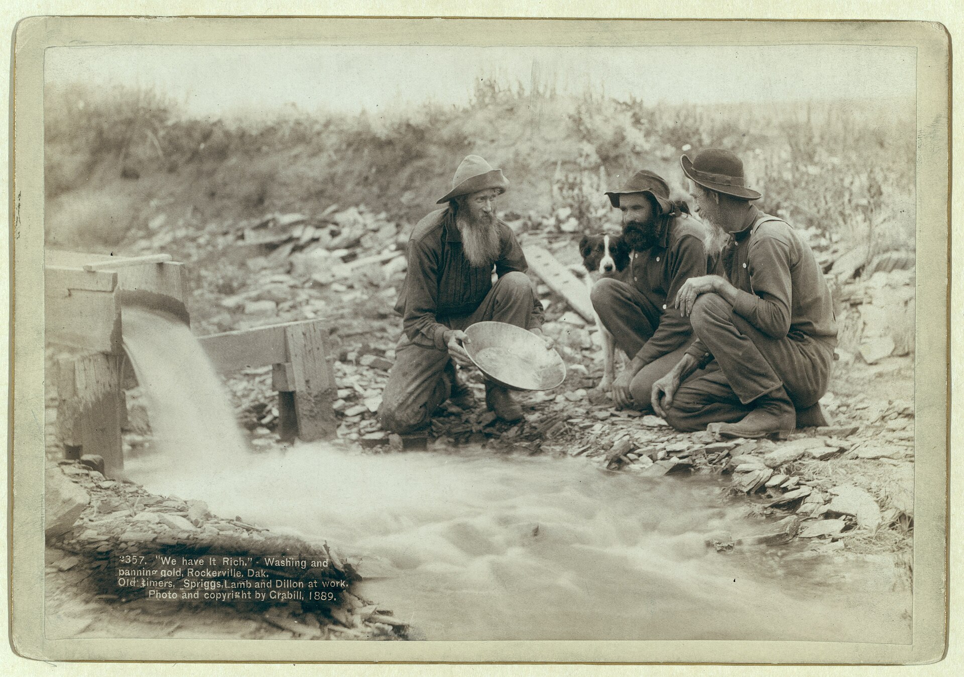
Some placer gold is far older than any creek. The conglomerate at the base of the Deadwood Formation, a Cambrian layer resting on the ancient core rocks, holds gold that Norton judged to be largely of placer origin, worn out of older rock and washed into gravel long before the Hills rose. Rockerville Gulch drew most of its gold from that conglomerate. Water was scarce there, so a 17-mile flume carried it in.
Why Did So Much Gold Collect at Lead?
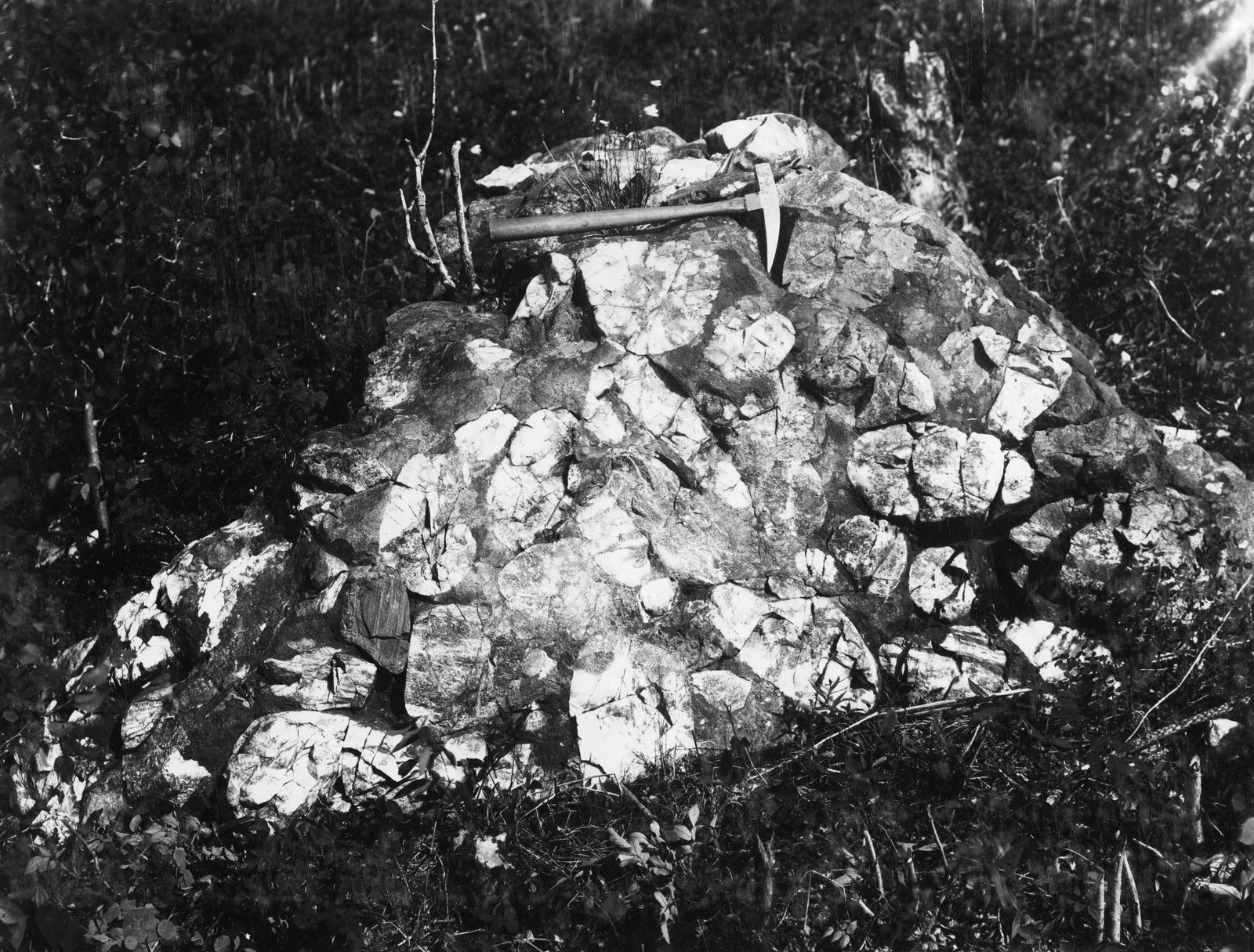
Gold collected at Lead because three conditions met in one layer of rock there, the Homestake Formation, a band of Precambrian iron-formation (layered rock rich in iron minerals). USGS work places it in the Early Proterozoic, which makes it part of the old crystalline core at the center of the Hills, the innermost ring described on How the Black Hills Formed. Heat and pressure deep underground turned the formation at the mine into schist made mostly of cummingtonite, an iron-magnesium mineral, with streaks of cherty quartz.
Norton named the three. The formation seems to have started out with more gold in it than other iron-rich layers in the Hills. Later folds, crossing older ones, opened zones where gold gathered into pipe-shaped ore bodies. And those ore bodies sit where rising heat changed the formation's main mineral from an iron carbonate to cummingtonite. That reaction gives off carbon dioxide, which would have joined the fluid that most likely built the ore bodies. Even so, only a very small part of the formation ever became ore. North of Lead the formation dives under younger rock, and in 1974 no one had shown that it surfaces again elsewhere in the Hills.
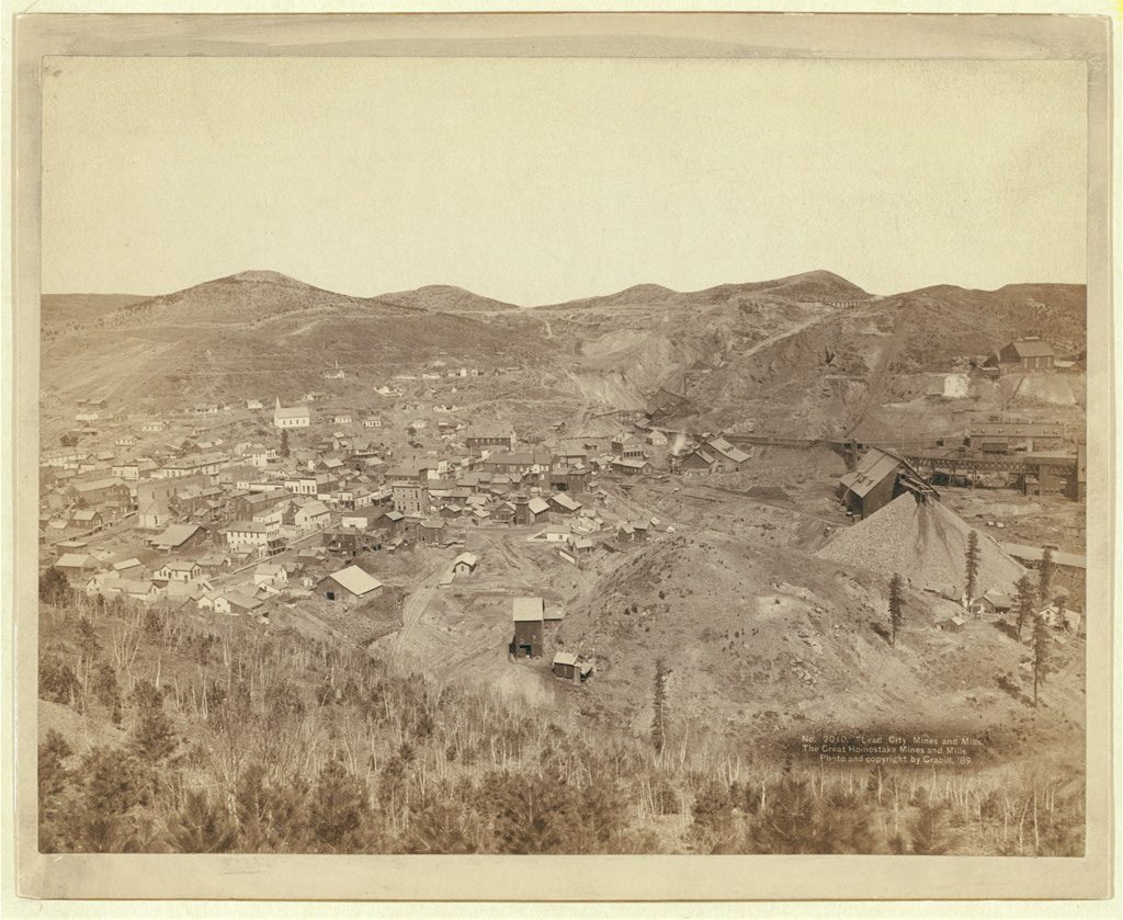
The Homestake Mine produced nearly 40 million ounces of gold in 125 years, according to South Dakota's state mining regulators, and its workings reached more than 8,000 feet below the surface. The last ton of ore came out at 7:46 p.m. on December 14, 2001, from the 1400 level, close to straight below the Open Cut, where the Homestake strike of 1876 was made. The mill shut down for good on February 13, 2002.
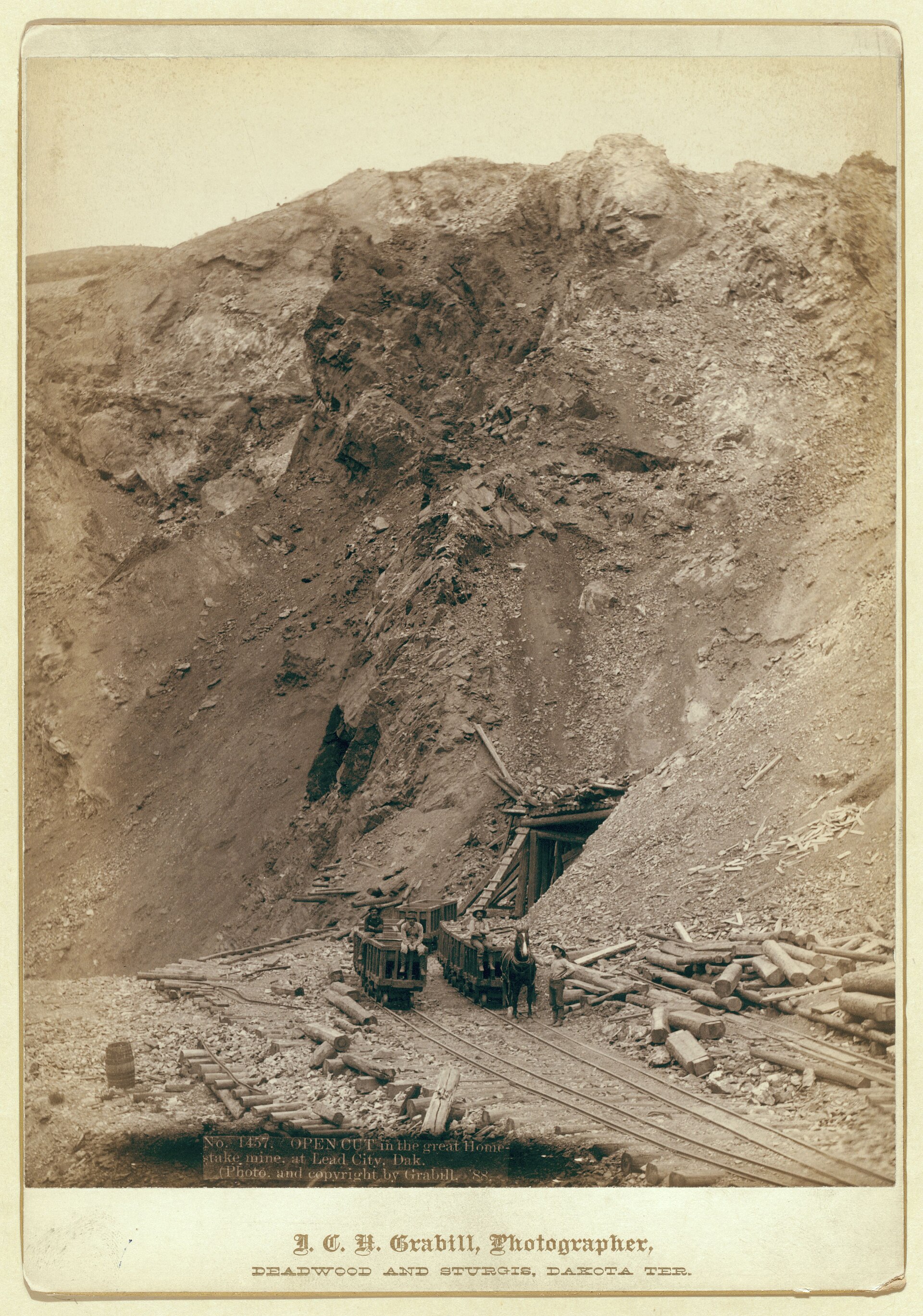
The claim, the company town and the physics experiments that moved into the tunnels are covered on The Homestake Mine and Sanford Lab, and the town itself on Lead, South Dakota.
Mica, Feldspar, Lithium and Tin From the Pegmatites
South of the gold country, around Black Elk Peak (called Harney Peak until 2016), the core rocks are shot through with pegmatite: granite so coarse that crystals 3 to 5 feet long are common. The Harney Peak Granite, as geologists still call the rock of the peak and of the granite core, grades into pegmatite in many places. USGS geologists who mapped the pegmatites from 1942 to 1945 found bodies from a few inches to more than a mile long.
Sheet mica came first, in 1879, from the McMackin (Crown) mine at Custer. Tin brought heavy prospecting and little metal. Cassiterite, the ore of tin, was recognized in the Etta pegmatite at Keystone in 1883, and the Harney Peak Tin Mining, Milling, and Manufacturing Co. prospected the southern Hills from 1884 to 1893, yet the Hills produced only about 180 tons of tin from 1884 to 1936, some of it from Tinton in the northern Hills. Lithium followed in 1898, when 30 tons of spodumene, a lithium mineral, were shipped from the Etta mine, which by the early 1950s had yielded more spodumene than any other mine in the Hills. Commercial feldspar production began in 1923.
During World War II, USGS geologists studied the pegmatites to help produce mica, beryllium, tantalum and lithium for war uses. Peacetime uses could be humbler. In 1950, scrap mica from the Peerless pegmatite near Keystone went to a Chicago mica company and ended up as fake snow on Christmas decorations.
The same pegmatites grew giant crystals: USGS geologists reported a spodumene crystal 47 feet long in the Etta pegmatite and beryl crystals up to 18 feet long at the Bob Ingersoll mine. Those crystals and the wartime minerals are the subject of Giant Crystals, Wartime Minerals and Keystone.
Gypsum, Uranium and Bentonite Beyond the Core
Away from the core, the minerals follow the rings of rock. In the Red Valley, the red shale and sandstone of the Spearfish Formation carry beds of gypsum, a mineral made of calcium sulfate and water; in the Sundance area the main bed runs 20 to 30 feet thick. Heated to drive off its water and then ground, gypsum becomes plaster of Paris. When N. H. Darton described the Sundance area for the USGS in 1904, gypsum was worked for sale only at Hot Springs and Sturgis, and even there the cost of getting it to market weighed heavily on the business.
The next ring out, the Hogback, is built of Inyan Kara Group sandstones. Near the base of one of them, the sandstone geologists call the Lakota, Jerry G. Brennan of Rapid City found uranium in June 1951 in Craven Canyon, about 8 miles north of Edgemont. The South Dakota School of Mines identified the mineral as carnotite, which shows as yellow stains on the sandstone, and by mid-November at least 28 claims had been staked. The USGS geologists who examined them that month were working on behalf of the Atomic Energy Commission.
A mill at Edgemont processed uranium ore from 1956 to 1972. The Tennessee Valley Authority bought it in 1974 but never ran it, and about 4 million tons of tailings and other contaminated material now lie in a clay-walled disposal cell about 2 miles south of the old mill, in the care of the US Department of Energy. More is on Edgemont, South Dakota, and the wider Cold War story on Uranium, the Cold War and the Missiles.
On the plains edge north of the Hills, around Belle Fourche, Cretaceous shales hold beds of bentonite, a clay formed from altered volcanic ash. When dry sodium bentonite, the kind mined here, gets wet, it balloons into a soft gel. Most of it came from one bed, the Clay Spur, near the top of the Mowry Shale, in a district that a 1962 USGS report placed mostly in Crook County, Wyoming, and Butte County, South Dakota.
The district's first mill for powdered bentonite opened in 1934. Most of the clay left by rail through Belle Fourche, and by 1949 the district was producing more bentonite than the rest of Wyoming combined. It went into oil-well drilling mud, foundry sand and the binder for taconite iron-ore pellets. Where it crops out on bare ground, repeated soaking and drying crumble its surface into knobby lumps that look like popcorn.
Connected
- The Black Hills Gold RushThe rush of miners onto treaty land that the placer gold set off.
- Gold, a Broken Treaty and Land BackHow the gold reports led to the taking of the Hills, and the claim since.
- The Homestake Mine and Sanford LabThe mine that worked the Homestake Formation, from 1876 to 2002 and after.
- Lead, South DakotaThe town built over the Homestake lode and the Open Cut.
- Giant Crystals, Wartime Minerals and KeystoneThe pegmatites' giant crystals and the minerals wanted for war.
- Edgemont, South DakotaThe railroad town near the 1951 uranium find and the old mill.
- Uranium, the Cold War and the MissilesThe Cold War years in western South Dakota.
- Belle Fourche, South DakotaThe rail town that shipped the northern Hills' bentonite.
- Gold, Lithium and the New Mining RushWho is mining and drilling in the Hills now, and under which law.
Sources
- Gold in the Black Hills, South Dakota, and How New Deposits Might Be Found (Circular 699, James J. Norton). U.S. Geological Survey, 1974.
- Prospecting for Gold in the United States (Harold Kirkemo). U.S. Geological Survey, general interest publication, undated web edition.
- Fort Laramie Treaty (1868). National Archives, Milestone Documents.
- United States v. Sioux Nation of Indians, 448 U.S. 371. U.S. Supreme Court, 1980 (text from Legal Information Institute, Cornell Law School).
- Report of a Reconnaissance of the Black Hills of Dakota, Made in the Summer of 1874 (William Ludlow, with N. H. Winchell's geology report). U.S. Army Corps of Engineers, 1875.
- Deadwood Historic District, National Historic Landmark nomination. National Park Service, 1976, amended 1989.
- Summary of the Mining Industry in South Dakota, 2001. South Dakota Department of Environment and Natural Resources, 2002.
- Homestake Strikes Gold Again. Lawrence Berkeley National Laboratory, 2007.
- Geolex: Homestake Formation, publication references. U.S. Geological Survey, National Geologic Map Database.
- Pegmatite Investigations 1942–1945, Black Hills, South Dakota (Professional Paper 247, Lincoln R. Page and others). U.S. Geological Survey, 1953.
- Geology and Beryl Deposits of the Peerless Pegmatite, Pennington County, South Dakota (Professional Paper 297-A). U.S. Geological Survey, 1957.
- Description of the Sundance Quadrangle (Geologic Atlas Folio 127, N. H. Darton). U.S. Geological Survey, text dated June 1904.
- The Carnotite Prospects of the Craven Canyon Area, Fall River County, South Dakota (Circular 175, L. R. Page and J. A. Redden). U.S. Geological Survey, 1952.
- Edgemont, South Dakota, Disposal Site: Fact Sheet. U.S. Department of Energy, Office of Legacy Management, 2026.
- Bentonite Deposits of the Northern Black Hills District, Wyoming, Montana, and South Dakota (Bulletin 1082-M, Maxwell M. Knechtel and Sam H. Patterson). U.S. Geological Survey, 1962.
Last reviewed: