Landscape and Geology
How the Badlands Erode
An inch a year. That is the National Park Service's average for how fast the buttes of Badlands National Park wear down. Black Hills granite, by the park's comparison, needs some 10,000 years to lose the same inch. The difference lies in what the Badlands are made of: soft, loosely bound layers of mud, sand and volcanic ash, laid down between about 75 and 28 million years ago, which rain, frost and the White River take apart with little effort.
A Seafloor at the Bottom, Ash at the Top
The Badlands are a stack of nearly flat layers, with an ancient seafloor at the bottom and volcanic ash near the top. The layers were never crumpled into mountains, so a single butte reads in order from its base, the oldest rock, to its crest.
At the base is the Pierre Shale, dark gray to black rock that began as mud on the floor of the Western Interior Seaway, a warm, shallow sea that once ran from the Gulf of Mexico to the Arctic. The Pierre settled out between about 75 and 69 million years ago. Grass grows thick on the shale, which holds phosphorus, potassium and iron, and hides most of it; the rock shows mainly where a creek has cut a bank. The younger rock above is poor in those nutrients and mostly bare.
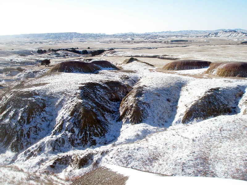
The Yellow Mounds, rounded hills the color of mustard, are a paleosol: an ancient soil that lay buried for millions of years before erosion uncovered it. It formed on old seafloor rock once the sea was gone, and the mineral goethite gives it the yellow. Above it lies a second ancient soil, the red-to-purple Interior paleosol.
The Chadron Formation, about 37 to 34 million years old, is mostly light gray claystone, left by rivers that flooded a hot, wet plain again and again. It weathers into low, rounded mounds where almost nothing grows.
The Brule Formation, about 34 to 30 million years old, dates from a time when the climate cooled and dried and open savanna replaced the wet floodplain. Many of the Badlands' stripes come from the Brule's lower part, the Scenic Member, where rust-colored bands of old soil sit between pale bands of sand that streams laid down. Higher up, in the Poleslide Member, the red thins out and pale sandstone takes over, standing in cliffs.
The Sharps Formation, about 30 to 28 million years old, caps the stack. Its base is the Rockyford Ash, the only layer of pure volcanic ash in the park, and above that lie sandstones of old river channels. The Brule and the Sharps hold the most rugged peaks and canyons. At the Yellow Mounds Overlook in Badlands National Park, much of the sequence shows in one view: yellow at the bottom, then purple, then gray, then striped red.
Where Did the Volcanic Ash Come From?
Eruptions in the Great Basin, the part of the West that now holds Nevada and Utah, supplied the Badlands ash. Most of it reached the area in moving water, not as fallout, mixed with grit that streams had worn off the Black Hills. That is why so many layers are a blend, often close to half ash and half sediment.
Late in the story, about when the Sharps Formation began, huge explosive eruptions in the Great Basin dropped thick falls of ash straight onto the region from time to time. The Rockyford Ash is the trace of that time: ash hardened into a rock called tuff, in a thick band that marks the boundary between the Brule and the Sharps.
Little of any of this was ever firmly cemented. Geologists call the beds poorly consolidated, meaning the grains hold together loosely, and that is why summer storms can strip them so fast.
How Rain and Frost Take the Rock Apart
Rain does much of the work. The Badlands get about 15 to 17 inches of precipitation a year, and roughly three-quarters of it falls from April through September, much of it in short, heavy thunderstorms. Bare slopes have no soil to soak it up. The water runs off in sheets, gathers into small rills and then into gullies and washes, and carries mud with it. A big enough storm sets off flash floods.
The clay helps the rain along. Bentonite, a clay that swells when it gets wet, is plentiful in the Chadron Formation. A storm leaves Chadron slopes slick and sticky, a mud known as gumbo, and drying bakes the surface into small, lumpy knobs that geologists liken to popcorn. Little can root in that crust, so the slopes stay mostly bare.
Frost adds its share. Larry Stetler, a geologist at the South Dakota School of Mines and Technology, reported in 2018 that at his study sites in the park, spring and fall each brought several weeks of daily freezing and thawing. As ice forms in the upper inch or two of clay, it pries the surface into thin shards, and the next wetting turns them loose. The popcorn crust is partly frost's work. Direction matters too: in the measurements Stetler reported, north-facing slopes wore back fastest and south-facing slopes slowest.
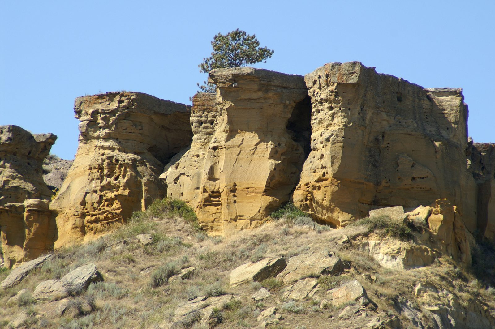
Not all erosion is grain by grain. In a slump, a whole section of butte drops downslope intact; Cliff Shelf in the park formed that way. A hoodoo is what remains when clay wears away on every side of a sandstone cap but not underneath it.
How Fast Do the Badlands Erode?
The National Park Service gives about an inch a year as the average for its buttes, and it notes that change can come much slower or much faster. Measured rates do vary widely from slope to slope.
Studies that Stetler summarized show the range. Slopes measured over about eight years, from the mid-1950s to the early 1960s, retreated roughly 0.3 to 0.6 inch a year. A later park-wide study of slopes at fossil sites found an average of about 0.16 inch, close to a sixth of an inch, with sites ranging from about 0.1 to 0.6 inch depending on the rock formation, the properties of its material, the way a slope faced and the rain it got. Both sets of measurements came in below the park's average.
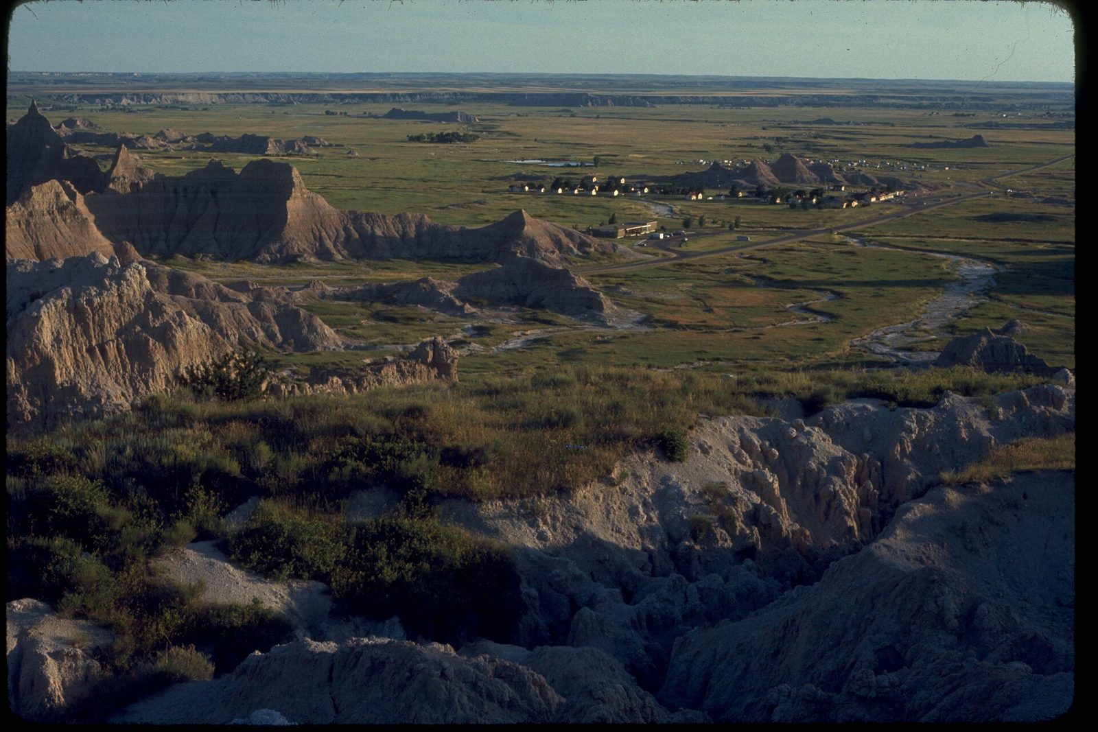
The park watches erosion at its fossil sites, and Stetler's 2018 study was meant to help set a schedule for checking them. The fossils themselves, from sea creatures in the Pierre Shale to the mammals of the old floodplains, are covered on Fossils and the Mammoth Site.
The White River and the Wall
The National Park Service dates the start of the carving to about 500,000 years ago, when the White and Cheyenne Rivers began cutting down through a plain that had been flat until then. A 2003 U.S. Geological Survey report takes a longer view, tying much of the landscape to erosion over the past two million years. The two agencies don't agree on when the cutting began.
Much of the White River's suspended sediment comes from the stretch in and around Badlands National Park, which the river reaches not long after crossing from northwestern Nebraska into South Dakota. From there it heads east to the Missouri River, which it joins at Lake Francis Case near Oacoma. A 2007 assessment for the state found that load so large, and so natural, that South Dakota's limit on suspended solids could not be met on the river. The name comes from that load: white Badlands sediment that turns the water milky.
The Wall is the long line of cliffs the river left behind, the step between a higher prairie to the north and a lower one to the south. From near Kadoka it runs west toward the town of Wall, which took its name from it, and erosion keeps pushing its face north, away from the river. Interior lies 2 miles south of the park entrance that carries the town's name. The country around both towns is described on The Badlands and Wall.
How Long Will the Badlands Last?
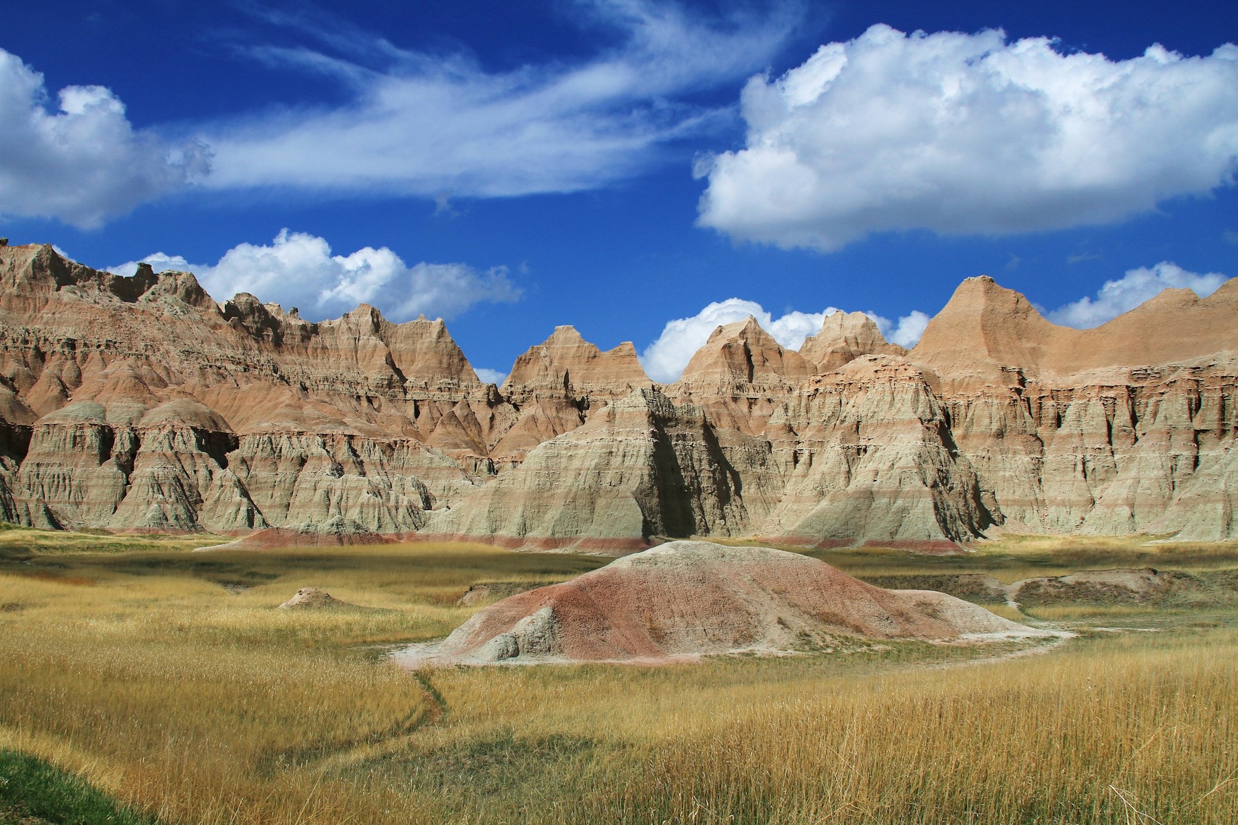
By the National Park Service's estimate, the last of the Badlands will wash away in about 500,000 more years. On the park's own count, starting from the rivers' first cuts, that gives the landscape a life of roughly a million years.
Until then the shapes keep changing. As the edges of the old plateau retreat, they leave flat-topped tables and pinnacles behind. Geologists call a big, blocky mass of bare rock a castle and a lone pinnacle a monument. On the valley floors sit sod tables, low mounds with grassy tops, remnants of an older valley floor that new gullies are now cutting apart.
Part of what washes off the buttes reaches the Gulf of Mexico, the park says, by way of the White, Bad and Cheyenne Rivers, the Missouri and the Mississippi. Some never gets that far. Storms spread it across the prairie at the foot of the buttes, raising the ground there a little at a time.
Connected
- Badlands National ParkVisiting the park where these layers are laid bare.
- The Badlands and WallThe region around the Wall and the White River.
- Wall, South DakotaThe town named for the Badlands escarpment.
- Interior, South DakotaThe town 2 miles south of the park entrance named for it.
- Fossils and the Mammoth SiteThe animals that erosion brings to the surface.
- How the Black Hills FormedThe uplift whose eroded sediment helped build the Badlands layers.
- Fossil Hunters and Tribal StoriesWho found the bones erosion uncovers, and what they made of them.
Sources
- Geologic Formations: How Badlands Buttes Came to Be. National Park Service, Badlands National Park, 2020.
- Geology: A Tribute to Deposition and Erosion (park brochure). National Park Service, Badlands National Park, undated; copy held by the NPS History Collection.
- Geology of Badlands National Park: A Preliminary Report, by Philip W. Stoffer (Open-File Report 03-35). U.S. Geological Survey, 2003.
- Impacts of Material Engineering Properties on Slope Wash and Stability in Fine-Grained Bedrock Slopes at Fossil-Bearing Sites, Badlands National Park, South Dakota, USA, by Larry D. Stetler. Geosciences 8(7), 2018.
- Yellow Mounds Overlook. National Park Service, Badlands National Park, 2020.
- Badlands Wall. National Park Service, Badlands National Park, 2020.
- Directions. National Park Service, Badlands National Park, 2020.
- Phase 1 Environmental Assessment of the White River Watershed. Prepared for the South Dakota Department of Environment and Natural Resources, 2007.
- White River, South Dakota. NASA Earth Observatory, 2017.
- Geologic Activity. National Park Service, Mount Rushmore National Memorial, 2024.
- Yellow Mounds. U.S. Geological Survey, Geology and Ecology of National Parks, 2009.
- Pinnacles Overlook. U.S. Geological Survey, Geology and Ecology of National Parks, 2009.
Last reviewed: