Landscape and Geology
The Red Valley
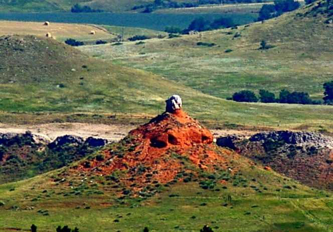
Red slopes streaked with white mark the Red Valley wherever its bare ground shows. The red is shale and siltstone; the white is gypsum. The Red Valley is the third of the four rings of rock that make up the Black Hills, counting from the center out: a lowland that runs all the way around the Hills between the Limestone Plateau and the Hogback. Its color, its white bands and the towns built along it all come back to one soft layer of rock, the Spearfish Formation. Its other name, the Racetrack, comes from the story of a great race told in Lakota and Cheyenne tradition.
Where Is the Red Valley?
The Red Valley is a lowland that circles the entire Black Hills. The USGS geologist N.H. Darton, writing about the northern Hills in 1909, called it “a wide depression that extends continuously around the hills.” Limestone slopes rise on its inner side toward the Limestone Plateau. On its outer side stands the Hogback, a ridge of hard Inyan Kara Group sandstone that forms the outer rim of the Hills and climbs several hundred feet above the valley floor. Beyond the Hogback, the land falls away to the plains. How the Black Hills formed lays out all four rings, from the core outward.
The main forests of the Hills end at the foot of the limestone slopes, so the valley floor lies open and its red soil shows from far off. It reaches about 2 miles across in places and shrinks to a narrow strip where the rock layers stand steeply. Most of the larger creeks leaving the Hills run straight across it toward the plains.
The valley also carries traffic. Interstate 90 follows it north from Rapid City to Sturgis, with the Hogback on the skyline to the east, according to a South Dakota Geological Survey road log, and inside Wind Cave National Park a park road runs north along it into Custer State Park. It isn’t one smooth trough, though. Low divides separate the creek valleys along it, and partway down its eastern side much younger deposits fill a long stretch.
Why Is the Rock Red?
The rock of the Red Valley is red because iron oxide colors it. Early USGS lab analyses of the red shale identified the pigment as iron oxide, and the National Park Service explains the color the same way: iron-rich minerals mixed through the sand, silt and clay. The layer is the Spearfish Formation, made of red shale, siltstone and sandstone, with beds of gypsum. Darton named it in 1899, probably after the town of Spearfish on the northern flank of the Hills. In the northern Hills it is 450 to nearly 700 feet thick.
The Spearfish Formation is roughly 250 to 200 million years old, reaching from the end of the Permian period into the Triassic. Accounts of where its sediment settled differ. The Park Service at Devils Tower describes much of the continent lying under water at the time. The early USGS survey of the southern Hills pictured instead vast salt lakes in a dry age, with gypsum settling out as their water evaporated and almost no rain came to refill them.
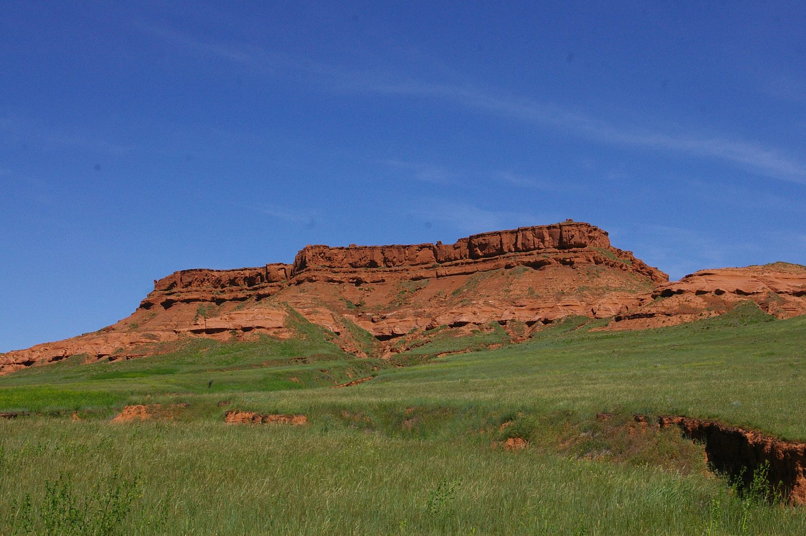
This one layer became a valley because it erodes faster than the rock on either side. Its shale and siltstone are soft, and in the semi-arid climate of the Black Hills they wear down easily, as the Park Service notes. The limestone inside and the hard sandstone of the Hogback outside hold up better, so erosion scooped out the red layer between them and left a trough that follows it around the Hills.
Snow-White Bands of Gypsum
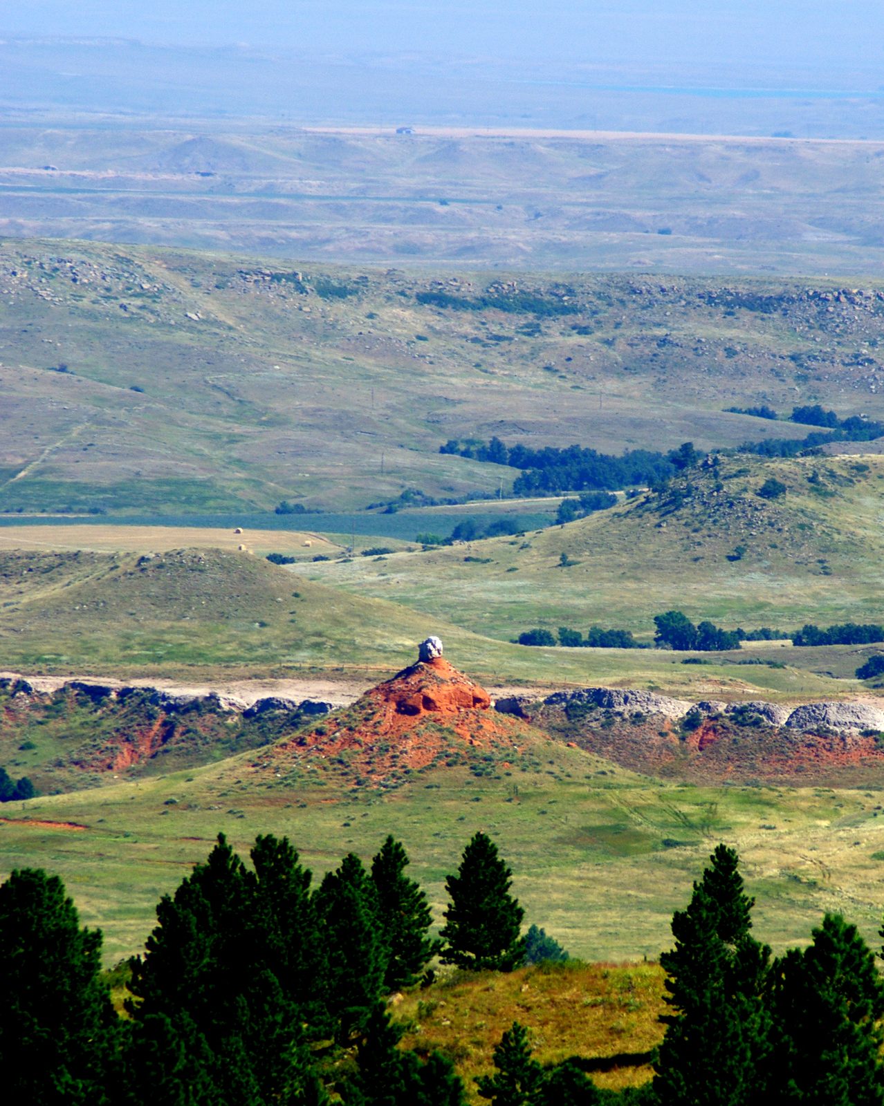
The white bands in the red slopes are gypsum, a mineral that water leaves behind as it evaporates. Gypsum turns up almost everywhere the red rock does, all the way around the Hills, in beds anywhere from 30 feet thick to under an inch. The beds are solid rock rather than thin sheets. White is the usual color, though some gypsum is gray or a dull blue. Fresh gypsum is hard and wears down more slowly than the shale around it, so it often stands up as ridges and knobs. The rises scattered across the valley floor are mostly gypsum knobs, some with trees on top. Where the gypsum sits within the layer varies. At Devils Tower, white streaks show toward the top of the red rock, while in the southern Hills the main bed lies about 80 feet above the base.
Near the northern towns, geologists disagree about which layer some of the thickest gypsum belongs to. Darton’s 1909 survey counted the top gypsum bed as part of the Spearfish Formation and recorded it at 18 to 20 feet thick in the ridge east of Spearfish, about 10 feet near Sturgis and 6 to 8 feet near Whitewood. A 2010 field guide by South Dakota geologists reads that ridge, Lookout Mountain, differently: its bright white gypsum belongs to a younger layer, the Gypsum Spring Formation, resting on top of the red beds.
Gypsum also dissolves in groundwater, and that shapes the ground. Sinks and caves open on gypsum slopes where water seeps underground. One, near Green Mountain in Wyoming, measured 30 feet wide and 25 feet or more deep, set in red shale. West of Spearfish, fields of small sinkholes in the red beds come from gypsum dissolving out of them. Shale like this normally keeps water from passing through. In the lower Spearfish Formation, though, water working along the gypsum beds has opened enough room for the rock to carry groundwater, and in 2010 the USGS geologist Jack Epstein called that part of the formation a “respectable aquifer.”
The Racetrack
The Red Valley has a second name, the Racetrack. In Lakota tradition, as the Oglala Lakota author James LaPointe recorded it in Legends of the Lakota (1976), the valley is the path of a great race: under the racers the ground sank into a track, and Hé Sápa, the Black Hills, rose inside their circle. A 2003 study written for the National Park Service reports that the Cheyenne tell of the great race too and regard the Racetrack highly, and that Lakota people link it to a spiritual pilgrimage their ancestors followed.
Which Towns Sit in the Red Valley?
Rapid City, Sturgis, Spearfish and Hot Springs all sit in the Red Valley or along its edge, and Interstate 90 links the northern towns through it. In Rapid City, Dinosaur Park stands on top of the Hogback, and a city marker there points out the Red Valley in the low ground below. The city’s southwest side, around Sheridan Lake Road and Catron Boulevard, lies in the valley and has built up fast since the 1990s. Northwest of town, much of the new building of the 2000s along the interstate went into the Red Valley and onto the slopes beside it, a 2010 field guide by South Dakota geologists reported.
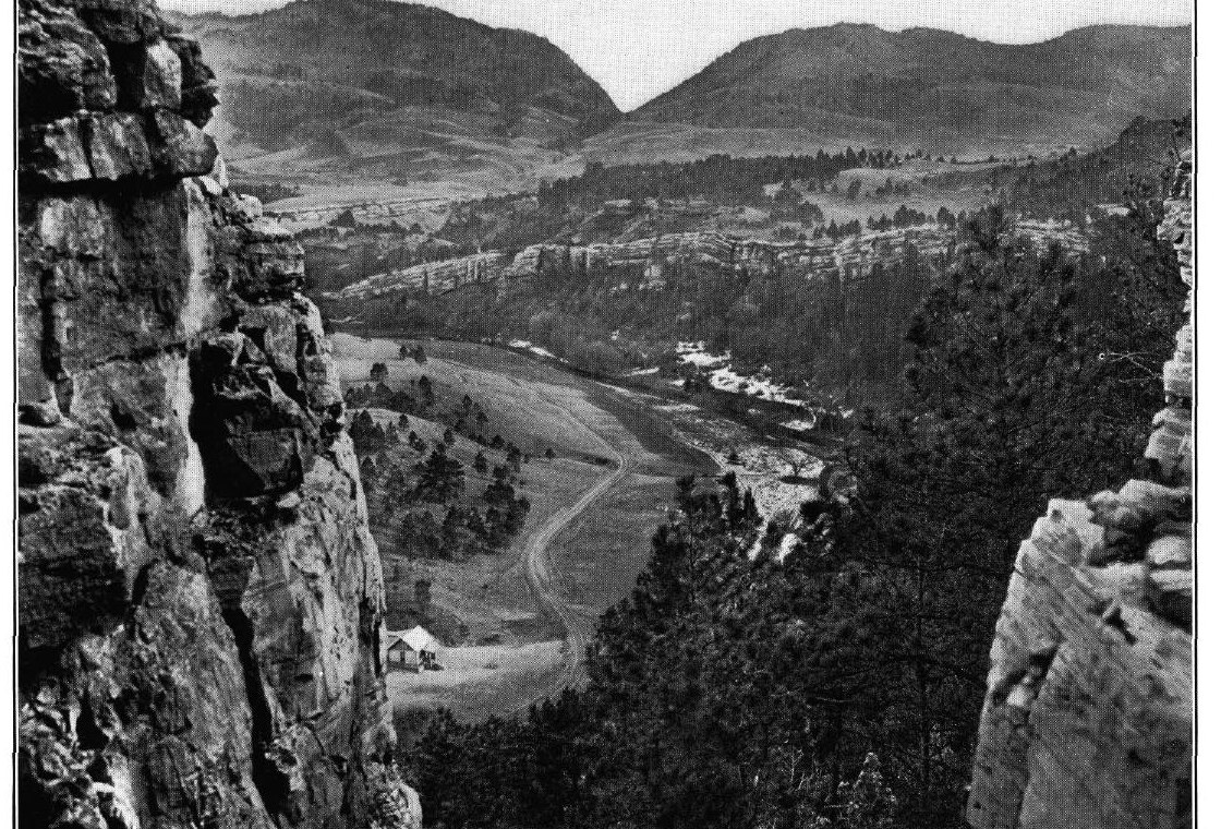
Around Sturgis, the red beds lie under a flat cap of gravel, the Sturgis terrace, on both sides of the interstate. Gypsum had been dug at Sturgis by 1909, though the long haul to market kept it from paying. Spearfish, which probably gave the formation its name, has red beds under part of the Spearfish Creek valley, and the 1909 report’s photograph of the valley was taken near Whitewood.
In the south, Hot Springs sits in the same valley. So does the Mammoth Site, a sinkhole left by a collapsed cavern in deeper rock, its tan fill standing out against the red shale around it. By 1903 gypsum was being quarried at Hot Springs, baked to remove its water, ground and shipped in barrels. West of town, the valley runs broad and treeless past Minnekahta, a railroad siding.
Building on gypsum has two kinds of cost. Unweathered gypsum seems firm enough to build on, but it swells as it weathers, and in Rapid City’s part of the valley the 2010 field guide described homes with lifted and broken foundations and doors and windows that no longer close. Dissolving gypsum does the opposite and lets the ground sink. Epstein reported that dissolving gypsum and anhydrite, a related mineral that turns into gypsum when it takes up water, have caused collapse and settling around the Black Hills, damaging houses and sewage ponds. In 1972 Spearfish built a sewage lagoon two miles north of the interstate; it leaked into sinkholes in the gypsum, and the city gave it up for a treatment plant.
Some collapses start far below the red beds. Sinkholes west of Spearfish probably formed over rock dissolving about 500 feet down, and their springs now supply fish hatcheries and local farms. That deeper dissolving keeps creeping outward from the center of the uplift as the Hills erode, so Epstein and his co-authors expect some of those springs to go dry and new ones to appear farther out.
Connected
- How the Black Hills FormedAll four rings of rock, with the Red Valley as the third.
- Hé Sápa: Why the Hills MatterThe Hills in Lakota understanding.
- Spearfish, South DakotaThe town the Spearfish Formation is probably named for.
- Sturgis, South DakotaA northern Hills town on red beds under a gravel terrace.
- Rapid City, South DakotaIts Dinosaur Park sits on the Hogback, above the Red Valley.
- Hot Springs, South DakotaA southern Hills town in the Red Valley, where gypsum was quarried by 1903.
- Whitewood, South DakotaThe town near the Red Valley photograph in the 1909 USGS report.
- Gold and the Other MineralsGypsum among the minerals of the Hills.
Sources
- Geology and Water Resources of the Northern Portion of the Black Hills and Adjoining Regions in South Dakota and Wyoming (Professional Paper 65). N.H. Darton, U.S. Geological Survey, 1909 (online edition, NPS History).
- Description of the Belle Fourche Quadrangle (Geologic Atlas Folio 164). N.H. Darton and C.C. O’Harra, U.S. Geological Survey, 1909.
- Description of the Edgemont Quadrangle (Geologic Atlas Folio 108). N.H. Darton and W.S. Tangier Smith, U.S. Geological Survey, text dated April 1903.
- Geologic Field Trips in the Black Hills Region, South Dakota (Bulletin No. 21). M.P. Terry, E.F. Duke and J.A. Tielke, editors; road logs by L. Stetler, A. Lisenbee, K. Katzenstein and J. Epstein; A.L. Lisenbee and E. Erslev; L.D. Stetler and J.J. Stone; M.D. Fahrenbach (South Dakota Geological Survey); and L.D. Agenbroad, D. Esker and J. Wilkins. South Dakota School of Mines and Technology, 2010.
- Stop #7: Spearfish Formation / Inyan Kara Group. National Park Service, Wind Cave National Park, 2021.
- Geologic Formations. National Park Service, Devils Tower National Monument.
- Geolex: Spearfish Formation. U.S. Geological Survey, National Geologic Map Database.
- Spearfish Formation. Lexicon of Canadian Geologic Units, Geological Survey of Canada.
- Evaporite Karst in the Black Hills, South Dakota and Wyoming. Jack Epstein, U.S. Geological Survey; Geological Society of America, Rocky Mountain Section meeting abstract, 2010.
- Great Race Exhibit at Journey Museum wraps up with local Lakota artists. Aly Duncan Neely, Native Sun News (republished by Indianz), 2016.
- The Great Race / Black Hills Geology (marker text). City of Rapid City, with an excerpt from James LaPointe’s account (spelled LaPoint on the marker), from an exhibit by the Center for American Indian Research and Native Studies; transcribed by the Historical Marker Database.
- The Home of the Bison: An Ethnographic and Ethnohistorical Study of Traditional Cultural Affiliations to Wind Cave National Park. Patricia C. Albers and others, University of Minnesota for the National Park Service, 2003.
Last reviewed: