Towns
Edgemont, South Dakota
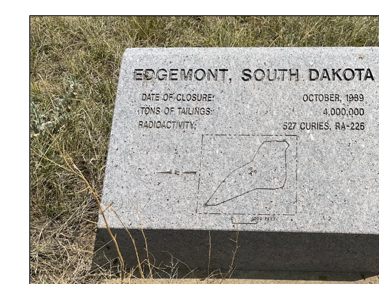
About 2 miles south of Edgemont, a 100-acre tract seeded with prairie grasses has been licensed for grazing since 2006. Beneath 9 feet of clay, fill and topsoil lie about 4 million tons of waste from the town's old uranium mill: its sandy tailings, plus tainted soil, equipment and building rubble. Edgemont, a Fall River County town of 725 people in the 2020 census, lies at the southwest edge of the Black Hills, in the Southern Hills. It began in 1890 as a railroad terminal, lived through an Army depot and a uranium boom, and is now the south end of a 109-mile trail.
Shale Flats Beyond the Sandstone Rim
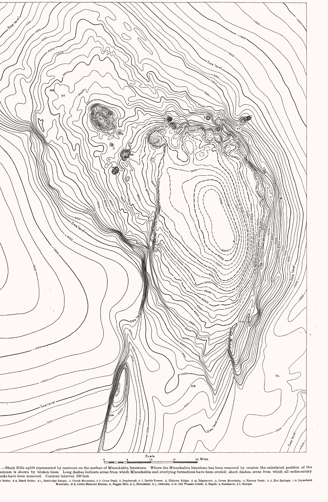
Edgemont stands on the flat floor of the Cheyenne River valley, just outside the Hogback, the hard sandstone ridge that rings the Black Hills on the outside (see How the Black Hills Formed). Near town the valley is worn mostly into soft shale, but east and southeast of town the river has cut gorges into the harder sandstone of the rim, N.H. Darton and W.S. Tangier Smith reported in a 1904 U.S. Geological Survey folio.
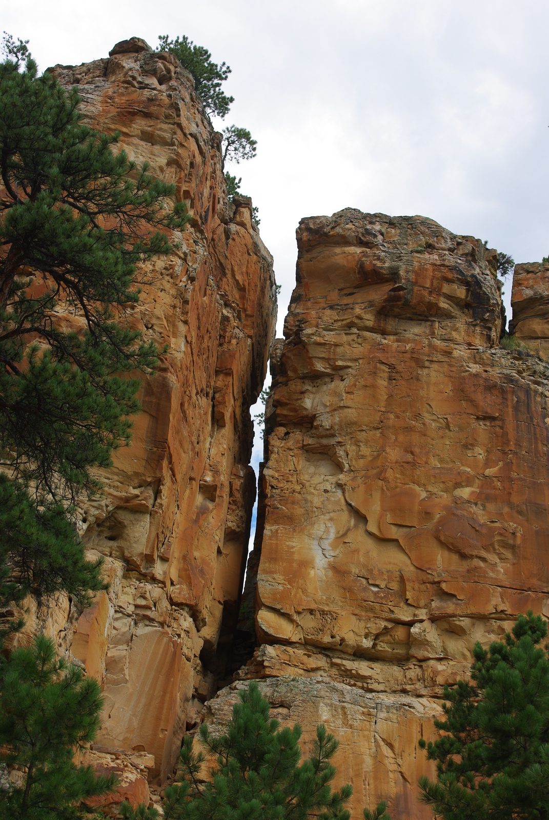
The district's uranium came out of that rim. A 1955 USGS bulletin placed Fall River County's ore in the Lakota and Fall River sandstones of the Inyan Kara Group, which stand up as ridges around the edge of the uplift. In the Craven Canyon area north of town, the deposits keep to the lowest 100 to 150 feet of the Lakota, a white to buff sandstone, and the ore mineral, carnotite, is yellow (see Gold and the Other Minerals). A visitor sees the rock at work: pale sandstone walls in the canyons north of Edgemont, the river's gorges, and south of the river the rolling prairie the 1904 folio described.
How Did Edgemont Begin?
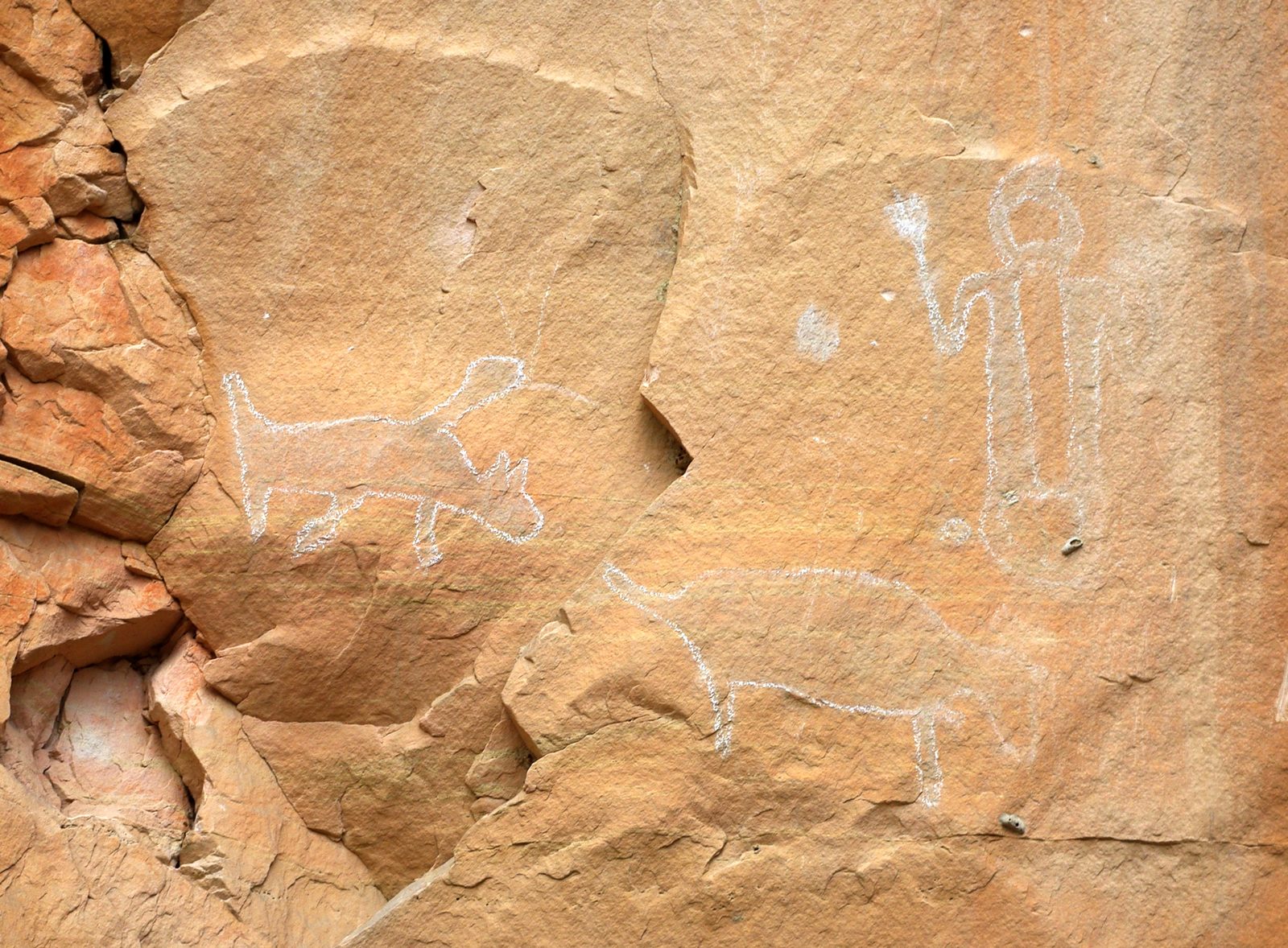
Edgemont began as a town in the summer of 1890, but travelers were crossing the Cheyenne River nearby 14 years earlier. A 2016 state marker on U.S. Highway 18 says coaches on the Cheyenne-to-Deadwood stage line came through in 1876 and 1877, and that J.W. Dear built the Cheyenne River Station by the crossing early in 1876; in 1879 it became headquarters of the TOT Ranch. This country lay inside the Great Sioux Reservation set apart by the 1868 Fort Laramie Treaty, and the 1877 Act took it from the tribes without the consent the treaty required (see The 1876 War and the Taking of the Hills).
Early in 1890 the Burlington laid out Siding 7 close to where its branch into the Hills left the main line bound for Wyoming's coal fields, and it meant to keep its yards there. Twice it failed to get more land next to the siding, so it bought ground south of the river from Hand Carsley, a homesteader, and built its terminal there instead, a 1989 centennial marker at the same pull-out explains. The town that grew up beside the terminal took the name Edgemont, meaning "edge of the mountains." The branch north to Deadwood was finished in January 1891 (see Stagecoaches and Railroads).
In the spring of 1942 the Army began building the Black Hills Ordnance Depot on about 21,000 acres of open hills between the village of Provo and Edgemont, to store munitions in earth-covered concrete bunkers called igloos. About 4,200 people lived in the depot town of Igloo by the summer of 1945, South Dakota Public Broadcasting reported in 2016. Defense Secretary Robert McNamara announced in 1964 that the depot would close, and it wound down in stages until the summer of 1967. Clarence Anderson, who moved to Igloo as a boy, told SDPB the closing was "devastating" and guessed that nearly half of Edgemont's people left.
Carnotite, a Mill and Uranium Still in the Ground
In June 1951 a Rapid City man, Jerry G. Brennan, came on uranium in Craven Canyon, about 8 miles north of Edgemont. The South Dakota School of Mines identified it as carnotite, and prospectors had staked at least 28 claims by November, when USGS geologists examined them for the Atomic Energy Commission. After December 1952 the commission bought ore at a station in Edgemont, and from 1956 to 1972 a mill in town processed ore, most of it from Black Hills mines on both sides of the Wyoming line. The Cold War side of the story is on Uranium, the Cold War and the Missiles.
The Tennessee Valley Authority bought the mill in 1974 but, after studying it, never ran it. At the Nuclear Regulatory Commission's order, TVA decommissioned it from 1986 to 1989, cleaning up the mill site and 137 nearby properties, which were certified to the Environmental Protection Agency's standards and released for any use. The waste went into the cell south of town, set into shale 300 to 700 feet thick. In 1996 the NRC ended TVA's license, and the site passed to the Energy Department.
A mining company proposes the Dewey-Burdock project, spread over more than 10,000 acres of Custer and Fall River counties: an in-situ mine, one that would dissolve uranium where it lies and pump it up through wells. The Oglala Sioux Tribe opposes it. In 2024 its president, Frank Star Comes Out, told ICT the tribe was worried about the aquifers: if a mine contaminated one, "that's our main water supply." In July 2026 the tribe's historic preservation officer, Russel H. Zephier, told the Nuclear Regulatory Commission's licensing board in a sworn declaration that the tribe has long wanted the site surveyed for places of cultural and religious importance to it "before any licensing decision." On June 30, 2026, the federal Permitting Council said the project had completed federal permitting, its executive director calling more domestic uranium production "critical to national security and energy dominance." Mark Hollenbeck, a nearby rancher who once managed the project, told KOTA in April 2026 it is "very much supported locally"; in 2022, 56 percent of Fall River County voters had backed declaring uranium mining a nuisance. By late October 2026, as the company restarted its state permitting, it was seeking water rights from the Inyan Kara and Madison aquifers; the state's chief water-rights engineer recommended approval, and the Water Management Board set a hearing for December 2 in Pierre, the South Dakota Searchlight reported.
Milepost 0 and the Country Around
Milepost 0 of the George S. Mickelson Trail stands in Edgemont's city park, at 3,454 feet the lowest point on the trail. From there the trail runs 109 miles north on a former rail line, through Custer and Hill City to Deadwood (see The George S. Mickelson Trail). A kiosk at the trailhead calls Edgemont a ranching and farming community and says uranium mining in the area had stopped paying by 1980.
The Buffalo Gap National Grassland, federal prairie of almost 600,000 acres, reaches to the point where Wyoming, Nebraska and South Dakota come together, and one of its two ranger districts is based in Hot Springs, northeast of Edgemont. Across the Wyoming line, Newcastle, a coal-and-railroad town of 1889, sits on the same southwest flank of the Hills.
Downstream from Edgemont, the Cheyenne cuts a crooked passage of several miles through the Hogback at the southern tip of the Hills, and southeast of Hot Springs it fills Angostura Reservoir, behind an irrigation dam the Bureau of Reclamation built in 1949 (see Lakes of the Black Hills).
Connected
- The Southern HillsThe warmer, drier south end of the Hills, from Custer to Edgemont.
- Gold and the Other MineralsThe 1951 carnotite find in the Lakota sandstone near Edgemont, among the Hills' other minerals.
- Uranium, the Cold War and the MissilesThe thread from Edgemont's uranium to the Minuteman years.
- The George S. Mickelson TrailThe 109-mile trail that begins at milepost 0 in Edgemont.
- Stagecoaches and RailroadsThe 1890 terminal and the line north from Edgemont to Deadwood.
- How the Black Hills FormedThe Hogback, the sandstone outer ring at the edge of town.
- The 1876 War and the Taking of the HillsHow the reservation land around Edgemont was taken.
- Hot Springs, South DakotaThe spring town northeast of Edgemont, home of the grassland's Fall River district.
- Uranium Mining Around the Black HillsThe proposal near Edgemont, its permits and the aquifers.
Sources
- Edgemont, South Dakota, Disposal Site: Fact Sheet. U.S. Department of Energy, Office of Legacy Management, 2026.
- 2024 UMTRCA Title II Sites Annual Report: Edgemont, South Dakota, Disposal Site. U.S. Department of Energy, Office of Legacy Management, 2024.
- Tennessee Valley Authority: Notice of Acceptance of the Long-Term Surveillance Plan and Termination of License SUA-816 (Edgemont uranium mill site). U.S. Nuclear Regulatory Commission, Federal Register 61:130, 1996.
- Description of the Edgemont Quadrangle (Geologic Atlas Folio 108), by N.H. Darton and W.S. Tangier Smith. U.S. Geological Survey, 1904.
- The Carnotite Prospects of the Craven Canyon Area, Fall River County, South Dakota (Circular 175), by L.R. Page and J.A. Redden. U.S. Geological Survey, 1952.
- Uranium Deposits in Fall River County, South Dakota (Bulletin 1009-G), by Henry Bell and W.E. Bales. U.S. Geological Survey, 1955.
- Siding 7 (marker 505). Edgemont State Centennial Committee, Burlington Northern Railroad, South Dakota State Historical Society and South Dakota Department of Transportation, 1989; transcribed by the Historical Marker Database.
- Cheyenne River Crossing: 1876-1877 Cheyenne to Deadwood Stage Trail (marker 705). State of South Dakota, 2016; transcribed by the Historical Marker Database.
- Edgemont: Where the Trail Begins (trailhead kiosk, Edgemont City Park). Transcribed by the Historical Marker Database, 2018.
- Treaty of Fort Laramie (1868), transcript. National Archives.
- Igloo, South Dakota: The Utopia That War Built, by Michael Zimny. South Dakota Public Broadcasting, 2016.
- Oglala Sioux Tribe Takes Steps to Protect Black Hills, by Amelia Schafer. ICT, with the Rapid City Journal, 2024.
- Declaration of Russel H. Zephier, Tribal Historic Preservation Officer, Oglala Sioux Tribe (Powertech (USA) Inc., Dewey-Burdock In Situ Uranium Recovery Facility, Docket 40-9075-LR). U.S. Nuclear Regulatory Commission, Atomic Safety and Licensing Board, 2026.
- Dewey-Burdock ISR Uranium Project Completes Federal Permitting. Federal Permitting Improvement Steering Council, 2026.
- Dewey-Burdock Uranium Project Debate Continues in the Black Hills, by Karli West. KOTA Territory News, 2026.
- Uranium Mining Declared a Nuisance in Fall River County, by Lee Strubinger. South Dakota Public Broadcasting, 2022.
- Company Proposing Black Hills Uranium Mine Eyes State Permitting Restart After 13-Year Pause, by Makenzie Huber. South Dakota Searchlight, as published by KOTA Territory News, 2026.
- Proposed Black Hills Uranium Mine Gets Approval to Start Building Infrastructure on Portion of Site, by Meghan O'Brien. South Dakota Searchlight, 2026.
- One Uranium Project Takes a Step Toward State Permit, While Another Stays Stalled by Legal Questions, by Meghan O'Brien. South Dakota Searchlight, 2026.
- George S. Mickelson Trail. South Dakota Game, Fish and Parks.
- Buffalo Gap National Grassland. USDA Forest Service, Nebraska National Forests and Grasslands.
- Angostura Recreation Area. South Dakota Game, Fish and Parks.
- Public Comment Period Opens as Company Seeks State Permits for Uranium Mine, by Meghan O'Brien. South Dakota Searchlight, as published by the Rapid City Post, 2026.
Last reviewed: