The Outdoors
Jewel Cave National Monument
About 2 miles of Jewel Cave were known in 1959. By September 7, 2024, surveyors had mapped 220.33 miles, which makes Jewel Cave the fifth-longest known cave in the world and the second-longest in the United States, after Mammoth Cave in Kentucky. Jewel Cave National Monument lies along US 16 about 13 miles west of Custer, in the southern Black Hills. Visitors see the cave on four ranger-led tours and walk three trails above it. Its written history begins with a mining claim in 1900, and it became a national monument in 1908.
Why Is It Called Jewel Cave?
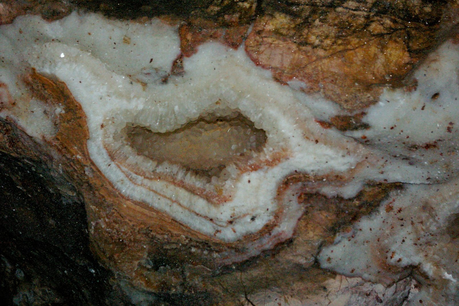
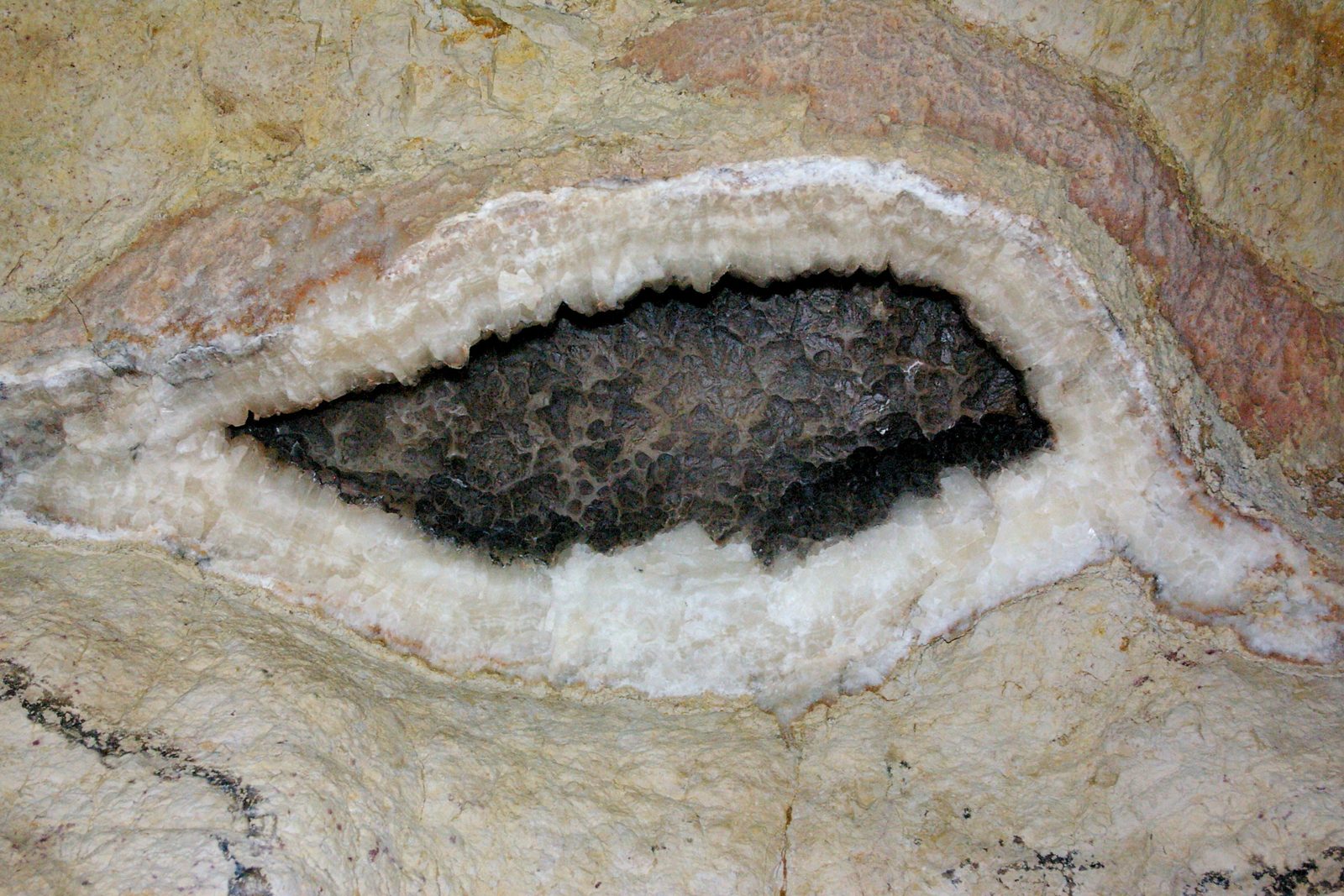
The name comes from calcite. In 1900 the first people known to go inside saw its cramped rooms glitter as their lanterns caught the crystals, and spar still coats most of the cave's surfaces, the Park Service says. The crystals are mainly of two types, dogtooth spar and nailhead spar, which the Park Service calls the jewels of the cave.
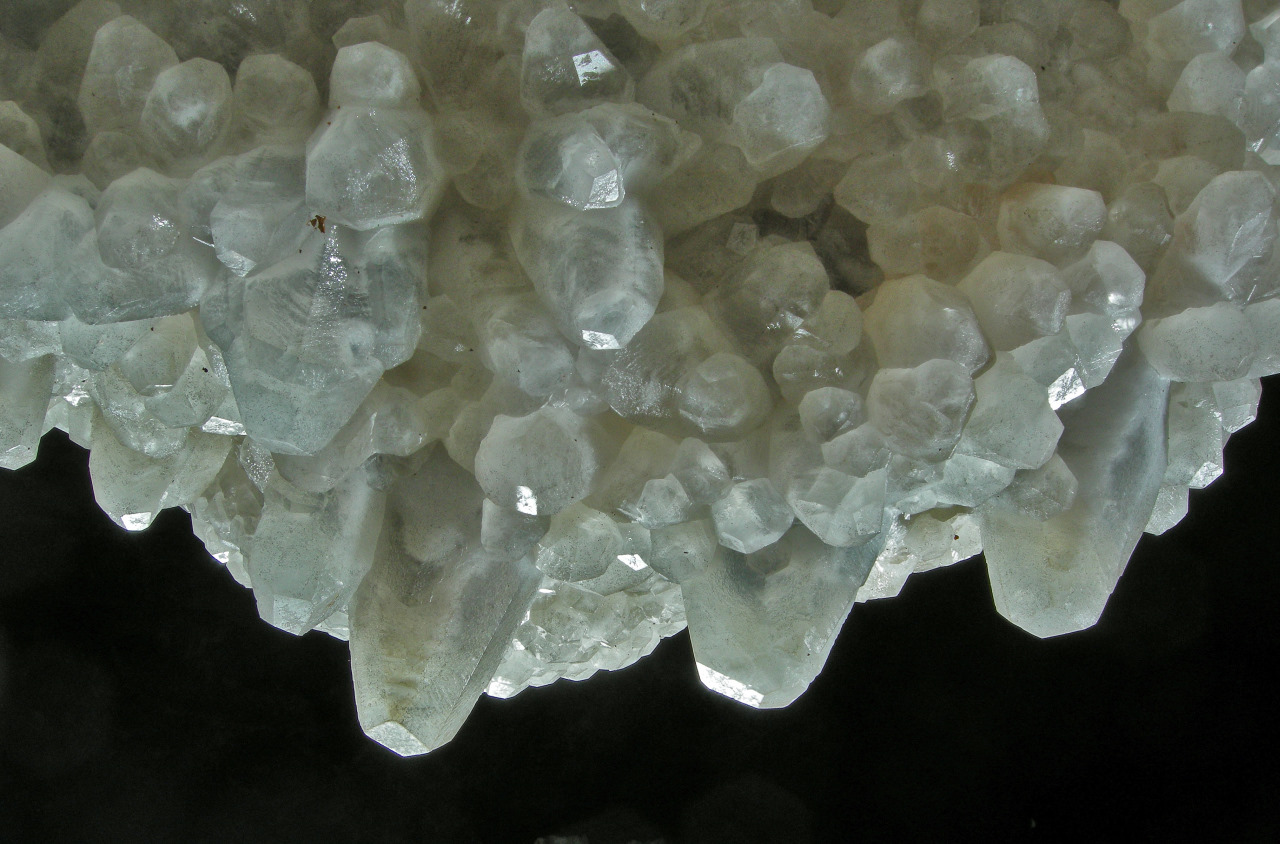
The rock is the Madison Limestone, laid down in a warm, shallow sea roughly 345 to 360 million years ago; Wind Cave lies in the same layer. Most of the cave, though, dates from a wetter climate that set in nearly 40 million years ago, the Park Service says, when mildly acidic rainwater seeped down to the water table and slowly widened cracks in the limestone. How the cave and its spar formed is the subject of The Limestone Plateau and the Caves.
What Are the Cave Tours Like?
All four tours are ranger-led, and they differ mostly in how far and how hard they go. Jewel Cave stays at 49°F all year, so the Park Service suggests long pants and a sweater or light jacket. Everyone must manage the route without help, and a child may be carried only in a front carrier, on the Discovery and Scenic tours.
The Discovery Tour takes 20 minutes. An elevator in the visitor center carries the group down to a single large chamber, the Target Room, where 15 steps lead to a metal platform and a ranger explains the two kinds of spar and how the cave is thought to have formed. Visitors who use wheelchairs or can't manage stairs can watch from an upper platform, and the Park Service recommends this tour for families with young children.
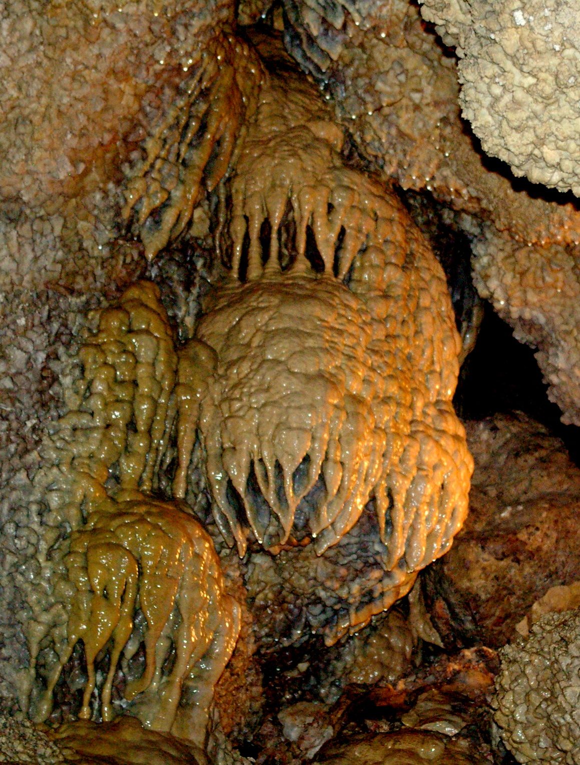
The Scenic Tour also uses the elevators. It covers a 1/2-mile loop with 734 stairs in 1 hour and 20 minutes, past both kinds of spar, stalactites and stalagmites, flowstone, cave popcorn and boxwork, and the cave bacon, a drapery that hangs in one long ribbon.
The Historic Lantern Tour, seasonal and rated strenuous, starts at the Historic Area, about a mile west of the visitor center, and enters through the cave's only known natural entrance, the hole the Michaud brothers enlarged. The route covers roughly 1/2 mile of low, tight passage and about 500 steep wooden steps that are more like ladders, some of them taken backward. Most people on the tour carry a lantern, and those lanterns give the only light. Everyone must be at least 8 years old.
The Wild Caving Tour, also seasonal, is the one the Park Service calls “extremely strenuous”: 2/3 mile in 3 to 4 hours, with belly-crawling through tight passages. Before setting out, each caver has to fit through an 8½-by-24-inch crawl space, and the minimum age is 16.
Trails Above the Cave, After the Jasper Fire
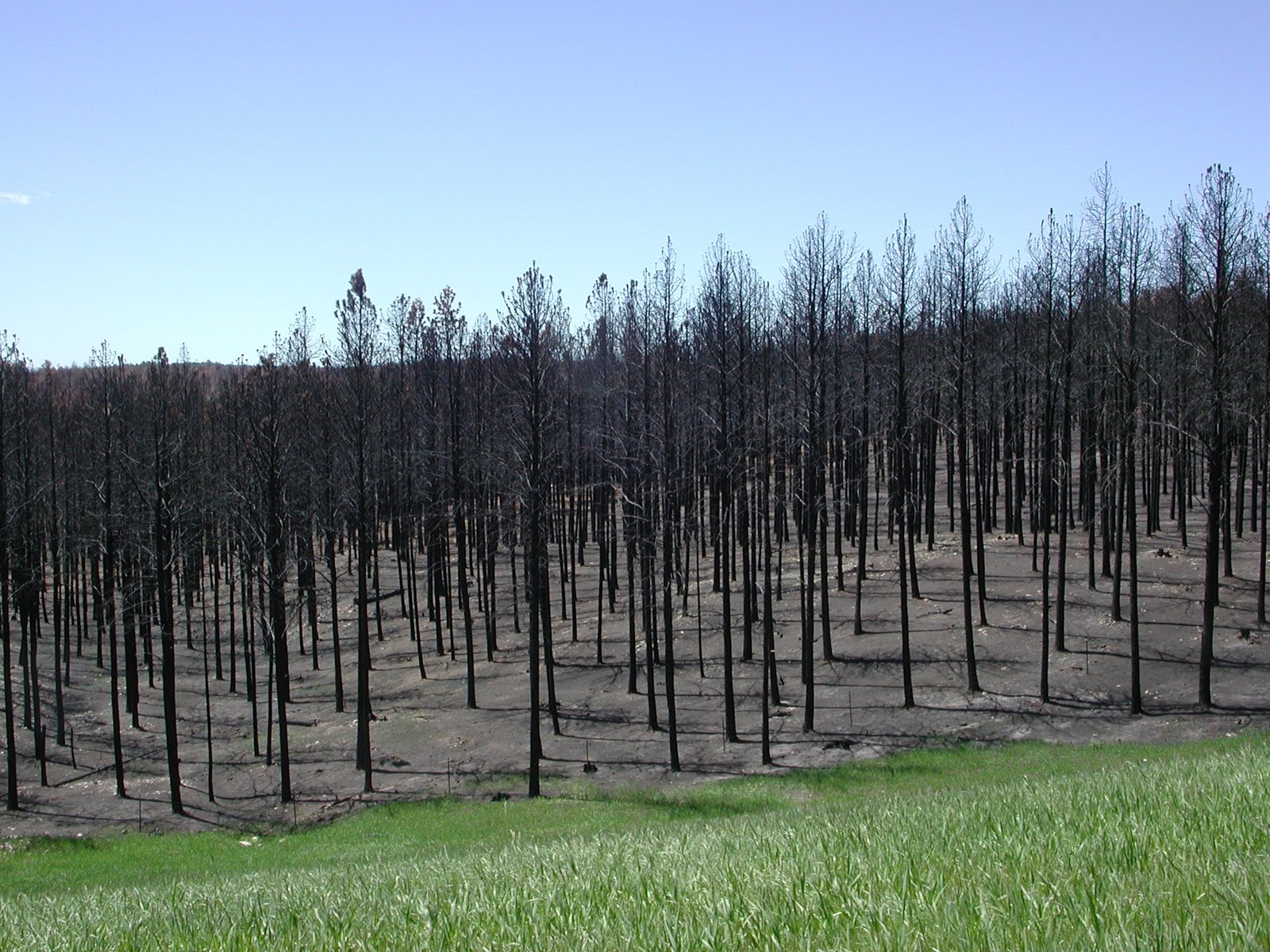
On the surface, Hell Canyon and Lithograph Canyon cut through ponderosa pine (Pinus ponderosa) forest. On August 24, 2000, the Jasper Fire broke out just west of the cave; it burned 83,508 acres, including about 90 percent of the monument, and The Ponderosa Forest, Fire and the Pine Beetle tells its story. Burned trees still fall, so stay clear of dead ones in high wind.
The Roof Trail, a 1/4-mile loop rated easy, starts on the south side of the visitor center and circles it through the pines. Its slopes are moderate, but it isn't built for wheelchairs or strollers.
The Canyons Trail, a 3.5-mile loop rated easy to moderate, leaves the Roof Trail about 650 feet from the visitor center, with a second access point at the Historic Area. Its route takes in both canyons, open meadows below cliffs and the historic entrance, and a 9/10-mile spur brings it back to the visitor center. Since the fire it has little shade, so carry plenty of water and a hat or sunscreen. Check often for ticks, which the Park Service says are not uncommon in the monument in late spring and summer.
The Hell Canyon Trail is Black Hills National Forest Trail 32, and its trailhead is on the north side of US 16, about a mile west of the visitor center. The Forest Service rates its 5.3 miles easy to moderate. After a steep first 1/2 mile up onto the limestone plateau, it keeps to the rim for about 3 miles, which can be hot in summer with little shade, then ends with 2 miles on the canyon floor. The Forest Service says bighorn sheep (Ovis canadensis) often turn up on the cliffs (more on Elk, Bighorn Sheep and Mountain Goats).
- Distance
- Roof Trail, 1/4-mile loop; Canyons Trail, 3.5-mile loop; Hell Canyon Trail, 5.3 miles (Forest Service); cave tours from one large room to 2/3 mile
- Elevation gain
- About 500 feet between the Hell Canyon parking lot and the canyon overlooks (Park Service); no figure published for the other trails
- Difficulty
- Roof Trail easy; Canyons Trail easy to moderate; Hell Canyon Trail easy to moderate by the Forest Service, moderate by the Park Service; cave tours moderately strenuous in general, strenuous for the Historic Lantern Tour and extremely strenuous for the Wild Caving Tour
- Trailhead
- Visitor center on US 16, about 13 miles west of Custer; the Historic Area, about a mile west; the Hell Canyon trailhead, about 15 miles west of Custer
- Season
- The cave stays at 49°F all year; the Historic Lantern and Wild Caving tours are seasonal; Hell Canyon Trail is open all year, though its trailhead isn't maintained in the shoulder seasons; snowshoes on loan at the visitor center in winter
From the Jewel Tunnel Claim to a National Monument
Tribes have lived in the Black Hills for thousands of years and hold places there sacred; the Park Service says they may have known of the cave's small natural entrance, though nothing in tribal or settler history shows that they went in. The written record starts in 1900 with two brothers, Frank and Albert Michaud, prospecting in Hell Canyon. They came on a hole blowing cold air, widened it with dynamite, and went in with a family friend, Charles Bush. On October 31, 1900, they filed a mining claim in Custer called the Jewel Tunnel.
The crystals were worth little, but the claim let the Michauds control who went in, and the Park Service reports a theory that they meant to show the cave to tourists all along. Over the next decade came a trail inside the cave, a lodge on the Hell Canyon rim and, in 1902, a dance club to draw visitors. None of it paid in a thinly settled region where the cave was hard to reach.
In 1906 the Michauds and Bertha Cain, who had bought part of the claim, asked for a Jewel Cave game reserve; Forest Service staff found too little wildlife for one and proposed a national monument instead. On February 7, 1908, President Theodore Roosevelt proclaimed Jewel Cave National Monument under the Antiquities Act of 1906, calling the cave a formation “of scientific interest.” The Park Service, which calls Jewel Cave the first cave ever made a national monument, took it over from the Forest Service in 1933.
Herb and Jan Conn and the Long Survey
In 1959 Dwight Deal, a geologist and caver, persuaded Herb and Jan Conn, rock climbers living near Custer, to join his trips into Jewel Cave. They agreed to go once and kept at it for more than 20 years, mapping more than 62 miles of passage between 1959 and 1979. In 1961 they found the route the Scenic Tour now follows, and they helped decide where the elevators and visitor center, finished in 1972, would go. Their book, The Jewel Cave Adventure, came out in 1977.
Volunteers and park staff still push the survey outward, on trips of up to 4 days and 3 nights underground. More than 24 miles of new passage, and the first lakes known in Jewel Cave, lie beyond the Southwest Splinter, a drafty crack in the western branch that explorers found in 2014. Judging by the cave's airflow, the Park Service estimates that the 220-plus miles mapped so far are less than 5 percent of the cave.
Connected
- The Limestone Plateau and the CavesHow the Madison Limestone dissolved into Jewel Cave, and how its spar crystals grew.
- Custer, South DakotaThe town about 13 miles east, where the Michauds filed their claim in 1900.
- The Southern HillsThe warmer, drier end of the Hills, home to both long caves.
- The Ponderosa Forest, Fire and the Pine BeetleThe Jasper Fire of 2000 and the forest it left behind.
- Wind Cave National ParkThe third-longest cave in the United States, in the same limestone.
- Elk, Bighorn Sheep and Mountain GoatsThe bighorn sheep seen on the walls of Hell Canyon.
Sources
- Cave Exploration. National Park Service, Jewel Cave National Monument, 2025.
- World Long Caves, compiled by Paul Burger for the National Speleological Society’s Geology and Geography Section. Cave-Exploring.com, updated October 18, 2026.
- A Small Cave No More. National Park Service, Jewel Cave National Monument, 2025.
- Cave Explorers. National Park Service, Jewel Cave National Monument, 2015.
- February 2018: A Jewel in the National Park System. South Dakota Historical Society Foundation, 2018.
- Discovery & Early History. National Park Service, Jewel Cave National Monument, 2025.
- Becoming a Monument. National Park Service, Jewel Cave National Monument, 2025.
- Proclamation 799: Setting Aside Jewel Cave National Monument, South Dakota, by Theodore Roosevelt, February 7, 1908. The American Presidency Project, University of California, Santa Barbara.
- Historic Entrance. National Park Service, 2025.
- Geology of Jewel Cave. National Park Service, Jewel Cave National Monument, 2023.
- NPS Geodiversity Atlas: Jewel Cave National Monument, South Dakota. National Park Service, 2024.
- Dogtooth and Nailhead Spar in Jewel Cave (photograph and description). U.S. Geological Survey.
- Guided Tours. National Park Service, Jewel Cave National Monument, 2026.
- Discovery Tour. National Park Service, Jewel Cave National Monument, 2025.
- Scenic Tour. National Park Service, Jewel Cave National Monument, 2025.
- Historic Lantern Tour. National Park Service, Jewel Cave National Monument, 2026.
- Wild Caving Tour. National Park Service, Jewel Cave National Monument, 2025.
- Basic Information. National Park Service, Jewel Cave National Monument, 2026.
- Directions & Transportation. National Park Service, Jewel Cave National Monument, 2024.
- Hiking Trails. National Park Service, Jewel Cave National Monument, 2025.
- Hell Canyon Trailhead. USDA Forest Service, Black Hills National Forest.
- The Jasper Fire. National Park Service, Jewel Cave National Monument, 2024.
Last reviewed: