Ghost Towns
Galena, South Dakota
A court fight over who owned the ore all but shut down the silver and lead mines along Bear Butte Creek in 1883, a 1970 study for the U.S. Geological Survey found. Their best years had just passed: from 1881 through 1883 they turned out about $750,000 worth of the two metals. Galena, the camp those mines built, lies in the creek's canyon about 5 miles southeast of Deadwood in the northern Black Hills. Its story runs from silver ore to a Superfund cleanup.
Galena Ore in Cambrian Rock
The camp is named for its ore. Galena is lead sulfide, and here it carried silver; the schoolhouse's 1999 National Register nomination traces the town's name to it. Silver-bearing galena was what made the mines worth working, a 1904 USGS report said. Ore from the Sitting Bull mine often carried 2,000 ounces of silver a ton, but most of the district's ore ran far poorer.
Bear Butte Creek has cut a deep canyon here, where two of the Hills' rings of rock meet (see How the Black Hills Formed). West of the creek lies mostly Precambrian schist, the ancient rock of the crystalline core. Across the creek the schist sinks to about water level, and the canyon wall above it is a stack of younger layers topped by the Mississippian limestone of the Limestone Plateau, the 1970 study reported.
The ore lay at the bottom of those layers, in the Deadwood Formation, about 350 feet of sandstone and dolomite resting on the schist. Most of it lay in two bands, one low in the formation and one high, as narrow shoots along vertical cracks. Those cracks cut through sills of igneous rock already in the formation, so the ore arrived after them, the 1904 report reasoned. The same formation carries gold elsewhere in the Hills, as Gold and the Other Minerals explains.
Why Did Galena Boom and Then Empty?
Silver made Galena. By the 1999 nomination's account, court fights, falling silver prices and hard times, among other causes, emptied it. Prospectors reached the creek during the Black Hills gold rush; the nomination dates the first claims to 1875. They were working land the 1868 Fort Laramie Treaty had set apart for the tribes, which the 1877 Act took without the consent the treaty required (see The 1876 War and the Taking of the Hills). The creek's gold proved somewhat disappointing, South Dakota Magazine wrote, so the camp turned to silver.
In the boom years a smelter ran at Galena, and the Richmond, which the 1904 report also called the Sitting Bull, led the district's silver mines. By the nomination's account the two began as separate mines: Colonel Davey followed his vein in the Sitting Bull into miners working the Richmond. The fight over ownership all but closed the district in 1883. Mining did not start up again until 1896, the 1904 report said, and then more modestly. The Richmond Silver Mining Company and three other plaintiffs sued John H. and Frank J. Davey, and by 1885 the case was on appeal before the Supreme Court of Dakota Territory.
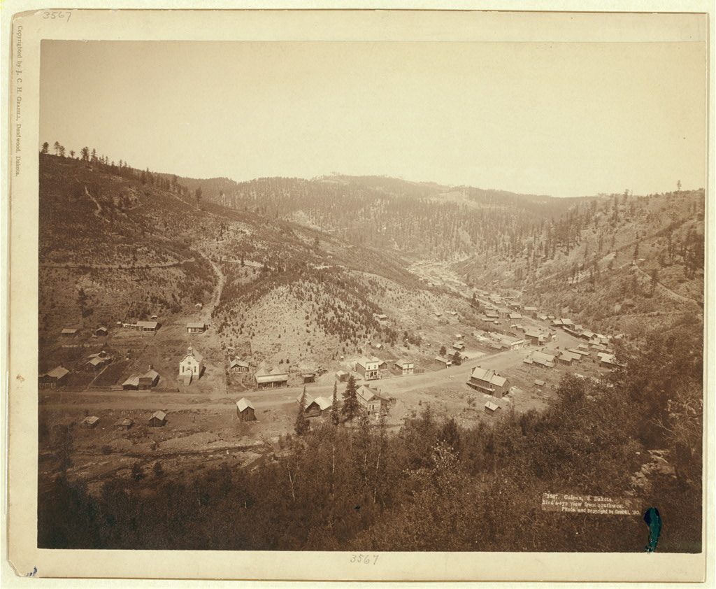
Local tradition makes the case grander. The nomination says it went to the U.S. Supreme Court, set a precedent "known today as the Apex Law," and disrupted mining for 16 years. The record located is the territorial appeal; the one U.S. Supreme Court case found involving the Richmond Silver Mining Company, from 1895, concerned stock promised for mining claims, not the vein. And the USGS reports' dates, 1883 and 1896, make the pause 13 years.
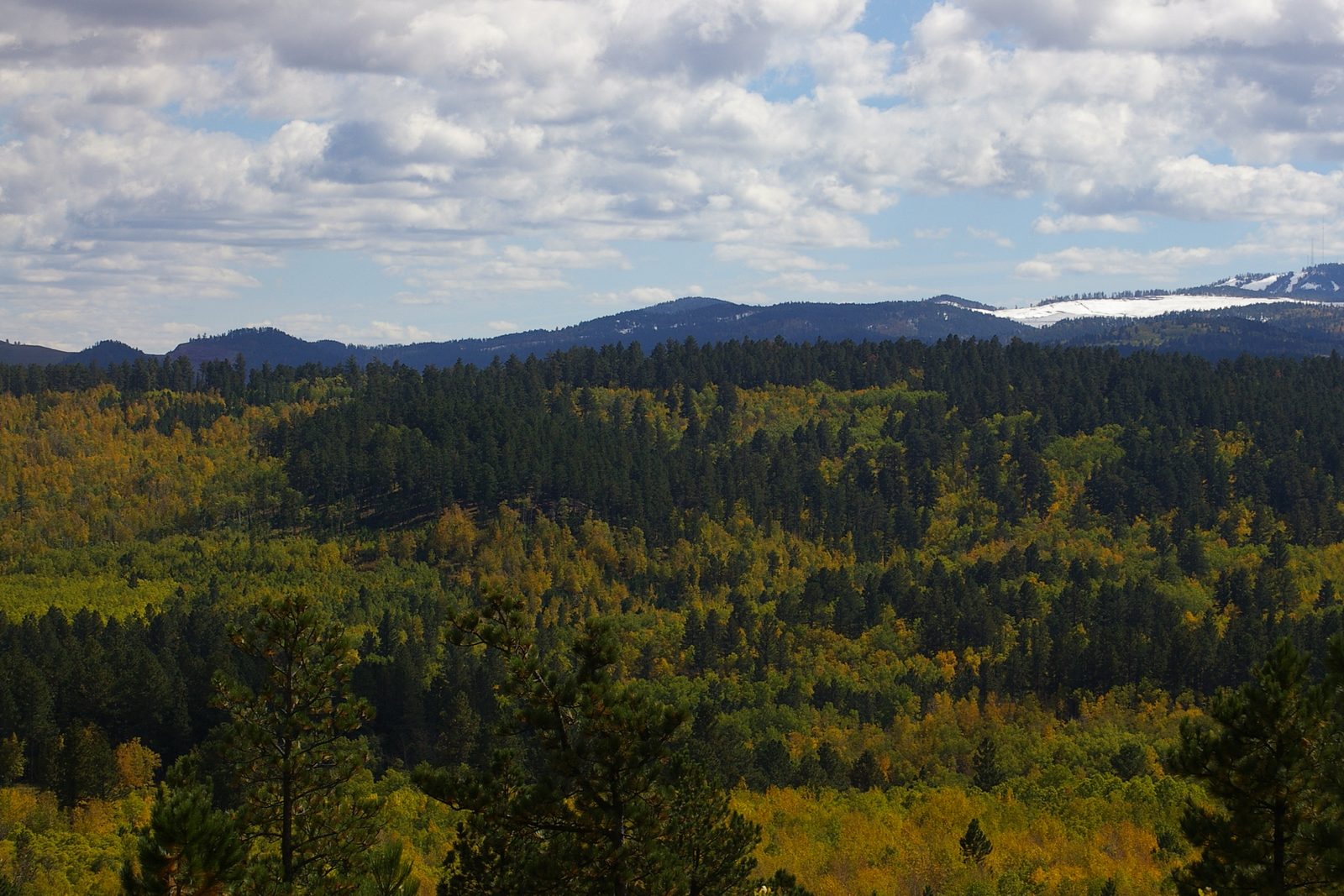
A smaller revival followed. A Burlington branch, the Deadwood Central, came up the creek to Galena in 1902, the nomination says, and the Branch Mint Mining Company, with more than 200 claims, ran a 20-stamp mill before going into receivership in 1912. The Gilt Edge gold mine, about a mile west, employed up to 70 men from 1937 to 1941; most residents left after it shut. The school closed in 1942 by the nomination's account, or a year later by the historical society's.
What Is Left at Galena Today?
Galena still has residents, an 1882 schoolhouse and a cemetery. A 2025 documentary by South Dakota Public Broadcasting (SDPB) described a town far from deserted, kept going by its residents and the local historical society.
The landmark is the schoolhouse, built in 1882 on a forested slope at the town's south end. Its 1999 National Register nomination described a white one-room frame school with a bell tower, its desks and blackboards still in place from 1942, and called it the only structure left from Galena's founding years. The Lead-Deadwood school district had deeded it to the Galena Historical Society in 1997.
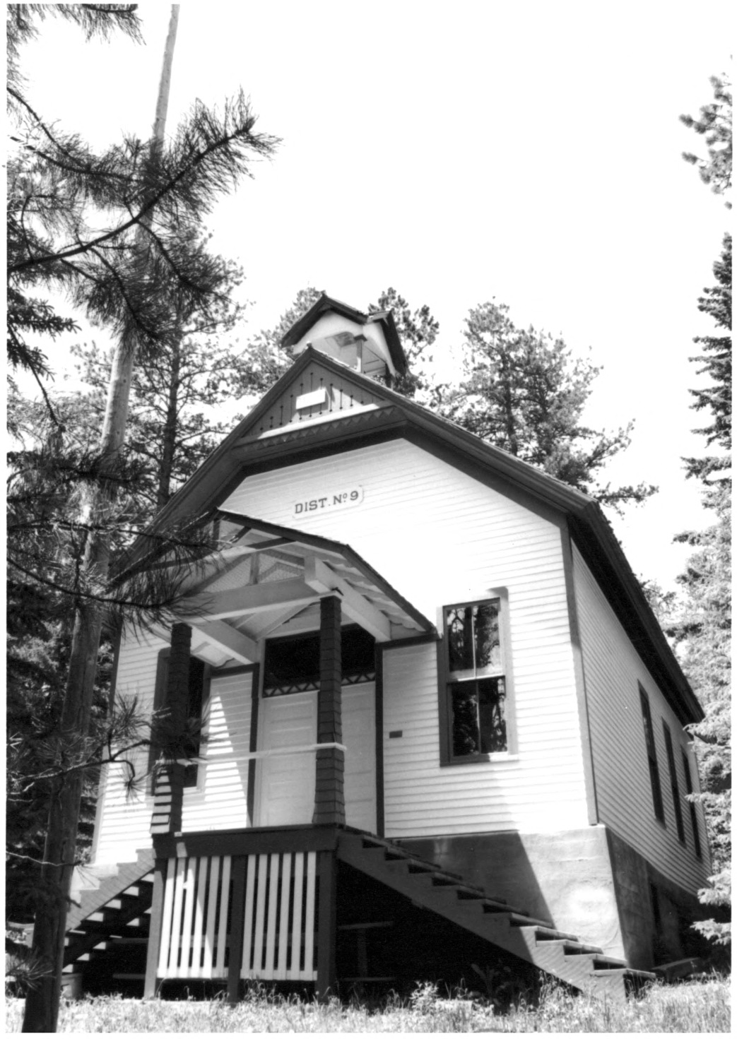
On its website, last updated in 2025, the society says it opens the schoolhouse on the second Saturday of June for a walk through the old camp that draws up to 800 people. The site also lists burials in the Galena Cemetery on Vinegar Hill.
Galena's townsite, schoolhouse included, is not Forest Service land, though it lies inside the Black Hills National Forest boundary; the public national forest land around it is managed by the USDA Forest Service's Northern Hills Ranger District.
The biggest mark on the land is newer. West of town lies the Gilt Edge, a gold mine abandoned by its operator. The Brohm Mining Company, which worked it as an open pit, went insolvent and left in 1999. The mine is now a Superfund site with about 360 acres of disturbed ground, the Environmental Protection Agency says. Acid water from the bared rock drains toward the heads of Strawberry Creek and Ruby Gulch, feeders of Bear Butte Creek, and the EPA treats it, upward of 100 million gallons a year. Agnico Eagle, a company studying whether to reopen the mine, pulled out in 2024. The EPA then ended its pause on filling and capping the old pits, and a spokesman told SDPB that year that construction would begin in 2028.
Connected
- The Northern HillsThe region of gold gulches, canyons and plains that holds Galena.
- Deadwood, South DakotaThe gold-rush town about 5 miles northwest of Galena.
- Gold and the Other MineralsThe Hills' other ores, including gold in the same Deadwood Formation.
- How the Black Hills FormedThe rings of rock that meet in Bear Butte Creek's canyon.
- The Black Hills Gold RushThe rush that first brought prospectors to the creek.
- The 1876 War and the Taking of the HillsHow the land the miners worked was taken from the tribes.
- Stagecoaches and RailroadsThe rail lines that reached the Hills' mining camps.
Sources
- Ore Deposits in Rocks of Paleozoic and Tertiary Age of the Northern Black Hills, South Dakota, by Lewis H. Shapiro and John Paul Gries (South Dakota School of Mines and Technology). U.S. Geological Survey Open-File Report, 1970.
- Economic Resources of the Northern Black Hills (Professional Paper 26), by J. D. Irving, with S. F. Emmons and T. A. Jaggar Jr. U.S. Geological Survey, 1904.
- National Register of Historic Places Registration Form: Galena School, prepared by Ross Wright, South Dakota State Historical Society. National Park Service, 1999.
- Galena's Ghosts, by Paul Higbee. South Dakota Magazine, 2015 (revised from the May/June 2013 issue).
- Fort Laramie Treaty, 1868 (text). USDA Forest Service, 2022.
- Michael Duggan, John Oleson, Daniel Egan and the Richmond Silver Mining Co. vs. John H. Davey and Frank J. Davey: Transcript of Record (catalog record). Supreme Court of Dakota Territory, May term 1885; HathiTrust.
- Koenigsberger v. Richmond Silver Mining Co., 158 U.S. 41. U.S. Supreme Court, 1895 (U.S. Reports, via GovInfo).
- Galena: The Ghost Town That Refuses to Die (program description). SDPB Documentaries, South Dakota Public Broadcasting, 2025.
- Galena Schoolhouse 1882 (home page, updated June 2025) and Galena Cemetery. Galena Historical Society.
- U.S. Forest Service Surface Ownership Parcels (map service). USDA Forest Service, consulted October 2026.
- Ranger District Boundaries (map service). USDA Forest Service, consulted October 2026.
- Geographic Names Information System, geographic names map service (Galena, feature 1265226; Deadwood, feature 1265180). U.S. Geological Survey, consulted October 2026.
- Case Summary: EPA Recovers Over $10 million for Cleanup Costs at the Gilt Edge Mine Superfund Site. U.S. Environmental Protection Agency, 2016, updated 2026.
- Gilt Edge Mine: Cleanup Activities (Superfund site profile). U.S. Environmental Protection Agency, consulted October 2026.
- Agnico Eagle Terminates Superfund Site Mine Lease, by Lee Strubinger. South Dakota Public Broadcasting, 2024.
Last reviewed: