Connections
The Dust Bowl, Free Ice Water and the Highway
South Dakota’s hottest reading on record came on July 5, 1936, when the thermometer near Gann Valley reached 120 degrees, a mark tied in 2006. Murdo hit 116 that day, the highest it has ever recorded, the National Weather Service notes. In that same July, by the account of the University of South Dakota’s archives, Dorothy Hustead hit on a way to get passing drivers to stop at the drugstore she and her husband, Ted, ran in Wall: promise them free ice water. The thread from there runs through the drought years on the western South Dakota plains, the roads that carried travelers past the town, the signs that turned them in, and the federal billboard rules of the interstate years.
Was Wall in the Dust Bowl?
Strictly, Wall lay outside the Dust Bowl. The National Drought Mitigation Center at the University of Nebraska–Lincoln says the name technically covers the Oklahoma Panhandle, the Texas Panhandle’s northern two-thirds, the western third of Kansas, southeastern Colorado and northeastern New Mexico, though it has come to stand for the whole country’s hard times in the 1930s. The drought itself reached much farther, over nearly all of the Plains for most of the decade, and the center counts at least four separate spells in it: 1930 to 1931, 1934, 1936, and 1939 to 1940.
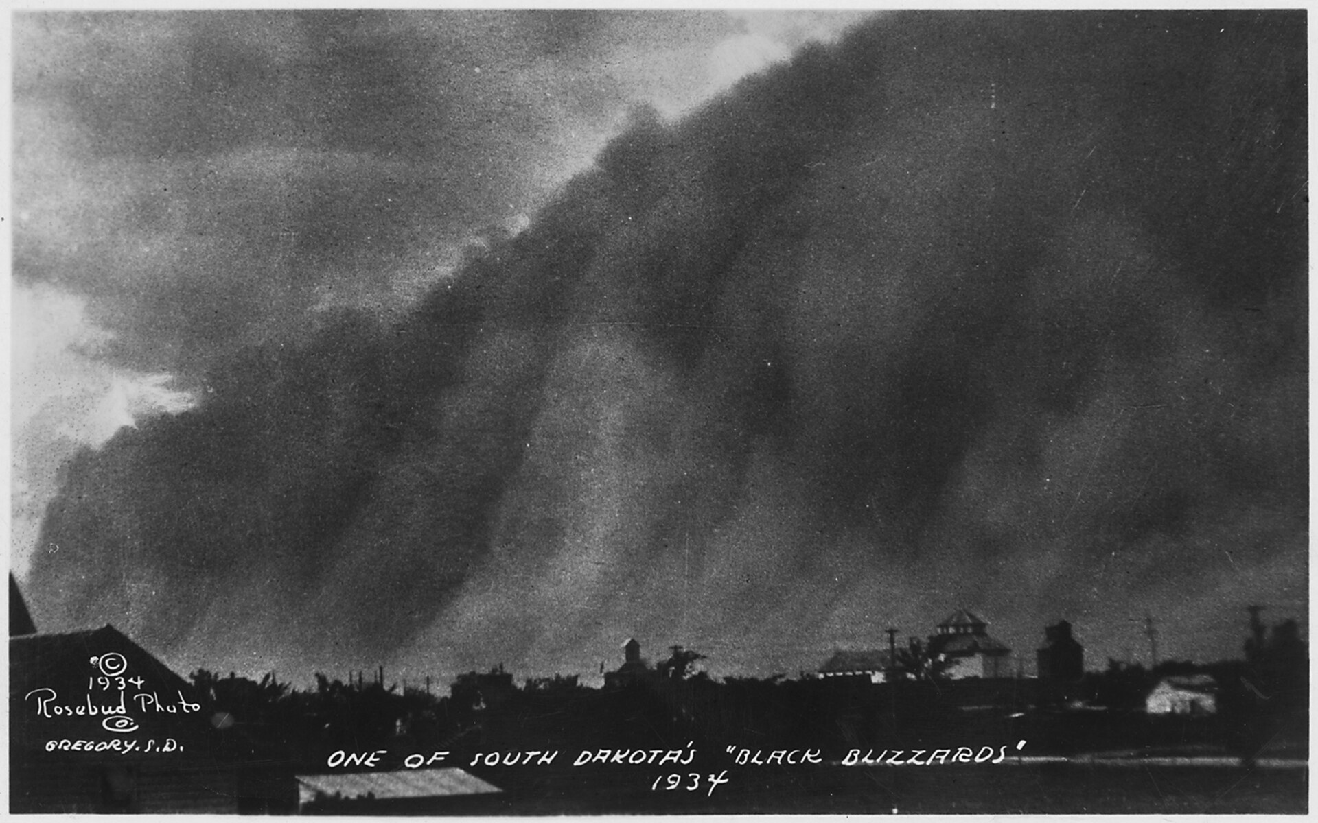
South Dakota had dust storms all the same, and one from 1934 survives in a photograph now held by the National Archives. A 1968 history of Badlands National Monument by Ray H. Mattison and Robert A. Grom, in its chapter on the Depression, lists drought, failed crops and grasshoppers, and names the state’s south-central and western counties as the hardest hit. How the dry years drove families off their claims across the West River country is told on Homesteading the Edges of the Hills.
The country around Wall had been inside the Great Sioux Reservation that the Fort Laramie Treaty of 1868 set apart, and the same history’s chronology dates to 1890 the change that made much of the Badlands public land, to be opened to settlers in time. By the early 1930s, the Encyclopedia of the Great Plains says, the farmers and ranchers who traded in Wall had little to spend, and the travelers going by seldom stopped.
A Drugstore, a Heat Wave and a Row of Signs
The Husteads bought their store in Wall on December 31, 1931. Ted, a recent pharmacy graduate, and Dorothy paid for it with $3,000 left to Ted by his father, and ran it as Hustead’s Drugstore. The encyclopedia names no month for Dorothy’s idea, only a summer hot spell in 1936; the university archive’s guide gives the month as July.
Ted made the signs, at Dorothy’s suggestion, on the Burma-Shave pattern, which split a message across a string of small boards for a driver to take in one at a time. More than 60 years later, by the account in the Encyclopedia of the Great Plains, the store was a complex of 76,000 square feet. The signs lead somewhere else: to the road they stood beside.
Which Road Ran Past Wall in 1936?
The sources give the road different numbers, and none of them explains the difference. The University of South Dakota’s guide says Ted put his signs along US Highway 16. The Encyclopedia of the Great Plains says the travelers who seldom stopped were on Route 16A. An entry on the business in the International Directory of Company Histories, a reference series, has Dorothy recalling that the noise of cars on route 16A, close by the store, made it hard to fall asleep, and it quotes a sign whose wording names Highway 14 as well.
The 1968 history does record an alternate route. Its chapter on the Depression years calls the first road through the Badlands “alternate U.S. 16”, without saying when the road took that number. It credits much of the road’s line to Ben H. Millard, who in 1931 picked the course he thought had the finest scenery. The same chapter puts the cost of the state’s 1935 highway at about $320,000: some 30 miles from Interior, across Big Foot Pass, as far as Sage Creek, with the Park Service’s approval. A road had been part of the plan since at least 1928, when Peter Norbeck’s bill called for South Dakota to build about 40 miles of road before the monument could be set aside; a House committee cut the figure to 30 in 1929. Whether the encyclopedia’s Route 16A is that Badlands road, none of these sources says.
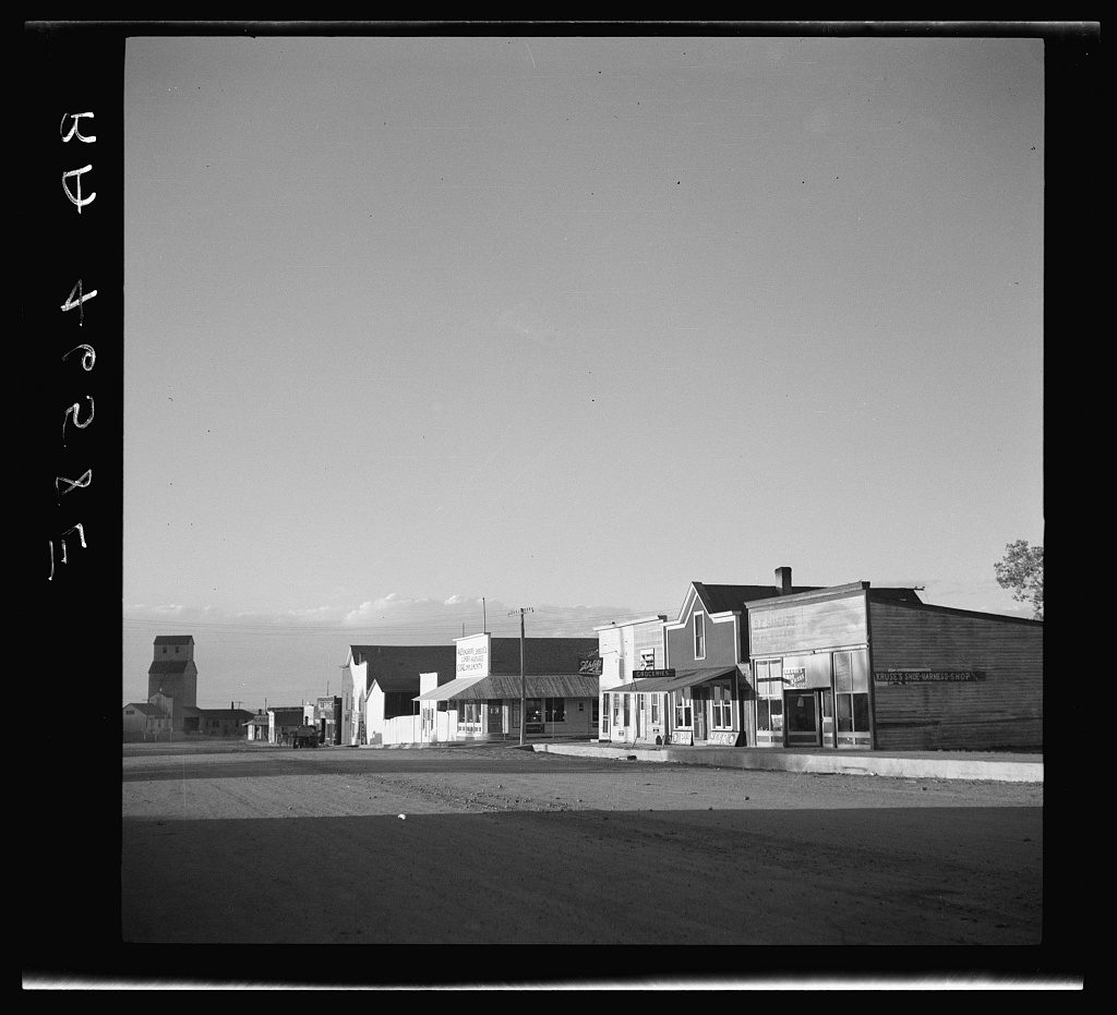
The same history counts Ted Hustead, with Millard and others, among the local people who worked for the monument. Badlands National Monument, about 150,000 acres, was established by presidential proclamation on January 25, 1939. The Badlands and Wall covers the country the new road opened to drivers.
Federal Sign Rules After 1965
In 1965 Congress set rules for signs along the main federal-aid highways. The Highway Beautification Act, approved October 22, 1965, required each state to control billboards within 660 feet of Interstate and primary highways from January 1, 1968, or lose 10 percent of its federal highway money. Signs were allowed in commercial and industrial areas, within limits on size, lighting and spacing, and a business could still advertise on its own property. Lawful signs that came down had to be paid for, with the federal government covering 75 percent of the cost.
The fixed distance had a side effect. The Federal Highway Administration’s overview of the program says many very large signs went up beyond the 660-foot line. In 1974 Congress extended control, outside urban areas, to signs standing farther back that were visible from the highway and placed to be read from it. A 1978 law required payment for lawfully built signs that were removed, even where local zoning would have phased them out unpaid, and the last appropriation for buying out signs came in 1983.
What the rules meant for Wall’s own signs rests on that directory entry alone, not on government records. By its count, 240 of the store’s 280 road signs were at risk under the 1965 act, and in 1975 the store put $280,000 into big signs close to Interstate 90. The money for paying sign owners, it adds, was used up by 1983, and it calls the law one that was never enforced. The federal overview backs only the first half of that: it records 1983 as the year of the last appropriation, then goes on to changes Congress made to the program in 1991 and 1992. The year the interstate reached Wall is not given in any of these sources.
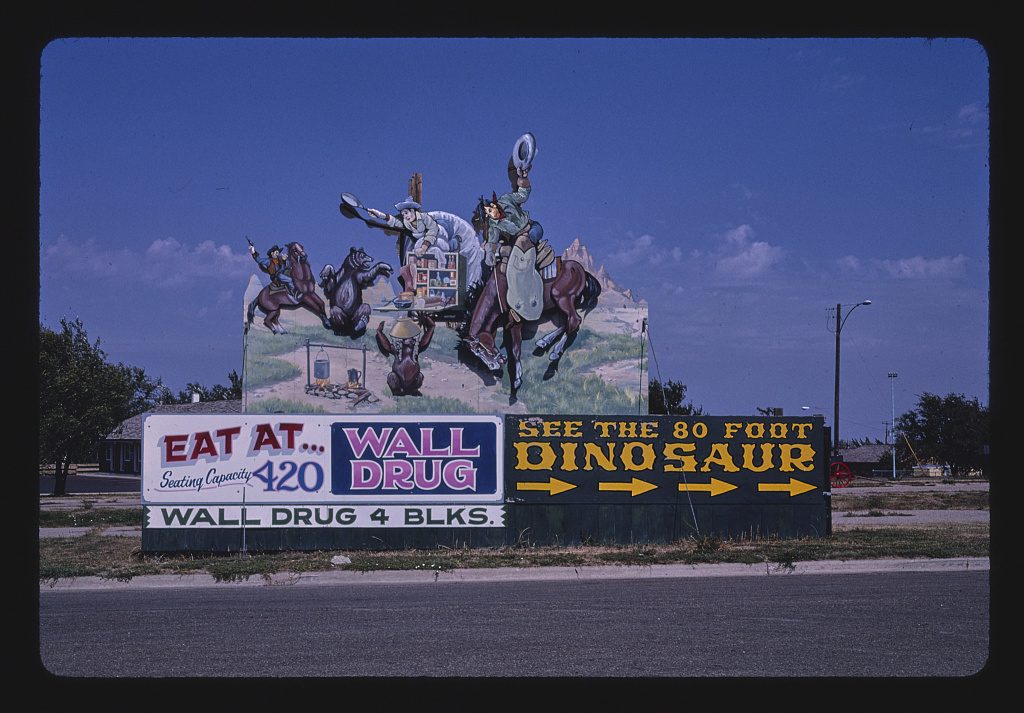
The 2020 census counted 699 people in Wall. Interstate drivers leave the highway for it at Exit 110, and from there the road south runs about 7 miles to the Pinnacles Entrance of Badlands National Park, the monument of 1939, renamed a national park on November 10, 1978.
Connected
- Wall, South DakotaThe town at the end of the Badlands Wall, and the drugstore’s own history.
- The Badlands and WallThe Badlands country the 1935 road crossed, and the exits off Interstate 90.
- Homesteading the Edges of the HillsThe claims around Wall and what the dry 1930s did to them.
- The Fort Laramie Treaties of 1851 and 1868The 1868 treaty that placed the country around Wall in the Great Sioux Reservation.
- Badlands National ParkThe 1939 monument, a park since 1978, reached from Wall at the Pinnacles Entrance.
Sources
- This Day in Weather History: July 5. National Weather Service, Aberdeen, South Dakota.
- Wall Drug: Overview (guide to the Wall Drug collection). Archives and Special Collections, University Libraries, University of South Dakota, 2023.
- The Dust Bowl. National Drought Mitigation Center, University of Nebraska–Lincoln.
- Dust Storms; “One of South Dakota’s Black Blizzards, 1934” (photograph, NAID 195304, Franklin D. Roosevelt Library). National Archives, DocsTeach.
- History of Badlands National Monument and the White River (Big) Badlands of South Dakota: The Depression Years, by Ray H. Mattison and Robert A. Grom. Badlands Natural History Association, 1968; copy held by the NPS History Collection.
- History of Badlands National Monument and the White River (Big) Badlands of South Dakota: Legislation for Park Establishment, by Ray H. Mattison and Robert A. Grom. Badlands Natural History Association, 1968; copy held by the NPS History Collection.
- History of Badlands National Monument and the White River (Big) Badlands of South Dakota: Chronology, by Ray H. Mattison and Robert A. Grom. Badlands Natural History Association, 1968; copy held by the NPS History Collection.
- Wall Drug, by Sheila R. Aaker. Encyclopedia of the Great Plains, University of Nebraska–Lincoln.
- Wall Drug Store, Inc., by Susan B. Culligan. International Directory of Company Histories, as carried by Encyclopedia.com.
- Public Law 89-285, Highway Beautification Act of 1965 (approved October 22, 1965), 79 Stat. 1028. U.S. Government Publishing Office.
- A History and Overview of the Federal Outdoor Advertising Control Program. Federal Highway Administration, 1994, with minor revisions 1997; copy held by the Dorothy Peyton Gray Transportation Library, Los Angeles County Metropolitan Transportation Authority.
Last reviewed: