Connections
Rails, Cattle and Belle Fourche
Cattle filled 4,700 railroad cars leaving Belle Fourche in 1894, by the count in the 1982 National Register nomination for its downtown. A 2017 National Park Service article on the Belle Fourche Dam counts 2,500 carloads a month “in those Old West days,” more than six times as many. Neither says where its number came from. Even the smaller count is large for a town only a few years old, and the town grew where it did because a railroad agreed to stop there. That choice tied the open range around the Black Hills to a new town at the forks of the Belle Fourche River and to the irrigated farms below it, while upriver another railroad made a cattle town of Moorcroft, Wyoming.
The cattle came before the rails. Herds driven up the Texas Trail were in northeastern Wyoming from the late 1870s, Nicole Lebsack writes in a 2014 article for WyoHistory, the Wyoming State Historical Society’s online encyclopedia, and the open range took in the South Dakota side too (see The Open Range and the Cattle Drives). In 1887 the photographer John C. H. Grabill made pictures of cowboys and cattle at a roundup on the Belle Fourche, before any track reached the river.
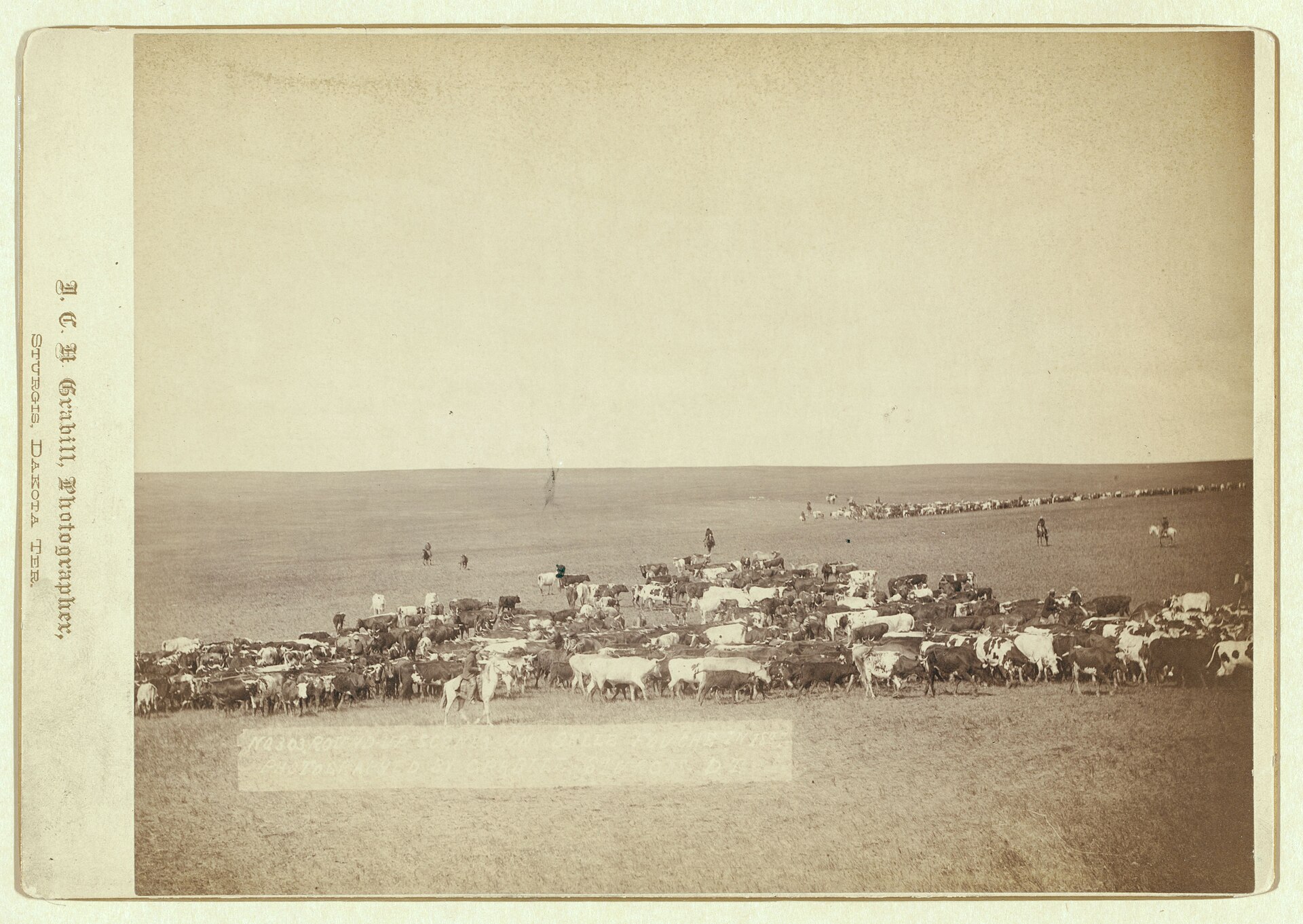
Getting those cattle onto a train was the hard part. Lebsack describes long drives to market from Wyoming’s northeast corner, far south to the Union Pacific at Rock Creek or, from 1881, north to the railhead at Miles City, Montana.
Three Years at Whitewood, Then the Forks
The rails that reached the northern range came from the east, on the Fremont, Elkhorn and Missouri Valley, tied to the Chicago and North Western (see Stagecoaches and Railroads). Its track got to Whitewood in November 1887 and stopped there for three years, Whitewood’s state marker says, before the line divided, with a branch climbing to Deadwood and the main line running out onto the plains.
Where the plains line put its station decided where a town would grow. The forks of the Belle Fourche lay on the S-B ranch, which Seth Bullock of Deadwood held with partners. Bullock let the railroad cross the ranch on 100-foot easements, in return for a partial release of a mortgage, and a contract committed the railroad to a depot at the forks; Minnesela, a nearby rival town, was passed over, the downtown’s nomination says. In the chamber of commerce’s own account, businesses willing to leave Minnesela got their lots free.
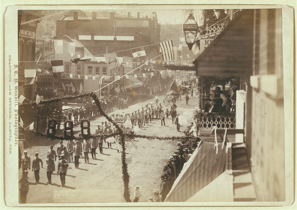
The records disagree on the year. By the nomination’s account, the station opened on December 28, 1890, in a town the Pioneer Townsite Company had founded that year. The chamber gives that same day for the railroad’s arrival and the town’s establishment, and June 9, 1891, for the auction of town lots. A Bureau of Reclamation history says the Chicago and North Western reached the town in 1891. That July, a letter from Miles City printed in the Omaha Daily Bee placed the end of the Elkhorn’s track at Middle Creek, north of the Belle Fourche, where the chamber puts the railroad’s shipping corrals.
What Did the End of Track Bring to Belle Fourche?
The end of track brought Belle Fourche the cattle of a wide range country. By the nomination’s account, the town drew its trade from the Belle Fourche Valley and from the cattle ranges along the Little Missouri and Grand rivers. In the Park Service’s view, the big ranches and the railroad companies held the power in 1890s Butte County, though the town had its farmers too.
The main line also drew traffic from beyond its own reach. In 1898 the Black Hills Coal Company gave its mines near Aladdin, in Wyoming, an 18-mile railroad, the Wyoming and Missouri River, built to meet the North Western’s main line at Belle Fourche, Lebsack writes. The short line ran from 1899 to 1927, though little coal moved on it after 1910, and cattle headed for the Omaha market were put aboard at Aladdin.
The nomination goes further for the early 1890s, ranking Belle Fourche “the world’s largest primary cattle shipping center.” It cites nothing for that and offers no other town’s figures. Reclamation’s history says the town was considered “the largest original shipping point for livestock in the United States.” With no numbers set beside either claim, neither can be tested.
Moorcroft, on a Line That Kept Going
The Chicago, Burlington and Quincy, building northwest from Alliance, Nebraska, had track at Newcastle in November 1889; Upton and Moorcroft followed in 1890 and 1891. The Burlington meant to go much farther. It was headed for a junction with the Northern Pacific in Montana, Gregory Nickerson writes for WyoHistory, and its rails reached Sheridan in November 1892.
What Moorcroft gave ranchers was a nearer railhead, one that spared local herds the long drive to Rock Creek or Miles City. During the 1890s, Lebsack writes, Moorcroft “became the largest cattle-shipping point in the U.S.” Belle Fourche’s nomination claims much the same title for the same decade, and two 1956 state markers claim one for Pierre. Not one of the three claims comes with figures.
Moorcroft was never the end of a line, so its tie to Belle Fourche is a thin one: the two towns share a river and a trade more than a railroad. Crook County ended up with loading points on both systems: Moorcroft on the Burlington, and Aladdin on the short line to the North Western at Belle Fourche. Belle Fourche lies on former reservation land west of the 103rd meridian, which the 1877 Act took from the tribes without the consent the 1868 treaty required; Moorcroft lies beyond the reservation’s old western line, in what the treaty called “unceded Indian Territory,” which the 1876 agreement, made law by the 1877 Act, took along with the tribes’ hunting rights there (see The 1876 War and the Taking of the Hills).
Ditches Where the Herds Had Grazed
The railroad also changed what the valley below Belle Fourche could be used for. Reclamation’s history says local leaders sought more farming there chiefly with two markets in mind: the expanding livestock trade and the Black Hills mining towns. The railroad gave them a way to ship what farms might raise. Federal approval came on May 10, 1904: the Belle Fourche Project was the new Reclamation Service’s second (see The Belle Fourche Irrigation Project). Its storage dam, Orman Dam (officially Belle Fourche Dam), was completed on June 30, 1911; no rolled-earth dam in the world was larger then.
The dam’s 1976 National Register form, prepared by a Reclamation employee, puts the change in acres: irrigation turned about 54,000 acres of mostly grazing land into hay and grain farms after 1908. Until the Utah-Idaho Sugar Company’s factory at Belle Fourche was dedicated in 1927, beets grown in the valley were shipped to Nebraska for processing, SDPB’s Brian Gevik writes.
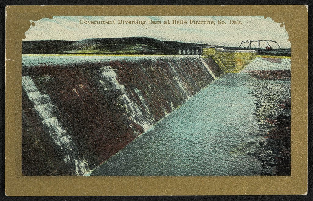
On the 57,000 or so acres the project waters, the 2017 Park Service article says, farmers raise alfalfa, barley, oats and forage, crops the agency links to the region’s cattle-ranching past.
Connected
- Stagecoaches and RailroadsThe Elkhorn line’s three years at Whitewood and its push on to Deadwood and Belle Fourche.
- The Open Range and the Cattle DrivesThe trail herds, outfits and roundups that filled the range before the rails came.
- Belle Fourche, South DakotaThe town that grew around the railroad’s station at the forks of the river.
- The Belle Fourche Irrigation ProjectOrman Dam and the canals that turned grazing land below the town into farms.
- Moorcroft, WyomingThe Burlington’s cattle town upriver, with its own claim to the national title.
Sources
- Belle Fourche Commercial Historic District, National Register of Historic Places nomination, by LeEllen Coacher for the Historical Preservation Center, from a 1980 survey, with a later boundary amendment. National Park Service, 1982.
- Belle Fourche History (the chamber’s own account). Belle Fourche Chamber of Commerce.
- South Dakota: Belle Fourche Dam. National Park Service, 2017.
- Exerpts from the early development of the Belle Fourche Project. Bureau of Reclamation, Missouri Basin Region, 2020.
- Orman Dam (Belle Fourche Dam): National Register of Historic Places Inventory–Nomination Form, prepared by Raymond A. Ninke, Bureau of Reclamation. National Park Service, 1976.
- The Belle Fourche Sugar Plant, by Brian Gevik. SDPB, 2016.
- Crook County, Wyoming, by Nicole Lebsack. WyoHistory.org, Wyoming State Historical Society, 2014.
- The Burlington Route: Wyoming’s Second Transcontinental Railroad, by Gregory Nickerson. WyoHistory.org, Wyoming State Historical Society, 2014.
- “Whitewood’s Railroad History” (South Dakota State Historical Society marker 716, text from the society’s records). Transcribed by Deane Barker.
- South Dakota Historical Markers, numerical master list (markers 143 and 175). South Dakota State Historical Society, revised 2020.
- “Montana and Omaha,” letter from Miles City, Montana, dated July 5, Omaha Daily Bee, July 11, 1891, page 11 (OCR text). Nebraska Newspapers, University of Nebraska–Lincoln Libraries.
- Round-up scenes on Belle Fouche [sic] in 1887. John C. H. Grabill, photograph; Library of Congress, Prints and Photographs Division, 1887.
- Treaty of Fort Laramie (1868), transcript. National Archives.
Last reviewed: